In recent years, I have observed a significant shift in military operations toward the extensive use of unmanned aerial vehicles, particularly for intelligence, surveillance, and reconnaissance (ISR) missions. The advantages of military drones in these roles are manifold, including lower operational costs, extended endurance beyond human pilot limitations, and the ability to execute high-risk tasks without endangering personnel. This paper delves into the current state of military drone ISR applications, drawing from extensive research and analysis of modern defense strategies. I will explore the various ISR tasks performed by military drones, the sensor payloads tailored for these missions, the sophisticated processing, exploitation, and dissemination (PED) systems that handle vast data streams, and the critical design considerations for adversarial environments. Throughout this discussion, I emphasize the centrality of military drones in reshaping battlefield awareness and decision-making processes.
The evolution of military drone technology has been driven by the need for persistent and precise ISR capabilities. As a researcher in this field, I have noted that military drones offer unique benefits in scenarios requiring rapid decision-making, high data heterogeneity, intermittent communications, and complex collaborative actions. For instance, military drones can efficiently collect data on enemy terrain, force dispositions, and infrastructure, enabling real-time planning and post-strike assessments. This enhances situational awareness and operational effectiveness. In the following sections, I systematically examine the key aspects of military drone ISR applications, supported by tables and mathematical formulations to clarify technical concepts.
Military drones are deployed for a wide range of ISR tasks, each demanding specific capabilities. Below, I categorize these missions and their operational significance.
| ISR Task Category | Description | Military Drone Examples |
|---|---|---|
| Wide-Area Mapping and Monitoring | Military drones operate at high altitudes for prolonged periods, conducting extensive geographic surveys. They provide real-time information on enemy positions, resources, and personnel over large areas. | High-altitude long-endurance (HALE) drones like the RQ-4 Global Hawk. |
| Target Tracking | Utilizing stealth and maneuverability, military drones can closely follow targets of interest in various environments, including urban or obstructed areas, using advanced sensors and AI-driven systems. | Small quadcopters and autonomous drones such as those in the Fast Lightweight Autonomy (FLA) program. |
| Chemical, Biological, Radiological, Nuclear, and Explosive (CBRNE) Detection | Military drones equipped with specialized sensors remotely detect hazardous substances, reducing risks to human personnel in contaminated or dangerous zones. | Drones deployed for radiation monitoring in nuclear incidents. |
| Close-Range Reconnaissance | In complex terrains like urban settings, military drones provide short-range surveillance around obstacles, offering real-time threat assessments to ground forces. | Urban combat drones in programs like Offensive Swarm Tactics (OFFSET). |
These tasks highlight the versatility of military drones in ISR roles. From my perspective, the success of these missions hinges on the integration of advanced sensor payloads, which I discuss next.
The efficacy of military drones in ISR missions is largely dependent on their sensor payloads. These devices are tailored to specific task requirements, enabling data collection under diverse conditions. I have analyzed several key sensor types commonly used on military drones.
| Sensor Type | Function | Applications in Military Drone ISR |
|---|---|---|
| Electro-Optical (EO) Cameras | Capture still images and full-motion video (FMV) in visible light, providing high-resolution visuals for real-time tracking and damage assessment. | Widely used for daytime surveillance and target identification; essential for reducing collateral damage. |
| Infrared (IR) Imaging Sensors | Detect heat signatures to produce images in low-light or dark conditions, extending operational capabilities beyond visible spectrum limitations. | Employed for night missions and tracking thermal emissions from personnel or vehicles. |
| Synthetic Aperture Radar (SAR) | Utilize radar waves to generate high-resolution images regardless of weather or lighting, offering all-weather surveillance. | Critical for missions in adverse conditions; complements EO and IR sensors by filling gaps in data collection. |
| Multi-Spectral (MSI) and Hyper-Spectral (HSI) Sensors | Analyze multiple wavelength bands to enhance terrain analysis, create detailed maps, and support 3D modeling of environments. | Used for geological surveys, camouflage detection, and environmental monitoring in ISR contexts. |
| Additional Specialized Sensors | Include moving target indicators, laser detection and ranging (LIDAR), and signal intelligence (SIGINT) sensors for specific threat detection. | Applied in electronic warfare, CBRNE missions, and communications intercepts. |
To illustrate the integration of these sensors, consider the following representation of data fusion in a military drone system. The overall information collected, denoted as \( I \), can be modeled as a combination of inputs from various sensors:
$$ I = \sum_{i=1}^{n} w_i S_i $$
where \( S_i \) represents the data from sensor \( i \), and \( w_i \) is a weighting factor based on sensor reliability and mission priority. This formula underscores the importance of sensor synergy in military drone ISR operations. Moreover, the advancement of sensor technology has enabled military drones to gather unprecedented volumes of data, necessitating robust PED systems, which I explore in the next section.
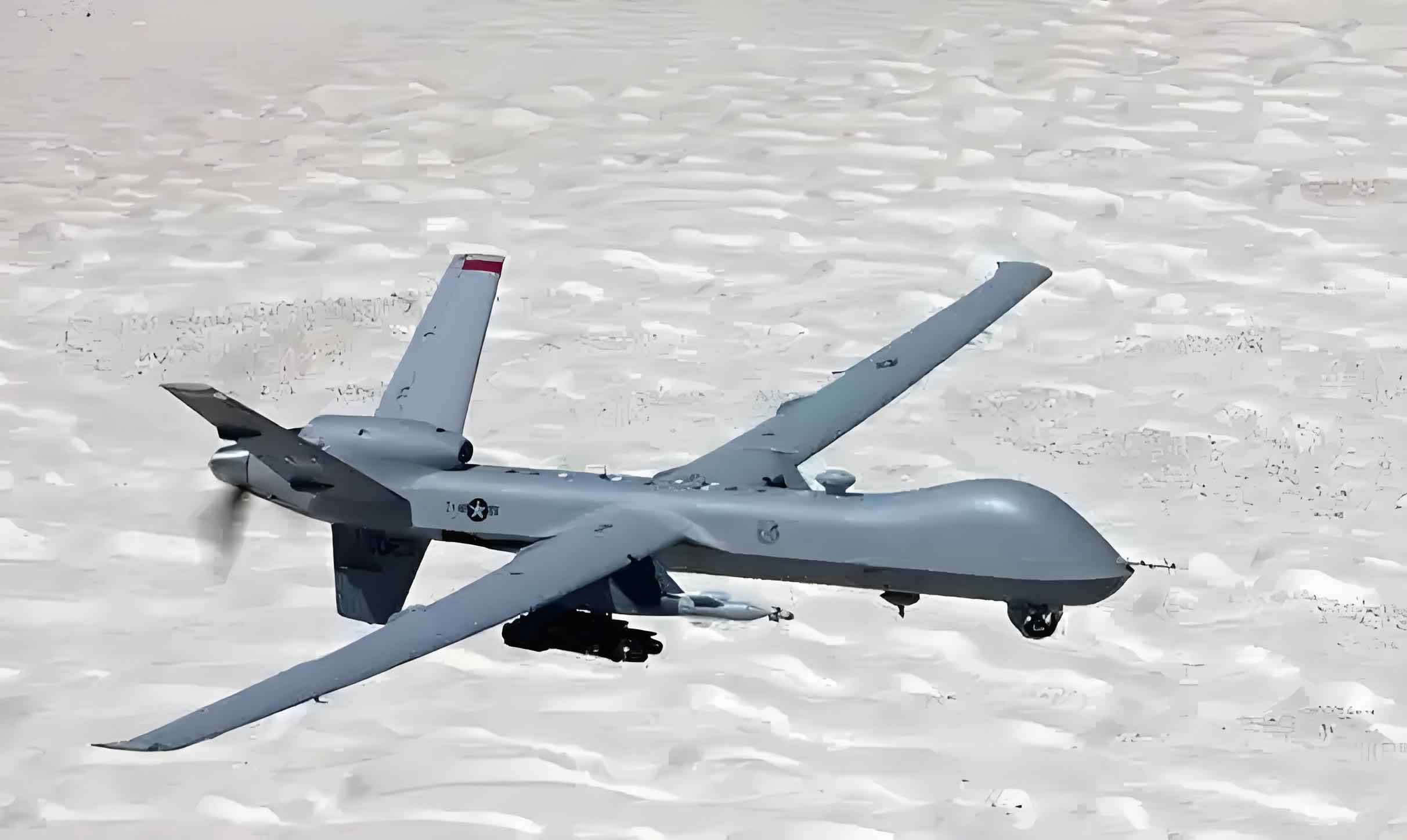
The image above depicts a typical military drone configured for ISR missions, highlighting the compact design and sensor mounts that facilitate diverse data collection. As I have studied, such platforms are pivotal in modern warfare, and their effectiveness is further amplified by sophisticated data handling mechanisms.
Processing, exploitation, and dissemination (PED) systems are the backbone of military drone ISR capabilities, transforming raw data into actionable intelligence. From my research, I identify two primary PED approaches: onboard real-time processing and ground-based analysis. Each has its challenges, such as data latency and bandwidth constraints. To address these, military drones increasingly incorporate AI and machine learning algorithms for automated data analysis. For instance, the Maven project by the U.S. Department of Defense leverages machine learning to analyze hours of aerial footage, automating target detection and freeing analysts for higher-level tasks. The core of such systems can be expressed through a classification algorithm:
$$ \hat{y} = \arg\max_{y} P(y | \mathbf{x}; \theta) $$
where \( \hat{y} \) is the predicted target class, \( \mathbf{x} \) is the input sensor data, and \( \theta \) represents the model parameters learned from historical data. This enables military drones to identify patterns and threats with minimal human intervention. Additionally, I have examined specific PED systems like the Lynx multi-mode radar, which integrates SAR and ground moving target indication (GMTI) for continuous surveillance. The effectiveness of these systems is quantified by metrics such as precision and recall, calculated as:
$$ \text{Precision} = \frac{TP}{TP + FP}, \quad \text{Recall} = \frac{TP}{TP + FN} $$
where \( TP \), \( FP \), and \( FN \) denote true positives, false positives, and false negatives, respectively. These metrics are crucial for evaluating the performance of military drone ISR systems in dynamic environments.
Beyond data handling, the adversarial nature of military operations necessitates robust design features for military drones. I have investigated several key areas of concern, including cybersecurity, battlefield survivability, and navigation in denied environments. Military drones are vulnerable to network attacks, such as command hijacking or data corruption. To mitigate this, programs like the High-Assurance Cyber Military Systems (HACMS) develop mathematically verified software to secure drone systems. The risk of interception by anti-drone defenses, such as man-portable air-defense systems (MANPADS), also poses significant threats. Moreover, electronic warfare tactics, like jamming communication links, can disrupt military drone operations. In response, research focuses on anti-jamming technologies and alternative navigation methods. For example, in GPS-denied environments, military drones employ vision-based navigation systems, where position estimation relies on visual odometry:
$$ \mathbf{p}_{t+1} = \mathbf{p}_t + \Delta \mathbf{p}, \quad \Delta \mathbf{p} = f(\mathbf{I}_t, \mathbf{I}_{t+1}) $$
here, \( \mathbf{p}_t \) is the drone’s position at time \( t \), and \( \Delta \mathbf{p} \) is derived from image sequences \( \mathbf{I} \). Programs like DARPA’s FLA aim to enhance autonomous navigation in cluttered spaces without GPS. Furthermore, distributed battle management (DBM) systems enable coordinated operations among multiple military drones in communication-limited scenarios, using algorithms for decentralized decision-making. The resilience of military drones in adversarial settings is thus a critical factor in their ISR efficacy.
To synthesize the interplay between tasks, sensors, PED systems, and adversarial design, I propose a holistic framework for military drone ISR optimization. The overall mission success probability \( P_{\text{success}} \) can be modeled as a function of these components:
$$ P_{\text{success}} = \alpha \cdot T(\text{tasks}) + \beta \cdot S(\text{sensors}) + \gamma \cdot P(\text{PED}) + \delta \cdot A(\text{adversarial}) $$
where \( T, S, P, A \) represent performance metrics for each aspect, and \( \alpha, \beta, \gamma, \delta \) are weighting coefficients based on mission priorities. This formulation underscores the integrated nature of military drone systems. In practice, continuous innovation is essential. For instance, the use of swarm intelligence in military drone networks allows for scalable ISR operations, with individual drones collaborating to cover larger areas. The collective behavior can be described using flocking algorithms:
$$ \mathbf{v}_i(t+1) = \mathbf{v}_i(t) + \sum_{j \in N_i} \phi(\mathbf{r}_{ij}) $$
where \( \mathbf{v}_i \) is the velocity of drone \( i \), \( N_i \) is its neighborhood, and \( \phi \) is a function of relative positions \( \mathbf{r}_{ij} \). Such advancements promise to further elevate the role of military drones in ISR.
In conclusion, my analysis reveals that military drones have become indispensable assets for ISR missions, offering unparalleled advantages in persistence, flexibility, and risk reduction. The synergy of task-specific sensor payloads, advanced PED systems with AI integration, and resilient adversarial designs ensures that military drones can operate effectively in complex and contested environments. As technology evolves, I anticipate further enhancements in autonomy, data processing speeds, and interoperability with other military systems. The future of military drone ISR will likely see greater emphasis on real-time analytics, adaptive sensor suites, and robust countermeasures against emerging threats. Ultimately, the continuous development of military drone capabilities will shape the landscape of modern warfare, underscoring the need for ongoing research and investment in this critical domain.
Reflecting on this study, I assert that military drones represent a transformative force in intelligence gathering. Their ability to perform diverse ISR tasks—from wide-area monitoring to close-range reconnaissance—highlights their versatility. The integration of sophisticated sensors, such as EO, IR, and SAR, enables comprehensive data collection under varying conditions. Meanwhile, PED systems powered by machine learning algorithms, like those in the Maven project, efficiently process vast datasets to deliver timely intelligence. Adversarial considerations, including cybersecurity and GPS-denied navigation, ensure that military drones remain operational in hostile settings. As I look ahead, I envision military drones becoming even more autonomous and interconnected, driving innovations in swarm tactics and real-time decision support. This evolution will cement their status as cornerstone elements of military ISR strategies, with implications for global security and defense planning. Through this exploration, I hope to contribute to a deeper understanding of military drone applications and inspire further advancements in this rapidly evolving field.