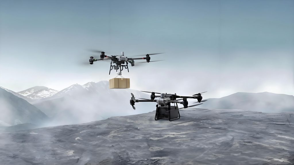
In recent years, the application of civil drones has expanded rapidly across various sectors, including film production, agriculture, surveying, and security. As a branch of general aviation, these operations predominantly occur in low-altitude airspace below 1000 meters. Meteorological services are a critical foundation for safe and efficient civil drone operations, yet they have increasingly become a bottleneck in the development of the general aviation industry. There is a pressing need for systematic and targeted meteorological indicators and support measures tailored to civil drone activities. In this article, I explore the formulation of meteorological standards through multi-sectoral collaboration and propose a comprehensive support system to enhance the safety and effectiveness of civil drone operations. The integration of advanced data fusion, communication mechanisms, and standardized protocols is essential to address the unique challenges faced by civil drone operators.
The growth of civil drone usage is undeniable, with applications spanning from precision agriculture to emergency response. However, meteorological factors such as wind, precipitation, temperature, visibility, and humidity significantly impact the performance and safety of civil drone operations. For instance, strong winds can destabilize flight, while extreme temperatures affect battery efficiency. Through surveys and empirical studies, it has been established that weather-related issues account for a substantial portion of operational failures. To tackle this, a collaborative approach involving meteorological departments, air traffic management, training institutions, and drone manufacturers is crucial. This partnership aims to develop standardized meteorological criteria that can be applied across different civil drone applications, ensuring consistency and reliability.
One of the primary challenges in civil drone operations is the lack of dense meteorological monitoring networks, particularly in remote or rural areas. Traditional weather stations are often spaced too far apart to provide real-time, high-resolution data for low-altitude airspace. This gap can be bridged by leveraging satellite remote sensing, radar data, and mobile observation platforms. For example, satellite imagery offers broad coverage but may lack the spatial resolution needed for precise civil drone route planning. Similarly, Doppler radar provides valuable insights into precipitation and wind patterns, yet it has limitations in detecting micro-scale weather phenomena. To address this, I propose the use of high-resolution numerical weather prediction models, such as those with 1 km × 1 km grid spacing, which can generate minute-by-minute forecasts tailored to civil drone operations. The integration of these data sources through advanced algorithms can enhance the accuracy of weather assessments for civil drone activities.
To quantify the impact of meteorological factors on civil drone operations, I have developed a meteorological index that combines various elements into a single evaluative metric. This index is derived from weighted factors based on their influence on flight safety and efficiency. For instance, wind speed is often the most significant variable, followed by precipitation and temperature. The meteorological index (MI) can be expressed mathematically as:
$$ MI = w_1 \cdot L(Ws) + w_2 \cdot L(P) + w_3 \cdot L(T) + w_4 \cdot L(V) + w_5 \cdot L(RH) $$
where \( w_1, w_2, \ldots, w_5 \) represent the weights assigned to each meteorological factor (e.g., wind speed \( Ws \), precipitation \( P \), temperature \( T \), visibility \( V \), and relative humidity \( RH \)), and \( L(\cdot) \) denotes the level of impact on a scale from 1 (favorable) to 5 (unfavorable). The weights can be determined through expert scoring, statistical analysis, or machine learning techniques applied to historical civil drone operation data. This index allows operators to quickly assess whether conditions are suitable for specific civil drone tasks, such as aerial photography or crop spraying.
In the context of civil drone operations, multi-sectoral collaboration is key to establishing robust meteorological standards. By bringing together stakeholders from meteorology, aviation regulation, and drone technology, we can create a unified framework that addresses the diverse needs of civil drone applications. For example, in agricultural drone operations like plant protection, standardized forms for recording weather conditions and forecasts have been developed. These forms help in documenting real-time meteorological data and predicting potential hazards. Below is a sample table illustrating the weather forecast record for civil drone plant protection operations, which includes parameters such as wind speed, temperature, and visibility, along with their impact levels.
| Time Period | Weather Phenomenon | Wind Speed (m/s) | Impact Level (L1) | Temperature (°C) | Impact Level (L2) | Visibility (m) | Impact Level (L3) | Relative Humidity (%) | Impact Level (L4) | Meteorological Condition Level | Remarks |
|---|---|---|---|---|---|---|---|---|---|---|---|
| hh1:hh2 | e.g., Clear | 3.5 | 2 | 25 | 1 | 5000 | 1 | 60 | 2 | 2 | Wind |
| hh3:hh4 | e.g., Rain | 6.0 | 4 | 18 | 2 | 2000 | 3 | 85 | 4 | 4 | Precipitation, Humidity |
Similarly, a table for real-time weather information during civil drone operations can be used to log minute-by-minute data, ensuring that operators have access to up-to-date conditions. This is particularly important in dynamic environments where weather can change rapidly, affecting the safety of civil drone flights.
| Time (hh:mm) | Weather Phenomenon | Wind Speed (m/s) | Impact Level (L1) | Temperature (°C) | Impact Level (L2) | Visibility (m) | Impact Level (L3) | Relative Humidity (%) | Impact Level (L4) | Meteorological Condition Level | Remarks |
|---|---|---|---|---|---|---|---|---|---|---|---|
| 08:00 | Sunny | 2.0 | 1 | 22 | 1 | 10000 | 1 | 50 | 1 | 1 | None |
| 08:15 | Cloudy | 4.5 | 3 | 20 | 1 | 8000 | 1 | 65 | 2 | 2 | Wind |
The development of meteorological standards for civil drone operations also involves classifying drones based on their weight and application type. This classification helps in tailoring meteorological criteria to specific drone categories, ensuring that guidelines are relevant and practical. For instance, lighter civil drones may be more susceptible to wind gusts, while heavier models might have different operational thresholds. The table below outlines a weight-based classification system for civil drones, which can be used to define appropriate meteorological parameters.
| Classification Level | Empty Weight (kg) | Takeoff Weight (kg) |
|---|---|---|
| I | 0 < W ≤ 0.25 | 0 < W ≤ 1.5 |
| II | 0.25 < W ≤ 4 | 1.5 < W ≤ 7 |
| III | 4 < W ≤ 15 | 7 < W ≤ 25 |
| IV | 15 < W ≤ 116 | 25 < W ≤ 150 |
| V | Plant Protection Drones | Specific to application |
| XI | 116 < W ≤ 5700 | 150 < W ≤ 5700 |
| XII | W > 5700 | W > 5700 |
Building on these standards, the meteorological support system for civil drone operations must address several shortcomings in current practices. First, the integration of diverse data sources is essential. By combining ground-based observations, satellite imagery, and numerical weather prediction models, we can create fusion products that provide high-resolution, real-time insights into low-altitude weather conditions. For example, the use of machine learning algorithms to analyze historical civil drone operation data alongside meteorological records can improve forecast accuracy. The following equation represents a simplified data fusion model for civil drone meteorological support:
$$ F(x,y,t) = \alpha \cdot O_{ground}(x,y,t) + \beta \cdot S_{satellite}(x,y,t) + \gamma \cdot M_{model}(x,y,t) $$
where \( F(x,y,t) \) is the fused meteorological field at location \( (x,y) \) and time \( t \), \( O_{ground} \) is ground observation data, \( S_{satellite} \) is satellite data, \( M_{model} \) is model output, and \( \alpha, \beta, \gamma \) are weighting coefficients optimized through validation against actual civil drone performance data.
Second, the communication infrastructure for civil drone operations needs enhancement. Establishing a reliable ground-air-space communication network is vital for transmitting meteorological warnings and operational commands. This can be achieved through technologies like 5G networks, which offer low latency and high bandwidth, enabling real-time data exchange between civil drones and control centers. Additionally, the implementation of automatic dependent surveillance-broadcast (ADS-B) systems tailored for civil drones can improve situational awareness. The integration of these technologies into a unified platform allows for the customization of meteorological alerts based on user-defined thresholds. For instance, if wind speeds exceed a certain limit for a specific civil drone type, an automatic warning can be triggered to abort or modify the mission.
Third, the development of a comprehensive meteorological保障体系 for civil drone operations requires the creation of visual short-term forecasting and alerting tools. These tools can be embedded in drone operating systems, providing operators with intuitive interfaces to monitor weather conditions along planned routes. By simulating civil drone flights in augmented reality (AR) environments combined with real-time meteorological data, we can assess risks and optimize paths. The meteorological index mentioned earlier can be dynamically updated and displayed, allowing for quick decision-making. Moreover, standardized operating procedures (SOPs) for handling high-impact weather events should be incorporated into training programs for civil drone pilots. This ensures that operators are prepared to respond effectively to adverse conditions, reducing the likelihood of accidents.
In conclusion, the rapid evolution of civil drone technology necessitates equally advanced meteorological standards and support systems. Through multi-sectoral collaboration, we can develop tailored meteorological indices, integrate diverse data sources, and establish robust communication frameworks. The continuous refinement of these elements, based on feedback from real-world civil drone operations, will foster a safer and more efficient environment for low-altitude aviation. As civil drone applications continue to diversify, from logistics to environmental monitoring, the role of meteorology will only grow in importance. By embracing innovation and standardization, we can unlock the full potential of civil drones while mitigating weather-related risks.
Looking ahead, further research should focus on the real-time adaptation of meteorological models to civil drone operations, incorporating artificial intelligence for predictive analytics. Additionally, international cooperation could harmonize standards, facilitating cross-border civil drone activities. The journey toward a fully integrated meteorological support system for civil drones is ongoing, but with concerted efforts, we can achieve a future where weather no longer poses a significant barrier to the expansion of civil drone applications.