
The rapid emergence of low-altitude economies has unlocked transformative potential for unmanned aerial vehicles (UAVs) across multiple sectors. Agricultural drones, as critical components of this ecosystem, are redefining efficiency in modern farming practices through precision operations and data-driven management.
Current Application Landscape of Agricultural Drones
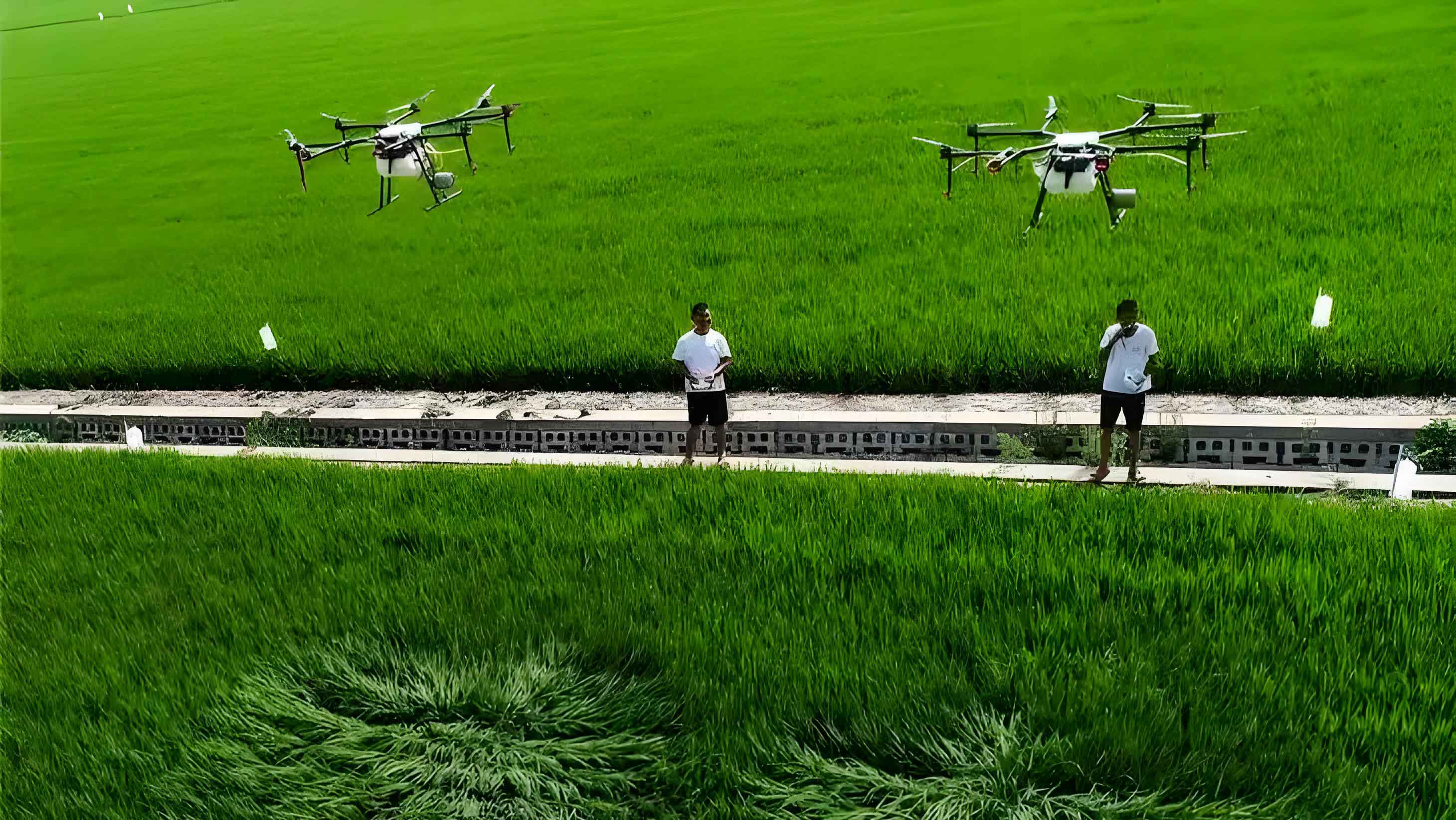
Agricultural UAVs primarily consist of flight platforms (fixed-wing, helicopter, multi-rotor), navigation control systems, and spraying mechanisms. Multi-rotor agricultural drones dominate approximately 70% of the market due to operational flexibility and terrain adaptability. These systems enable diverse applications including pesticide spraying, fertilizer distribution, seeding, and feed dispersion, achieving efficiency gains exceeding traditional methods by 30% while reducing chemical usage by 20%. The operational superiority is quantified by:
$$ \text{Efficiency Gain} = \frac{A_t – A_d}{A_t} \times 100\% $$
where \(A_t\) = time required for traditional methods, \(A_d\) = time required for agricultural drone operations.
| Agricultural UAV Type | Market Share (%) | Key Applications | Chemical Reduction |
|---|---|---|---|
| Multi-rotor | 70 | Spraying, Seeding | 15-25% |
| Fixed-wing | 20 | Large-area Monitoring | 10-20% |
| Single-rotor | 10 | Heavy Payload Tasks | 5-15% |
In a major agricultural county of Shandong Province, registered agricultural UAVs exceeded 1,000 units by 2023, representing 10% of the provincial total. Government subsidies covering 25% of purchase costs and specialized training programs have trained over 1,000 operators. These agricultural drones serviced more than 1 million acres annually, improving operational efficiency by 35% while reducing pesticide usage by 25% among trained operators.
| Performance Metric | Pre-Intervention | Post-Intervention | Improvement |
|---|---|---|---|
| Operation Efficiency | Base: 100% | 135% | +35% |
| Chemical Usage | Base: 100% | 75% | -25% |
| Service Coverage | 600,000 acres | 1,000,000+ acres | +40% YoY |
Development Opportunities in Low-Altitude Economy
Integrated Information Management Platforms
Agricultural UAV ecosystems now integrate with national digital supervision platforms, creating “smart agriculture + digital governance” models. A county-level implementation features:
$$ \text{Platform Effectiveness} = \frac{\sum (D_i \times T_i)}{\sum R_j} \times \alpha $$
where \(D_i\) = drone operational data points, \(T_i\) = terrain parameters, \(R_j\) = resource inputs, \(\alpha\) = calibration coefficient.
This system manages 3,000 registered agricultural drones with centimeter-level tracking, generating dynamic heatmaps that revealed 35% lower efficiency in hilly terrain. Subsequent interventions included specialized subsidies for long-endurance multi-rotor agricultural UAVs, increasing mountainous deployments by 120%. Night-operation accident rates decreased by 73% through targeted training protocols, while pesticide application costs reduced by 28%.
National Standards Implementation
Compliance with national agricultural UAV standards has driven comprehensive upgrades:
| Standardization Area | Technical Requirement | Impact Metric |
|---|---|---|
| Safety Certification | 7-level wind resistance (±15cm positioning) | 40% increase in R&D investment |
| Performance Testing | 13 mandatory indicators (IPX5+, ≤2% battery deviation) | 27 non-compliant models eliminated |
| Data Recording | Flight black boxes + geofencing | Crop loss rate: 3% → 0.5% |
The “agricultural drone + insurance” mechanism reduced premium rates by 28 percentage points through flight data verification. Equipment maintenance rates reached 96%, with individual agricultural UAVs servicing over 8,000 acres annually, reducing disease control costs by 40%.
Specialized Group Standards
Regional agricultural UAV adaptations address unique terrain challenges. For mountainous tea plantations, customized standards specifying 27 operational parameters including:
$$ \text{Spray Adjustment} = B \times (1 + 0.25 \times \frac{W}{4}) \times (1 + 0.2 \times \frac{S}{30}) $$
where \(B\) = base spray volume, \(W\) = wind speed level, \(S\) = slope angle (°).
These protocols increased pest control effectiveness by 35% while reducing chemical usage by 32%. The standards enabled innovative “agricultural UAV + insurance” products that reduced claim rates from 22% to 8% through operational compliance verification.
Targeted Purchase Subsidies
Tiered subsidy mechanisms for agricultural drones significantly reduce adoption barriers:
| Subsidy Component | Mountainous Areas | Plains Areas | Financial Innovation |
|---|---|---|---|
| Airframe Subsidy | 55% | 35% | “Farm Machinery Loan”: $3.8M disbursed |
| Battery/Insurance | 30% | 15% | |
| Effective Cost | $21,000 (from $60,000) | $39,000 |
These policies created a “technology-cost-efficiency” cycle that increased agricultural UAV deployments to 2,800 units. Disease control costs decreased from $18 to $7.5 per acre while chemical deposition uniformity reached 93%. Social service adoption surged from 45% to 82% through innovative financing models using agricultural drones as loan collateral.
Conclusion
Agricultural UAV development demonstrates significant growth through policy frameworks and technological standardization. Future advancements will focus on operational optimization in complex environments and enhanced AI integration, further driving agricultural modernization through precision agriculture solutions enabled by sophisticated agricultural drone ecosystems.