As a practitioner in the field of forest resource management, I have witnessed firsthand the transformative impact of modern geospatial and unmanned aerial vehicle (UAV) technologies. Traditional methods of forest survey and monitoring, relying on ground measurements and manual statistics, are often labor-intensive, time-consuming, and inadequate in complex terrains. The advent of high-precision tools like Ovi Interactive Map and DJI Pilot flight control software, coupled with robust DJI drones, has revolutionized our approach. This article delves into my extensive experience applying these technologies to achieve efficient, accurate, and real-time forest resource assessment. I will detail the methodologies, present analytical frameworks using formulas and tables, and highlight the critical role of DJI drones in enhancing data quality and operational speed.
1. Overview of Core Application Tools
In my work, the integration of several software and hardware platforms is essential. Below is a summary of the primary tools.
| Tool | Primary Function | Key Features Relevant to Forestry |
|---|---|---|
| Ovi Interactive Map | Multi-platform map browsing and 3D visualization | Offline map downloading, integration of satellite imagery with elevation data for 3D modeling, CAD support, and trajectory sharing. |
| DJI Drone (e.g., Phantom, Mavic, Matrice series) | Aerial data acquisition platform | High-resolution cameras, stable multi-rotor flight, long flight endurance, and compatibility with professional payloads. The DJI drone is the cornerstone for rapid aerial scanning. |
| DJI Pilot Flight Control Software | Professional UAV operation and mission planning | Real-time HD video transmission, waypoint flight planning, camera control, firmware updates, and comprehensive flight data logging. It is indispensable for automating DJI drone missions. |
| ArcGIS Software | Geographic Information System (GIS) for data processing | Spatial analysis, map creation, data management, and conversion of formats (e.g., to KMZ/KML) for field use. |
The synergy between these tools is crucial. For instance, the DJI drone, when controlled via DJI Pilot, becomes an intelligent sensor platform, while Ovi Interactive Map provides the spatial context and 3D planning environment. I frequently use various models of the DJI drone, each selected based on mission requirements. The following table compares common DJI drone models used in my forestry projects.
| DJI Drone Model | Typical Flight Time (minutes) | Max Service Ceiling Above Sea Level (m) | Camera Resolution | Best Suited For |
|---|---|---|---|---|
| Phantom 4 RTK | 30 | 6000 | 20 MP | High-precision mapping and survey |
| Mavic 3 Enterprise | 45 | 6000 | 20 MP/48 MP (zoom) | Rapid deployment, detailed inspection |
| Matrice 300 RTK | 55 | 7000 | Supports multiple payloads (e.g., 45 MP) | Long-endurance, heavy-payload missions |
| Inspire 2 | 27 | 4500 | Up to 24 MP (various cameras) | Cinematic survey and dynamic monitoring |
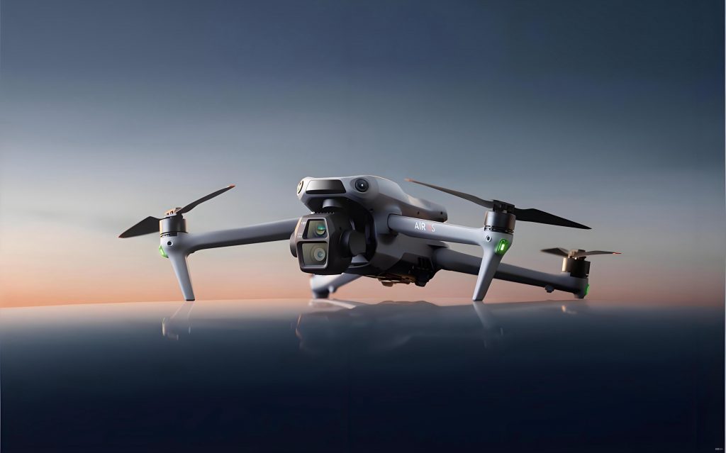
The image above illustrates a typical DJI drone deployed in a forestry setting. The versatility and reliability of the DJI drone make it an irreplaceable asset. In all my missions, ensuring the optimal performance of the DJI drone is paramount, and this is where DJI Pilot software plays a central role.
2. Technical Methodology and Integrated Workflow
My standard operational workflow integrates desktop GIS preparation with field execution using the DJI drone. The process can be mathematically conceptualized to optimize efficiency. Let the total survey area be \( A_{total} \) (in hectares). The effective coverage per DJI drone flight sortie depends on flight parameters: ground sampling distance (GSD), flight speed \( v \), and operational time \( t \). The area covered per sortie \( A_{sortie} \) can be approximated by:
$$ A_{sortie} = v \times t \times w $$
where \( w \) is the swath width, which is a function of the camera’s field of view (FOV) and flight altitude \( h \):
$$ w = 2 \times h \times \tan\left(\frac{\theta}{2}\right) $$
Here, \( \theta \) is the horizontal FOV of the camera lens. This formula highlights why selecting the right DJI drone and configuring its parameters in DJI Pilot is critical.
2.1. Creation of the Survey Layer Base Map
I initiate projects in ArcGIS by creating a detailed base map. This involves importing administrative boundaries, historical forest inventory data, and recent satellite imagery. The key output is a polygon layer representing all survey plots (e.g., forest compartments, change detection patches). Each polygon is attributed with relevant information (ID, suspected change type). This layer is then exported in KMZ format, which preserves geometries and labels for use in Ovi Interactive Map on mobile devices. The data conversion ensures seamless transition from office to field.
2.2. Planning and Optimizing UAV Waypoints
Using the imported KMZ in Ovi Interactive Map, I visually inspect each plot. For plots requiring aerial imagery, I draw a continuous polyline that connects all vertices (拐点) of the target polygons. This line ensures the flight path covers the entire area of interest. The coordinates of each vertex \( (x_i, y_i) \) become potential waypoints. In cases with numerous small plots, I optimize the path to minimize total flight distance \( D_{total} \), akin to a path optimization problem:
$$ D_{total} = \sum_{i=1}^{n-1} \sqrt{(x_{i+1} – x_i)^2 + (y_{i+1} – y_i)^2} $$
where \( n \) is the number of waypoints. This polyline is then exported as a KML file. The use of Ovi’s high-resolution imagery here is crucial for accurate vertex placement, especially in identifying recent disturbances like illegal logging or encroachment.
2.3. Importing and Configuring Missions in DJI Pilot
The KML file containing the flight path is imported into the DJI Pilot application. The software interprets the line and automatically generates a sequence of waypoints. At this stage, I configure each waypoint’s action parameters. For a typical DJI drone, these parameters include:
- Altitude Above Ground Level (AGL): Set based on desired GSD. The relationship is $$ \text{GSD} = \frac{h \times s}{f} $$ where \( s \) is the sensor pixel size and \( f \) is the focal length.
- Heading: Adjusted to ensure the camera is oriented nadir or at a specific angle.
- Action: Usually “Take Photo” at each waypoint or at intervals.
DJI Pilot provides a simulation interface to review the flight path, which is vital for safety and completeness checks before deploying the DJI drone.
2.4. Leveraging Ovi Interactive Map 3D Perspective for Launch Site Selection
One of the most significant advantages I’ve found is using Ovi’s 3D view to select the optimal launch site for the DJI drone. The 3D terrain model, generated from satellite and elevation data, allows me to identify locations with maximal line-of-sight to the target areas. I evaluate potential sites based on elevation profile and obstruction analysis. The goal is to choose a site \( S_{launch} \) that minimizes signal attenuation and maximizes direct visibility to the majority of waypoints, thereby ensuring a stable communication link between the remote controller and the DJI drone throughout the mission.
2.5. Manual Supervision and Execution of Waypoint Flight
At the selected launch site, I initiate the automated waypoint mission via DJI Pilot. Although the flight is automated, I maintain manual supervision, monitoring key telemetry data displayed in real-time:
| Parameter | Optimal Range | Corrective Action if Out of Range |
|---|---|---|
| Remote Controller Signal Strength | > 3 bars | Reposition operator or increase altitude of DJI drone. |
| Video Downlink Signal Strength | > 3 bars | Ensure clear line-of-sight; adjust antenna orientation. |
| Battery Voltage/Capacity | > 30% | Command return-to-home (RTH) immediately. |
| Number of GNSS Satellites | > 12 | Wait for better satellite geometry before launch. |
| Wind Speed (estimated) | < 10 m/s | Abort mission if winds exceed DJI drone limits. |
The DJI drone executes the pre-planned route, capturing high-resolution images at each designated point. Post-flight, the imagery is geotagged and ready for processing in photogrammetry software to create orthomosaics or 3D models.
3. Practical Applications in Forest Resource Management
My team has applied this integrated approach across various forest monitoring mandates. The following table summarizes the applications and the specific value added by using the DJI drone and associated software.
| Application Domain | Main Challenge | How DJI Drone & Technology Provides Solution | Typical Data Outputs |
|---|---|---|---|
| Forest Supervision and Audit (Forest督查) | Detecting recent, often inaccessible, disturbances (illegal logging, land use change). | DJI drone can fly directly to coordinates of suspected change, capturing timely evidence. Ovi 3D view helps find launch sites near remote areas. | Geotagged photos/videos of disturbance sites, change area polygons. |
| Natural Forest and Public Welfare Forest Acceptance Checking | Verifying forest composition and land status within protected boundaries against management rules. | High-resolution imagery from the DJI drone allows species identification (via canopy texture) and land cover classification. Precise positioning confirms boundary adherence. | Map of compliant/non-compliant plots, species distribution maps. |
| Integrated Forest-Grassland-Wetland-Desertification (林草湿荒) Census | Large-scale, standardized data collection across diverse ecosystems for national inventories. | DJI drone enables rapid sampling and consistent angle imagery for “国土调查云” platform upload. Waypoint planning ensures systematic coverage. | Standardized photo sets, ecosystem type maps, biomass estimates. |
| Forest Fire Prevention and Pest Monitoring | Early detection of hotspots or pest infestation over vast areas. | Thermal cameras on compatible DJI drones can identify heat anomalies. Multispectral sensors help assess vegetation health (NDVI). | Thermal maps, NDVI maps, early warning alerts. |
In each application, the cycle time from planning to data acquisition is drastically reduced. For example, in a forest audit covering 100 suspected plots over 50 km², traditional ground teams might require two weeks. Using two DJI drones operating in parallel with this methodology, my team has completed similar tasks in 2-3 days, with superior spatial accuracy.
4. Operational Considerations and Best Practices
Successful deployment hinges on more than just technology. Based on numerous field campaigns, I have compiled key considerations, particularly concerning the DJI drone’s operation.
4.1. Environmental and Regulatory Factors
Forest environments pose unique challenges: dense canopy attenuates GNSS and control signals, and unpredictable weather can change rapidly. I always conduct a pre-flight check using the following risk assessment formula to decide on mission viability:
$$ R_{mission} = \frac{(W_{wind} + V_{visibility}) \times T_{terrain}}{B_{battery} \times S_{signal}} $$
Where each factor is scored from 1 (ideal) to 5 (poor). A score \( R_{mission} > 15 \) typically leads to mission postponement. Furthermore, compliance with local UAV regulations, including no-fly zones and altitude restrictions, is mandatory and programmed into DJI Pilot before flight.
4.2. Data Quality and Coverage Protocol
To ensure collected imagery is sufficient for later analysis, I adhere to a strict protocol. For each plot, the DJI drone must capture a minimum number of images \( N_{images} \) with sufficient forward and side overlap (typically >70%). This can be calculated as:
$$ N_{images} \approx \frac{A_{plot}}{(GSD \times (1 – O_{overlap}) \times \text{Image Width in Pixels})^2} $$
This ensures successful photogrammetric processing. Multiple flight angles (nadir and oblique) are often necessary for complex terrain or to capture vertical forest structure.
4.3. Equipment Redundancy and Maintenance
Reliance on a DJI drone means planning for contingencies. I always field at least two DJI drones for major projects. Regular maintenance, such as checking propeller integrity and calibrating sensors, is scheduled based on flight hours logged in DJI Pilot. Battery management is critical; I use a rule that no battery is used beyond 80% of its rated cycle life in critical missions.
5. Conclusion and Future Perspectives
The integration of Ovi Interactive Map’s 3D capabilities with DJI Pilot flight control software has fundamentally enhanced my approach to forest resource survey and monitoring. The DJI drone serves as the versatile and reliable aerial workhorse, enabling precise, efficient, and safe data acquisition across challenging landscapes. The methodologies described, supported by systematic planning and quantitative checks, have consistently yielded higher quality data at a fraction of the time and cost of traditional methods.
Looking ahead, I anticipate further advancements. The integration of AI-based real-time analytics within platforms like DJI Pilot could allow the DJI drone to make on-the-fly decisions, such as automatically focusing on detected disturbances. Furthermore, the development of heavier-payload DJI drone models will facilitate the use of more sophisticated sensors like LiDAR, enabling direct 3D forest structure measurement. The formula for success in modern forestry monitoring is clear: it lies in the continuous adaptation and deep integration of intelligent software like Ovi and DJI Pilot with robust, capable hardware like the DJI drone. This synergy not only addresses current challenges but also paves the way for more proactive and predictive forest resource management, ensuring the sustainability of these vital ecosystems for future generations.