The sustainable management of water resources in endorheic river basins represents one of the most critical challenges in arid and semi-arid regions globally. My analysis focuses on the principal artery of such a system, drawing from an extensive hydrological record spanning six decades, from the late 1950s to the present. The core of my investigation revolves around understanding the shifting patterns of water consumption across different segments of the river and across distinct historical periods defined by policy and infrastructural changes. This long-term perspective is crucial for formulating robust allocation strategies that can balance human needs with the imperative of ecological preservation, especially when a watercourse is formally designated as an ecological river. Through this first-person examination, I will synthesize the data, present allocation frameworks, and delve into the persistent challenges of fine-scale management. Furthermore, I will expand the discussion to encompass the transformative role of modern technology, such as drone training and remote sensing, in overcoming these very challenges.
The fundamental water balance for a river reach can be expressed as a simple yet powerful equation:
$$ Q_{in} – Q_{out} = \Delta S + C_{ag} + C_{eco} + C_{other} $$
Where \( Q_{in} \) is the inflow to the reach, \( Q_{out} \) is the outflow, \( \Delta S \) represents change in storage (often negligible over annual scales for a channel), \( C_{ag} \) is agricultural consumption, \( C_{eco} \) is ecological consumption (evapotranspiration from riparian vegetation), and \( C_{other} \) accounts for other losses. Analyzing the difference between \( Q_{in} \) and \( Q_{out} \) at key gauging stations provides the total consumption \( C_{total} \) for the intervening section.
My analysis of the hydrological data from three pivotal stations—representing the upper, middle, and lower river regions—reveals stark temporal trends. The data is best understood when segmented into three distinct policy eras, which I have defined as follows:
| Period | Characterization | Key Driver |
|---|---|---|
| 1957–1972 | Pre-development / Quasi-natural Flow | Limited large-scale human intervention. |
| 1973–2000 | Expansion & Diversion | Rapid agricultural reclamation and water extraction. |
| 2001–2017 | Ecological Restoration & Regulation | Implementation of comprehensive basin management and ecological water conveyance projects. |
The quantitative shifts in water volume at the key stations are summarized below. The values represent average annual flows in cubic meters per second (m³/s), illustrating the dramatic reduction in downstream water delivery over time.
| River Section (Gauging Station) | Period: 1957-1972 (m³/s) | Period: 1973-2000 (m³/s) | Period: 2001-2017 (m³/s) |
|---|---|---|---|
| Upper Reach (Alar) | 45.6 | 43.2 | 42.1 |
| Middle Reach (Ying Baza) | 32.1 | 12.8 | 15.4 |
| Lower Reach (Qiala) | 12.8 | 3.2 (often zero) | 6.5* |
*Increase due to emergency ecological water transfers.
From this data, the consumption in each reach can be derived. For instance, the consumption in the upper-mid reach during the expansion period (1973-2000) is approximately \( Q_{Alar} – Q_{YingBaza} = 43.2 – 12.8 = 30.4 \) m³/s. The allocation of this consumed water between agricultural and ecological uses is the central management puzzle.
Based on the historical analysis, I propose a macro-level allocation strategy for the river’s mainstream. This strategy prioritizes securing a baseline ecological flow to sustain the lower reaches, while defining sustainable withdrawal limits for the upper and middle sections. The proposed framework is not a fixed quota but a proportional allocation based on available incoming water, acknowledging inter-annual variability.
| River Section | Proposed Allocation Priority | Key Management Action |
|---|---|---|
| Upper Reach | Strict efficiency quotas. Water use must not exceed a defined percentage of inflow, with high-efficiency irrigation mandatory. | Enforce water-saving technologies; limit expansion of water-intensive crops; strengthen monitoring of diversions. |
| Middle Reach | Ecological rehabilitation quota. A significant portion of allocated water must be dedicated to restoring degraded riparian forests (Populus euphratica). | Seal unauthorized diversion channels; implement planned ecological water releases; convert marginal farmland to ecological land. |
| Lower Reach | Guaranteed minimum ecological flow. This is the non-negotiable output from the middle reach to prevent terminal lake desiccation and desertification advance. | Schedule and execute definitive annual ecological water conveyance; monitor groundwater response and vegetation recovery. |
The success of such a strategy hinges on delicate management, which is currently hampered by three fundamental and intertwined problems. I have identified these as core uncertainties that must be resolved.
1. Uncertainty of Cultivated Area: The exact spatial extent and water demand of irrigated agriculture is unclear due to informal reclamation and changing crop patterns. This can be modeled as an unknown variable in the consumption equation:
$$ C_{ag} = \sum_{i=1}^{n} (A_i \times IR_i) $$
where \( A_i \) is the area of crop \( i \) and \( IR_i \) is its irrigation requirement. The uncertainty \( \sigma_{C_{ag}} \) grows with the uncertainty in total area \( \sigma_A \):
$$ \sigma_{C_{ag}} \approx \sqrt{ \sum (IR_i^2 \cdot \sigma_{A_i}^2) } $$
This uncertainty directly undermines accurate allocation planning.
2. Uncertainty of Ecological and Agricultural Water Consumption: Differentiating between water consumed by a cultivated field and a natural riparian forest is complex. They share the same hydrological source—river runoff and shallow groundwater. The total consumption \( C_{total} \) in a reach is known from flow differentials, but its partition is not:
$$ C_{total} = C_{ag} + C_{eco} + \epsilon $$
where \( \epsilon \) encompasses measurement error and other losses. Without precise spatial data, estimating \( C_{eco} \) for mandatory preservation goals becomes guesswork.
3. Deviation of Hydrological Data: Streamflow records form the bedrock of all analysis. However, discrepancies can arise from gauge calibration, shifting channel morphology, or unmeasured subsurface interactions. This systematic or random error \( \delta \) means the recorded flow \( Q_{recorded} \) relates to true flow \( Q_{true} \) as:
$$ Q_{true} = Q_{recorded} \pm \delta $$
These deviations, if unaccounted for, propagate through all water balance calculations and allocations.
The background of these problems lies in the historical prioritization of agricultural development over integrated monitoring and the immense logistical difficulty of manually surveying vast, remote areas. The solution pathway must involve a shift to a truly integrated basin management approach, supported by transparent data sharing and, most importantly, advanced technological integration.
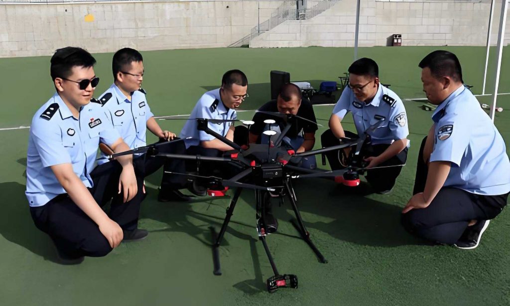
This is where the paradigm of drone training and remote sensing technology becomes a game-changer. Recognizing these core management problems is the first step; deploying the tools to solve them is the next. The potential of unmanned aerial vehicles (UAVs) to revolutionize data collection in river basin management cannot be overstated. A dedicated drone training program for resource managers, hydrologists, and ecologists is not merely a technical exercise; it is a fundamental capacity-building initiative for delicate water governance.
For example, to tackle the uncertainty of cultivated area, regular multispectral drone surveys can provide centimeter-resolution maps of land use. Machine learning algorithms can classify fields from natural vegetation with high accuracy, updating the variable \( A_i \) in our models dynamically and objectively. This directly reduces \( \sigma_A \). A comprehensive drone training curriculum would teach personnel not only flight operations but also mission planning for agricultural parcel mapping and data processing techniques.
Regarding the uncertainty of water consumption, drones equipped with thermal sensors can measure land surface temperature, a key input for estimating evapotranspiration (ET) using energy balance models like the Two-Source Energy Balance (TSEB) model:
$$ LE = R_n – G – H $$
where \( LE \) is latent heat flux (ET), \( R_n \) is net radiation, \( G \) is soil heat flux, and \( H \) is sensible heat flux. Drone-derived ET maps can spatially partition \( C_{ag} \) and \( C_{eco} \) by showing water use per pixel. Effective drone training must therefore cover the principles of remote sensing of the hydrological cycle, enabling local experts to generate these vital consumption datasets independently.
The deviation of hydrological data can be contextualized and corrected using drone technology. While drones do not replace stream gauges, they provide complementary spatial data. They can monitor river cross-sections to detect scour or sedimentation that affects stage-discharge ratings. They can also map flood extents during peak flows to calibrate hydrodynamic models. Drone training for hydrological applications would include techniques for bathymetric mapping, flow velocity measurement using surface particle tracking, and georeferenced aerial surveys of gauge station control sections.
The imperative for drone training extends beyond technical data collection. It fosters a new culture of evidence-based management. The process of planning a flight mission to audit water diversions or assess the health of an ecological water release site requires precise questions and systematic execution. This discipline is invaluable for delicate management. Furthermore, the data from drones creates a transparent, visual record that can build trust and facilitate dialogue among different water users and stakeholders in the basin.
International cooperation plays a vital role in accelerating this technological adoption. The transfer of expertise through collaborative drone training workshops in neighboring arid regions, sharing lessons learned from operational deployments for tasks like reservoir monitoring, landslide risk assessment, and vegetation restoration tracking, creates a community of practice. This shared knowledge base is critical for addressing transboundary environmental challenges and for standardizing monitoring protocols across regions facing similar water scarcity pressures. The ultimate goal of such a drone training initiative is to build self-reliance, enabling local agencies to own the entire data acquisition and analysis pipeline.
In conclusion, my analysis of the long-term hydrological data underscores the absolute necessity of moving from a macro-allocation framework to a data-driven, delicately managed system. The proposed allocation strategy based on historical periods provides a necessary policy direction. However, its effective implementation is contingent upon solving the trilemma of area, consumption, and data uncertainty. I posit that strategic investment in and widespread implementation of drone training and associated remote sensing technologies is the most direct and powerful means to break this deadlock. By equipping water management institutions with the capacity to frequently, accurately, and cheaply monitor the state of the river, its diversions, and its ecosystems, we can make the transition from reactive to predictive management. Clear recognition of the existing problems is the intellectual key to improvement, but sustained drone training and technological integration provide the practical tools to turn that key, driving the improvement of delicate management for the ecology and environment of arid river basins worldwide. The future of sustainable water allocation lies in the synergy of sound policy, robust science, and the eyes in the sky that modern drone training programs deliver.