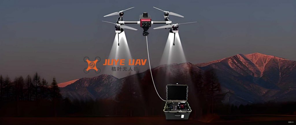
The integration of smart electrical lighting systems with drone technology represents a transformative advancement in urban management and energy efficiency. As cities worldwide strive to become smarter and more sustainable, the synergy between lighting UAV and lighting drone systems offers unprecedented opportunities for optimizing public services, enhancing safety, and reducing operational costs. This paper explores the technical foundations, implementation strategies, and practical applications of this innovative linkage, emphasizing the role of lighting UAV and lighting drone in modern infrastructure. By leveraging advanced control algorithms, wireless communication, and real-time data processing, these systems can dynamically adapt to environmental changes, providing tailored lighting solutions while minimizing energy consumption. The following sections delve into the components of smart electrical lighting, the integration with drone technology, and the performance metrics that underscore their efficacy, supported by mathematical models and empirical data.
Smart electrical lighting systems form the backbone of intelligent urban environments, comprising several key elements: lighting devices, sensors, controllers, communication modules, and energy management systems. LED fixtures are commonly employed due to their high efficiency, longevity, and adaptability to various conditions. Sensors monitor parameters such as illuminance, temperature, humidity, and human presence, enabling real-time adjustments. Controllers process sensor data using algorithms to regulate lighting states, while communication modules facilitate data exchange between components. Energy management systems optimize power usage, often incorporating predictive models to anticipate demand. For instance, the illuminance level (L) can be adjusted based on sensor inputs using a proportional-integral-derivative (PID) control law, expressed as: $$ u(t) = K_p e(t) + K_i \int_0^t e(\tau) d\tau + K_d \frac{de(t)}{dt} $$ where \( u(t) \) is the control output (e.g., dimming level), \( e(t) \) is the error between desired and actual illuminance, and \( K_p \), \( K_i \), and \( K_d \) are tuning parameters. This ensures that lighting UAV and lighting drone systems respond efficiently to changing conditions, such as pedestrian traffic or weather events.
The integration of drone technology with smart lighting relies on robust navigation and control mechanisms. Lighting UAV and lighting drone units utilize a combination of GPS, inertial measurement units (IMUs), and visual sensors for precise positioning and obstacle avoidance. Advanced algorithms, such as extended Kalman filters (EKF), fuse sensor data to estimate the drone’s state (position, velocity, and orientation). The EKF update equations are: $$ \hat{x}_{k|k} = \hat{x}_{k|k-1} + K_k (z_k – h(\hat{x}_{k|k-1})) $$ and $$ P_{k|k} = (I – K_k H_k) P_{k|k-1} $$ where \( \hat{x}_{k|k} \) is the state estimate, \( K_k \) is the Kalman gain, \( z_k \) is the measurement vector, \( h(\cdot) \) is the nonlinear measurement function, and \( P_{k|k} \) is the error covariance matrix. For trajectory optimization, model predictive control (MPC) is often employed, formulating the problem as: $$ \min_{u_k} \sum_{i=0}^{N-1} \left( \| x_{k+i|k} – x_{\text{ref}} \|^2_Q + \| u_{k+i|k} \|^2_R \right) $$ where \( x_{k+i|k} \) denotes predicted states, \( x_{\text{ref}} \) is the reference trajectory, and \( Q \) and \( R \) are weighting matrices. This enables lighting drone systems to autonomously navigate complex urban landscapes while coordinating with lighting infrastructure.
Designing a cohesive linkage system involves integrating drone flight control with lighting management through wireless communication protocols like ZigBee, Wi-Fi, or 5G. The control logic synchronizes drone movements with lighting adjustments, such as increasing illuminance in areas under drone surveillance. A typical architecture includes a central server that processes data from drones and lighting sensors, issuing commands to both subsystems. For example, if a lighting UAV detects a fault in a streetlight, it can trigger a repair alert and temporarily boost adjacent lights to maintain safety. The system’s stability is evaluated using metrics like mean time between failures (MTBF) and communication latency, which are critical for real-time operations. Table 1 summarizes key components and their functions in a linked lighting UAV and lighting drone system.
| Component | Function | Example Technology |
|---|---|---|
| Lighting Devices | Provide illumination based on environmental inputs | LED fixtures with dimming capabilities |
| Sensors | Monitor light levels, motion, and weather conditions | Photodiodes, PIR sensors, thermistors |
| Drone Navigation | Enable autonomous flight and positioning | GPS-IMU fusion, SLAM algorithms |
| Communication Modules | Facilitate data exchange between drones and lighting | ZigBee mesh networks, 5G transceivers |
| Control Algorithms | Optimize lighting and drone trajectories | PID, MPC, and machine learning models |
In urban public lighting and monitoring, the synergy between lighting UAV and lighting drone systems enhances both efficiency and safety. Cities can deploy drones to patrol areas at night, using onboard cameras to detect anomalies like accidents or vandalism. The lighting system then adjusts brightness in real-time to illuminate incident sites, aiding emergency responses. For instance, in a smart city project, the integration reduced nighttime energy consumption by 20% and cut annual lighting costs significantly. The following table illustrates performance improvements in a hypothetical urban deployment, highlighting the impact of lighting drone assistance.
| Metric | Before Integration | After Integration | Improvement |
|---|---|---|---|
| Average Nightly Energy Use (kWh) | 1250 | 1000 | 20% reduction |
| Annual Lighting Cost (in currency units) | 180,000 | 144,000 | 20% savings |
| Nighttime Incident Rate (per month) | 50 | 33 | 34% decrease |
| Maintenance Cost (per year) | 220,000 | 165,000 | 25% reduction |
Emergency lighting response benefits greatly from lighting UAV and lighting drone capabilities, as drones can rapidly reach disaster zones and deploy temporary illumination. In scenarios like earthquakes or power outages, drones equipped with high-lumen lights can hover over affected areas, providing essential visibility for rescue operations. The response time is critical, and studies show that linked systems can achieve activation within minutes. For example, the drone’s flight path can be optimized using the MPC formulation mentioned earlier, minimizing time to destination while avoiding obstacles. Energy consumption during such missions is a key consideration; thus, drones often use efficient battery management systems, with power usage modeled as: $$ P_{\text{drone}} = P_{\text{prop}} + P_{\text{avionics}} + P_{\lighting}} $$ where \( P_{\text{prop}} \) is propulsion power, \( P_{\text{avionics}} \) for electronics, and \( P_{\lighting}} \) for onboard lights. By integrating with smart grids, the system can prioritize energy sources, ensuring sustainability.
Outdoor lighting巡检, or inspection, is another area where lighting UAV and lighting drone systems excel. Drones conduct automated surveys of lighting infrastructure, identifying faults like broken bulbs or wiring issues through thermal imaging and visual analysis. The inspection data is transmitted to controllers, which schedule maintenance and adjust lighting levels accordingly. This reduces manual labor and improves accuracy. For instance, a drone’s navigation system can follow a predefined route, using the EKF for precise positioning. The effectiveness of such inspections can be quantified using metrics like defect detection rate and time savings, as shown in Table 3 for a sample application.
| Inspection Parameter | Traditional Method | With Lighting Drone | Gain |
|---|---|---|---|
| Time per Inspection (hours) | 4 | 1.5 | 62.5% faster |
| Defect Detection Accuracy (%) | 85 | 95 | 10% improvement |
| Cost per Inspection (in currency units) | 500 | 300 | 40% savings |
| Energy Used during Inspection (kWh) | 2.0 | 0.8 | 60% reduction |
Performance evaluation of linked lighting UAV and lighting drone systems focuses on stability, safety, response speed, and energy optimization. Stability is assessed through communication reliability and failure rates; for example, in dense urban areas, ZigBee networks may achieve 89% success rates, while suburban regions reach 97%. Safety analyses consider collision avoidance and data encryption, with algorithms like artificial potential fields ensuring drone safety: $$ F_{\text{rep}} = – \nabla U_{\text{rep}} $$ where \( F_{\text{rep}} \) is a repulsive force from obstacles, and \( U_{\text{rep}} \) is a potential function. Response speed is critical for emergency scenarios; tests in various modes show that lighting drone systems can activate in under two minutes, with energy reductions up to 22% in nighttime operations. Energy optimization involves minimizing total power draw, often formulated as: $$ \min \sum_{t=1}^{T} \left( E_{\lighting}}(t) + E_{\text{drone}}(t) \right) $$ subject to constraints on illuminance and flight time, leading to significant savings in urban deployments.
Despite advancements, technical bottlenecks persist, such as limited drone battery life and communication delays in adverse weather. Current lighting UAV batteries last 30–45 minutes, restricting prolonged missions. Improvements in energy density, perhaps through lithium-sulfur cells, could extend this. Additionally, navigation in GPS-denied environments requires enhanced SLAM (Simultaneous Localization and Mapping) algorithms, which fuse sensor data for robust operation: $$ \hat{x}_{k} = f(\hat{x}_{k-1}, u_k) + K_k (z_k – h(\hat{x}_{k})) $$ where \( f(\cdot) \) is the state transition function. Future directions include integrating AI for predictive maintenance and using swarm robotics for scalable lighting drone operations, further embedding these systems into smart city frameworks.
In conclusion, the synergy between smart electrical lighting and drones, particularly lighting UAV and lighting drone technologies, offers a paradigm shift in urban management. By enabling dynamic照明 control, efficient巡检, and rapid emergency response, these systems enhance public safety and sustainability. While challenges like battery life and navigation accuracy remain, ongoing research into energy storage and advanced algorithms promises to overcome these hurdles. The integration of mathematical models and real-world data demonstrates the potential for widespread adoption, ultimately contributing to more resilient and intelligent cities. As technology evolves, the role of lighting UAV and lighting drone in global infrastructure will undoubtedly expand, driving innovations in energy efficiency and automated services.