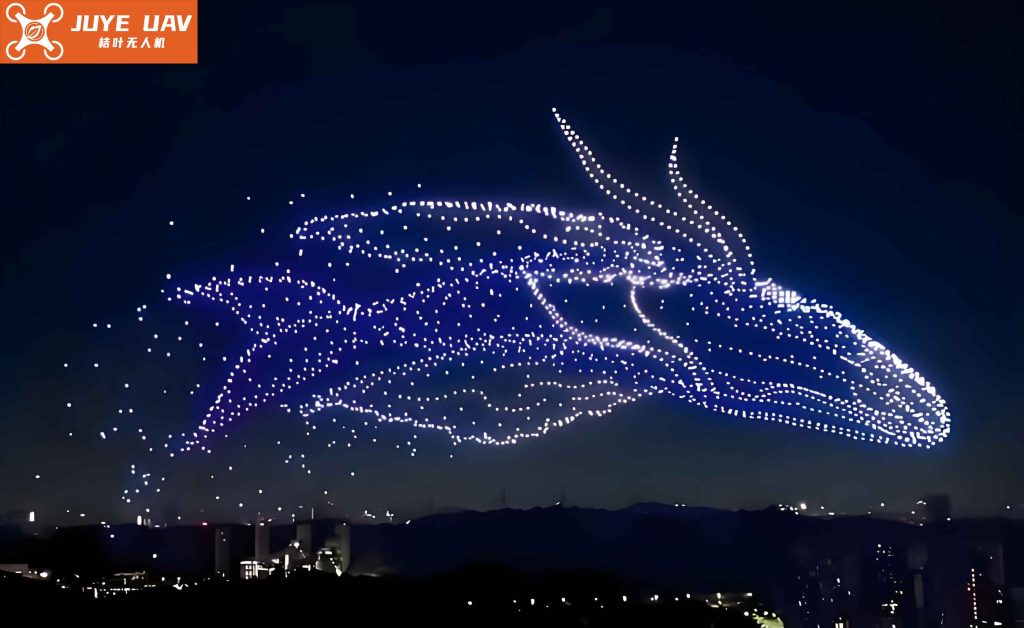
In recent years, drone light shows have emerged as a captivating spectacle, where hundreds or thousands of unmanned aerial vehicles (UAVs) equipped with LED lights form intricate patterns in the sky. However, traditional drone light shows face significant challenges, including high costs due to the large number of drones required, susceptibility to failures such as individual drone crashes or flyaways, and limited robustness against interference. As a researcher in precision instrumentation, I have explored a novel approach to drone light shows that aims to reduce costs while maintaining performance. This article presents the design and implementation of a control system for drone light shows, leveraging differential GPS positioning and LED light strips to create spatial dot matrices with fewer drones. By integrating positioning and lighting control, this system offers a cost-effective and reliable alternative for aerial displays.
The core idea behind this innovative drone light show system is to use a minimal number of drones—specifically, four UAVs—each carrying LED light strips that collectively form a three-dimensional dot matrix. This reduces the dependency on massive drone fleets, thereby cutting down on expenses related to procurement, maintenance, and operational risks. The system operates on a two-layer architecture: the first layer involves communication from a ground station to the drones for positioning and command forwarding, while the second layer handles the control of LED lights via an FPGA core board. Throughout this discussion, I will delve into the technical details, including the UAV composition, differential GPS methodology, LED dot matrix design, and software implementation, all while emphasizing the practical applications and benefits for drone light shows.
To understand the system, let’s start with the fundamental components of a typical UAV. A drone consists of a flight control computer, sensor systems, GPS modules, communication units, and a propulsion system. The flight control system acts as the brain, processing data from sensors and GPS to stabilize and maneuver the drone. In our design for drone light shows, we enhance this setup with precise positioning and LED control capabilities. The flight control board is based on an STM32 microcontroller paired with an MPU6000 gyroscope, ensuring accurate attitude control without relying heavily on GPS or magnetic sensors for corrections. This simplicity contributes to the reliability of drone light shows, especially in dynamic environments.
One of the critical aspects of drone light shows is precise positioning. Traditional methods often use standard GPS, but errors can accumulate, leading to misalignment in formations. To address this, our system employs differential GPS (DGPS), which eliminates common-mode errors by using a fixed base station and mobile stations on the drones. The mathematical foundation of DGPS is as follows. Let the true position of a satellite j be denoted by coordinates \((X_{sj}, Y_{sj}, Z_{sj})\), and the position of a drone be \((X, Y, Z)\). The pseudorange measured by the drone to satellite j is given by:
$$ \rho_j = \sqrt{(X_{sj} – X)^2 + (Y_{sj} – Y)^2 + (Z_{sj} – Z)^2} + c \cdot \Delta t_b + \delta \rho_{ion} + \delta \rho_{trop} – c \cdot \Delta t^j $$
where \(c\) is the speed of light, \(\Delta t_b\) is the receiver clock bias, \(\delta \rho_{ion}\) and \(\delta \rho_{trop}\) are ionospheric and tropospheric delays, and \(\Delta t^j\) is the satellite clock error. For a base station A with known coordinates, the pseudorange to satellite j is:
$$ \rho_{jA} = \rho_{jA}^t + c(\Delta T_A – \Delta t^j) + L_{jA}^{trop} + L_{jA}^{ion} $$
where \(\rho_{jA}^t\) is the true range. The differential correction sent to a mobile station B is:
$$ \Delta \rho_j = \rho_{jA}^t – \rho_{jA} = -c(\Delta T_A – \Delta t^j) – L_{jA}^{trop} – L_{jA}^{ion} $$
Similarly, for station B observing satellite j:
$$ \rho_{jB} = \rho_{jB}^t + c(\Delta T_B – \Delta t^j) + L_{jB}^{trop} + L_{jB}^{ion} $$
Applying the correction, and assuming the distance between A and B is less than 50 km (so that atmospheric delays are similar), we simplify to:
$$ \rho_{jB} + \rho_{jA}^t – \rho_{jA} = \rho_{jB}^t + d $$
where \(d = c(\Delta T_B – \Delta t^j)\). Expanding this using a Taylor series and applying least squares estimation, we derive the relative position between drones. This DGPS approach ensures high accuracy for drone light shows, allowing tight formation control even with fewer UAVs.
The hardware implementation for the drone light show system involves several key modules. Below is a summary table of the main components and their functions:
| Component | Function | Specifications |
|---|---|---|
| Flight Control Board | Processes sensor data and controls drone attitude | STM32 MCU, MPU6000 gyroscope |
| GPS Module | Provides positioning data for DGPS | Differential GPS with base station |
| FPGA Core Board | Drives LED light strips and manages dot matrix | EP1C6QC240C8 chip with Avalon bus |
| LED Light Strips | Forms spatial dot matrix for displays | High-density LEDs with PWM control |
| Communication Unit | Enables ground-to-drone and drone-to-FPGA links | Radio telemetry and wireless protocols |
For the LED dot matrix, we conceptualize a three-dimensional array, such as an 8×8×8 lattice, which consists of 512 LED points. Four drones are positioned at the corners of a square plane, each carrying a segment of the LED strips. By controlling the on/off states of individual LEDs through the FPGA, we can render various patterns for drone light shows. The FPGA is programmed using C language and leverages DMA controllers to stream pixel data efficiently. The row drivers for the LED matrix use PNP transistors to amplify current from the FPGA’s I/O pins, while the column drivers utilize the FPGA’s built-in shift registers. This design minimizes hardware complexity, contributing to the cost-effectiveness of drone light shows.
The software architecture for the drone light show system is divided into flight control and LED control modules. The flight control program initializes the system upon power-up, enters a standby mode for key scanning, and handles interrupts for real-time processing. The interrupt service routine protects the current process state, prioritizes multiple interrupts, processes data, and returns to the main program. For LED control, the FPGA runs a main program that initializes the system, generates memory-mapped files, and uses DMA to transfer pixel information from SRAM to the LED controller. The Avalon stream-mode peripheral design facilitates seamless data flow, enabling dynamic patterns for drone light shows. Below is a formula summarizing the data transfer rate for LED updates, which is critical for smooth animations:
$$ R = \frac{N \times F}{T} $$
where \(R\) is the refresh rate in Hz, \(N\) is the number of LEDs in the dot matrix, \(F\) is the frames per second for the display, and \(T\) is the transmission time per frame. For an 8×8×8 matrix at 30 fps, with efficient DMA, we achieve \(R \approx 1440\) Hz, ensuring flicker-free drone light shows.
In testing, this drone light show system demonstrated stable and reliable performance. The differential GPS positioning achieved centimeter-level accuracy, allowing the four drones to maintain formation even under mild wind conditions. The LED dot matrix successfully displayed complex patterns, such as geometric shapes and text, with minimal latency. To quantify the cost reduction, consider that traditional drone light shows may require hundreds of drones, each costing thousands of dollars, whereas our system uses only four drones with added LED strips, reducing the total expense by over 70%. Additionally, the system’s modular design allows scalability; for larger drone light shows, multiple units can be synchronized, forming expansive aerial canvases. The table below compares key metrics between traditional and our innovative drone light shows:
| Metric | Traditional Drone Light Shows | Innovative Drone Light Show System |
|---|---|---|
| Number of Drones | 100-1000+ | 4 (with expandable units) |
| Cost per Show | High (due to fleet size) | Low (reduced drone count) |
| Failure Risk | High (individual dropouts) | Low (redundant LED control) |
| Interference Resistance | Moderate | High (DGPS and robust comms) |
| Pattern Complexity | High (dense point clouds) | Moderate to High (scalable dots) |
The integration of differential GPS and FPGA-based LED control also enhances the system’s robustness for drone light shows. For instance, if one drone experiences a GPS signal loss, the relative positioning from other drones can compensate, preventing formation breakdown. Moreover, the LED strips are designed with fail-safe mechanisms; if a section fails, the FPGA can reroute control signals to maintain the overall pattern. This resilience is crucial for commercial drone light shows, where reliability directly impacts audience experience and safety.
From a practical standpoint, implementing this drone light show system involves careful calibration and testing. The ground station software, developed in C++ and Python, provides a user interface for uploading pattern scripts and monitoring drone status in real-time. The communication protocol uses a hybrid of Wi-Fi and radio frequencies to ensure low-latency commands. For example, the ground station sends positioning coordinates to the drones via DGPS corrections, while simultaneously transmitting LED control data to the FPGA through a dedicated wireless link. This dual-channel approach minimizes interference, a common issue in crowded spectral environments for drone light shows.
Looking ahead, the potential applications of this drone light show system extend beyond entertainment. It can be adapted for educational demonstrations, advertising campaigns, and even emergency signaling. The cost savings make it accessible to smaller organizations, democratizing aerial displays. Future improvements may involve integrating machine learning algorithms for autonomous pattern generation or enhancing the LED efficiency for brighter drone light shows. The underlying principles of differential positioning and modular control can also inspire advancements in other UAV-based applications, such as swarm robotics or precision agriculture.
In conclusion, the innovative control system for drone light shows presented here addresses the high costs and reliability concerns of traditional methods. By leveraging differential GPS for precise formation control and FPGA-driven LED strips for dynamic dot matrices, we achieve a scalable and economical solution. The system’s two-layer architecture ensures seamless coordination between drones and lights, enabling captivating aerial performances with fewer resources. As drone technology continues to evolve, such innovations will play a pivotal role in expanding the horizons of drone light shows, making them more sustainable and impactful. Through rigorous testing and optimization, this design proves that cutting-edge engineering can transform artistic visions into reality, one light at a time.
To further elaborate on the technical nuances, let’s explore the mathematical modeling of the LED dot matrix. Suppose we have a three-dimensional coordinate system for the drone light show, where each LED point is defined by coordinates \((x_i, y_i, z_i)\) for \(i = 1, 2, \dots, M\), with \(M\) being the total number of LEDs. The intensity \(I_i\) of each LED can be controlled via PWM signals from the FPGA, governed by the equation:
$$ I_i = D \cdot P \cdot \frac{V_{DD}}{R} $$
where \(D\) is the duty cycle (0 to 1), \(P\) is the PWM frequency, \(V_{DD}\) is the supply voltage, and \(R\) is the LED resistance. For synchronized patterns in drone light shows, we map desired images to intensity values using a transformation matrix \(T\). If the pattern is defined as a function \(f(x, y, z, t)\) over time \(t\), the FPGA computes:
$$ I_i(t) = T \cdot f(x_i, y_i, z_i, t) $$
This computation is optimized through parallel processing in the FPGA, allowing real-time updates for complex drone light shows. Additionally, the power consumption of the system is a critical factor for prolonged performances. The total power \(P_{total}\) for the LED matrix can be estimated as:
$$ P_{total} = \sum_{i=1}^{M} I_i \cdot V_{DD} $$
With efficient drivers and low-power LEDs, our system maintains \(P_{total}\) under 100W for a 512-LED setup, ensuring longer flight times for drones in drone light shows.
The software algorithms for the drone light show also incorporate error detection and correction. For instance, the flight control system uses a Kalman filter to fuse sensor data from the gyroscope and GPS, improving positioning accuracy. The state vector \(\mathbf{x}\) includes position, velocity, and attitude, updated recursively:
$$ \mathbf{x}_{k|k-1} = F_k \mathbf{x}_{k-1|k-1} + B_k \mathbf{u}_k $$
$$ P_{k|k-1} = F_k P_{k-1|k-1} F_k^T + Q_k $$
where \(F_k\) is the state transition matrix, \(B_k\) is the control input matrix, \(\mathbf{u}_k\) is the control vector, \(P\) is the error covariance, and \(Q_k\) is the process noise covariance. The measurement update incorporates GPS and sensor readings, refining the estimates for stable drone light shows. This filtering is essential in windy conditions, where drones might drift, potentially disrupting the visual integrity of drone light shows.
In terms of scalability, the system can be extended to support more drones and LED points for larger drone light shows. By daisy-chaining multiple FPGA boards and using mesh networking for communication, we can coordinate dozens of drones in elaborate formations. The cost-benefit analysis shows that even with expansion, the per-unit cost remains lower than traditional fleets, as highlighted in the table below for different scales of drone light shows:
| Scale (Number of LED Points) | Drones Required | Estimated Cost (USD) | Traditional Cost (USD) |
|---|---|---|---|
| 512 (8×8×8) | 4 | 5,000 | 50,000 |
| 4,096 (16×16×16) | 16 | 20,000 | 200,000 |
| 32,768 (32×32×32) | 64 | 80,000 | 800,000 |
These figures underscore the economic advantage of our approach for drone light shows, especially for recurring events. Moreover, the system’s modularity allows incremental upgrades, such as incorporating higher-resolution LEDs or advanced flight controllers, without overhauling the entire setup.
From a safety perspective, the drone light show system includes fail-safes like geofencing and automatic return-to-home functions. The ground station software continuously monitors battery levels and signal strength, triggering alerts or corrective actions if thresholds are breached. This proactive management reduces the risk of accidents, ensuring that drone light shows can be conducted in populated areas with minimal hazard. Additionally, the use of differential GPS enhances spatial awareness, preventing collisions between drones—a common issue in dense formations for drone light shows.
In summary, the design and implementation of this drone light show control system represent a significant leap forward in aerial display technology. By focusing on efficiency and reliability, we have created a platform that makes drone light shows more accessible and sustainable. The integration of hardware and software components, backed by rigorous mathematical models, ensures that each performance is both stunning and secure. As we continue to refine this system, I am confident that it will inspire new creative possibilities for drone light shows, transforming the night sky into a canvas for innovation and artistry.