
As a researcher and practitioner in the field of emergency response technology, I have witnessed the rapid evolution of unmanned aerial vehicles (UAVs), particularly fire drones, in enhancing fire service operations. The integration of image transmission technology into small fire drones has revolutionized command and decision-making processes during rescue missions. This article delves into the comprehensive system architecture, technical characteristics, and application challenges of fire drone image transmission, aiming to provide a reference for stakeholders in adopting this transformative technology. The fire drone, a specialized UAV equipped with high-resolution imaging and real-time data links, offers unparalleled advantages in hazardous environments, making it a critical tool for modern firefighting.
The proliferation of fire drones in civilian applications, especially in fire services, is driven by their ability to provide real-time aerial imagery, which aids in situational awareness and resource allocation. In this discussion, I will explore the technical underpinnings of image transmission systems, their design considerations, and the practical hurdles in deployment. Throughout this article, the term “fire drone” will be emphasized to highlight its niche in emergency scenarios. The core of this technology lies in its wireless transmission capabilities, which must be robust and reliable under adverse conditions. For instance, during a major incident like the Tianjin explosions, fire drones proved invaluable by delivering live footage from inaccessible areas, underscoring their potential. However, widespread adoption remains in its infancy due to cost, technical expertise, and operational frameworks. By examining these aspects, I hope to shed light on optimizing fire drone utilization for fire services globally.
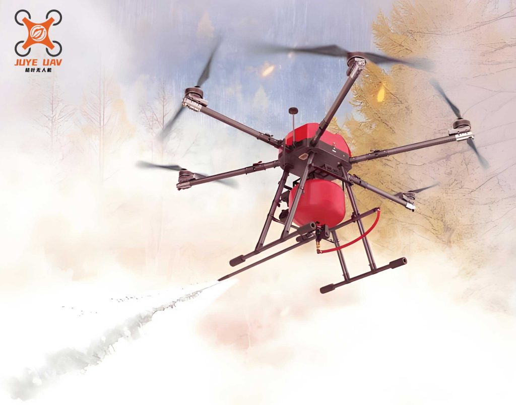
To understand the fire drone image transmission system, it is essential to break down its technical composition. The system comprises two main subsystems: the airborne transmission unit and the ground receiving station. The airborne unit includes a high-resolution camera for video capture, an encoder for digital compression, a wireless communication processor for data modulation, and an antenna for signal transmission. Conversely, the ground station handles signal reception, decoding, and application processing for command centers. This setup enables real-time video streaming from the fire drone to operators, facilitating immediate analysis. A summary of the components is presented in Table 1, which outlines their functions and specifications. The use of digital video ensures high fidelity for secondary processing, such as 3D modeling or remote diagnostics, crucial in fire scenarios where detail is paramount.
| Component | Function | Key Specifications |
|---|---|---|
| Airborne Camera | Captures high-resolution video | 1080p or 4K, low-light capability |
| Encoder | Compresses video data (e.g., H.264) | Bitrate: 2-10 Mbps, latency < 200 ms |
| Wireless Processor | Modulates data for transmission | COFDM modulation, power: 1-20 W |
| Antenna | Transmits signals to ground | Omnidirectional or directional, gain: 3-10 dBi |
| Ground Receiver | Receives and decodes signals | Sensitivity: -90 dBm, range: up to 20 km |
| Processing Platform | Analyzes video for decision support | DSP/FPGA/PC-based, real-time analytics |
The technical characteristics of fire drone image transmission are shaped by regulatory standards and engineering constraints. In many countries, frequency allocations for UAVs are specified to minimize interference. For example, bands such as 840.5–845 MHz for uplink control and 1430–1444 MHz for downlink telemetry are commonly used for fire drones. These frequencies ensure reliable communication in urban and rural fire scenes. The control signal design often employs Orthogonal Frequency Division Multiplexing (COFDM) to combat multipath interference and non-line-of-sight conditions. The coverage radius of a fire drone’s control signal can be calculated using the formula: $$ \text{Coverage Radius} = P_{\text{out}} \times k_d \times S_{\text{rx}} $$ where \( P_{\text{out}} \) is the output power in watts, \( k_d \) is the distance factor (typically 0.5–1.0 for urban areas), and \( S_{\text{rx}} \) is the receiver sensitivity in dBm. For instance, a 1 W transmitter might achieve a radius of 300–1200 meters, while a 20 W unit can extend to 10–20 km, depending on environmental factors. This mathematical model helps in planning fire drone deployments for optimal signal strength.
Error correction is another critical aspect, as transmission channels for fire drones are prone to noise and data loss. To ensure integrity, advanced coding schemes like Reed-Solomon (RS) codes concatenated with convolutional codes are implemented. The RS code, based on the CCSDS standard, uses a generator polynomial for error detection and correction. For a RS(255,223) code with symbol size 8 bits and error-correcting capability \( t = 16 \), the generator polynomial is: $$ g(x) = \prod_{i=1}^{2t} (x – \alpha^i) = (x – \alpha)(x – \alpha^2) \cdots (x – \alpha^{32}) $$ where \( \alpha \) is a primitive element in the Galois field GF(256). The interleaving depth \( I \) (e.g., \( I=4 \)) enhances burst error correction, vital for fire drone operations in electromagnetically noisy environments like industrial fires. The overall code rate is given by: $$ R = \frac{k}{n} = \frac{223}{255} \approx 0.875 $$ indicating efficient data throughput. Such mathematical formulations underpin the reliability of fire drone image streams, enabling clear visuals even in challenging conditions.
However, several application challenges hinder the seamless integration of fire drone image transmission in fire services. These can be categorized into flight performance, airborne unit design, and backend processing. First, the flight load capacity of a fire drone dictates its endurance and payload. Typically, fire drones use electric batteries or gasoline engines, with trade-offs between weight and flight time. For example, a multirotor fire drone might carry 1–5 kg of equipment for 20–40 minutes, while fixed-wing variants offer longer endurance but less maneuverability. Table 2 compares common fire drone types based on load capacity and flight duration, aiding selection for specific fire scenarios like forest blazes or urban rescues.
| Drone Type | Max Payload (kg) | Flight Time (min) | Typical Use in Fire Services |
|---|---|---|---|
| Multirotor (Electric) | 1–3 | 20–30 | Close-range inspection, indoor fires |
| Fixed-Wing (Gasoline) | 3–10 | 60–120 | Large-area surveillance, wildfire mapping |
| Hybrid VTOL | 2–5 | 40–60 | Versatile operations, obstacle-rich environments |
Second, the airborne video acquisition and transmission unit must balance power consumption, data rate, and environmental robustness. A typical fire drone module includes a camera, encoder, and transmitter, with total power draw often exceeding 50 W. The data rate \( R_d \) for video transmission can be estimated as: $$ R_d = f_r \times r_w \times r_h \times b_p $$ where \( f_r \) is the frame rate (e.g., 30 fps), \( r_w \) and \( r_h \) are resolution width and height (e.g., 1920×1080), and \( b_p \) is bits per pixel (e.g., 24 for RGB). This yields raw data rates up to 1.5 Gbps, necessitating compression to 2–10 Mbps for wireless transmission. Advanced fire drones employ H.265 encoding to reduce bandwidth while maintaining quality. Third, the backend processing platform choice—whether DSP, FPGA, or PC-based—impacts analysis capabilities. Table 3 summarizes their pros and cons for fire service applications, guiding infrastructure decisions.
| Platform | Advantages | Disadvantages | Suitability for Fire Drones |
|---|---|---|---|
| DSP-based | Low power, real-time processing | Limited flexibility, complex programming | High for embedded systems in mobile command units |
| FPGA-based | Parallel processing, customizable | High development cost, steep learning curve | Moderate for specialized tasks like thermal imaging |
| PC-based | Rich software ecosystem, ease of use | High power consumption, bulkiness | High for stationary command centers with robust power |
In fire service operations, the advantages of fire drone image transmission are multifaceted. Primarily, fire drones enable rapid situational assessment during the initial response phase, providing video feeds that inform dispatch decisions. For instance, in a chemical fire, a fire drone can safely approach the epicenter to identify hazards, reducing risk to firefighters. Additionally, real-time imagery supports continuous command updates, allowing for dynamic resource allocation. The fire drone’s ability to transmit from dangerous zones, such as collapsing structures or toxic atmospheres, enhances safety and efficiency. Moreover, remote experts can access live streams for consultation, bridging geographical gaps in expertise. These benefits are quantified in Table 4, which links fire drone capabilities to operational outcomes in fire services.
| Advantage | Description | Impact on Fire Services |
|---|---|---|
| Early reconnaissance | Provides first video within minutes of arrival | Reduces response time by up to 30%, improves initial strategy |
| Real-time monitoring | Streams continuous footage from hotspots | Enables adaptive tactics, minimizes collateral damage |
| Remote expertise access | Allows off-site analysts to view feeds | Enhances decision quality, especially in complex incidents |
| Risk reduction | Replaces human scouts in perilous areas | Lowers injury rates, complies with safety regulations |
Despite these advantages, the current state of fire drone image transmission faces barriers. Cost remains a significant hurdle, with a basic fire drone system ranging from $10,000 to $50,000, plus maintenance and training expenses. Many fire departments, especially in developing regions, struggle with budget constraints. Furthermore, technical expertise is scarce; operating a fire drone requires certified pilots and analysts, necessitating investment in human resources. Interoperability issues also arise, as fire drone systems must integrate with existing communication networks and video management systems. For example, compatibility with standard protocols like RTSP or ONVIF is essential for seamless data sharing. Additionally, regulatory compliance, such as adhering to frequency bands and flight regulations, adds complexity. These challenges underscore the need for standardized frameworks and funding initiatives to promote fire drone adoption in fire services worldwide.
Looking ahead, the future of fire drone image transmission holds promising expansions. Beyond real-time video, fire drones could incorporate multispectral sensors for detecting heat signatures or gas leaks, using algorithms like: $$ T_{\text{target}} = \epsilon \sigma (T_{\text{obj}}^4 – T_{\text{env}}^4) $$ where \( T_{\text{target}} \) is the radiant temperature, \( \epsilon \) is emissivity, \( \sigma \) is the Stefan-Boltzmann constant, and \( T_{\text{obj}} \) and \( T_{\text{env}} \) are object and environment temperatures. This would enhance fire assessment and post-fire analysis. Moreover, autonomous fire drones with AI-driven navigation could perform tasks like false alarm verification, saving resources. For instance, a fire drone could be dispatched to confirm a reported fire, transmitting video to a control center for validation. Integration with IoT systems might enable automated fire suppression, where fire drones deploy extinguishing agents based on image analytics. The convergence of 5G networks could also boost transmission speeds, reducing latency to under 50 ms for near-instant feedback.
In conclusion, as an advocate for technological innovation in emergency response, I believe fire drone image transmission is a cornerstone of modern firefighting. By addressing the technical intricacies and application hurdles, fire services can harness this tool for safer, more effective operations. The fire drone’s evolution will likely see increased affordability, smarter analytics, and broader regulatory support, paving the way for ubiquitous use. As we continue to refine these systems, collaboration between engineers, firefighters, and policymakers will be key to unlocking the full potential of fire drones in saving lives and property.