
In the evolving landscape of emergency response, the integration of unmanned aerial systems has marked a transformative shift. Among these, the specialized fire drone has emerged as a cornerstone technology for modern firefighting and rescue operations. This article, from my perspective as a researcher and practitioner in the field, delves into a comprehensive analysis of the efficacy and multifaceted applications of fire drone technology, with a particular focus on the demanding environment of wildland fire rescue. The discussion extends beyond mere description to include a critical evaluation based on performance metrics, supported by analytical models and comparative data.
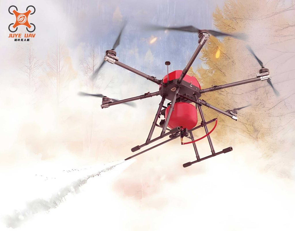
The operational philosophy of a fire drone is fundamentally centered on augmenting human capability and safety. By serving as a remote sensory and operational platform, it provides commanders with unprecedented situational awareness and enables intervention in zones deemed too hazardous for initial human entry. The core value proposition lies in its triad of advantages: rapid deployment, persistent aerial monitoring, and the ability to deliver targeted countermeasures. The following sections will systematically unpack the architecture, performance parameters, tactical applications, and future trajectory of this critical technology.
1. Systemic Architecture of a Modern Fire Drone
The effectiveness of a fire drone is intrinsically linked to its integrated design. It is not merely an aircraft but a sophisticated cyber-physical system. Its architecture can be decomposed into several synergistic subsystems, each contributing to mission success. A breakdown is provided in the table below.
| Subsystem | Key Components | Primary Function | Technical Considerations for Fire Context |
|---|---|---|---|
| Flight Control & Navigation | Flight Controller (FC), IMU, GPS/GNSS, Barometer, Visual/Ultrasonic Sensors | Stabilization, autonomous flight, path planning, precision hovering and navigation. | Must filter out turbulence from thermal updrafts and maintain GPS-denied navigation in dense smoke or canopy cover. |
| Propulsion & Power | Brushless DC Motors, ESCs, Propellers, High-Capacity LiPo/Li-ion Batteries | Generate lift and thrust, determine flight endurance and payload capacity. | Requires high torque for heavy payloads (e.g., extinguishing agents). Battery chemistry must be tolerant of elevated ambient temperatures. |
| Sensing & Payload | RGB Cameras, Thermal Imaging Cameras (LWIR), Multispectral Sensors, LiDAR, Gas Sensors, Payload Release Mechanisms | Environmental perception, data acquisition (visual, thermal, chemical), and mission-specific task execution (e.g., dropping retardant). | Payloads are mission-critical. Thermal cameras must penetrate smoke. Sensors need protection from heat and particulate matter. |
| Communication & Data Link | Radio Transceivers (2.4/5.8 GHz), LTE/5G Modules, Satellite Communication Terminals | Bi-directional transmission of control signals and high-bandwidth sensor data (video, telemetry) to/from the Ground Control Station (GCS). | Must be robust against interference from fireground communications and physical obstacles. Long-range, low-latency links are essential for BVLOS operations. |
| Airframe & Structure | Carbon Fiber/Composite Fuselage, Motor Arms, Landing Gear, Protective Enclosures | Physical integrity, housing for all components, and aerodynamic performance. | Must be lightweight yet durable, with potential heat shielding for components. Design varies significantly between multi-rotor (for hover) and fixed-wing (for range) fire drone platforms. |
The dynamics of a multi-rotor fire drone, the most common type for tactical operations, are governed by nonlinear equations. The thrust (T) generated by each rotor is proportional to the square of its angular velocity (ω):
$$T_i = k_f \cdot \omega_i^2$$
where \(k_f\) is the thrust coefficient. The total thrust \(F\) and the torques \(\tau_{\phi}, \tau_{\theta}, \tau_{\psi}\) causing roll, pitch, and yaw are related to the individual motor speeds through a mixing matrix derived from the airframe geometry. The translational dynamics in the earth-fixed frame can be expressed using Newton-Euler formulations. The altitude (z-axis) dynamics, crucial for terrain following during mapping, are:
$$m\ddot{z} = (\cos\phi \cos\theta) \cdot U_1 – mg$$
where \(m\) is the mass, \(g\) is gravity, \(\phi\) and \(\theta\) are roll and pitch angles, and \(U_1\) is the total thrust input from the flight controller. The control system’s role is to solve for the required motor commands to achieve desired trajectories, often using techniques like PID, backstepping, or model predictive control to handle these nonlinear dynamics under disturbance.
2. Quantitative Efficacy Evaluation Framework
Assessing a fire drone requires moving beyond qualitative claims to measurable key performance indicators (KPIs). These KPIs form a multi-dimensional matrix for evaluating suitability for specific fire rescue missions.
2.1 Coverage Area and Operational Speed
This KPI defines the fire drone‘s capability to survey terrain and respond to evolving incidents. It is a function of endurance, cruising speed, and sensor footprint. For area coverage, a critical metric is the Search Area Rate (SAR), often measured in km²/hour.
$$SAR = v_{eff} \cdot s_w$$
where \(v_{eff}\) is the effective ground speed (accounting for wind and maneuver time) and \(s_w\) is the sensor sweep width, which for a nadir-pointing camera depends on altitude \(h\) and sensor field of view \(\alpha\): \(s_w \approx 2h \cdot \tan(\alpha/2)\). A comparative analysis is essential:
| Platform Type | Typical Endurance | Cruise Speed | Coverage Strength | Best Use Case in Firefighting |
|---|---|---|---|---|
| Multi-rotor Fire Drone | 20-45 minutes | 10-15 m/s | High-resolution, persistent surveillance of a localized incident. Excellent for hovering and detailed inspection. | Tactical operations: structural triage, hotspot identification, personnel/asset tracking near the fire front. |
| Fixed-wing Fire Drone | 1.5-4+ hours | 20-35 m/s | Rapid mapping of large perimeters. High SAR for situational overview. | Strategic reconnaissance: initial fire perimeter mapping, post-fire damage assessment over vast forest areas. |
| VTOL (Hybrid) Fire Drone | 1-2 hours | 15-25 m/s | Combines vertical takeoff/hover with efficient forward flight. Balanced capability. | Versatile missions requiring both broad area coverage and focused, stationary observation. |
2.2 Image and Data Fidelity
The utility of intelligence gathered by a fire drone is dictated by data quality. Key parameters include spatial resolution (Ground Sample Distance – GSD), thermal sensitivity (Noise Equivalent Temperature Difference – NETD), and data latency.
$$GSD = \frac{h \cdot p}{f}$$
where \(h\) is flight altitude, \(p\) is camera sensor pixel pitch, and \(f\) is lens focal length. For fire detection, a GSD under 10 cm is often desired. Thermal cameras are evaluated by their ability to distinguish temperature differences; an NETD of < 50 mK is preferable for identifying smoldering hotspots amidst cooler ground clutter. Data fusion algorithms, combining RGB, thermal, and multispectral inputs, enhance detection probability \(P_d\) while reducing false alarms. A simplified model for a fusion-based detection system might be:
$$P_{d\_fused} = 1 – \prod_{i=1}^{n} (1 – P_{d\_i})$$
where \(P_{d\_i}\) is the detection probability from sensor \(i\), assuming independent detection events.
2.3 Communication Link Stability and Robustness
The data link is the fire drone‘s lifeline. Stability is quantified by metrics like Latency (\(L\)), Packet Loss Rate (\(PLR\)), and Link Margin (\(LM\)). In fire environments, attenuation from smoke, terrain, and distance is significant. The Friis transmission equation models received power \(P_r\):
$$P_r = P_t + G_t + G_r – 20\log_{10}\left(\frac{4\pi d}{\lambda}\right) – L_{atm} – L_{other}$$
where \(P_t\) is transmit power, \(G_t/G_r\) are antenna gains, \(d\) is distance, \(\lambda\) is wavelength, \(L_{atm}\) is atmospheric attenuation (exacerbated by smoke particles), and \(L_{other}\) includes other losses. A robust fire drone system employs frequency diversity (using both 2.4 GHz for range and 5.8 GHz for bandwidth, or licensed bands), mesh networking between drones, or satellite back-up to maintain a positive link margin under degrading conditions.
2.4 Autonomous Obstacle Avoidance and Navigation
This capability allows the fire drone to operate safely in complex, dynamic environments like burning forests with tall trees and rising smoke plumes. It relies on sensor fusion (vision, LiDAR, ultrasound) and real-time path planning algorithms. A common approach uses a local replanner based on artificial potential fields or rapidly-exploring random trees (RRT). The repulsive force \(F_{rep}\) from an obstacle in a potential field model can be defined as:
$$
F_{rep} = \begin{cases}
\eta \left(\frac{1}{\rho} – \frac{1}{\rho_0}\right) \frac{1}{\rho^2} \nabla \rho, & \text{if } \rho \le \rho_0 \\
0, & \text{if } \rho > \rho_0
\end{cases}
$$
where \(\eta\) is a scaling constant, \(\rho\) is the distance to the nearest obstacle, and \(\rho_0\) is the distance threshold for influence. The fire drone then navigates by following the negative gradient of the total potential field (sum of attractive goal field and repulsive obstacle fields).
2.5 Endurance and Energy Management
Flight time \(T_{flight}\) is the ultimate limiting factor. For electric multi-rotors, it is approximated by:
$$T_{flight} \approx \frac{C_{batt} \cdot V_{batt} \cdot \zeta}{P_{avg}}$$
where \(C_{batt}\) is battery capacity (Ah), \(V_{batt}\) is voltage, \(\zeta\) is the depth-of-discharge factor (e.g., 0.8), and \(P_{avg}\) is the average power draw. \(P_{avg}\) itself is a function of weight (including payload), aerodynamics, and operational profile (hovering vs. transit). This equation highlights the direct trade-off between payload mass and operational duration, a central design constraint for any fire drone intended for tasks like extinguishing agent delivery.
3. Application Analysis in Wildland Fire Scenarios
The theoretical KPIs translate into practical value across the wildfire incident lifecycle. The following table summarizes the primary applications and their technical dependencies.
| Application Domain | Specific Tasks | Critical Fire Drone Capabilities | Payload & Sensor Requirements |
|---|---|---|---|
| Intelligence, Surveillance, Reconnaissance (ISR) | • Initial Fire Detection & Verification • Perimeter Mapping & Progression Tracking • Hotspot Identification (Post-Control) • Structure/Asset Assessment |
• Long Range/Endurance (Fixed-wing/VTOL) • High-Data-Rate, Low-Latency Link • Geo-referencing & Mapping Software |
• EO/IR Dual-Sensor Gimbal (High-res, Low NETD) • Multispectral/LiDAR for fuel/terrain analysis • RTK GPS for cm-level accuracy |
| Direct Fire Suppression Support | • Aerial Ignition (Backfiring) • Targeted Retardant/Water Droplet Delivery • Creating Firebreaks via Precision Drops |
• High Paylift Capacity & Precise Hover • Protected Payload Release Mechanism • Flight Stability in Turbulent, Hot Air |
• Pneumatic/Mechanical Dispenser for Ping-Pong balls (ignition) • Liquid Tank & Pump/Spray System (2-50+ L capacity) • Guidance system for drop accuracy |
| Logistical & Communication Support | • Ad-hoc Communication Relay • Delivery of Critical Supplies • Night Operations Illumination |
• High-altitude Loitering Capability • Significant Paylift Margin for Supplies • Extended Endurance |
• LTE/Radio Repeater Payload • Cargo Hook or Secure Container • High-lumen Spotlights/LED Arrays |
| Search and Rescue (SAR) | • Locating Trapped Firefighters or Civilians • Assessing Escape Routes • Delivering Emergency Survival Gear |
• Agile Maneuvering in Complex Terrain • Advanced Obstacle Avoidance • Rapid Deployment from Forward Bases |
• High-zoom EO & High-sensitivity Thermal • Loudspeaker for communication • Small SAR Pod (medical kit, radio, water) |
3.1 Deep Dive: Aerial Delivery of Extinguishing Agents
The use of a fire drone for direct suppression, such as dropping water or retardant, involves a complex interplay of physics and control. The goal is often to cool a specific hotspot or create a damp barrier. The effectiveness of a liquid drop depends on the impact energy and coverage. The kinetic energy \(E_k\) of a falling droplet mass \(m_d\) released from a fire drone at height \(H\) (ignoring air resistance initially) is:
$$E_k = \frac{1}{2} m_d v^2 \approx m_d g H$$
This shows why low-altitude, precision drops are more effective for targeted cooling than high-altitude blanket coverage. The fire drone must stabilize itself against the momentum shift from the released payload. The change in the vehicle’s angular velocity \(\Delta\omega\) can be estimated from the conservation of angular momentum if the payload is released with an offset \(r\) from the center of gravity:
$$I \Delta\omega \approx m_d \cdot (r \times v_{rel})$$
where \(I\) is the drone’s moment of inertia and \(v_{rel}\) is the payload’s release velocity relative to the drone. The flight controller must instantly compensate for this disturbance to maintain station.
3.2 Deep Dive: Communication Relay Modeling
When a fire drone acts as an aerial relay node to connect isolated ground teams with the command post, it optimizes the communication link. Consider a scenario where direct ground-to-ground (G2G) communication fails due to topographic blockage. An airborne fire drone relay creates two hop links: Ground-to-Air (G2A) and Air-to-Ground (A2G). The total path loss for the relayed link can be less than the obstructed direct link. The signal-to-noise ratio (SNR) at the receiver via the drone relay, assuming amplify-and-forward, is bounded by the weaker of the two hops:
$$SNR_{end-to-end} \approx \min(SNR_{G2A}, SNR_{A2G})$$
Optimal relay positioning is therefore at a point that balances and maximizes the SNR of both links, often at a high altitude with clear line-of-sight to both parties. A formation of multiple fire drone relays can further extend the network mesh deep into the fire zone.
4. Limitations and Forward-Looking Recommendations
Despite its transformative potential, current fire drone technology faces non-trivial constraints that must be acknowledged and addressed.
4.1 Persistent Limitations
• Energy Density Ceiling: The specific energy of commercial LiPo batteries (~250 Wh/kg) fundamentally limits endurance. A fire drone carrying a 20L water payload (~20 kg) may have a flight time of only 10-15 minutes, necessitating a very efficient operational cycle.
• Environmental Vulnerability: Extreme radiant heat can damage electronics and sensors, while dense smoke and ash can clog air intakes and coat lenses. Icing conditions at higher altitudes present another hazard.
• Regulatory and Airspace Integration: Operating BVLOS in controlled airspace, especially near other aerial assets like manned tankers and helicopters, requires robust Detect-and-Avoid (DAA) systems and complex regulatory approvals.
• Data Overload: The volume of high-resolution imagery and sensor data can overwhelm incident command systems without automated AI-driven analytics to highlight critical information.
4.2 Strategic Recommendations for Advancement
1. Hybrid-Electric and Alternative Power Systems: Research must pivot towards hybrid gas-electric propulsion for multi-rotors to drastically extend loiter time. Hydrogen fuel cells, with specific energy >500 Wh/kg, represent a promising long-term solution for the fire drone platform.
2. AI-Enhanced Autonomy: Embedding lightweight neural networks for real-time, onboard analysis is crucial. This includes:
• Fire Behavior Prediction: Using real-time visual/thermal data to run micro-scale fire spread models.
• Automated Damage Assessment: Instant classification of structural integrity from imagery.
• Swarm Intelligence: Coordinated fleets of heterogeneous fire drone units (scout, relay, suppression) operating under a shared tactical objective, governed by swarm algorithms.
3. Resilient Hardware Design: Developing standardized, modular, and hardened payload bays for the fire drone. This includes passive/active cooling systems, self-cleaning sensor domes, and air-filtered ventilation.
4. Integrated Airspace Awareness: Equipping every fire drone with ADS-B In/Out and acoustic-based DAA systems to safely deconflict with manned aviation, moving towards full UAS Traffic Management (UTM) integration.
5. Human-Machine Teaming Protocols: Establishing doctrine and intuitive control interfaces that allow a single operator to effectively manage a small swarm of fire drone assets, shifting the human role from pilot to mission commander.
5. Concluding Synthesis
The fire drone has unequivocally established itself as a force multiplier in wildland fire rescue. Its value proposition is anchored in providing persistent, penetrating awareness and enabling risk-worthy interventions, thereby enhancing both operational effectiveness and firefighter safety. This analysis has systematically deconstructed its efficacy through a framework of quantifiable performance indicators—coverage, data fidelity, link stability, autonomy, and endurance—and mapped these to concrete tactical applications from ISR to direct suppression and SAR.
The trajectory for the fire drone is one of increasing integration and intelligence. The future wildland firefighting toolkit will not feature a single drone, but a collaborative ecosystem of specialized aerial agents: long-endurance mappers, heavy-lift suppressors, agile recon units, and persistent communication nodes, all orchestrated through a common network. Realizing this vision requires concerted advancement on three parallel fronts: technological (breaking the energy barrier, advancing AI), regulatory (enabling safe, scalable BVLOS operations), and doctrinal (training personnel and adapting incident command structures).
In conclusion, the fire drone is more than a tool; it is the vanguard of a data-driven, precision-based paradigm in emergency response. By continuing to address its limitations through focused innovation and integration, its role will evolve from a supportive asset to a central, indispensable pillar of modern wildland firefighting strategy, saving lives, protecting property, and preserving natural resources with unprecedented efficiency.