
The rapid acceleration of urbanization has positioned metro systems as a critical backbone of public transportation. Ensuring their operational safety and reliability is paramount for alleviating urban congestion and fostering economic growth. However, traditional maintenance paradigms for metro vehicles are increasingly revealing significant shortcomings, struggling to meet the high standards of modern, dense operational schedules. These conventional methods are predominantly manual, leading to inefficiencies, susceptibility to human error, and difficulty in accessing confined or hazardous spaces. This often results in overlooked potential faults, inconsistent inspection quality due to variable technician expertise, and high operational costs from extensive labor and potential service disruptions.
In this context, the evolution towards intelligent maintenance systems presents a transformative solution. Current advancements, such as the deployment of 360° intelligent panoramic inspection systems, utilize high-definition line-scan cameras and algorithms to detect surface anomalies. Concurrently, Unmanned Aerial Vehicle (UAV) technology is emerging as a highly complementary and potent tool within the smart maintenance ecosystem. UAVs offer unparalleled flexibility for rapid, close-up inspection of areas difficult for humans or fixed systems to access, such as complex undercarriage assemblies, roof-mounted equipment, and narrow gaps. When equipped with advanced sensors and integrated with wider inspection networks, UAVs can significantly enhance detection coverage, precision, and overall operational efficiency, paving the way for a more predictive and automated maintenance future.
1. UAV Technology: Classification, Evolution, and Synergistic Applications
UAV technology, or Unmanned Aircraft Systems (UAS), encompasses a diverse range of remotely piloted or autonomously operated aerial platforms. Their classification is primarily based on design and application, as summarized in Table 1.
| Type | Key Characteristics | Primary Application Domains |
|---|---|---|
| Fixed-Wing UAV | High speed, long endurance, strong payload capacity. | Large-scale corridor inspection, mapping, long-range logistics. |
| Multi-Rotor UAV (e.g., Quadcopter, Hexacopter) | Vertical Take-Off and Landing (VTOL), excellent hovering capability, high maneuverability. | Detailed close-range inspection, confined space operation, precise data acquisition. |
| Hybrid VTOL UAV | Combines vertical lift with efficient forward flight. | Applications requiring both long-range transit and stationary inspection. |
Table 1: Classification of UAVs Relevant to Infrastructure Inspection.
The progression of UAVs from military and niche applications to widespread commercial use has been fueled by advancements in miniaturization, sensor technology, and data processing. In the realm of infrastructure inspection, UAVs equipped with high-resolution optical cameras, thermal imagers, Light Detection and Ranging (LiDAR), and gas sensors have become indispensable. A key trend is the move towards highly automated workflows. For instance, systems can now pre-plan optimal flight paths based on 3D models of assets, automatically capture imagery with specified overlap, and process data using cloud-based or edge-computing platforms to generate actionable reports.
The core advantage lies in the fusion of mobility and sensing. Modern UAVs serve as intelligent, flying sensor platforms. Data processing, particularly through computer vision and deep learning algorithms, has seen remarkable progress. Algorithms based on convolutional neural networks (CNNs), such as YOLO (You Only Look Once) or Faster R-CNN, enable real-time or post-processed identification of defects like cracks, corrosion, loose components, and thermal anomalies from the captured visual and infrared data. The performance of such detection systems is often evaluated using metrics like accuracy, precision, and recall, which can be formally expressed. For a binary defect detection task, if we define True Positives (TP), True Negatives (TN), False Positives (FP), and False Negatives (FN), the detection accuracy $$A$$ is given by:
$$A = \frac{TP + TN}{TP + TN + FP + FN}$$
Similarly, precision $$P$$ (the correctness of identified defects) and recall $$R$$ (the completeness of defect detection) are critical:
$$P = \frac{TP}{TP + FP}, \quad R = \frac{TP}{TP + FN}$$
Optimizing these metrics, often through a harmonized mean like the F1-score $$F1 = 2 \cdot \frac{P \cdot R}{P + R}$$, is a central focus in developing reliable UAV-based inspection systems. The integration of these technologies signifies a shift from simple remote viewing to automated condition assessment and data-driven decision-making.
2. Optimizing Metro Maintenance: A Multi-Technology Fusion Framework
The limitations of purely manual or single-technology automated systems call for an integrated approach. While track-based robots or fixed 360° scanners provide excellent coverage for specific zones (like the undercarriage in a pit or the vehicle sides), they lack the omnidirectional flexibility of UAVs. Conversely, UAVs face challenges with flight time (endurance) and may not be optimal for scanning very large, continuous surfaces with the ultra-high consistency of a fixed system. Therefore, the optimal maintenance model is a synergistic fusion.
This composite strategy leverages the strengths of each technology. The operational framework can be conceptualized as follows: Routine, high-frequency inspections of standardized areas (e.g., full train exterior profiles) are handled efficiently by fixed 360° scanning systems. UAVs are then deployed for targeted missions, activated by triggers from the fixed system, scheduled based on risk assessment, or requested for incident response. Their roles include:
- Detailed inspection of complex undercarriage areas outside the fixed scanner’s field of view.
- Close-up examination of roof-mounted pantographs, air conditioning units, and antennae.
- Rapid assessment of accident or incident damage in situ.
- Inventory checks in hard-to-reach storage or technical compartments.
The heart of a UAV inspection system is its integrated platform. The overall architecture consists of several key modules, as outlined in Table 2.
| System Module | Components | Function |
|---|---|---|
| Aerial Platform & Propulsion | Frame, Motors, Electronic Speed Controllers (ESCs), Propellers, Battery. | Provides stable flight, maneuverability, and payload capacity. Endurance is a key limiting factor: $$E = \frac{C \cdot V}{P}$$ where \(E\) is endurance, \(C\) is battery capacity, \(V\) is nominal voltage, and \(P\) is average power draw. |
| Perception & Sensing Suite | High-res RGB Camera, Thermal Imager, LiDAR, Ultrasonic/ToF Sensors. | Data acquisition. Sensor fusion algorithms combine inputs for robust navigation and detailed inspection. A payload capacity constraint exists: $$M_{\text{payload}} \leq M_{\text{max}} – (M_{\text{uav}} + M_{\text{battery}})$$. |
| Navigation & Control | Flight Controller (FCU), IMU, GNSS, Barometer, Vision Positioning System (VPS). | Autonomous flight, precision hovering, and obstacle avoidance. Navigation in GNSS-denied depots relies on VPS and LiDAR SLAM (Simultaneous Localization and Mapping). |
| Communication & Data Link | Radio Controller, Wi-Fi/4G/5G Data Link. | Real-time telemetry, live video feed, and command transmission. Redundancy is critical for safety. |
| Ground Control Station (GCS) & Processing | Software for mission planning, live monitoring, data analysis, and AI defect detection. | The command center and brain of the operation. Handles mission planning, real-time control, and post-flight data analysis using the AI models mentioned earlier. |
Table 2: Architectural Modules of a Metro Inspection UAV System.
The efficacy of this integrated model can be measured by the overall inspection efficiency gain. If a traditional manual inspection of a specific component takes time \(T_{\text{manual}}\), and the UAV-assisted process takes \(T_{\text{flight}} + T_{\text{processing}}\), the time efficiency ratio \(\eta_t\) is:
$$\eta_t = \frac{T_{\text{manual}}}{T_{\text{flight}} + T_{\text{processing}}}$$
Similarly, a coverage completeness metric \(\eta_c\) can be defined as the percentage of inspectable surfaces accessed by the combined system compared to the theoretical total, aiming for values near 100%.
3. Implementation Pathway and Formidable Challenges
Deploying UAVs in the critical environment of metro maintenance is not merely a technical exercise; it requires a holistic system integration addressing operational, regulatory, and human factors. A structured implementation framework is essential, progressing from pilot studies to full operational deployment. This phased approach must be coupled with a rigorous and continuous drone training program for all personnel involved, from pilots to maintenance analysts and safety managers.
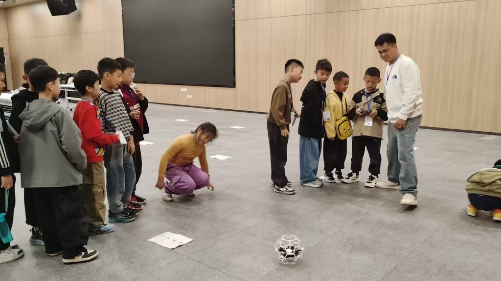
The challenges are multifaceted and interlinked, as analyzed below:
3.1 Technical and Environmental Hurdles
The depot environment is uniquely challenging: enclosed spaces with low ceilings, dense clutter (catenary wires, gantries, other trains), poor or absent GNSS signals, and potential electromagnetic interference. UAVs require robust navigation systems, such as vision-based SLAM or ultra-wideband (UWB) anchoring, to operate safely and precisely. Furthermore, the demand for high-resolution data conflicts with the limited flight endurance. This necessitates advanced mission planning algorithms that optimize the flight path for maximum data yield per battery cycle, a problem often framed as a variant of the Coverage Path Planning (CPP) or Traveling Salesman Problem (TSP).
3.2 Regulatory and Standardization Vacuum
Operating in safety-critical transport infrastructure exists in a regulatory grey area. Specific standards for BVLOS (Beyond Visual Line of Sight) operations in confined indoor/outdoor spaces like depots are lacking. Clear protocols are needed for airspace risk assessment within the depot, defining geofenced volumes, fail-safe procedures, and communication requirements. Developing these standards requires close collaboration between metro operators, aviation authorities, UAV manufacturers, and insurance companies. A core component of compliance will be demonstrating a robust safety case, which is fundamentally built upon comprehensive drone training and certification of operational crews.
3.3 The Human Factor: Skills and Safety Culture
The successful adoption of UAV technology hinges on people. Maintenance technicians must transition from hands-on inspectors to supervisors of automated systems and analysts of digital data. This shift necessitates significant investment in drone training. Training programs must be multi-tiered, covering:
– Pilot Training: Certified flight skills for manual takeover, emergency procedures, and understanding system limitations.
– Mission Specialist Training: Skills for planning autonomous missions, selecting appropriate sensors, and ensuring data quality.
– Data Analyst Training: Competence in using AI-assisted software to review findings, validate defect flags, and integrate results into maintenance management systems.
A safety-first culture must be ingrained, where the UAV is treated as another piece of heavy, mobile machinery with specific hazards.
3.4 Data Management and Cybersecurity
UAVs generate vast amounts of high-definition imagery and sensor data. Efficiently storing, processing, and analyzing this data is a significant IT challenge. Edge computing on the UAV or a local server can pre-process data to reduce bandwidth needs. Furthermore, the entire system—the UAV, its data link, and the ground station—is a potential cyber-attack vector. Securing these systems against unauthorized access or data manipulation is paramount to ensure the integrity of maintenance decisions.
4. Towards a Systematized Solution: Addressing Challenges Holistically
Overcoming these barriers requires a coordinated, multi-pronged strategy that views the UAV not as a standalone tool but as an integrated node within the broader smart depot ecosystem. The solutions correspond directly to the challenges outlined.
4.1 Advancing Core Technology for Depots
Research and development must focus on “depot-hardened” UAV solutions. Key areas include:
– Advanced Perception: Developing sensor fusion algorithms that combine visual, thermal, and geometric (LiDAR) data for reliable obstacle avoidance and navigation in dynamic, low-light environments.
– Swarm Intelligence: Exploring coordinated fleets of smaller UAVs to parallelize inspection tasks, improving coverage speed and providing redundancy.
– Docking and Charging Automation: Implementing autonomous docking stations for wireless data transfer and charging, enabling persistent, semi-autonomous inspection capabilities without manual battery swaps.
4.2 Co-Creating the Regulatory Framework
Metro operators should proactively engage with national aviation authorities (like the FAA or EASA) to develop a specialized regulatory framework for “Infrastructure Inspection in Controlled Environments” (IICE). This framework would establish:
– Performance-based standards for UAV reliability and failure modes.
– Operational limits for depot BVLOS flights.
– Data security and privacy guidelines.
– Certification requirements for operators and maintenance organizations, heavily emphasizing documented drone training programs.
4.3 Building a Sustainable Training and Change Management Program
Investing in human capital is critical. A formal drone training academy or partnership with specialized institutions should be established. The curriculum should blend theoretical knowledge (regulations, physics, data science) with extensive practical simulation and live, supervised depot flights. Change management is equally important to address workforce concerns, highlighting how UAVs augment human roles—removing them from dirty, dangerous, and dull tasks—and create new, skilled positions in data analysis and system management.
4.4 Integrating with Digital Twins and Predictive Analytics
The ultimate value of UAV inspection is realized when its data feeds into a larger digital ecosystem. Inspection findings should automatically populate a “Digital Twin” of the rolling stock—a dynamic, virtual model that reflects the real-time condition of each vehicle. This allows for:
– Trend analysis of component wear over time.
– Predictive maintenance modeling, using historical UAV data to forecast remaining useful life.
– Optimized spare parts logistics and maintenance scheduling.
The integration workflow, from data capture to decision support, is the cornerstone of the next-generation maintenance paradigm.
5. Conclusion
The integration of UAV technology into metro vehicle maintenance systems represents a profound shift towards intelligent, data-driven, and predictive asset management. While traditional methods are reaching their limits, UAVs offer a powerful means to enhance inspection coverage, precision, and efficiency, particularly in confined and complex spaces. The proposed multi-technology fusion framework, combining the strengths of fixed scanners and mobile UAVs, provides a robust model for comprehensive vehicle assessment.
However, the path to widespread adoption is paved with significant interdisciplinary challenges. Technical hurdles in navigation and endurance, a nascent regulatory landscape, the critical need for comprehensive drone training and workforce development, and complex data integration demands must all be systematically addressed. Success hinges on collaborative efforts between technology developers, metro operators, regulatory bodies, and educational institutions. By tackling these challenges holistically, the rail industry can unlock the full potential of UAVs, transitioning from scheduled and reactive maintenance to a truly condition-based and predictive strategy, thereby ensuring higher levels of safety, reliability, and cost-effectiveness for urban rail transit systems worldwide.