In recent years, the monitoring of ecological and environmental risks in coastal areas has become increasingly critical due to the growing pressures from human activities and climate change. Traditional monitoring methods often fall short in providing comprehensive and real-time data, leading to delayed responses and inadequate risk management. As a researcher in this field, I have explored the integration of low-power multirotor drone technology with oblique photography to develop an intelligent monitoring system for coastal ecological risks. This approach leverages the flexibility and efficiency of multirotor drones to capture high-resolution, multi-angle images, enabling detailed analysis and early warning of potential environmental threats. The use of multirotor drones allows for extensive coverage and precise data collection, which is essential for accurate risk assessment in dynamic coastal environments.
The core of this method involves deploying multirotor drones equipped with advanced cameras to perform oblique photography over coastal regions. These drones are designed to operate with minimal energy consumption, making them ideal for prolonged missions. By adjusting flight paths and camera angles, the multirotor drone can capture comprehensive imagery of both terrestrial and marine components, providing a holistic view of the ecosystem. The following sections detail the technical aspects, including image acquisition, feature extraction, and risk modeling, supported by formulas and tables to illustrate the process. Throughout this work, the multirotor drone proves to be a versatile tool, enhancing our ability to monitor and protect coastal environments effectively.
To begin with, the image acquisition process using a multirotor drone involves careful planning of flight routes and camera settings. The multirotor drone is programmed to follow specific trajectories that cover the entire survey area, ensuring that no critical zones are missed. During flight, the drone’s gimbal system stabilizes the camera, allowing it to maintain a constant orientation relative to the ground, even as the multirotor drone moves. This stability is crucial for obtaining clear, high-quality images without motion blur. The camera parameters, such as focal length and aperture, are adjusted dynamically based on environmental conditions. For instance, the focal distance formula is used to determine the optimal focus: $$H = f + \frac{f^2}{s c}$$ where \(H\) is the focal distance, \(f\) is the lens focal length, \(s\) is the aperture number, and \(c\) is the permissible circle of confusion. This ensures that images are sharp and detailed, even in varying light conditions. Additionally, the multirotor drone’s ability to automatically match ISO sensitivity helps prevent overexposure or underexposure, further enhancing image quality.
Another key aspect is the calculation of the photographic object distance, which determines how far the multirotor drone should be from the subject to achieve the desired resolution. This is derived using the formula: $$S = \frac{n}{2 \tan\left(\frac{r}{2}\right)}$$ where \(S\) is the object distance, \(n\) is the number of pixels, and \(r\) is the lens parameter. By optimizing this distance, the multirotor drone can capture images with sufficient detail for subsequent analysis. The multirotor drone’s GPS system aids in maintaining the correct altitude and position, ensuring consistent coverage across the entire area. This systematic approach allows the multirotor drone to efficiently traverse all path points, collecting a comprehensive dataset that forms the basis for ecological risk assessment.
Once the images are acquired, the next step is to extract relevant ecological features from the data. This involves converting the raw images into a format suitable for analysis and applying preprocessing techniques to enhance key elements. For example, grayscale detection is used to identify features based on pixel intensity, as described by the formula: $$g(x,y) = \frac{1}{2} \sum_{j=1}^{k} T(a,c)$$ where \(g(x,y)\) represents the pixel position, \(j\) is the gray level, and \(T\) is the gray coefficient. This method helps in distinguishing different environmental components, such as vegetation, water bodies, and anthropogenic structures, by analyzing their tonal variations. The multirotor drone’s high-resolution imagery enables precise feature identification, which is essential for accurate risk evaluation. Furthermore, the integration of data from multiple sources, including historical records and real-time sensors, allows for a more robust analysis of ecological trends and anomalies.
To model and predict ecological risks, we employ a Bayesian network framework that captures the dependencies between various environmental factors. This model uses the collected data to estimate the probability of different risk states, such as low, medium, or high risk. The expectation-maximization algorithm is applied to optimize the model parameters, with the conditional expectation given by: $$Q(\theta | \theta_i) = E[\log p(x, z | \theta), y]$$ where \(\theta\) represents the conditional probabilities, \(x\) and \(z\) are observed and latent variables, and \(y\) is the iteration step. This iterative process refines the model, improving its predictive accuracy over time. The risk assessment matrix is defined as: $$M = (N + 1)k + 1$$ where \(N\) is the identity matrix and \(k\) is the path length between nodes. This matrix helps quantify the interrelationships between risk factors, enabling a comprehensive evaluation of potential threats. The multirotor drone’s data inputs are crucial here, as they provide the empirical basis for calibrating the model and validating its outputs.
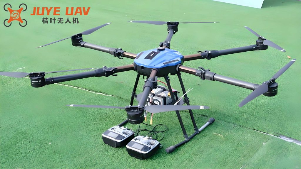
In our experimental setup, we utilized an A-type multirotor drone with specifications detailed in the table below. This multirotor drone was selected for its endurance and imaging capabilities, which are essential for extensive coastal monitoring. The performance parameters of the multirotor drone are summarized as follows:
| Technical Indicator | Parameter |
|---|---|
| Maximum Flight Time | 30 minutes |
| Flight Altitude | Relative height 600 m / Altitude 6000 m |
| Image Transmission Distance | 3 km |
| Lens Specification | F2.8 fixed aperture |
| Photo Resolution | 15 million pixels |
| Sensor Size | 1/2.5 mm |
| Pixel Size | 1.45 μm |
| Supports Secondary Development | Yes |
The results of our monitoring efforts over a 15-year period from 2009 to 2023 are presented in the following table, which shows the comprehensive environmental quality indices for three ecological protection zones (A, B, and C). These indices, derived from the multirotor drone data and model outputs, indicate the overall health of the ecosystems, with values above 90 signifying high quality suitable for activities like aquaculture. The consistent high scores demonstrate the effectiveness of the multirotor drone-based approach in maintaining and improving ecological conditions.
| Year | Ecological Zone A | Ecological Zone B | Ecological Zone C |
|---|---|---|---|
| 2009 | — | 99 | 96 |
| 2010 | 93 | 93 | 96 |
| 2011 | 94 | 94 | 99 |
| 2012 | 96 | 96 | 97 |
| 2013 | 99 | 93 | 94 |
| 2014 | 97 | 97 | 93 |
| 2015 | 95 | 99 | 97 |
| 2016 | 96 | 94 | 93 |
| 2017 | 93 | 93 | 96 |
| 2018 | 100 | 96 | 95 |
| 2019 | 94 | 94 | 93 |
| 2020 | 96 | 99 | 99 |
| 2021 | 95 | 93 | 94 |
| 2022 | 93 | 97 | 97 |
| 2023 | 99 | 95 | 94 |
The data reveals that the environmental quality indices remained above 90 throughout the period, highlighting the success of the multirotor drone-based monitoring system in enhancing ecosystem health. This improvement is attributed to the timely detection of risks and the implementation of preventive measures based on the model’s predictions. The multirotor drone’s role in providing accurate, up-to-date information cannot be overstated, as it enables proactive management of coastal environments. Moreover, the integration of intelligent algorithms allows for continuous learning and adaptation, ensuring that the monitoring system remains effective even as conditions change.
In conclusion, the use of low-power multirotor drones for oblique photography has revolutionized the way we monitor ecological risks in coastal areas. This method not only improves data accuracy and coverage but also facilitates early warning and rapid response. The multirotor drone’s versatility and efficiency make it an indispensable tool in modern environmental management. However, there is room for refinement, particularly in optimizing computational processes and expanding the model’s capabilities. Future work should focus on enhancing the multirotor drone’s autonomy and integrating additional data sources to further improve risk prediction. By continuing to innovate in this area, we can better safeguard coastal ecosystems and support sustainable development. The multirotor drone technology, combined with advanced analytics, holds great promise for addressing the complex challenges of environmental monitoring in the years to come.