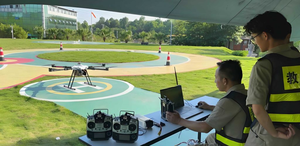
As a lead developer and researcher in the field of power grid digitization, I have witnessed firsthand the rapid proliferation of Unmanned Aerial Vehicles (UAVs), or drones, within modern utility operations. Their applications span from routine transmission line inspection and construction site monitoring to post-disaster damage assessment and emergency repair. This surge in adoption has created an unprecedented demand for skilled drone pilots who are not only proficient in basic flight control but are also experts in the specific operational protocols and safety procedures of the power industry. Traditional drone training methods, which heavily rely on real aircraft practice, are fraught with limitations: high costs for equipment and potential damage, logistical constraints, weather dependencies, and significant safety risks, especially when training near high-voltage infrastructure. To address this critical bottleneck in our “machines replacing manpower” strategy, my team and I pioneered the development of a comprehensive Drone Patrol Line Assessment and Simulation System. This system is designed to provide a safe, cost-effective, scalable, and highly realistic platform for drone training and certification, specifically tailored for power grid applications.
The core philosophy behind our system is to create a holistic virtual environment that mirrors real-world grid drone training scenarios. We moved beyond generic flight simulators by integrating three synergistic modules: a high-fidelity Flight Control Simulation module, a massive-scale Visual Simulation Engine built on real geospatial data, and an intelligent Training & Assessment module embedded with grid-specific operational logic. This integration allows trainees to transition seamlessly from learning fundamental piloting skills to executing complex inspection missions, all within a risk-free virtual space. The system has been deployed across training centers and pilot sites within the Guangdong power grid, demonstrating substantial improvements in drone training efficiency, pilot competency, and certification pass rates.
1. Introduction: The Imperative for Specialized Drone Training in Grid Operations
The integration of drones into power grid maintenance represents a paradigm shift towards automated, data-driven asset management. Drones enhance the efficiency, safety, and accuracy of tasks such as identifying insulator defects, measuring conductor sag, surveying vegetation encroachment, and inspecting tower structures after natural disasters. However, the operational environment of a power grid presents unique challenges that generic drone piloting skills cannot address. Pilots must navigate in close proximity to conductive elements, understand the electromagnetic interference environment, follow strict operational checklists defined by standards like DL/T 1482-2015, and accurately identify and document specific types of equipment defects.
Previously, drone training for grid personnel was bifurcated: basic flight skills were acquired through generic simulators or small-scale practice, while grid-specific knowledge was taught through classroom sessions. This disconnection often led to a gap between theoretical knowledge and practical execution. Our solution bridges this gap by creating a unified simulation platform. The system’s primary innovations include: 1) A physics-based flight control module interfaced with real transmitter hardware; 2) A province-wide, precise 3D model of terrain and transmission network assets (covering 28,270 km of lines and 79,732 towers); 3) Simulation of standard grid inspection workflows (tower acceptance, vegetation survey, fault inspection); and 4) An automated assessment engine for both skill-based (e.g., AOPA-style exams) and knowledge-based (e.g., defect finding) evaluations.
2. System Architecture and Overall Design
The architecture of our Drone Patrol Line Assessment and Simulation System is built upon three pillars: the Flight Control (Flight Sim) Module, the Visual Scene Simulation Module, and the Training & Assessment Module. The data flow and interaction between these modules create a closed-loop, immersive drone training experience.
2.1 Flight Control Simulation Module
This module is the cornerstone of realistic pilot feel. It consists of a hardware interface and a software dynamics engine. Trainees use actual, physical drone transmitters connected to the system via USB. The software engine interprets the control stick inputs (throttle, yaw, pitch, roll) and mode switches, calculating the drone’s kinematic state in real-time using a six-degree-of-freedom (6DOF) model. The core dynamics are governed by Newton-Euler equations. The translational motion is described by:
$$ m \frac{d\vec{V}}{dt} = \vec{F}_g + \vec{F}_T + \vec{F}_D $$
where \( m \) is the mass of the drone, \( \vec{V} \) is its velocity vector, \( \vec{F}_g \) is the gravitational force, \( \vec{F}_T \) is the total thrust vector from the rotors, and \( \vec{F}_D \) is the aerodynamic drag force. The rotational motion is given by:
$$ I \frac{d\vec{\omega}}{dt} + \vec{\omega} \times (I \vec{\omega}) = \vec{\tau} $$
where \( I \) is the inertia tensor, \( \vec{\omega} \) is the angular velocity vector, and \( \vec{\tau} \) is the total torque generated by differential thrust across the rotors. The module also simulates a gimbal system. A dedicated control on the transmitter allows the trainee to adjust the camera’s pitch and yaw, and a shutter button triggers a simulated photo capture. The metadata for each “captured” image, including the drone’s GPS coordinates, altitude, camera orientation, and timestamp, is logged for later assessment. Environmental factors like wind gusts (modeled as force vectors \( \vec{F}_w \)) and turbulence can be injected into these equations to create advanced drone training scenarios.
2.2 Visual Scene Simulation Module
This module generates the immersive 3D world. Its key achievement is the automatic, large-scale modeling of an entire provincial power grid’s geography and infrastructure. We fused multi-source data including high-resolution satellite imagery and Digital Elevation Models (DEM) to create a accurate terrain model. The transmission network modeling is a two-step process:
- Tower Placement and Orientation: Using the grid’s asset database (or “ledger”), each tower is instantiated from a library of 3D models (e.g., tangent tower, strain tower, angle tower) at its real-world geographic coordinates (longitude, latitude). The tower’s orientation is algorithmically determined by calculating the bisector of the angles formed by its incoming and outgoing transmission line directions, ensuring spatial accuracy.
- Conductor Modeling: The lines between towers are modeled as dynamic catenary curves using triangular meshes. We differentiate between voltage levels: 220 kV lines are modeled as twin-bundled conductors, while 500 kV lines are modeled as quad-bundled conductors. The conductor model has two states:
- Static Model: Represents the line’s position under no-wind conditions, calculated based on tower attachment points, span length, and sag parameters.
- Wind-Blown Model: A dynamic simulation that displaces the conductor catenary based on simulated wind speed and direction, which is crucial for training pilots to judge safe clearance distances during windy conditions. The displacement \( y(x,t) \) at a point \( x \) along the span at time \( t \) can be approximated using a simplified equation of motion for a suspended cable element:
$$ \frac{\partial^2 y}{\partial t^2} = c^2 \frac{\partial^2 y}{\partial x^2} – k \frac{\partial y}{\partial t} + F_w(x,t) $$
where \( c \) is the wave speed, \( k \) is a damping coefficient, and \( F_w \) is the wind force per unit length.
2.3 Training & Assessment Module
This is the “brain” of the drone training system, encoding operational expertise. It sits atop the other two modules, analyzing the flight trajectory data and simulated photo log. The module is divided into two core subsystems:
| Subsystem | Purpose | Key Features |
|---|---|---|
| Operational Training System | To train pilots on standard grid inspection workflows. |
|
| Certification & Assessment System | To evaluate pilot skills for certification (e.g., AOPA) or internal competition. |
|
The assessment algorithms work by comparing the trainee’s actions against a pre-defined golden standard or rule set. For example, in a tower acceptance mission, the system checks if the virtual camera was positioned within a tolerance cone aimed at a specific component. The scoring formula for a mission with \( N \) objectives can be generalized as:
$$ S_{total} = \sum_{i=1}^{N} (w_i \cdot S_i) – \sum_{j=1}^{M} (p_j \cdot V_j) $$
where \( S_i \) is the score for the \( i \)-th objective (e.g., photo captured correctly), \( w_i \) is its weight, \( V_j \) is a violation (e.g., flying too close to a conductor), and \( p_j \) is its penalty. Real-time feedback and post-mission debrief reports are generated automatically.
3. Implementation of Key Technology: Vegetation Auto-Modeling
A significant challenge in creating a realistic visual simulation for line inspection drone training is the automatic generation of vegetation, which is the primary source of clearance violations (“tree obstacles”). Manually modeling forests across thousands of kilometers is infeasible. Our solution was to develop an automatic vegetation segmentation and placement algorithm based on satellite imagery.
The goal is to segment vegetation areas \( A = \{A_1, A_2, …, A_m\} \) from the satellite image and then populate them with 3D tree models from a library. The core of our method is a seed point spreading algorithm. Let \( E \) be the set of all vegetation pixels in the image and \( R = \{(x_1, y_1), …, (x_n, y_n)\} \) be the set of initial seed points. An ideal \( R \) must satisfy: 1) \( R \subset E \) (seeds are true vegetation pixels), and 2) \( \forall A_i \in A, \exists r(x_i, y_i) \in R \) such that \( r \in A_i \) (at least one seed in each distinct vegetation region).
3.1 Initial Seed Point Selection
We first constructed a sample library of RGB values for typical vegetation (grassland, forest, shrubland) in our satellite imagery. The algorithm traverses the entire image. A pixel at coordinates \( (x, y) \) with intensity vector \( \vec{I}_{xy} = (R, G, B) \) is selected as a seed only if it matches exactly an entry in the vegetation sample library \( V \). This strict criterion ensures high confidence that the initial seeds \( R \) are pure vegetation pixels, minimizing error propagation in the next stage.
$$ R_{initial} = \{ (x, y) \mid \vec{I}_{xy} \in V \} $$
3.2 Seed Point Spreading Algorithm
The spreading process must determine starting points, stopping criteria, and spreading rules. We convert the RGB image to a grayscale image \( I_{gray} \). The starting intensity value \( I_{start} \) is the arithmetic mean of the grayscale values of all initial seed points. The stopping threshold \( I_{stop} \) is determined using Otsu’s method, which finds the threshold that maximizes the inter-class variance between foreground and background pixels.
We then consider every integer intensity threshold \( T_k \) in the sequence from \( I_{start} \) to \( I_{stop} \). For each \( T_k \), we create a binary image \( B_k \) where a pixel is foreground (1) if \( I_{gray}(x, y) \geq T_k \), else background (0). The spreading rule is based on 8-connectivity. The algorithm proceeds in two scans over the current seed map \( S_{current} \) (initialized with \( R_{initial} \)):
- Forward Scan: For each pixel \( (x, y) \) marked as seed in \( S_{current} \), check its right \( (x+1, y) \) and down \( (x, y+1) \) neighbors in the binary image \( B_k \). If the neighbor is foreground (1) in \( B_k \), add it to the seed set for the next iteration \( S_{next} \).
- Backward Scan: For each pixel in \( S_{current} \), check its left \( (x-1, y) \) and up \( (x, y-1) \) neighbors in \( B_k \), adding foreground neighbors to \( S_{next} \).
We iterate this process through the sequence of \( B_k \) images, updating \( S_{current} = S_{next} \) after each full scan, until we reach the final threshold \( I_{stop} \). The final \( S_{current} \) is the complete vegetation mask. This multi-threshold, connectivity-based approach effectively captures vegetation regions with varying luminance due to shadows or canopy density, which is critical for accurate drone training scenarios in wooded areas. The resulting mask is then used to control the density and placement of 3D tree models.
4. System Application and Training Efficacy
The Drone Patrol Line Assessment and Simulation System has been fully operational at the Guangdong Power Grid Training Center and deployed in pilot branches such as Jiangmen and Huizhou. It serves as the cornerstone of our standardized drone training program for all new UAV operators. The system offers two primary modes: Patrol Mode and Mission Training Mode. A network of 19 virtual “take-off points” corresponding to major substations across the province provides localized training contexts.
4.1 Training Modes and Scenarios
Patrol Mode is designed for familiarization and rapid route reconnaissance. It defaults to clear daytime weather but allows for increased virtual flight speed, enabling trainees to quickly navigate long sections of transmission lines to understand geography and tower sequencing.
Mission Training Mode is the core of operational drone training. It provides a highly configurable environment where instructors or trainees can set various parameters to simulate challenging real-world conditions:
| Parameter Category | Options | Training Purpose |
|---|---|---|
| Time of Day | Morning, Noon, Afternoon | To train for varying sun angles and shadow effects on visual inspection. |
| Weather | Clear, Cloudy, Fog, Rain, Snow | To practice flying and inspecting in reduced visibility and adverse conditions. |
| Environmental Hazard | Wildfire, Landslide | To simulate emergency response and damage assessment scenarios. |
| Wind | None, Level 3 (~12-19 km/h), Level 5 (~29-38 km/h) | To develop piloting skills for stabilization and safe maneuvering in windy conditions near obstacles. |
| Training Curriculum | Tower Acceptance (Modules 1,2,3), Vegetation Survey, Tower Fault Inspection | To systematically build competency in standard grid operational tasks. |
4.2 Certification and Automated Assessment
The system’s assessment engine is rigorously used for two key evaluations that blend piloting skill and operational knowledge:
- Pole Circumnavigation: This directly mirrors the AOPA practical exam. The system’s scoring algorithm evaluates flight path deviation \( \delta \) from the ideal figure-8, altitude consistency \( \sigma_h \), and total time \( T \). A composite score \( C_{pole} \) is calculated as:
$$ C_{pole} = \alpha \cdot (1 – \frac{\delta}{\delta_{max}}) + \beta \cdot (1 – \frac{\sigma_h}{h_{max}}) + \gamma \cdot (1 – \frac{T}{T_{max}}) $$
where \( \alpha, \beta, \gamma \) are weighting coefficients, and terms with \( max \) subscripts are maximum allowable thresholds. - BVLOS Defect Finding: This advanced test simulates a real inspection order. The pilot is given map coordinates, must navigate BVLOS to the target, locate multiple pre-placed defects (e.g., a broken damper, a missing bolt), and capture clear photos as evidence. The system scores based on navigation efficiency (path length \( L \) vs. optimal \( L_{opt} \)), defect detection rate \( D_{found}/D_{total} \), and photo quality (clarity, framing).
The automated, objective scoring eliminates grader bias and provides trainees with immediate, quantifiable feedback on their performance, which is a powerful tool for accelerated learning in drone training programs.
| Metric | Before System Deployment | After System Deployment | Improvement / Note |
|---|---|---|---|
| Average Time to Operational Readiness | ~40 hours (mixed theory & risky field practice) | ~20-25 hours (structured simulation + targeted field validation) | ~40% reduction in training time. |
| AOPA Certification Pass Rate (First Attempt) | Approximately 65% | Consistently above 85% | Substantial increase in success rate. |
| Training Cost per Pilot (Equipment Damage) | High (frequent minor crashes during early training) | Negligible (all initial skill building in simulator) | Major cost savings on drone repair/replacement. |
| Safety Incidents During Training | Several per year (minor collisions, flyaways) | Zero recorded in the simulation phase | Elimination of risk in the most error-prone phase of drone training. |
| Standardization of Inspection Workflow | Variable, based on individual instructor experience | Highly consistent, encoded in simulation mission logic | Improved quality and reliability of field inspections. |
5. Conclusion and Future Work
The development and deployment of this Drone Patrol Line Assessment and Simulation System have fundamentally transformed drone training within our power grid operations. By creating a safe, scalable, and highly realistic virtual environment that faithfully replicates both the physics of flight and the specific complexities of the grid landscape, we have successfully bridged the gap between basic pilot instruction and expert operational competency. The system’s integrated approach—combining flight dynamics, massive geo-specific 3D modeling, and intelligent assessment—has proven effective in enhancing training efficiency, standardizing procedures, improving certification outcomes, and most importantly, fostering a culture of safety and precision among our UAV operators.
However, one acknowledged limitation of the current system is its presentation on flat-screen displays, which lack stereoscopic depth cues and full immersive presence. This can sometimes affect the trainee’s ability to judge distances accurately in complex 3D spaces, such as threading a drone through tower members. Our next major research and development focus is to integrate Virtual Reality (VR) and Augmented Reality (AR) technologies. Immersive VR headsets will provide true depth perception and a greater sense of spatial awareness, potentially accelerating skill acquisition for intricate maneuvers. AR applications could be developed for mixed-reality field training, where virtual hazards or defects are overlaid on a real-world view through smart glasses, providing advanced on-the-job drone training. The continued evolution of this simulation platform is essential to keep pace with advancing drone technologies and increasingly sophisticated grid applications, ensuring our workforce remains at the forefront of this transformative field.