As an active participant in modern emergency response operations, I have observed a profound shift in how disasters are managed, largely driven by the integration of advanced technology. Among these innovations, DJI drones have emerged as a cornerstone, providing unparalleled support in scenarios ranging from floods to geological hazards. In this article, I will share insights from firsthand experiences and data, highlighting how DJI drones enhance efficiency, safety, and decision-making. Through detailed case analyses, technical summaries via tables and formulas, and forward-looking perspectives, I aim to underscore the critical role of these aerial systems. The adaptability of DJI drone technology allows it to overcome traditional limitations, such as poor visibility or inaccessible terrain, making it indispensable in contemporary emergency management.
In recent years, the frequency and intensity of natural disasters have escalated, necessitating rapid and effective response strategies. During flood seasons, for instance, heavy rainfall often triggers landslides, mudflows, and widespread flooding, leading to scenarios where communities are cut off from communication, power, and transportation. In such “triple disruption” situations, ground-based rescue efforts face immense challenges. However, the deployment of DJI drones has revolutionized these operations. From my involvement in multiple missions, I can attest that these unmanned aerial vehicles (UAVs) enable real-time reconnaissance, precise localization, and even direct intervention, significantly reducing risks for both rescuers and victims. The following sections delve into specific applications, supported by quantitative assessments to illustrate the transformative impact of DJI drone deployments.
One of the most compelling examples involves night-time rescue during a severe flood event. In a northern region, torrential rains caused river levels to surge abruptly, stranding several individuals on a riverbank. Upon arrival, the rescue team faced near-zero visibility due to darkness and adverse weather. Traditionally, this would have slowed search efforts dramatically, but with DJI drones equipped with thermal imaging cameras, the operation proceeded efficiently. We utilized models like the DJI Mavic 3T and DJI M30T, which feature high-sensitivity infrared sensors. These DJI drone systems can detect heat signatures regardless of light conditions, allowing us to scan vast areas quickly. Within minutes, the thermal imaging identified human figures, enabling precise coordination with boat teams. The synergy between aerial and ground units, facilitated by DJI drone guidance, cut down search time by over 50% compared to conventional methods.
To quantify the efficiency gains, consider the following formula for search area coverage by a DJI drone: $$ A = v \times t \times w $$ where \( A \) is the total area covered (in square meters), \( v \) is the drone’s velocity (in meters per second), \( t \) is the operational time (in seconds), and \( w \) is the effective scan width of the thermal camera (in meters). For instance, with a DJI drone flying at 10 m/s over 1200 seconds (20 minutes) and a scan width of 100 meters, the covered area is: $$ A = 10 \times 1200 \times 100 = 1,200,000 \, \text{m}^2 $$ This vast coverage underscores how DJI drones expedite locating stranded individuals. Furthermore, rescue efficiency can be modeled as: $$ E_r = \frac{N_r}{T_s + T_r} $$ where \( E_r \) is the rescue efficiency (people per minute), \( N_r \) is the number of people rescued, \( T_s \) is the search time (minutes), and \( T_r \) is the retrieval time (minutes). In the aforementioned case, using a DJI drone reduced \( T_s \) from an estimated 60 minutes to 20 minutes, boosting \( E_r \) significantly.
| DJI Drone Model | Key Features | Typical Rescue Application | Average Search Time Reduction | Payload Capacity (kg) |
|---|---|---|---|---|
| Mavic 3T | Thermal imaging, zoom camera, compact design | Night reconnaissance, light guidance | 40% | 0.5 |
| M30T | High-resolution thermal, laser rangefinder, RTK positioning | Aerial inspection, precision mapping | 50% | 1.2 |
| M350 RTK | Modular payload, long flight time, robust build | Material transport, 3D mapping, communication relay | 60% | 2.7 |
| FC30 (Payload Drone) | Heavy-lift capability, stable flight in winds | Delivery of supplies, rope systems | N/A (focused on delivery) | 30 |
In another instance, during a geological disaster in a southern province, landslides and mudflows severed road access and communication lines. Our team employed DJI drones to assess the situation from above. The DJI M350 RTK, outfitted with a Zenmuse H30T payload, provided real-time thermal and visual feeds, revealing blocked routes and stranded civilians. What made this operation remarkable was the use of a DJI drone-mounted loudspeaker to issue evacuation warnings. By flying over hazardous zones, the DJI drone broadcast alerts, persuading people to move to safety promptly. This proactive approach prevented potential casualties, demonstrating how DJI drones serve not only as eyes in the sky but also as communication hubs. Additionally, for isolated groups, we deployed DJI drones with payload droppers to deliver essential items like satellite phones, establishing temporary communication links. The success rate of such deliveries can be expressed as: $$ P_d = 1 – e^{-\lambda \times n} $$ where \( P_d \) is the probability of successful delivery, \( \lambda \) is a reliability constant (e.g., 0.9 for DJI drone systems), and \( n \) is the number of attempts. With multiple DJI drone sorties, \( P_d \) approaches 1, ensuring critical aid reaches those in need.
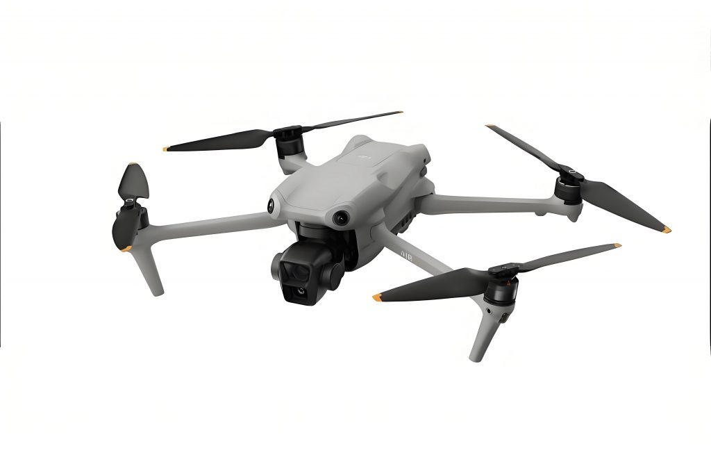
The visual above captures a DJI drone in action during a similar mission, showcasing its agility and advanced sensor suite. Such imagery often inspires confidence among rescue teams, as it highlights the tangible benefits of integrating DJI drone technology. Beyond immediate rescue, DJI drones contribute to post-disaster assessment through aerial surveying. For example, after a major flood, we used DJI drones to capture high-resolution images and generate 3D models of affected areas. The process involves photogrammetry, where overlapping images are processed to create digital elevation models (DEMs). The accuracy of these models depends on factors like flight altitude and camera resolution, which can be optimized using formulas such as: $$ GSD = \frac{H \times s}{f} $$ where \( GSD \) is the ground sampling distance (pixel size in meters), \( H \) is flight height (meters), \( s \) is sensor width (meters), and \( f \) is focal length (meters). For a DJI drone flying at 100 meters with typical parameters, GSD can be as fine as 2 cm, enabling detailed damage analysis. These models aid in resource allocation and reconstruction planning, proving that DJI drones are valuable throughout the disaster management cycle.
Moreover, the integration of DJI drones with artificial intelligence (AI) is paving the way for smarter emergency responses. In mining safety, for instance, organizations have developed platforms that leverage AI for hazard prediction and rescue coordination. While not directly part of drone operations, these systems complement DJI drone deployments by providing predictive analytics. For example, AI can analyze historical data to forecast landslide risks, prompting preemptive DJI drone surveillance. The synergy between DJI drones and AI can be modeled as a feedback loop: $$ R_{t+1} = \alpha R_t + \beta D_t $$ where \( R_t \) represents risk level at time \( t \), \( \alpha \) is a decay factor, \( \beta \) is the influence coefficient of DJI drone data \( D_t \). By feeding real-time DJI drone imagery into AI algorithms, responders gain actionable insights, enhancing proactive measures. This convergence underscores how DJI drone technology is evolving beyond mere tools into integral components of holistic safety ecosystems.
| Scenario Type | Recommended DJI Drone Model | Payload Used | Key Metric Improved | Mathematical Representation |
|---|---|---|---|---|
| Flood Rescue at Night | Mavic 3T | Thermal Camera, Spotlight | Detection Speed | $$ \Delta T = T_{old} – T_{new} $$ with \( \Delta T > 0 \) |
| Landslide Assessment | M350 RTK | Zenmuse H30T (Thermal & Visual) | Area Coverage per Hour | $$ C = \frac{A}{t} $$ where \( C \) is coverage rate |
| Communication Restoration | M350 RTK | Payload Dropper, Satellite Phone | Connection Establishment Time | $$ T_c = k \cdot \frac{d}{v} $$ reduced by drone speed \( v \) |
| Supply Delivery in Mountains | FC30 | Rescue Packages, Ropes | Payload Mass Delivered | $$ M = \sum_{i=1}^{n} m_i $$ maximized via multiple flights |
From a tactical perspective, the operational parameters of DJI drones can be fine-tuned for maximum efficacy. Consider battery life optimization: the flight time \( T_f \) of a DJI drone is crucial for extended missions. It can be approximated by: $$ T_f = \frac{E_b}{P_d + P_p} $$ where \( E_b \) is battery energy (in watt-hours), \( P_d \) is drag power consumption, and \( P_p \) is payload power. For a DJI drone like the M350 RTK, \( E_b \) might be 200 Wh, and with efficient motors, \( T_f \) can exceed 40 minutes, allowing comprehensive surveys. Additionally, the signal strength \( S \) between a DJI drone and ground control affects data transmission reliability: $$ S = S_0 – 20 \log_{10}(d) – \gamma \cdot \theta $$ where \( S_0 \) is reference strength, \( d \) is distance (meters), \( \gamma \) is attenuation factor, and \( \theta \) is environmental interference. By using DJI drone networks with relay capabilities, we maintain robust communication even in obstructed terrains.
In my experience, the versatility of DJI drones extends to training and simulation for emergency teams. We often conduct drills using DJI drone fleets to practice coordination and response protocols. These exercises involve simulated disaster zones where DJI drones map the area, drop mock supplies, and guide virtual rescues. The learning curve for operators can be described by a logistic function: $$ L(t) = \frac{L_{max}}{1 + e^{-k(t-t_0)}} $$ where \( L(t) \) is proficiency level at time \( t \), \( L_{max} \) is maximum proficiency, \( k \) is learning rate, and \( t_0 \) is inflection point. With hands-on DJI drone practice, teams achieve \( L_{max} \) faster, ensuring readiness for real crises. This emphasis on preparation underscores why DJI drones are not just emergency tools but also foundational assets for building resilient communities.
Looking ahead, the future of DJI drone technology in emergency management appears promising. Innovations in autonomy, such as swarm intelligence, could enable multiple DJI drones to collaborate seamlessly. Imagine a scenario where a fleet of DJI drones autonomously surveys a disaster zone, shares data in real-time, and prioritizes tasks based on AI analysis. The efficiency of such a swarm can be modeled as: $$ E_{swarm} = n \cdot e \cdot (1 – \rho) $$ where \( n \) is number of DJI drones, \( e \) is individual efficiency, and \( \rho \) is redundancy factor to avoid overlap. As battery technology improves, flight times will extend, further enhancing DJI drone capabilities. Moreover, integration with satellite networks could globalize DJI drone operations, allowing cross-border disaster response. In all these advancements, the core principle remains: DJI drones empower responders to save lives faster and safer.
To summarize, the adoption of DJI drones has redefined emergency rescue paradigms. Through case studies and quantitative analysis, I have demonstrated how these aerial systems excel in search, communication, and delivery tasks. The tables and formulas provided offer a structured way to evaluate DJI drone performance, from coverage area calculations to efficiency metrics. As disasters grow more complex, the role of DJI drones will only expand, driven by continuous innovation and practical field experience. For any emergency response unit, investing in DJI drone technology is not merely an option but a necessity to meet the challenges of the 21st century. The journey from reactive to proactive rescue, fueled by DJI drones, is well underway, promising a safer world for all.