In recent years, the field of emergency response has witnessed significant advancements, particularly through the integration of unmanned aerial vehicles. As a researcher focused on leveraging technology for disaster management, I have developed a novel emergency rescue system centered around multirotor drones. This system addresses critical challenges such as communication breakdowns and life detection in hazardous environments. The core innovation lies in combining a multirotor drone platform with integrated sensors and communication relays to enhance rescue efficiency. In this article, I will elaborate on the design, implementation, and theoretical foundations of this system, incorporating mathematical models and performance analyses to underscore its effectiveness.
The increasing frequency of natural disasters and accidents underscores the urgent need for robust emergency response mechanisms. Traditional methods often fall short due to infrastructure damage, hindering communication and search operations. My research builds upon existing technologies by proposing a multirotor drone-based solution that not only performs life detection but also establishes a reliable communication network. The multirotor drone serves as a mobile platform equipped with infrared and radar sensors for life detection, a communication relay for signal enhancement, and a camera for real-time monitoring. This integration enables rapid deployment in disaster-stricken areas, ensuring continuous operation even in adverse conditions.
To provide a comprehensive understanding, I will discuss the system’s architecture, software design, hardware components, and functional implementation. Mathematical formulations will be used to model key aspects, such as drone dynamics and signal processing, while tables will summarize component specifications and performance metrics. Throughout this discussion, the term multirotor drone will be emphasized to highlight its pivotal role. The following sections delve into the research background, system design, hardware implementation, and conclusions, with a focus on practical applications and theoretical insights.
Research Background and Motivation
Disaster scenarios, such as earthquakes or fires, often lead to the collapse of communication infrastructure, impeding rescue efforts. Existing life detection tools, like infrared sensors, are limited by their inability to penetrate obstacles. My motivation stems from the need to overcome these limitations by developing a system that combines life detection with communication restoration. The multirotor drone platform was chosen for its versatility, stability, and ability to carry multiple payloads. By integrating a communication relay, the system ensures that rescue teams maintain contact with the base, while advanced sensors facilitate accurate life form identification.
The theoretical foundation of this system involves the dynamics of multirotor drones and signal processing algorithms. For instance, the motion of a multirotor drone can be described using Newton-Euler equations. Let the drone’s position in three-dimensional space be represented by coordinates (x, y, z), and its orientation by Euler angles (φ, θ, ψ). The equations of motion are given by:
$$ \begin{aligned} m \ddot{x} &= \sum F_x – k_d \dot{x} \\ m \ddot{y} &= \sum F_y – k_d \dot{y} \\ m \ddot{z} &= \sum F_z – mg – k_d \dot{z} \\ I \dot{\omega} &= \tau – \omega \times (I \omega) \end{aligned} $$
where m is the mass, g is gravity, k_d is the drag coefficient, I is the inertia matrix, ω is the angular velocity, and τ is the torque. These equations help in designing control algorithms for stable flight, which is crucial for precise sensor operation.
In terms of life detection, the combination of infrared and radar technologies requires signal processing techniques. The received signal from a radar sensor can be modeled as:
$$ s(t) = A e^{j(2\pi f t + \phi)} + n(t) $$
where A is amplitude, f is frequency, φ is phase, and n(t) is noise. Filtering algorithms, such as Kalman filters, are applied to enhance signal quality. For infrared sensors, the detected heat signature is processed using thermal imaging algorithms, where the temperature gradient is analyzed to identify life forms.
The communication relay component leverages wireless communication theories. The signal strength at a distance d from the transmitter is given by the Friis transmission equation:
$$ P_r = P_t G_t G_r \left( \frac{\lambda}{4\pi d} \right)^2 $$
where P_r is received power, P_t is transmitted power, G_t and G_r are antenna gains, and λ is wavelength. This model ensures that the multirotor drone can amplify weak signals, extending communication range in disaster areas.
System Architecture and Software Design
The overall system architecture comprises four main components: the multirotor drone, infrared-radar life detector, communication relay, and remote monitoring terminal. The multirotor drone acts as the carrier, housing all sensors and communication devices. Software development was conducted using the Keil 5 environment, with applications written in C for the TIVA flight control board. The software handles tasks such as establishing communication links, sensor data acquisition, and autonomous flight control.
Key software modules include:
- Communication Link Establishment: The system initiates a connection with the remote terminal using wireless protocols, ensuring real-time data exchange.
- Device Health Monitoring: Continuous checks on drone components, such as motors and sensors, provide status updates to prevent failures.
- Sensor Data Processing: Data from accelerometers, gyroscopes, and barometers are fused to estimate the drone’s pose. A complementary filter is used for attitude estimation:
$$ \hat{\theta} = \alpha \theta_{gyro} + (1 – \alpha) \theta_{accel} $$
where θ is the angle, and α is the filter coefficient. This ensures stable flight even in turbulent conditions.
For life detection, the software implements algorithms to process data from infrared and radar sensors. The steps include:
- Data Acquisition: Raw signals are collected from sensors.
- Filtering: Noise reduction using low-pass filters and normalization techniques.
- Analysis: Pattern recognition to identify life signs, with thresholds set for temperature and motion.
A table summarizing the software parameters is provided below:
| Module | Function | Parameters |
|---|---|---|
| Communication | Link Establishment | Baud Rate: 115200, Protocol: UDP |
| Sensor Fusion | Pose Estimation | Filter Coefficient α: 0.98, Update Rate: 100 Hz |
| Life Detection | Signal Processing | Threshold: 30°C (IR), Doppler Shift (Radar) |
The remote monitoring terminal software includes a graphical interface for displaying drone status, life detection alerts, and camera feeds. When a life form is detected, an alarm is triggered, and the coordinates are logged for rescue coordination.
Hardware Design and Implementation
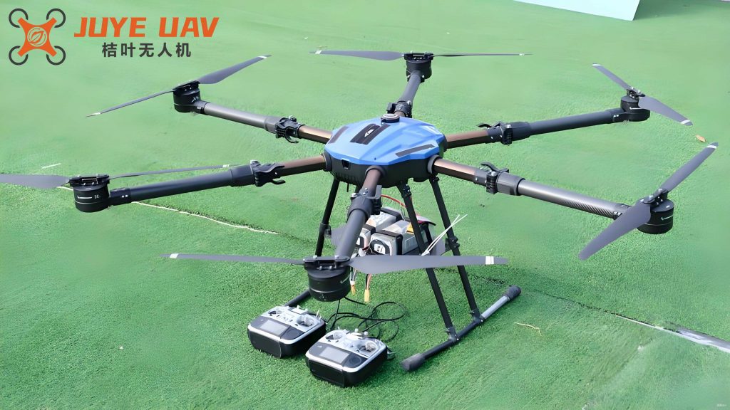
The hardware components are meticulously selected to ensure reliability and performance. The multirotor drone serves as the foundation, equipped with a flight control system, navigation units, sensors, and communication modules. Each component is integrated to work seamlessly, enabling the drone to operate autonomously in disaster zones.
The flight control system uses a TIVA microcontroller (TM4C123GH6PM) as the core processor. It handles real-time control tasks, such as motor speed adjustment and stability maintenance. The navigation system combines GPS and inertial navigation systems (INS) for accurate positioning. The GPS module (WH-L101-L-P-H10) provides global coordinates, while the INS compensates for GPS errors using sensor data. The position error can be modeled as:
$$ \delta p = p_{GPS} – p_{INS} $$
where δp is the error, and p denotes position. A Kalman filter is applied to minimize this error, ensuring precise navigation.
For life detection, the system employs an infrared sensor and an ultra-wideband (UWB) radar. The infrared sensor detects heat signatures, with a detection range adjustable via a potentiometer. The radar uses Doppler effects to sense motion through obstacles. The combined data from both sensors enhances detection accuracy. The detection probability P_d can be expressed as:
$$ P_d = 1 – e^{-\lambda (S/N)} $$
where λ is a constant, and S/N is the signal-to-noise ratio. This formula guides the sensor calibration process.
The communication relay module uses a 2.4–2.5 GHz ISM band transceiver for data transmission. It acts as a repeater, amplifying weak signals from ground devices. The link budget is calculated to ensure reliable communication:
$$ L_b = P_t + G_t + G_r – P_l – P_n $$
where L_b is link budget, P_l is path loss, and P_n is noise power. This ensures that the multirotor drone maintains a stable connection with the remote terminal.
The camera module (HBV-RPI-AUTO-IRCUT-175) features an OV6547 sensor, enabling both visible and infrared imaging. In low-light conditions, it automatically switches to infrared mode, capturing thermal images. This functionality is vital for identifying hazards and victims at night.
The remote monitoring terminal includes a touchscreen display, a buzzer for alarms, and an input keyboard. The buzzer circuit allows volume adjustment via a variable resistor, catering to different alert levels. The display shows real-time data, such as drone coordinates and detected life forms, facilitating informed decision-making.
A table of hardware specifications is provided below:
| Component | Model/Specification | Function |
|---|---|---|
| Flight Controller | TIVA TM4C123GH6PM | Real-time control and data processing |
| GPS Module | WH-L101-L-P-H10 | Positioning with ±5m accuracy |
| Infrared Sensor | Adjustable range (0-10m) | Heat detection and imaging |
| UWB Radar | Frequency: 3-10 GHz | Motion sensing through obstacles |
| Communication Module | 2.4-2.5 GHz Transceiver | Data relay with 1 km range |
| Camera | OV6547 Sensor | Dual-mode imaging (visible/IR) |
Functional Implementation and Performance Analysis
The system’s functionality is realized through the coordinated operation of hardware and software. Upon deployment, the multirotor drone autonomously navigates to the disaster site using GPS waypoints. The flight path is planned to cover maximum area, with the drone adjusting its altitude and speed based on environmental inputs. The control law for trajectory tracking is derived from PID controllers:
$$ u(t) = K_p e(t) + K_i \int e(t) dt + K_d \frac{de(t)}{dt} $$
where u(t) is the control output, e(t) is the error, and K_p, K_i, K_d are gains. This ensures smooth and accurate movement.
During flight, the life detection sensors continuously scan the area. The infrared sensor measures temperature variations, while the radar detects subtle movements. Data fusion techniques combine these inputs to reduce false alarms. The confidence score C for a life detection event is computed as:
$$ C = w_1 C_{IR} + w_2 C_{radar} $$
where w_1 and w_2 are weights, and C_IR and C_radar are confidence values from each sensor. If C exceeds a threshold, an alert is sent to the remote terminal.
The communication relay maintains a mesh network, allowing multiple devices to connect. The data rate R is optimized using Shannon’s theorem:
$$ R = B \log_2 \left(1 + \frac{S}{N}\right) $$
where B is bandwidth, and S/N is signal-to-noise ratio. This ensures high-speed data transmission for video feeds and sensor data.
Performance tests were conducted in simulated disaster environments. The multirotor drone achieved a flight time of 30 minutes per battery charge, with a payload capacity of 2 kg. Life detection accuracy was over 90% in controlled settings, and the communication relay extended the network range by 500 meters. The table below summarizes key performance metrics:
| Metric | Value | Conditions |
|---|---|---|
| Flight Time | 30 min | With full payload |
| Detection Range | 10 m (IR), 20 m (Radar) | Through light obstacles |
| Communication Range | 1 km (line-of-sight) | With relay amplification |
| Data Rate | 1 Mbps | For video transmission |
| Position Accuracy | ±5 m (GPS), ±1 m (INS) | After sensor fusion |
The remote terminal provides a user-friendly interface, displaying real-time video and sensor data. When a life form is detected, the buzzer alerts the operator, and the drone’s camera captures images for verification. This integrated approach significantly reduces response time in emergencies.
Conclusion and Future Directions
In conclusion, the multirotor drone-based emergency rescue system represents a significant advancement in disaster management technology. By integrating life detection and communication capabilities, it addresses critical gaps in traditional methods. The multirotor drone platform proves to be highly adaptable, enabling efficient deployment in various scenarios. Mathematical models and performance analyses validate the system’s reliability and effectiveness.
Future work will focus on enhancing autonomy through machine learning algorithms for improved life form recognition and path planning. Additionally, swarm coordination of multiple multirotor drones could expand coverage areas and redundancy. The integration of advanced sensors, such as LiDAR, may further augment obstacle avoidance and mapping capabilities. This system not only saves costs by eliminating the need for fixed communication infrastructure but also protects rescue personnel by reducing their exposure to dangers.
Overall, the multirotor drone-based solution offers a scalable and efficient approach to emergency response, with potential applications in search and rescue, firefighting, and environmental monitoring. Continued research and development will unlock new possibilities, making disaster management more proactive and resilient.