In recent years, the rapid advancement of multirotor drone technology has revolutionized various fields, including disaster response, military reconnaissance, and emergency inspections. The flexibility, efficiency, and precision of multirotor drones make them indispensable tools in complex and dynamic environments. However, traditional ground-based inspection methods are often limited by terrain, transportation, and weather conditions, hindering comprehensive and rapid assessments. To address these challenges, I have focused on developing an integrated emergency inspection system centered around a mobile shelter, which serves as a deployable base for storing, maintaining, and operating multirotor drones. This system enhances operational efficiency, reduces preparation time, and ensures the safety and longevity of the drones. In this article, I will detail the system’s architecture, workflow, structural design of the drone shelter, task allocation models using optimization algorithms, and validation through simulations and experiments. The goal is to provide a robust solution for multi-drone coordination in emergency scenarios, leveraging the capabilities of multirotor drones to achieve higher inspection efficiency and reduced response times.
The core of this system is a modular design that integrates hardware, software, multirotor drones, and the shelter into a cohesive unit. As illustrated in the system framework, the multirotor drones are equipped with onboard computers, such as the NUC, which communicate with the Pixhawk flight controller via the QGroundControl (QGC) software. Users define inspection points in QGC, which are then uploaded to the drones. The shelter, constructed from a standard 20GP container, features a double-layer landing platform mechanism controlled by a Programmable Logic Controller (PLC). This allows for the simultaneous deployment and retrieval of two multirotor drones, enabling parallel task execution. The workflow begins with flight planning in QGC, followed by pre-flight checks and initialization of the drones. Upon confirmation, the PLC extends the landing platform, and the multirotor drones take off autonomously. During flight, the onboard computer uses MAVROS nodes in a ROS environment to send control commands and monitor the drone’s status, ensuring accurate navigation to target points. After completing the inspection tasks, the drones return to the shelter, where the PLC retracts the landing platform and secures the drones. This integrated approach minimizes human intervention and maximizes the operational readiness of multirotor drones in emergency situations.
The structural design of the drone shelter is critical for supporting the efficient operation of multirotor drones. The shelter utilizes a 20GP container as its base, incorporating a double-layer landing platform that employs a scissor-lift mechanism and sliding mechanisms for space-efficient storage and deployment. The upper and lower platforms share these mechanisms, allowing time-multiplexed operations for launching and recovering drones. The upper platform is connected to an electric actuator for extension, while the lower platform is linked to a scissor-lift mechanism that facilitates vertical movement. Hydraulic drives power the scissor-lift, controlled by the PLC via IO expansion modules. When deploying the upper multirotor drone, the sliding fork extends, and the scissor-lift raises to align with the upper platform. The electric actuator then pushes the platform onto the lift, where electromagnetic locks secure it. The lift elevates to the maximum height for drone takeoff. For the lower drone, the scissor-lift ascends to detach the platform from pins, and the sliding fork extends to position it for launch. This design ensures that both multirotor drones can be deployed sequentially without interference, optimizing the shelter’s footprint and operational flow.
To enhance the stability and safety of multirotor drones during storage and transport, an automatic centering module is integrated into the landing platforms. This module consists of lateral and longitudinal positioning mechanisms that work in tandem to guide the drone’s landing gear to the center of the platform. Upon landing, these mechanisms converge toward the middle, nudging the drone into the optimal position. Locking plates then firmly secure the landing gear, preventing any movement during platform retraction or shelter transit. This centering and locking process occurs simultaneously with the platform’s descent, ensuring that the multirotor drone remains stable and protected. The automation of this module reduces the risk of damage and misalignment, which is crucial for maintaining the readiness of multirotor drones in high-stakes emergency responses.
Task allocation is a pivotal aspect of multi-drone systems, as it directly impacts the efficiency and coverage of inspection missions. In this system, I have modeled the task allocation problem as an optimization challenge where multiple multirotor drones must visit a set of inspection points while minimizing the total flight distance. The problem involves assigning each multirotor drone a sequence of points to visit, starting and ending at the shelter. Let the set of inspection points be defined as $T = \{T_1, T_2, \dots, T_n\}$, and let $m$ represent the number of multirotor drones. The decision variable $x_{ij}^k$ is introduced to indicate whether drone $k$ travels from point $i$ to point $j$:
$$x_{ij}^k =
\begin{cases}
1 & \text{if drone } k \text{ traverses from } i \text{ to } j \\
0 & \text{otherwise}
\end{cases}$$
The objective is to minimize the total distance $L$ covered by all multirotor drones, expressed as:
$$L = \sum_{k=1}^{m} \sum_{i=0}^{n} \sum_{j=0}^{n} D_{ij} \cdot x_{ij}^k + D_{0k} + D_{k0}$$
where $D_{ij}$ is the distance between points $i$ and $j$, $D_{0k}$ is the distance from the shelter to the first point for drone $k$, and $D_{k0}$ is the distance from the last point back to the shelter. To ensure balanced workload distribution among multirotor drones, a constraint is applied such that the difference in total distance between any two drones does not exceed 50 units. For drones $k_1$ and $k_2$, this is formulated as:
$$D_{k} = \sum_{i=1}^{n} \sum_{j=1}^{n} d_{ij} x_{ij}^k \quad \forall k \in \{k_1, k_2\}$$
$$|D_{k_1} – D_{k_2}| \leq 50$$
Additionally, each inspection point must be visited exactly once by one multirotor drone, and the path for each drone must form a closed loop from and to the shelter. These constraints are captured by:
$$\sum_{k=1}^{m} \sum_{j=1}^{n} x_{ij}^k = 1 \quad \forall i \in T$$
$$\sum_{j=1}^{n} x_{ij}^k = \sum_{j=1}^{n} x_{ji}^k \quad \forall i \in T, \forall k \in \{1, 2, \dots, m\}$$
To solve this task allocation problem, I employed the ant colony optimization (ACO) algorithm, which mimics the foraging behavior of ants to find optimal paths. The algorithm initializes parameters such as the number of ants $m$, the number of points $n$, the pheromone evaporation factor $\rho$, the pheromone intensity $Q$, and the maximum iterations. The probability $P_{ij}^k$ of drone $k$ moving from point $i$ to point $j$ is calculated as:
$$P_{ij}^k = \frac{[\tau_{ij}(t)]^\alpha \cdot [\eta_{ij}(t)]^\beta}{\sum_{s \in \text{allow}_k} [\tau_{is}(t)]^\alpha \cdot [\eta_{is}(t)]^\beta}$$
where $\tau_{ij}(t)$ is the pheromone level on path $(i,j)$ at time $t$, $\eta_{ij}(t)$ is the heuristic function representing the desirability of moving from $i$ to $j$ (typically the inverse of distance), $\alpha$ and $\beta$ are parameters controlling the influence of pheromone and heuristic information, and $\text{allow}_k$ is the set of allowable points for drone $k$. The heuristic function is defined as $\eta_{ij} = 1 / d_{ij}$, encouraging shorter paths.
After generating initial paths, the 2-opt optimization algorithm is applied as a local search strategy to refine the routes. For a given path, 2-opt involves swapping two points and evaluating the new path length. If the swap results in a shorter distance, the new path is accepted. The path length before and after optimization is computed as:
$$L_{\text{before}} = \sum_{i=1}^{n-1} D(v_i, v_{i+1}) + D(v_1, v_{\text{shelter}}) + D(v_n, v_{\text{shelter}})$$
$$L_{\text{after}} = \sum_{i=1}^{n-1} D(v’_i, v’_{i+1}) + D(v’_1, v_{\text{shelter}}) + D(v’_n, v_{\text{shelter}})$$
where $v_i$ represents the points in the original path, and $v’_i$ denotes the points after the 2-opt swap. This process helps in escaping local optima and converging towards a global solution.
Pheromone update is a key step in ACO, where the pheromone levels are adjusted based on the quality of the paths found. The pheromone increment $\Delta \tau_{ij}$ for each path is calculated as:
$$\Delta \tau_{ij} = \sum_{k=1}^{m} \frac{Q}{L_k} \cdot x_{ij}^k$$
where $L_k$ is the total distance traveled by ant $k$. To simulate evaporation and prevent stagnation, the pheromone matrix is updated as:
$$\tau_{ij}(t+1) = (1 – \rho) \cdot \tau_{ij}(t) + \Delta \tau_{ij}$$
This update rule ensures that paths with shorter distances accumulate more pheromone, guiding future iterations toward better solutions. The combination of ACO and 2-opt enables efficient task allocation for multirotor drones, balancing exploration and exploitation in the search space.
To validate the proposed system, I conducted simulations and real-world experiments. The simulation scenario involved two multirotor drones and 12 inspection points, with the shelter located at the origin. The parameters for the ACO algorithm and the scenario are summarized in the following tables:
| Parameter | Value |
|---|---|
| Number of Ants (m) | 2 |
| α (Pheromone Influence) | 1 |
| β (Heuristic Influence) | 5 |
| ρ (Evaporation Factor) | 0.1 |
| Q (Pheromone Intensity) | 50 |
| Maximum Iterations | 400 |
| Parameter | Value |
|---|---|
| Shelter Coordinates | [0, 0] |
| Inspection Points Coordinates | [-40, 50], [50, 90], [25, 110], [-22, 73], [30, 60], [60, 100], [-15, 35], [75, 20], [45, 40], [80, 90], [-20, 10], [70, 70] |
The simulation was implemented in MATLAB, and the results demonstrated that the ACO algorithm effectively allocated tasks to the two multirotor drones. The assignment scheme and flight distances are shown below:
| Drone ID | Assignment Sequence | Flight Distance (m) |
|---|---|---|
| k1 | T5 → T3 → T4 → T1 → T7 → T11 | 283.3 |
| k2 | T9 → T2 → T6 → T10 → T12 → T8 | 297.1 |
The iterative process of the ACO algorithm showed a consistent decrease in the shortest path length, with rapid improvements in early iterations and convergence toward stability after 400 iterations. This indicates the algorithm’s ability to efficiently explore the solution space and find near-optimal paths for the multirotor drones. The resulting paths were non-overlapping and well-balanced, with a distance difference of only 13.8 meters between the two drones, satisfying the constraint.
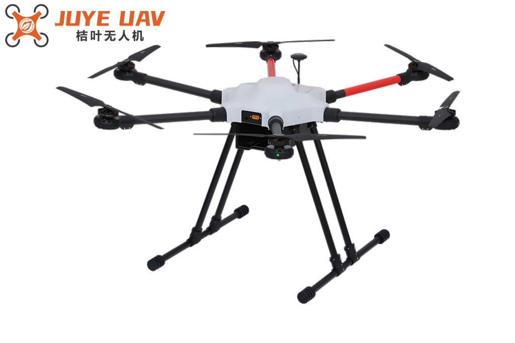
In real-world testing, I used hexacopter multirotor drones equipped with Pixhawk flight controllers and NUC onboard computers. The QGC ground station was employed to monitor and control the drones during flight. The tests confirmed that all system components, including the shelter mechanisms and communication links, functioned as intended. The multirotor drones successfully followed the assigned paths, reached all target points, and returned to the shelter autonomously. The integration of the ACO-based task allocation and 2-opt optimization contributed to a significant reduction in total inspection time, highlighting the practicality of the system for emergency scenarios.
In conclusion, the design of this emergency inspection system leveraging multirotor drones and a mobile shelter addresses critical limitations in traditional methods. The modular shelter structure, with its double-layer platform and automated centering mechanisms, provides a reliable base for drone operations. The task allocation model, based on ant colony optimization and enhanced with 2-opt local search, enables efficient and balanced distribution of inspection tasks among multiple multirotor drones. Simulations and experiments validate the system’s effectiveness, showing that it can optimize paths, reduce flight distances, and ensure coordinated drone deployments. Future work could explore dynamic task reassignment and integration of real-time data to further enhance the system’s adaptability in unpredictable emergency environments. The continued advancement of multirotor drone technology will undoubtedly expand the capabilities of such systems, making them invaluable tools for rapid response and inspection missions.