As a key component of modern transportation infrastructure, highways symbolize national economic progress and present unique challenges for safety management. The rapid increase in vehicle numbers and highway mileage has unfortunately led to a corresponding rise in traffic accidents, often with severe consequences. Statistics indicate that despite representing a smaller portion of the total road network, highways account for a disproportionately high number of accidents, fatalities, and economic losses. The high-speed, closed-access nature of these roads means that any incident—whether caused by adverse weather, driver error, or mechanical failure—can quickly escalate into multi-vehicle collisions, causing significant casualties, prolonged congestion, and complex emergency response scenarios requiring coordination between traffic police, fire departments, and medical services.
Traditional monitoring methods, such as fixed cameras and occasional high-altitude radar, are fundamentally limited. Their lack of mobility and high cost make comprehensive, real-time coverage over vast highway networks impractical. They primarily serve as post-incident recording tools, relying on reports from scene witnesses via wireless communication. This reactive approach creates a critical gap in situational awareness and rapid response capability. Therefore, the development of a cost-effective, agile, and intelligent monitoring system is not just beneficial but essential.
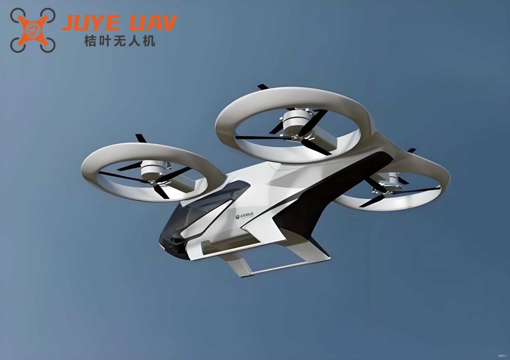
This is where the quadrotor drone presents a transformative solution. The quadrotor drone‘s primary advantage is its Vertical Take-Off and Landing (VTOL) capability, enabling it to operate in rugged, inaccessible terrain commonly found near mountainous highways. A quadrotor drone can be programmed to follow a pre-set flight path along a highway corridor, transmit real-time video and telemetry data back to a command center, and hover precisely over areas of interest, such as accident-prone zones or ongoing incidents. This provides traffic management authorities with an immediate, aerial perspective, facilitating informed decision-making for traffic diversion, emergency dispatch, and on-scene coordination for rescue and clearance operations. Consequently, the research and implementation of a highway monitoring system centered on the quadrotor drone holds significant scientific and practical importance. From a first-person design perspective, the goal is to create a robust, autonomous system that extends the eyes and ears of traffic management into the third dimension.
System Architecture and Overall Design
The proposed monitoring system is designed to perform persistent, dynamic surveillance of high-traffic volumes, accident-prone sections, and disaster-susceptible areas like mountain passes. The core function is to provide real-time visual and telemetric data of roadway conditions, enabling the command center to instantly recognize incidents, assess their severity and location, and initiate a coordinated response. The system fundamentally consists of two integrated modules: the quadrotor drone airframe with its payload and the ground-based Telemetry and Information System (TIS).
The quadrotor drone serves as the mobile sensing platform. Its payload is meticulously integrated and includes:
- Flight Controller: The central processing unit for autonomous navigation and stability control.
- Sensor Suite: Inertial Measurement Units (IMUs), barometer, magnetometer for attitude, velocity, and heading data.
- Imaging System: A high-definition camera, often mounted on a gimbal for stabilization, responsible for video capture.
- Data Link Module: A bi-directional radio for transmitting telemetry/video and receiving commands.
- Positioning System: A high-precision GPS module for geo-referencing.
Operating at a safe altitude above the roadway, the quadrotor drone can execute automated patrols along geofenced routes or be manually piloted based on the live feed, dynamically avoiding obstacles and adjusting for environmental factors like localized fog.
The ground-based Telemetry and Information System (TIS) acts as the nerve center. It receives, processes, and analyzes the data stream from the quadrotor drone. This information is then fused with data from other sources, such as traffic sensor networks and public safety databases, creating a Common Operational Picture (COP). This integrated data supports shared situational awareness and informed decision-making across departments like traffic police and emergency services. Furthermore, based on TIS analysis, traffic advisories and warnings can be automatically disseminated to drivers via variable message signs or mobile applications using GPRS/4G networks. The high-level system architecture is conceptualized below, illustrating the data flow between the aerial platform and the ground infrastructure.
| Module | Primary Components | Function |
|---|---|---|
| Aerial Platform (Quadrotor Drone) | Frame, Motors (x4), ESCs (x4), Propellers (x4), Battery | Provides lift, propulsion, and physical structure for the payload. |
| Avionics & Payload | Flight Controller (APM), GPS/Compass, HD Camera/Gimbal, Telemetry Radio, FPV Tx | Navigation, stabilization, data acquisition, and communication. |
| Ground Control Station (GCS) | Mission Planner Software, Telemetry Radio, FPV Rx, Monitoring Displays | Mission planning, real-time monitoring, data logging, and command interface. |
| Information Fusion Center | Servers, Data Analytics Software, Communication Interfaces | Data integration, analysis, alert generation, and inter-agency coordination. |
Mathematical Modeling of Quadrotor Drone Dynamics
To design an effective automatic control system for the quadrotor drone, a rigorous mathematical model of its dynamics is essential. A quadrotor drone is an underactuated, highly coupled nonlinear system with six degrees of freedom (position and orientation) but only four independent control inputs (motor speeds). The standard configuration involves four identical rotors mounted at the ends of a cross-shaped frame. Rotors 1 and 3 rotate counter-clockwise, while rotors 2 and 4 rotate clockwise. This opposite rotation in adjacent pairs cancels out the net aerodynamic torque about the vertical axis, allowing for stable yaw control. The vehicle’s motion is controlled by varying the relative speeds of these four rotors to generate differential thrust and torque.
Two coordinate frames are defined: the earth-fixed inertial frame \(\{E\} = (O_E, X_E, Y_E, Z_E)\) and the body-fixed frame \(\{B\} = (O_B, X_B, Y_B, Z_B)\) attached to the quadrotor drone‘s center of mass. The vehicle’s orientation is described by the Euler angles \(\boldsymbol{\Theta} = (\phi, \theta, \psi)^T\), representing roll, pitch, and yaw respectively. The rotation matrix \(R\) from \(\{B\}\) to \(\{E\}\) is given by:
$$ R = \begin{bmatrix}
c_\theta c_\psi & s_\phi s_\theta c_\psi – c_\phi s_\psi & c_\phi s_\theta c_\psi + s_\phi s_\psi \\
c_\theta s_\psi & s_\phi s_\theta s_\psi + c_\phi c_\psi & c_\phi s_\theta s_\psi – s_\phi c_\psi \\
-s_\theta & s_\phi c_\theta & c_\phi c_\theta
\end{bmatrix} $$
where \(s_\cdot\) and \(c_\cdot\) denote sine and cosine functions. The translational dynamics in the inertial frame are derived from Newton’s second law:
$$ m \ddot{\mathbf{p}} = \begin{bmatrix} 0 \\ 0 \\ -mg \end{bmatrix} + R \begin{bmatrix} 0 \\ 0 \\ T \end{bmatrix} + \mathbf{d}_t $$
where \(m\) is the mass, \(\mathbf{p}=(x,y,z)^T\) is the position, \(g\) is gravity, \(T\) is the total thrust, and \(\mathbf{d}_t\) represents translational disturbances (e.g., wind). The total thrust \(T\) is the sum of individual rotor thrusts: \(T = \sum_{i=1}^{4} F_i\). For simplicity, thrust is often modeled as \(F_i = k_f \omega_i^2\), where \(k_f\) is a thrust coefficient and \(\omega_i\) is the angular speed of the i-th motor.
The rotational dynamics are derived from the Euler equation:
$$ I \dot{\boldsymbol{\omega}} + \boldsymbol{\omega} \times (I \boldsymbol{\omega}) = \boldsymbol{\tau} + \mathbf{d}_r $$
where \(I\) is the inertia matrix, \(\boldsymbol{\omega}=(p,q,r)^T\) is the angular velocity in the body frame, \(\boldsymbol{\tau}\) is the total torque vector, and \(\mathbf{d}_r\) represents rotational disturbances. The torques include moments generated by differential thrust (for roll \(\tau_\phi\) and pitch \(\tau_\theta\)) and the reaction torque difference between counter-rotating pairs (for yaw \(\tau_\psi\)). These can be expressed in terms of motor speeds:
$$
\begin{aligned}
\tau_\phi &= l k_f (-\omega_2^2 + \omega_4^2) \\
\tau_\theta &= l k_f (-\omega_1^2 + \omega_3^2) \\
\tau_\psi &= k_\tau (\omega_1^2 – \omega_2^2 + \omega_3^2 – \omega_4^2)
\end{aligned}
$$
where \(l\) is the arm length from the center to a motor, and \(k_\tau\) is a drag/torque coefficient. The control inputs for the standard quadrotor drone model are often defined as virtual inputs \((U_1, U_2, U_3, U_4)\) related to the squared motor speeds:
$$
\begin{bmatrix} U_1 \\ U_2 \\ U_3 \\ U_4 \end{bmatrix} =
\begin{bmatrix}
k_f & k_f & k_f & k_f \\
0 & -k_f l & 0 & k_f l \\
-k_f l & 0 & k_f l & 0 \\
k_\tau & -k_\tau & k_\tau & -k_\tau
\end{bmatrix}
\begin{bmatrix} \omega_1^2 \\ \omega_2^2 \\ \omega_3^2 \\ \omega_4^2 \end{bmatrix}
$$
Here, \(U_1\) controls total thrust (altitude), \(U_2\) controls roll, \(U_3\) controls pitch, and \(U_4\) controls yaw. This model forms the basis for designing advanced control algorithms (PID, LQR, Sliding Mode Control) to ensure stable and precise flight of the quadrotor drone under varying environmental conditions, a prerequisite for reliable monitoring.
Flight Control System Design with APM2.8
The heart of the autonomous quadrotor drone is its flight controller. For this system, the ArduPilotMega (APM) 2.8 autopilot was selected due to its open-source nature, reliability, and rich feature set. The APM2.8 is a versatile board capable of controlling various unmanned vehicles. Its core is an Atmel ATMega2560 microcontroller, interfaced with a suite of sensors: an MPU-6000 IMU (3-axis gyro + accelerometer), a MS5611 barometer for altitude, and a HMC5883L magnetometer for heading. This integrated sensor package allows for robust attitude and heading reference system (AHRS) functionality.
The control architecture typically involves a cascaded loop structure. The inner loop stabilizes the attitude (roll, pitch, yaw angles or rates) using feedback from the gyroscopes and accelerometers. The outer loop controls the vehicle’s position and altitude based on GPS and barometer data, sending setpoints to the inner attitude controller. The APM firmware implements sophisticated algorithms such as complementary or Kalman filtering to fuse sensor data accurately, even in the presence of noise and vibration inherent to a quadrotor drone.
Communication with the ground is facilitated through the MAVLink protocol, a lightweight messaging standard for unmanned systems. A bi-directional digital telemetry radio (e.g., 3DR) establishes a persistent data link. This allows the ground control station (GCS) software, such as Mission Planner, to perform several critical functions:
- Mission Planning: Defining complex automated flight paths by clicking waypoints on a map interface. The quadrotor drone can autonomously take off, follow this route, loiter over points of interest, and return to launch.
- Real-Time Telemetry: Monitoring battery voltage, GPS lock, attitude, altitude, and sensor health in real-time.
- Parameter Tuning: Adjusting control gains (P, I, D values) for optimal flight performance.
- Data Logging: Recording all flight data for post-mission analysis and system refinement.
The reliability of this open-source flight control system is paramount for the quadrotor drone to safely and consistently execute its monitoring duties over highways.
| Control Loop | Primary Sensors | Processed State | Control Output |
|---|---|---|---|
| Attitude Stabilization (Inner Loop) | Gyroscope, Accelerometer | Roll (\(\phi\)), Pitch (\(\theta\)), Yaw Rate (\(r\)) | Motor Speed Adjustments (\(\Delta\omega_i\)) |
| Altitude Hold | Barometer, Accelerometer (Z-axis) | Vertical Velocity, Altitude (\(z\)) | Collective Thrust (\(U_1\)) |
| Position Hold / Navigation (Outer Loop) | GPS, Magnetometer | 2D Position (\(x, y\)), Heading (\(\psi\)) | Roll & Pitch Setpoints for Inner Loop |
Hardware Subsystem Design and Integration
The practical realization of a capable monitoring quadrotor drone hinges on careful selection and integration of hardware components. Each subsystem plays a vital role in overall performance, endurance, and data quality.
1. Power Module: The energy source dictates operational endurance. A Lithium-Polymer (Li-Po) battery is standard due to its high energy density. For a medium-sized quadrotor drone, a 3S (11.1V) battery with a capacity of 5000mAh to 10000mAh is typical. The choice involves a trade-off between flight time and weight. The system must include power distribution boards to deliver appropriate voltages to the flight controller, motors, and ancillary equipment.
2. Propulsion and Motor Control: This comprises brushless DC motors, electronic speed controllers (ESCs), and propellers. The ESCs are critical; they receive Pulse-Width Modulation (PWM) signals from the flight controller (typically at 50-500Hz) and convert battery DC into three-phase AC to drive the motors at precisely controlled speeds. Modern ESCs support protocols like DShot for faster, digital communication with lower latency, enhancing the quadrotor drone‘s responsiveness.
3. Sensor Suite: While the APM2.8 has onboard sensors, augmentation may be necessary. A secondary, higher-grade GNSS module (e.g., U-Blox NEO-M8N) with multi-constellation support (GPS, GLONASS, BeiDou) provides faster time-to-first-fix and improved positional accuracy, crucial for reliable automated navigation along a highway corridor. An external compass should be mounted on a mast to avoid magnetic interference from power lines and the vehicle’s own electronics.
4. Communication and Data Links: Two primary wireless links are required:
- Telemetry/Command Link: A long-range (1-10 km) digital telemetry radio operating at 433 MHz, 915 MHz, or 2.4 GHz. This link carries MAVLink packets for commands and telemetry.
- First Person View (FPV) Video Link: A separate analog (5.8 GHz) or digital (2.4 GHz) video transmitter streams the live camera feed to the ground. A gimbal-stabilized camera is essential for obtaining clear, jitter-free video usable for monitoring and analysis. Low-latency and high resistance to multipath interference are key requirements for the video link.
5. Imaging Payload: Beyond a standard FPV camera, the system can be equipped with more advanced sensors depending on the monitoring need. A high-resolution 4K camera on a 3-axis gimbal provides cinematic quality footage for post-incident analysis. For all-weather or night operations, a thermal imaging camera becomes invaluable for detecting vehicles, people, or hotspots (e.g., from a fire) in total darkness or through light fog.
| Subsystem | Component | Example Specification / Model | Key Parameter |
|---|---|---|---|
| Airframe & Propulsion | Frame Size | 450mm – 550mm (motor diagonal) | Determines payload capacity and stability. |
| Motor & Propeller | KV500-800, 10″-13″ Prop | Thrust-to-weight ratio > 2:1 recommended. | |
| Power | Battery | Li-Po 6S 10000mAh | Target flight time: 25-40 minutes. |
| Avionics | Flight Controller | APM 2.8 / Pixhawk | Runs ArduCopter firmware. |
| GNSS Module | U-Blox NEO-M8N | GPS+GLONASS, ~1.5m CEP accuracy. | |
| Telemetry Radio | 3DR 915MHz | Range up to 10km (line-of-sight). | |
| Imaging & Comms | FPV Camera & VTx | FPV Camera, 5.8GHz 600mW VTx | Low-latency analog video feed. |
| HD Gimbal Camera | GoPro/DJI Camera, 3-axis Gimbal | Records high-quality stabilized video. |
System Operation, Data Processing, and Advanced Applications
The operational workflow of the quadrotor drone monitoring system is a cycle of planning, execution, and analysis. A typical mission begins at the Traffic Management Center (TMC). Operators use the GCS to plan a survey flight along a specified highway segment, setting waypoints, altitudes, and loiter times. The quadrotor drone is deployed, autonomously navigating the route while streaming live video and telemetry. Operators monitor the feed in real-time. If an incident is detected (manually by the operator or automatically via future AI), the quadrotor drone can be commanded to break from its planned route, hover over the incident for a closer look, and provide a persistent aerial view to first responders.
The raw video data, while useful for live viewing, gains immense value when processed. Offline or real-time video analytics algorithms can be applied to automatically detect and classify objects (cars, trucks, pedestrians), estimate traffic flow parameters (vehicle count, speed, density), and identify anomalous events (stopped vehicles, wrong-way drivers, debris on the road). Integrating this with the quadrotor drone‘s precise GPS coordinates allows for geo-tagging every event.
The telemetry and analyzed data feed into the larger Information Fusion Center. Here, data from multiple quadrotor drone flights, fixed cameras, and inductive loop sensors are correlated. This enables the generation of comprehensive traffic status reports, predictive models for congestion, and automated alerting systems. For instance, if a quadrotor drone detects slowing traffic and a minor collision ahead, the system can automatically calculate the likely impact on traffic flow, suggest alternative routes, and dispatch the nearest traffic patrol unit, all within minutes of the event’s occurrence.
Looking forward, the capabilities of such a system can be expanded significantly. Swarms of cooperative quadrotor drones could monitor vast stretches of highway simultaneously. Equipping drones with loudspeakers could allow for direct audio communication with drivers or accident victims. Automated charging pads or docking stations along the highway could enable persistent 24/7 surveillance with rotating drone fleets, ensuring continuous coverage without human intervention for deployment and retrieval. The integration of 5G technology will facilitate ultra-high-definition, low-latency video streaming and enable more complex real-time edge computing on the drone itself.
In conclusion, the design and implementation of a highway monitoring system based on a quadrotor drone platform address a critical gap in modern transportation infrastructure management. By leveraging the unique VTOL agility, perspective, and autonomy of the quadrotor drone, we can transition from reactive, fixed-point monitoring to proactive, dynamic, and intelligent highway management. The system design encompasses a sophisticated integration of aerodynamic modeling, flight control, robust hardware, and data fusion. When deployed, this system promises to enhance situational awareness, accelerate emergency response, improve traffic flow efficiency, and ultimately, save lives on our highways. The quadrotor drone is not merely a tool but a foundational element for the next generation of intelligent transportation systems.