
As a practitioner deeply involved in the integration of low-altitude economy applications within urban rail transit systems, I have dedicated significant effort to understanding and mitigating the safety risks associated with Unmanned Aerial Vehicles (UAVs), or drones, in subway inspection scenarios. The adoption of drones for inspecting subway infrastructure—such as tracks, bridges, tunnels, and surrounding environments—offers remarkable efficiency gains over traditional manual methods. However, the complex urban settings, dense populations, and critical nature of subway operations introduce multifaceted safety hazards. This article presents a detailed exploration of a safety risk assessment mechanism that spans the entire drone flight lifecycle, with a strong emphasis on the pivotal role of drone training in ensuring operational safety. The framework discussed here is designed to be practical, scalable, and adaptable to evolving technologies and regulations.
Drones in subway inspection represent a synergy between low-altitude economy and rail transit, promising faster data collection, reduced costs, and enhanced coverage. Yet, without rigorous safety protocols, these benefits could be overshadowed by incidents leading to property damage, service disruptions, or even casualties. My research and field observations confirm that a proactive risk assessment approach—covering personnel, equipment, and environmental factors—is indispensable. In particular, drone training emerges as a cornerstone, influencing every phase of operation. Through this article, I aim to elucidate how structured assessments, supported by quantitative models and systematic processes, can foster safer drone deployments.
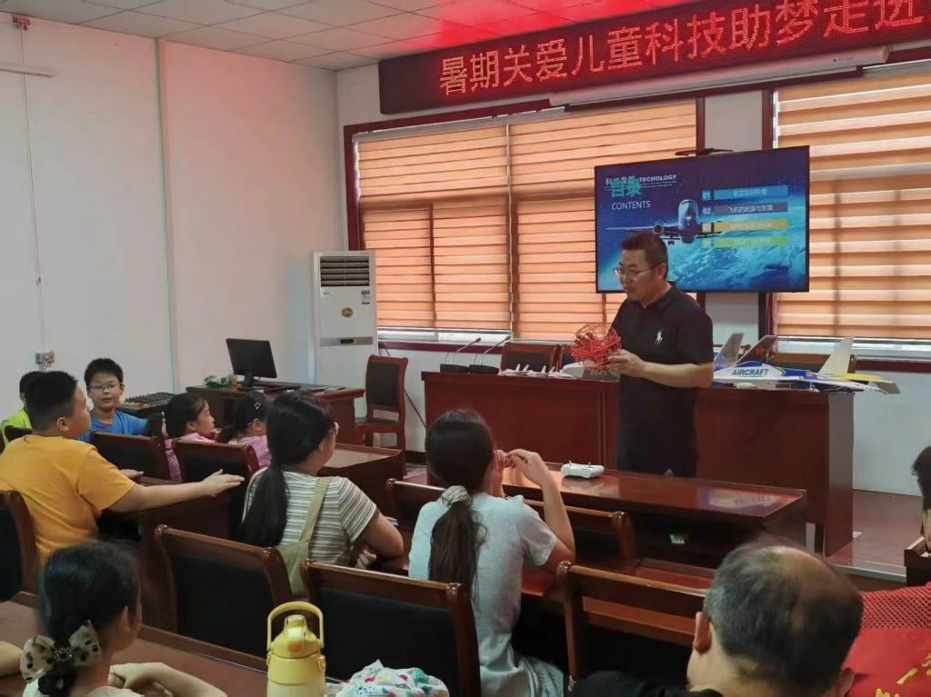
The importance of drone training cannot be overstated. Effective drone training programs equip operators with the skills to navigate complex scenarios, adhere to regulations, and respond to emergencies. In subway environments, where obstacles like high-rise buildings, moving trains, and electromagnetic interference abound, well-trained operators are the first line of defense against accidents. Drone training should encompass not only basic flight maneuvers but also specialized modules for night operations, adverse weather handling, and understanding subway-specific risks. Continuous drone training ensures that operators remain proficient and aware of the latest safety protocols, thereby reducing human error—a significant contributor to incidents.
To formalize the risk assessment process, I propose a phased approach divided into pre-flight, in-flight, and post-flight stages. Each stage involves evaluating specific risk factors, with drone training interwoven throughout. For instance, pre-flight assessments verify operator qualifications—a direct outcome of prior drone training—while post-flight analyses may identify training gaps for future improvement. By integrating drone training into the assessment cycle, we create a feedback loop that continuously enhances safety.
Pre-flight Safety Risk Assessment
Before any drone takes off, a comprehensive pre-flight assessment must be conducted. This stage sets the foundation for safe operations by addressing potential risks in advance. The assessment focuses on three core categories: personnel, equipment, and environment.
Personnel Assessment
Personnel factors are critical, as human error accounts for a substantial portion of drone incidents. The assessment should verify that operators possess valid certifications for the drone class being used and have completed relevant drone training programs. Drone training records must be reviewed to ensure operators are trained for specific mission types, such as night inspections or operations in extreme weather. Additionally, operator fatigue levels should be monitored; excessive flight hours without rest can impair judgment. A risk score for personnel can be modeled using a formula that incorporates training levels, experience, and fatigue:
$$ P_{risk} = \alpha_1 \cdot (1 – T_{score}) + \alpha_2 \cdot (1 – E_{score}) + \alpha_3 \cdot F_{score} $$
Here, $P_{risk}$ represents the personnel risk score, $T_{score}$ is a normalized measure of drone training completeness (ranging from 0 to 1, with 1 indicating comprehensive training), $E_{score}$ reflects operational experience, $F_{score}$ indicates fatigue level, and $\alpha_1, \alpha_2, \alpha_3$ are weighting coefficients summing to 1. Higher $T_{score}$ values, achieved through rigorous drone training, directly lower $P_{risk}$. Operators with inadequate drone training or high fatigue should be restricted from flying until deficiencies are addressed.
Drone training programs should be tailored to subway inspection contexts. For example, they might include simulations of flying near electrified rails or managing signal loss in tunnels. Regular refresher courses—part of ongoing drone training—help maintain competency. The table below outlines key personnel assessment items and their linkage to drone training.
| Assessment Item | Description | Role of Drone Training | Risk Mitigation |
|---|---|---|---|
| Operator Certification | Verification of licenses for drone class and operation type | Drone training provides the knowledge and skills needed for certification exams. | Restrict flight if certification is invalid or expired. |
| Training Records | Review of completed training modules, especially for specific scenarios | Drone training records serve as proof of preparedness; advanced drone training covers complex environments. | Require additional drone training if gaps are identified. |
| Fatigue Status | Monitoring of flight hours and rest periods | Drone training includes modules on fatigue management and its impact on safety. | Implement flight hour limits and mandatory rest periods. |
| Incident History | Analysis of past operational errors or violations | Drone training addresses common pitfalls and learns from historical incidents. | Suspend operators with poor records until remedial drone training is completed. |
Equipment Assessment
Equipment reliability is paramount for safe drone flights. The assessment should cover the drone itself, its payload (e.g., cameras, sensors), and supporting infrastructure like drone nests or charging stations. Key checks include battery health, communication system functionality, navigation accuracy (e.g., GPS/RTK), and sensor calibration. For subway inspection, drones must often withstand electromagnetic interference and physical stressors; thus, equipment ruggedness should be evaluated. A risk model for equipment can incorporate failure probabilities:
$$ E_{risk} = \sum_{i=1}^{n} w_i \cdot \lambda_i $$
where $E_{risk}$ is the equipment risk score, $\lambda_i$ is the failure rate of component $i$ (e.g., motor, battery, communication module), and $w_i$ is its weight based on criticality. Regular maintenance and pre-flight checks, often emphasized in drone training, can reduce $\lambda_i$. Drones with high $E_{risk}$ scores should be grounded for repairs.
Drone training plays a role here by teaching operators how to conduct thorough pre-flight inspections and recognize early signs of equipment degradation. For instance, drone training modules might include hands-on sessions on battery management or troubleshooting sensor faults. The integration of drone training with equipment protocols ensures that operators can identify risks before they escalate.
Environmental Assessment
The environment in which drones operate—especially around subway systems—is fraught with hazards. Pre-flight environmental assessment involves analyzing airspace restrictions, weather conditions, communication signal quality, and physical obstacles like mountains, high-rise buildings, or moving trains. No-fly zones, such as those near airports or military facilities, must be identified and avoided. Weather parameters like wind speed, precipitation, visibility, and temperature can significantly impact flight stability. A composite environmental risk score can be derived:
$$ Env_{risk} = \beta_1 \cdot W_{index} + \beta_2 \cdot O_{density} + \beta_3 \cdot C_{loss} $$
Here, $Env_{risk}$ is the environmental risk score, $W_{index}$ quantifies weather severity (e.g., using wind speed in m/s: $W_{index} = \frac{v}{12}$ for $v$ in m/s, capped at 1), $O_{density}$ represents obstacle density in the flight path, $C_{loss}$ estimates communication signal loss probability, and $\beta_1, \beta_2, \beta_3$ are weights. High $Env_{risk}$ values may necessitate flight postponement or route adjustment.
Drone training prepares operators to interpret environmental data and make informed decisions. For example, drone training should cover how to read weather forecasts, map obstacle-rich areas, and plan alternative routes. The table below summarizes environmental assessment factors.
| Factor | Risk Indicator | Impact on Drone Safety | Role of Drone Training |
|---|---|---|---|
| Airspace Restrictions | Presence of no-fly or restricted zones | Collision with manned aircraft or regulatory violations | Drone training includes airspace regulation education and geofencing techniques. |
| Weather Conditions | Wind speed >10 m/s, precipitation, low visibility | Loss of control, equipment damage, reduced sensor efficacy | Drone training covers weather assessment and emergency procedures for sudden changes. |
| Communication Signals | Signal strength, interference levels | Loss of control link, data transmission failures | Drone training teaches operators to recognize signal issues and switch to backup systems. |
| Physical Obstacles | Density of buildings, bridges, terrain | Collisions, navigation errors | Drone training includes obstacle avoidance simulations and route planning exercises. |
In practice, pre-flight assessments often involve software tools that integrate real-time data feeds. These tools can automatically compute risk scores and suggest mitigations, but human oversight—guided by drone training—remains essential. For instance, if an operator notices marginal weather conditions, their drone training should enable them to decide whether to proceed or delay.
In-flight Safety Risk Assessment
Once a drone is airborne, continuous monitoring is necessary to detect and respond to emerging risks. In-flight assessment relies on real-time data from the drone’s sensors, telemetry, and environmental sources. The goal is to identify anomalies—such as sudden weather changes, equipment malfunctions, or unexpected obstacles—and take corrective actions promptly.
Key parameters monitored during flight include battery voltage, motor temperatures, GPS accuracy, communication link quality, and proximity to obstacles. Autonomous systems can perform some of this monitoring, but operator vigilance, honed through drone training, is crucial. For example, drone training should emphasize interpreting telemetry data to spot trends like rapid battery drain or gradual signal degradation.
A dynamic risk score during flight can be computed as a function of time-varying factors:
$$ R_{in-flight}(t) = \gamma_1 \cdot S_{dev}(t) + \gamma_2 \cdot E_{alert}(t) + \gamma_3 \cdot W_{change}(t) $$
where $R_{in-flight}(t)$ is the instantaneous risk at time $t$, $S_{dev}(t)$ measures deviation from the planned flight path, $E_{alert}(t)$ indicates equipment alerts (e.g., low battery, overheating), $W_{change}(t)$ captures sudden weather changes, and $\gamma_1, \gamma_2, \gamma_3$ are coefficients. If $R_{in-flight}(t)$ exceeds a threshold, the system or operator should initiate mitigations such as altering course, returning to base, or performing an emergency landing.
Drone training is vital for in-flight decision-making. Operators must be trained to handle emergencies like motor failure or loss of communication. Scenario-based drone training, using simulators or controlled environments, can build muscle memory for these situations. For instance, drone training modules might include practicing forced landings in open areas away from subway tracks or crowds. The ability to remain calm and execute procedures under stress is a direct outcome of effective drone training.
Moreover, in-flight assessment benefits from technologies like artificial intelligence for obstacle detection and predictive maintenance. However, these technologies require operators to understand their limitations—a topic covered in advanced drone training. By combining automation with trained human oversight, risks can be managed more effectively.
Post-flight Safety Risk Assessment
After a drone completes its mission and lands, post-flight assessment begins. This stage involves analyzing flight data, inspecting equipment for wear or damage, and reviewing any incidents or deviations. The findings feed back into the risk assessment cycle, helping to improve future operations.
Post-flight activities include downloading flight logs, checking for regulatory compliance (e.g., adherence to no-fly zones), and assessing the performance of sensors and payloads. Any anomalies—such as unexpected vibrations, navigation errors, or communication dropouts—should be investigated. A post-flight risk score can be calculated to evaluate the overall mission safety:
$$ R_{post-flight} = \delta_1 \cdot V_{count} + \delta_2 \cdot D_{total} + \delta_3 \cdot M_{issues} $$
Here, $R_{post-flight}$ is the post-flight risk score, $V_{count}$ is the number of airspace violations, $D_{total}$ is the total deviation from the planned path (in meters), $M_{issues}$ represents the count of equipment malfunctions, and $\delta_1, \delta_2, \delta_3$ are weights. High scores indicate areas needing attention.
Drone training plays a reflective role in post-flight assessment. Operators should be trained to conduct thorough debriefings, identifying what went well and what could be improved. For example, if a flight encountered unexpected wind gusts, the operator’s drone training should guide them to analyze whether better pre-flight weather checks or in-flight adjustments could have helped. This reflective practice, embedded in drone training culture, fosters continuous learning.
Furthermore, post-flight data can inform updates to drone training curricula. If certain risks recur—say, frequent battery issues in cold weather—drone training modules can be augmented to address these specifics. Thus, drone training evolves based on real-world experiences, closing the loop on risk management.
Integrated Risk Assessment Framework
To consolidate the phased approach, I propose an integrated framework that combines pre-flight, in-flight, and post-flight assessments into a cohesive system. This framework relies heavily on drone training to bridge the stages and ensure consistency. The core idea is to treat risk assessment as a continuous process, with drone training as the enabler for effective implementation.
The framework can be represented mathematically as an optimization problem where the goal is to minimize total risk over a flight mission:
$$ \min \left( \int_{t=0}^{T} R_{in-flight}(t) \, dt + R_{pre-flight} + R_{post-flight} \right) $$
subject to constraints such as regulatory limits, equipment capabilities, and operator availability. Here, $R_{pre-flight}$ is the pre-flight risk score (aggregated from personnel, equipment, and environmental assessments), $R_{in-flight}(t)$ is the dynamic in-flight risk, $R_{post-flight}$ is the post-flight score, and $T$ is the mission duration. Drone training influences this minimization by reducing $R_{pre-flight}$ through better personnel preparedness and by enabling lower $R_{in-flight}(t)$ via skilled responses.
A key component of the framework is a risk registry—a database that logs all assessment items and outcomes. This registry can be used to identify trends and prioritize drone training needs. For instance, if equipment failures are frequent, drone training might emphasize maintenance procedures; if environmental factors dominate, drone training could focus on weather interpretation. The table below provides a holistic view of the assessment items across stages, highlighting the pervasive role of drone training.
| Flight Stage | Primary Categories | Key Assessment Items | Drone Training Integration | Typical Mitigations |
|---|---|---|---|---|
| Pre-flight | Personnel | Certifications, training records, fatigue, incident history | Drone training ensures qualifications; refresher courses address gaps. | Restrict unfit operators; mandate additional drone training. |
| Equipment | Battery health, sensor functionality, communication tests | Drone training covers inspection protocols and troubleshooting. | Repair or replace faulty components; calibrate sensors. | |
| Environment | Airspace maps, weather forecasts, obstacle databases | Drone training includes environmental analysis and route planning. | Adjust flight plans; delay missions; use alternative routes. | |
| In-flight | Real-time Monitoring | Telemetry data, obstacle detection, weather updates | Drone training enables interpretation of real-time data and emergency response. | Change altitude or path; initiate return-to-home; emergency landing. |
| Post-flight | Data Analysis | Flight logs, compliance checks, equipment inspection | Drone training fosters analytical skills for debriefing and improvement. | Update risk models; revise procedures; enhance drone training content. |
The framework also incorporates quantitative risk thresholds. For example, if the pre-flight personnel risk score $P_{risk}$ exceeds 0.7 (on a scale of 0 to 1), the flight should be canceled until further drone training is provided. Similarly, during flight, if $R_{in-flight}(t)$ surpasses 0.8, automated systems might trigger a return-to-home sequence. These thresholds should be calibrated based on historical data and refined through ongoing drone training exercises.
Advanced Considerations: Drone Training and Technology Synergy
As drone technology advances, with features like AI-driven autonomy, swarm capabilities, and enhanced sensors, the role of drone training becomes even more critical. Operators must understand not only how to use these technologies but also their limitations and failure modes. For subway inspection, where precision and reliability are paramount, drone training must keep pace with innovation.
I envision drone training programs that include modules on data analytics from drone sensors, cybersecurity for communication links, and ethical considerations in urban airspace. Moreover, drone training should leverage virtual reality (VR) simulations to recreate challenging subway environments—allowing operators to practice without real-world risks. Such immersive drone training can significantly reduce the learning curve and improve safety outcomes.
From a risk assessment perspective, advanced technologies can provide more data for modeling. For instance, machine learning algorithms can predict equipment failures based on vibration patterns, but operators need drone training to trust and act on these predictions. Similarly, real-time risk mapping tools can overlay drone位置 with population density and obstacle data, but drone training is necessary to interpret these maps correctly.
To quantify the impact of drone training on overall safety, consider a reliability growth model where the probability of an incident decreases with cumulative training hours:
$$ \lambda(T_h) = \lambda_0 \cdot e^{-k \cdot T_h} $$
Here, $\lambda(T_h)$ is the incident rate after $T_h$ hours of drone training, $\lambda_0$ is the initial incident rate, and $k$ is a decay constant specific to the training quality. This model underscores that investment in drone training yields exponential safety benefits, justifying its central place in risk assessment mechanisms.
Conclusion and Future Directions
In conclusion, ensuring drone safety in subway inspection scenarios requires a multifaceted risk assessment mechanism that spans pre-flight, in-flight, and post-flight stages. My analysis highlights that personnel factors, particularly drone training, are foundational to mitigating risks. By embedding drone training into every phase—from certifying operators to debriefing after missions—we can create a culture of safety that adapts to complexities.
The proposed framework, supported by quantitative models and systematic tables, offers a practical guide for implementers. Future efforts should focus on standardizing drone training curricula across the industry, developing shared risk databases, and fostering collaboration between rail authorities, drone manufacturers, and regulatory bodies. As low-altitude economy expands, continuous improvement in drone training will be key to harnessing drones’ potential while safeguarding subway systems and the public.
Ultimately, the integration of robust drone training with dynamic risk assessment paves the way for sustainable drone deployments in critical infrastructure like subways. Through persistent emphasis on training and assessment, we can unlock efficiency gains without compromising safety—a goal that aligns with the broader vision of smart, resilient urban transit networks.