
As an educator deeply involved in the development of tactical aviation resources for law enforcement, I have witnessed the rapid integration of unmanned aerial systems into modern policing. The police drone has evolved from a novel gadget to an indispensable tool across a wide spectrum of public safety operations. However, the pedagogical frameworks for training law enforcement personnel in their use remain fragmented and inconsistent. Drawing from practical experience and educational theory, this article outlines a holistic curriculum designed to standardize and elevate police drone education, focusing on a multi-modal teaching approach, structured content, and rigorous assessment.
The operational value of a police drone is multifaceted. Its core advantages can be summarized by key parameters that define its effectiveness in the field. We can conceptualize a police drone‘s operational utility function, U, as being dependent on several factors:
$$U_{pd} = f(A, P, S, C, L)$$
Where:
- A represents Aerodynamic & Platform Capability (flight time, payload, stability).
- P represents Payload & Sensor Suite (optical, thermal, LiDAR, loudspeaker).
- S represents Software & Data Processing (real-time streaming, photogrammetry, AI analytics).
- C represents Controller Skill & Tactical Acumen (pilot proficiency, mission planning).
- L represents Legal & Regulatory Compliance (airspace authorization, privacy laws).
Maximizing U is the ultimate goal of any police drone program, and the curriculum must address each variable systematically.
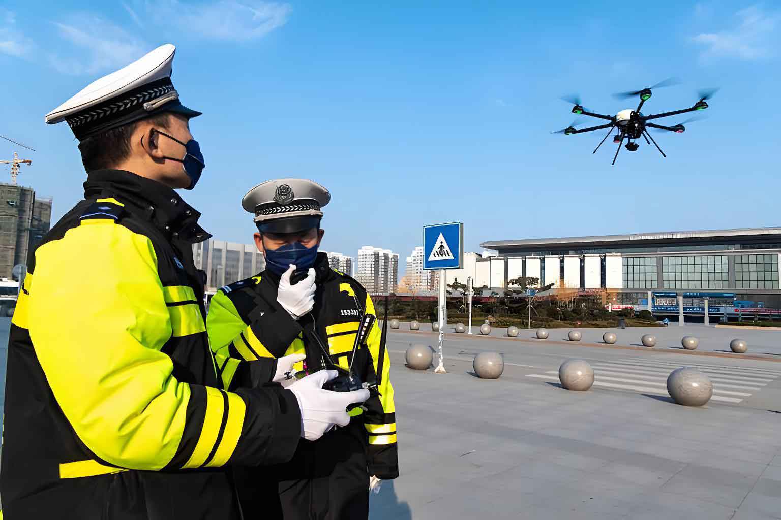
The educational journey begins with a solid theoretical foundation. This module employs a receptive teaching model, where instructors deliver concentrated knowledge to ensure students efficiently absorb critical information. The content is divided into distinct, interconnected blocks.
| Module | Core Learning Objectives | Key Content Areas | Teaching Methodology |
|---|---|---|---|
| 1. Law & Regulation | Understand the legal framework governing UAS operations in national and international airspace. | National aviation authority rules (e.g., FAA, EASA), law enforcement-specific exemptions, privacy law (e.g., GDPR, Fourth Amendment), criminal statutes for “rogue drone” incidents, insurance and liability. | Lecture, case study analysis of legal precedents, guest speakers from aviation authorities. |
| 2. Aeronautics & Technology | Comprehend the principles of flight, drone components, and data link systems. | Basic aerodynamics (lift, drag, thrust, weight), multi-rotor and fixed-wing mechanics, propulsion systems, GNSS (GPS, GLONASS), RF communication and encryption, failure modes. | Interactive lectures, 3D model demonstrations, diagrammatic explanations of systems. |
| 3. Mission-Specific Tactics (MST) | Learn to apply drone technology to core law enforcement functions. | Search & Rescue (SAR) patterns, crime scene & traffic accident photogrammetry, crowd monitoring & surveillance tactics, tactical support for raids (overwatch, distraction), hazardous material assessment, aerial pursuit tracking. | Scenario-based learning, analysis of after-action reports from real deployments. |
The transition from theory to skill is achieved in the Simulation and Flight Training module. This phase adopts a self-learning guided tutoring model. Students first master control inputs and emergency procedures in a risk-free virtual environment before progressing to physical aircraft. The core flight competency progression can be modeled as a function of training time and complexity:
$$C_{flight}(t) = \int_{0}^{T} [B(\tau) + I(\tau) + A(\tau)] d\tau$$
Where Cflight is cumulative competency, t is time, and the integrand represents the rate of skill acquisition in Basic (B), Intermediate (I), and Advanced (A) maneuvers. A structured syllabus ensures comprehensive skill coverage:
| Training Phase | Core Skills & Drills | Platform & Environment | Success Metrics |
|---|---|---|---|
| Basic Simulation | Orientation, throttle control, basic translation (hover, box pattern), introductory emergency responses (loss of GPS, high wind). | Desktop flight simulator (e.g., DJI Sim, Liftoff), simulated open field. | Maintain position within a 2m cube for 2 minutes; complete pattern within defined boundaries. |
| Intermediate Live Flight | Pre-flight checks, precise maneuvering (orbit, figure-8), payload gimbal control, mission planning software introduction. | Training quadcopter (e.g., DJI Mavic 3 Enterprise), designated open field. | Capture a series of nadir (straight down) images of 5 marked points on ground; maintain a stable orbit around an object. |
| Advanced Live Flight | FPV (First-Person View) training for complex environments, low-light/thermal operations, coordinated multi-drone flights, failure recovery (e.g., forced landing). | Advanced enterprise drones & FPV racing drones, varied terrain (wooded, urban canyon). | Navigate an FPV obstacle course; perform a coordinated search pattern with two drones; execute a manual landing after simulated signal loss. |
The pinnacle of the curriculum is the Applied Integration and Data Exploitation module. Here, teaching shifts to exploratory and example-based models. Students confront complex, real-world problems where the police drone is part of a larger solution. A critical function is the conversion of raw aerial data into actionable intelligence. For instance, the process of creating a measurable 3D model from aerial images involves photogrammetric principles. The spatial accuracy of a generated model can be influenced by the number and overlap of images, expressed conceptually as:
$$G_{accuracy} \propto \sqrt{N \cdot O_{avg}}$$
Where Gaccuracy is geospatial accuracy, N is the number of captured images, and Oavg is the average overlap between consecutive images. Students learn to plan flight paths to maximize these variables.
Furthermore, data analytics plays an increasing role. A police drone equipped with AI can perform automatic object detection. The performance of such a system in a search task can be evaluated using standard metrics from confusion matrices:
$$\text{Precision} = \frac{TP}{TP + FP} \quad \text{Recall} = \frac{TP}{TP + FN}$$
Where TP is True Positives (correctly identified objects), FP is False Positives, and FN is False Negatives. Students must learn to interpret these metrics to assess the reliability of AI-assisted police drone outputs.
A core component of this advanced module is Counter-UAS (C-UAS) tactics. As guardians of airspace, law enforcement must also manage non-compliant drones. The curriculum covers the technology and legal protocols for detection, identification, tracking, and mitigation of rogue drones. This includes understanding the sensor fusion logic in a C-UAS system:
$$Threat_{confidence} = \omega_r RF(r) + \omega_o Optical(o) + \omega_a Acoustic(a)$$
Where RF(r), Optical(o), and Acoustic(a) are confidence scores from different sensors, and ω represents their respective weighting factors in the final threat assessment algorithm.
To crystallize these concepts, the curriculum employs detailed case study explorations. One such example is a “Major Crime Scene Documentation” exercise. Students are given a simulated homicide scene in a large, complex outdoor area. Their task is to plan and execute a mission to create a definitive forensic record. The workflow is systematic:
- Mission Planning: Using mapping software, students design a double-grid flight path at two different altitudes (e.g., 50m for context, 25m for detail) with 80% front and side overlap. They calculate estimated flight time, battery needs, and generate a digital flight log.
- Execution & Data Capture: Teams deploy a police drone to execute the plan, capturing hundreds of high-resolution geotagged images. They also conduct targeted manual flights to capture oblique angles of key evidence.
- Data Processing: Using photogrammetry software (e.g., Pix4D, Agisoft Metashape), students process the images to generate high-resolution orthomosaics (2D maps) and dense 3D point cloud models.
- Analysis & Reporting: In the 3D model, students take precise linear measurements between evidence markers, create elevation maps of the terrain, and generate fly-through videos for courtroom presentation. The final report integrates these digital assets with the traditional forensic report.
This end-to-end exercise teaches not just drone operation, but evidence chain of custody, data management, and the presentation of complex technical findings.
Finally, a robust and multi-dimensional evaluation framework is essential to validate competency. Moving beyond simple written tests, assessment must mirror the diverse skills required for police drone operations. The proposed evaluation matrix is weighted to reflect operational priorities:
| Assessment Component | Weight | Format & Criteria | Learning Domain Measured |
|---|---|---|---|
| Theoretical Knowledge Exam | 20% | Written exam covering regulations, aerodynamics, tactics, and safety protocols. Includes multiple-choice, short-answer, and scenario-analysis questions. | Cognitive Knowledge |
| Standardized Flight Evaluation | 40% | Practical test on a closed course. Candidates must perform a pre-flight checklist, execute a set of basic and advanced maneuvers (precision hover, orbit, figure-8, simulated emergency procedure), and demonstrate payload management. Scored on accuracy, smoothness, and safety adherence. | Psychomotor Skills & Procedure |
| Tactical Scenario Resolution | 30% | Full-scale field exercise (e.g., search for a missing person, document a simulated traffic fatality). Evaluated on mission planning, safe execution, crew resource management, data acquisition quality, and post-mission briefing. A rubric scores each phase. | Applied Integration & Judgment |
| Peer Review & Portfolio | 10% | Review of the student’s logbook, processed data outputs from exercises (e.g., quality of a generated 3D model), and constructive participation in team exercises and debriefs. | Professionalism & Continuous Learning |
The passing threshold is set at 80% overall, with mandatory minimum scores in the Flight Evaluation and Scenario Resolution components to ensure operational safety and effectiveness. This system ensures that a certified police drone operator is not merely a remote pilot, but a savvy aerial law enforcement specialist.
In conclusion, the effective integration of police drone technology into law enforcement hinges on a sophisticated, standardized, and rigorous educational curriculum. By structuring learning around core theoretical modules, progressive skill-based flight training, and advanced applied integration, we can move beyond ad-hoc training. Employing diverse teaching models—receptive, guided, and exploratory—ensures that knowledge is not only absorbed but also critically applied. This comprehensive framework, underscored by multi-faceted assessment, aims to produce operators who maximize the operational utility function Upd of their systems. The ultimate goal is to equip law enforcement agencies with personnel who can leverage the full potential of the police drone as a force multiplier, enhancing public safety, operational efficiency, and officer safety in an increasingly complex world.