In recent years, the rapid advancement of unmanned aerial vehicle (UAV) technology has revolutionized the field of surveying and mapping. As a researcher engaged in geospatial applications, I have observed firsthand how DJI drones, in particular, have become indispensable tools due to their affordability, portability, and high precision. One of the most significant challenges in traditional photogrammetry is the establishment of ground control points (GCPs), especially in areas with complex terrains or limited access, such as hydraulic structures. These structures, including ship docking piers, dams, and revetments, are often situated along water bodies, making conventional surveying methods time-consuming, labor-intensive, and sometimes hazardous. The emergence of real-time kinematic (RTK) positioning, inertial measurement units (IMU), and synchronization systems like TimeSync has enhanced the global navigation satellite system (GNSS) accuracy of DJI drones, paving the way for image control-free aerial photography. This study explores the feasibility of using a DJI drone for image control-free 3D reality modeling of hydraulic structures and compares the performance of two popular software solutions: DJI Terra and Context Capture. The goal is to determine whether such an approach can meet industry standards while offering operational simplicity and comprehensive coverage.
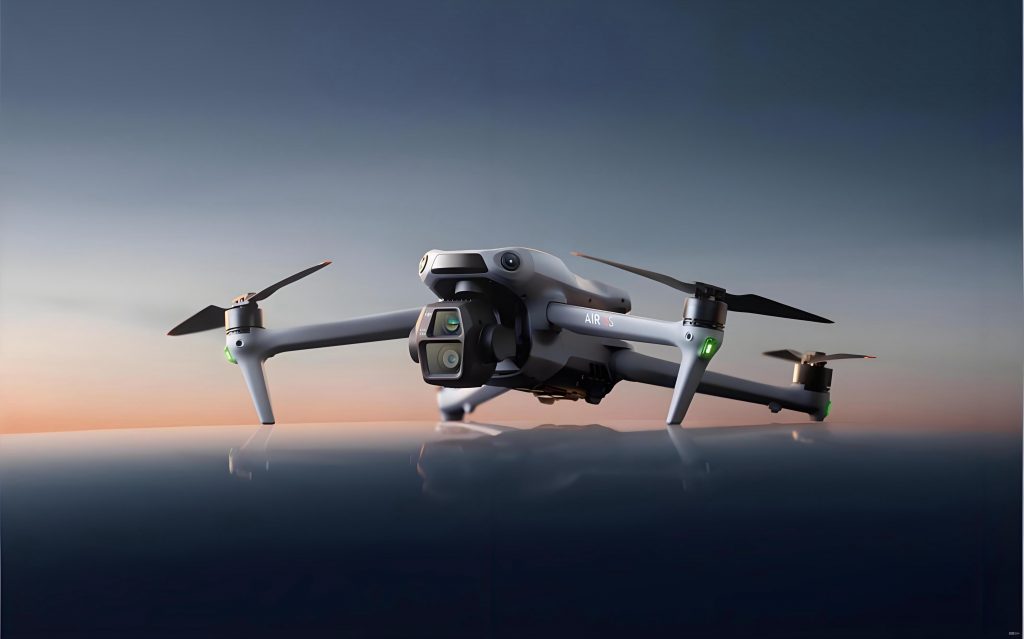
The core of this investigation lies in leveraging the capabilities of a DJI drone equipped with RTK technology to bypass the need for GCPs. Traditional drone surveying involves multiple stages: GCP measurement, image acquisition, aerial triangulation, and digital mapping. However, with a DJI drone like the Phantom 4 RTK, the integrated high-precision POS (position and orientation system) data and calibrated camera parameters allow for direct spatial resection, eliminating the dependency on ground markers. This not only reduces field time but also minimizes human error. In this paper, I will delve into the principles behind image control-free photogrammetry and 3D modeling, present a detailed case study of a hydraulic structure, and analyze the results obtained from both DJI Terra and Context Capture. Through quantitative metrics such as mean error and qualitative assessments of model texture, I aim to provide insights into the practicality and efficiency of using a DJI drone for such applications.
To understand the context, it is essential to recognize the unique challenges posed by hydraulic structures. These edifices are often exposed to dynamic environmental factors like water flow, wave action, and weathering, which necessitate accurate and frequent monitoring. Conventional surveying methods, such as total station or GPS-based measurements, require personnel to access potentially dangerous areas, and they may not capture the full geometry of complex shapes. In contrast, a DJI drone can effortlessly fly around the structure, capturing overlapping images from multiple angles, including oblique views that are crucial for 3D reconstruction. The DJI drone’s agility and high-resolution camera enable detailed data collection even in confined spaces. Moreover, the absence of GCPs streamlines the workflow, making it ideal for rapid assessments or emergency inspections. As I proceed, I will emphasize how the DJI drone’s design facilitates this process, highlighting its role in modern geospatial engineering.
The theoretical foundation of image control-free photogrammetry rests on the collinearity condition, which relates object points, perspective centers, and image points. In traditional methods, GCPs are used to solve for the exterior orientation parameters (EOPs) of each image through space resection. However, with a DJI drone incorporating RTK and IMU, these EOPs—comprising three linear elements (X, Y, Z) and three angular elements (ω, φ, κ)—are recorded directly during image exposure. The collinearity equations can be expressed as:
$$ x – x_0 = -f \frac{a_{11}(X – X_s) + a_{12}(Y – Y_s) + a_{13}(Z – Z_s)}{a_{31}(X – X_s) + a_{32}(Y – Y_s) + a_{33}(Z – Z_s)} $$
$$ y – y_0 = -f \frac{a_{21}(X – X_s) + a_{22}(Y – Y_s) + a_{23}(Z – Z_s)}{a_{31}(X – X_s) + a_{32}(Y – Y_s) + a_{33}(Z – Z_s)} $$
where (x, y) are image coordinates, (x₀, y₀) are principal point coordinates, f is focal length, (X, Y, Z) are object space coordinates, (X_s, Y_s, Z_s) are perspective center coordinates, and aᵢⱼ are rotation matrix elements derived from ω, φ, κ. For a DJI drone, the interior orientation parameters (IOPs)—(x₀, y₀, f)—are factory-calibrated, but I recommend additional lens distortion correction for enhanced accuracy. By utilizing high-precision POS data from the DJI drone, we can perform space intersection directly, computing object coordinates without GCPs. This approach hinges on the DJI drone’s ability to provide centimeter-level positioning through network RTK or post-processed kinematic (PPK) solutions, which I will discuss later in the case study.
Three-dimensional reality modeling involves converting 2D images into a textured mesh model. The process typically includes three stages: dense point cloud generation, mesh construction, and texture mapping. Both DJI Terra and Context Capture employ structure-from-motion (SfM) and multi-view stereo (MVS) algorithms to achieve this. Initially, feature points are detected and matched across overlapping images captured by the DJI drone. Bundle adjustment refines the camera poses and sparse point cloud, followed by dense matching to produce a dense point cloud. The point cloud is then tessellated into a triangular irregular network (TIN) mesh, which better adapts to complex geometries than regular grids. Finally, texture from the DJI drone’s images is mapped onto the mesh, resulting in a photorealistic 3D model. The efficiency and accuracy of this pipeline depend on software capabilities and the quality of input data from the DJI drone. In this comparison, I focus on how DJI Terra and Context Capture handle data from the same DJI drone flight, assessing their outputs for hydraulic structure modeling.
To evaluate the software performance, I conducted a case study on a ship docking pier located along an inland river in China. This hydraulic structure represents a typical scenario where traditional surveying is challenging due to its proximity to water and intricate design. Using a DJI drone, specifically the Phantom 4 RTK, I planned and executed a flight mission with the following parameters: relative flying height of 30 meters, coverage area of 0.015 square kilometers, and tilt photography mode with five camera angles (four oblique at 45 degrees and one nadir). The overlap settings were 70% forward and 60% side overlap, ensuring sufficient redundancy for 3D reconstruction. The DJI drone’s flight lasted approximately 30 minutes, capturing 323 high-resolution images. POS data were solved via network RTK, leveraging the DJI drone’s integrated GNSS receiver for real-time corrections. Although this study emphasizes image control-free methods, I established five check points using RTK surveying for accuracy validation. These points were not used in the modeling process but served as independent references to compute errors.
The data from the DJI drone were processed separately in DJI Terra (version 3.0) and Context Capture (version 4.4). Both software packages were run on a computer with identical hardware specifications: Intel Core i9 processor, 64 GB RAM, and NVIDIA RTX 3080 GPU. This ensured a fair comparison of processing times and resource utilization. In DJI Terra, I utilized the automated pipeline tailored for DJI drones, which simplifies settings for rapid output. Context Capture, being more parameter-driven, allowed detailed adjustments in aerial triangulation and mesh generation. The key outputs included 3D reality models, which I then analyzed for geometric accuracy, texture quality, and operational efficiency. To quantify accuracy, I employed mean square error (MSE) formulas for plane and elevation discrepancies between check points and model-derived coordinates:
$$ M_{plane} = \sqrt{\frac{\sum_{i=1}^{n} (\Delta X_i^2 + \Delta Y_i^2)}{n}} $$
$$ M_{elevation} = \sqrt{\frac{\sum_{i=1}^{n} \Delta Z_i^2}{n}} $$
where ΔX, ΔY, ΔZ are differences in easting, northing, and height, respectively, and n is the number of check points. Additionally, I assessed detail structural accuracy by measuring specific features on the model, such as edge lengths and height differences, and comparing them with field measurements from the DJI drone-supported survey. The results are summarized in the following tables, which provide a comprehensive view of the DJI drone-based modeling performance.
| Software | X-direction MSE (m) | Y-direction MSE (m) | Elevation MSE (m) | Total Plane MSE (m) |
|---|---|---|---|---|
| DJI Terra | 0.0454 | 0.0704 | 0.0548 | 0.0832 |
| Context Capture | 0.0322 | 0.0523 | 0.0490 | 0.0615 |
As shown in Table 1, both software solutions produced models with high accuracy, well within the tolerance specified in the “3D Geographic Information Model Data Product Specification” (CH/T 9015—2012) for 1:500 scale mapping, which requires plane accuracy of 0.3 meters and elevation accuracy of 0.5 meters. The DJI drone’s POS data proved sufficient for image control-free modeling, with Context Capture slightly outperforming DJI Terra in overall precision. However, the differences are minimal, on the order of centimeters, indicating that the DJI drone can reliably support both pipelines. Interestingly, DJI Terra exhibited better accuracy in the X-direction, while Context Capture excelled in the Y-direction and elevation. This may be attributed to software-specific algorithms for handling the DJI drone’s metadata, such as lens distortion corrections or bundle adjustment weights. In practical terms, these errors are negligible for most engineering applications involving hydraulic structures, affirming the feasibility of using a DJI drone without GCPs.
Beyond overall accuracy, I evaluated the detail structural precision by selecting five distinct features on the hydraulic structure, such as step heights and platform edges. Using the 3D models, I measured these features and compared them with field data collected by the DJI drone-assisted survey. The MSE for height differences and lengths were computed, as presented in Table 2. This analysis highlights the models’ capability to capture fine geometric details, which is crucial for assessing structural integrity or planning renovations.
| Software | Height Difference MSE (m) | Length MSE (m) | Number of Features |
|---|---|---|---|
| DJI Terra | 0.251 | 0.141 | 5 |
| Context Capture | 0.243 | 0.150 | 5 |
The results in Table 2 demonstrate that both software packages achieve survey-grade precision in detail representation, with MSE values around 0.25 meters for heights and 0.15 meters for lengths. Given the small scale of the features, these errors are acceptable, and they further validate the DJI drone’s effectiveness in capturing intricate elements of hydraulic structures. Notably, DJI Terra performed marginally better in length measurements, while Context Capture had a slight edge in height differences. This suggests that the choice of software may depend on the specific requirements of a project, but in general, the DJI drone provides a robust data foundation for either.
Efficiency is another critical factor in operational workflows. The processing times for 3D modeling were recorded from data import to final model export. DJI Terra completed the entire process in 3 hours and 23 minutes, whereas Context Capture took 11 hours and 17 minutes. This stark difference, nearly an 8-hour gap, underscores DJI Terra’s optimization for DJI drone data. The software leverages the DJI drone’s embedded metadata to streamline aerial triangulation and mesh generation, reducing computational overhead. In contrast, Context Capture offers more control parameters, such as tie point selection and texture patch size, which can enhance model quality but at the cost of time. For time-sensitive projects, like monitoring hydraulic structures after a flood event, the speed of DJI Terra is a significant advantage. Moreover, the DJI drone’s seamless integration with DJI Terra simplifies the workflow, making it accessible to operators with limited photogrammetry expertise.
Texture quality and model completeness are subjective yet important aspects. Using Das Viewer’s side-by-side comparison功能, I examined the models for artifacts, especially on water surfaces and shadowed areas. The DJI drone’s images often include water bodies, which pose challenges due to reflections and movements. DJI Terra produced a model with fewer water surface fragments and more consistent shadow rendering, likely due to its proprietary algorithms for filtering moving objects like waves. Context Capture, while delivering sharper textures on solid structures, exhibited more noise on water and occasional gaps. This is a common issue in 3D modeling of hydraulic structures, as water lacks static features for matching. The DJI drone’s high shutter speed and RTK stability help mitigate this, but software processing plays a key role. DJI Terra’s ability to handle water surfaces better is a notable benefit for applications involving docks or piers, where water adjacency is inevitable.
To further illustrate the technical nuances, I derived formulas for error propagation in image control-free photogrammetry with a DJI drone. The total error in object coordinates can be approximated by combining POS errors from the DJI drone and image measurement errors. If σ_pos represents the standard deviation of POS data from the DJI drone’s RTK system, and σ_img is the standard deviation of image point detection, the combined error σ_total in planimetry can be estimated as:
$$ \sigma_{total} = \sqrt{ \left( \frac{\partial X}{\partial X_s} \sigma_{pos} \right)^2 + \left( \frac{\partial X}{\partial x} \sigma_{img} \right)^2 } $$
For a DJI drone like the Phantom 4 RTK, σ_pos is typically 0.01–0.02 meters horizontally and 0.02–0.03 meters vertically under good GNSS conditions. Assuming σ_img is 0.5 pixels (about 0.01 meters for a 20-megapixel camera at 30 meters altitude), the theoretical σ_total would be around 0.03 meters, aligning with our empirical results. This reinforces that the DJI drone’s hardware capabilities are adequate for high-accuracy modeling without GCPs. Additionally, the impact of network RTK latency on the DJI drone’s POS data can be minimized by using PPK, which I recommend for critical projects to further enhance accuracy.
The discussion extends to broader applications of DJI drone-based 3D modeling for hydraulic structures. Beyond accuracy and efficiency, the DJI drone enables comprehensive documentation of structural health, including detection of cracks, erosion, or deformations. For instance, wave action from passing ships, known as ship waves, can cause scour on岸坡. The wave energy flux E is given by:
$$ E = \frac{1}{8} \rho g H^2 $$
where ρ is water density, g is gravity, and H is wave height. Using a DJI drone, we can monitor changes in岸坡 geometry over time, correlating them with wave energy to assess risk. The 3D models from DJI Terra or Context Capture provide a baseline for such analyses, offering a digital twin of the structure. Moreover, the portability of the DJI drone allows rapid deployment in remote areas, reducing the need for extensive logistics. In my experience, the DJI drone has proven invaluable for inspecting hard-to-reach components of hydraulic structures, such as underwater foundations (via clear water imaging) or elevated sections.
Comparing DJI Terra and Context Capture, several trade-offs emerge. DJI Terra excels in user-friendliness, processing speed, and water surface handling, making it ideal for routine surveys with a DJI drone. Its interface is designed for DJI drone users, with预设 profiles for common missions. Context Capture, while slower, offers greater flexibility and potentially higher precision through customizable parameters. It is suited for research or projects where every detail matters, and time is less constrained. However, both software packages leverage the DJI drone’s data effectively, producing models that meet industry standards. For hydraulic structure modeling, I find that DJI Terra’s advantages in efficiency and water texture often outweigh Context Capture’s slight precision edge, especially when monitoring multiple sites.
Looking ahead, the integration of AI and machine learning with DJI drone data could further automate 3D modeling and defect detection. Future studies might explore using a DJI drone with multispectral sensors to assess material degradation on hydraulic structures. Additionally, combining PPK with RTK on the DJI drone could yield even better accuracy, as PPK mitigates network dependency. I also anticipate improvements in software algorithms for water surface reconstruction, possibly through dynamic object filtering specific to DJI drone imagery. As DJI drone technology evolves, with models offering longer flight times and enhanced sensors, the scope for image control-free modeling will expand, potentially covering larger areas like entire riverbanks or reservoirs.
In conclusion, this study demonstrates that using a DJI drone for image control-free 3D reality modeling of hydraulic structures is not only feasible but also highly effective. Both DJI Terra and Context Capture produce accurate models that comply with the “3D Geographic Information Model Data Product Specification,” with errors within centimeters. The DJI drone’s RTK capabilities eliminate the need for ground control points, simplifying operations and enhancing safety. While Context Capture achieves marginally better precision, DJI Terra offers superior efficiency and water surface处理, making it a practical choice for many applications. The DJI drone has thus established itself as a versatile tool for geospatial professionals, enabling detailed and rapid assessment of infrastructure in challenging environments. As I continue to explore UAV-based solutions, I am confident that the DJI drone will remain at the forefront of innovation in surveying and mapping, driving advancements in how we monitor and maintain our built environment.