Geophysical prospecting (geophysical exploration or “geoprospecting”) stands as a pivotal methodology for foundational geological surveys. This is particularly true in the exploration and development of hydrocarbon resources, where the demands for mapping offshore oil and gas reserves, detecting marine pollution, and collecting abyssal seabed information are ever-growing. To achieve rapid and efficient information detection and collection, it is imperative to select appropriate geophysical methods tailored to the target of interest and the specific environmental conditions. In this context, the civilian UAV (Unmanned Aerial Vehicle) has emerged as a widely adopted mobile sensing platform for offshore and underwater geophysical prospecting, prized for its relatively low cost, operational flexibility, and high safety profile. By deploying a civilian UAV equipped with lightweight measurement apparatus, one can efficiently gather data while it traverses the marine environment, thereby significantly enhancing the productivity of geophysical surveys. This discourse is grounded in the current developmental backdrop of civilian UAV-based offshore and underwater prospecting technologies. It delves into the underlying technical principles, outlines the critical technical facets, and elucidates application methodologies.
The rapid advancement of our socio-economic landscape has been paralleled by the continuous evolution and widespread adoption of geophysical prospecting technologies across diverse industries. This interdisciplinary field synthesizes knowledge from physics, materials science, and computer technology, primarily employing various geophysical instruments to detect and acquire relevant subsurface parameters. From hydroelectric projects and coal geology to petroleum exploration and railway construction, geophysical techniques play an indispensable role. They not only aid in delineating resource distributions and subsurface geological conditions but also facilitate environmental monitoring for terrestrial and marine pollution and contribute to early warning systems for geological hazards. Evidently, geophysical prospecting holds profound significance for both resource exploitation and environmental stewardship. Concurrently with the rapid development of these technologies, the civilian UAV, leveraging its unique advantages, is assuming an increasingly critical role in offshore and underwater geophysical operations.
I. Background and Context
In engineering geological investigations, geophysical prospecting is extensively applied for its capability to rapidly collect and analyze fundamental subsurface data over large areas within relatively short timeframes. It is characterized by high exploration efficiency, speed, and quality. The suite of available geophysical methods is diverse. Among them, aerial geophysical prospecting (airborne geophysics) primarily utilizes UAVs as the operational platform. By outfitting a civilian UAV with appropriate survey equipment, one can swiftly conduct comprehensive reconnaissance of geological conditions, resource distributions, pollution status, and natural geographical environments within a target area. The collected data provides crucial informational support for specific engineering projects. The technology of offshore and underwater geophysical prospecting using UAVs represents a novel integration of aviation technology and geophysical exploration techniques. In recent years, with the increase in China’s offshore construction projects and the growing demand for marine environmental assessments, the practical value of applying civilian UAVs to offshore and underwater prospecting has become increasingly prominent. Advancements in Global Positioning Systems (GPS), big data analytics, and cloud computing have progressively enhanced the accuracy of data acquired by UAV-based geophysical systems. These improvements offer vital guarantees for related engineering and scientific research endeavors. The continuous development of prospecting technologies, coupled with the maturation of detection devices and instrumentation, now allows for data analysis and visualization processing powered by computer information technology. This facilitates the construction of corresponding three-dimensional models, providing direct decision-making support.
II. Technical Overview of Offshore and Underwater Prospecting UAVs
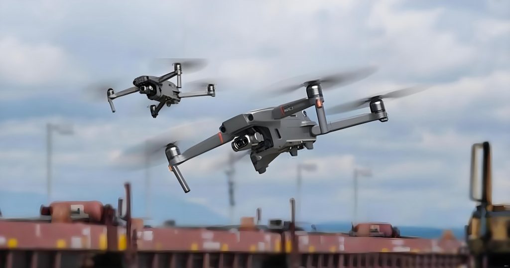
A civilian UAV is a type of unmanned aircraft. This apparatus achieves powered flight primarily through radio remote control systems and its own programmable control unit. Among its myriad applications, the image and data acquisition capabilities of the civilian UAV are extensively utilized. This is particularly true in the current context of offshore and underwater geophysical prospecting, where it has made significant contributions to marine environmental monitoring, geospatial data collection, and hydrocarbon resource exploration. In recent years, aerial geophysical prospecting technology for maritime applications, predominantly based on civilian UAVs, has experienced substantial development. Different types of UAVs and varying flight altitudes are selected based on the specific natural conditions of the target水域 (water body). Operators directly maneuver small UAVs to monitor and collect information within the prospecting area. This method offers considerable safety advantages. The relatively small size of UAVs enables the cooperative flight of multiple units to complete surveying tasks, while the direct control by technicians ensures the accuracy of the survey and the precision of flight control. The standard processing workflow for offshore and underwater UAV-based geophysical prospecting typically involves: deploying the UAV in the operational area and controlling it to conduct field measurements, transforming the acquired geophysical fields, performing integrated interpretation of the detected data, remotely reporting and analyzing data, and finally submitting the data products. Fundamental detection of offshore and underwater geological conditions is accomplished through aerial measurements and near-surface measurements.
III. Innovative Design of the UAV Aerial Platform
The innovative application of a civilian UAV for offshore and underwater aerial prospecting lies in its customized integration of specialized detection sensors and instruments, unlike traditional UAV uses. This transforms the UAV into a versatile geophysical data acquisition platform.
A. Technical Essentials for Sensor and Payload Integration
The core innovation involves equipping the civilian UAV with relevant prospecting devices and instruments—such as magnetometers, electromagnetic sensors, gamma-ray spectrometers, and gravimeters—to enable comprehensive information gathering across the survey area. Measurement methodologies differ depending on the location and physical properties of the target. For instance, some survey points may require only magnetic susceptibility testing of surface rocks, while others might necessitate a combination of radiometric, electrical, and magnetic surveys. Different survey objectives demand the integration of different specialized instruments. The selection and integration criteria are summarized below:
| Geophysical Method | Primary Sensor | Measured Parameter | Typical Application in Offshore/Underwater Context |
|---|---|---|---|
| Magnetic | Magnetometer (e.g., Fluxgate, Cs-vapor) | Magnetic field intensity (nT) | Mapping basement structures, detecting ferrous objects, mineral exploration. |
| Electromagnetic (EM) | EM transmitter/receiver coils | Ground conductivity (Siemens/m) | Mapping shallow stratigraphy, detecting conductive minerals, UXO detection. |
| Radiometric | Gamma-ray Spectrometer | Counts of K, U, Th (ppm, %) | Surface geology mapping, environmental radioactivity monitoring. |
| Gravimetric | Micro-gravimeter | Gravitational acceleration (mGal) | Mapping density variations, salt dome detection, regional basin analysis. |
| Bathymetric/LiDAR | Sonar / Bathymetric LiDAR | Water depth / Seabed topography | Underwater terrain modeling, navigation hazard mapping. |
The integration challenge involves miniaturization, power management, and mitigating interference between the UAV’s electronics and the sensitive geophysical sensors. The total payload weight \( W_{payload} \) must satisfy the UAV’s lift capacity constraint:
$$ W_{payload} = \sum_{i=1}^{n} (W_{sensor_i} + W_{mount_i} + W_{data_i}) < W_{max\_lift} – W_{uav\_empty} $$
where \( W_{sensor_i} \) is the weight of the i-th sensor, \( W_{mount_i} \) is its mounting hardware weight, \( W_{data_i} \) is the weight of associated data acquisition hardware, \( W_{max\_lift} \) is the UAV’s maximum lift capacity, and \( W_{uav\_empty} \) is its empty weight.
B. Control Systems and Data Processing Methodologies
The control system of the UAV aerial platform consists primarily of the UAV’s native flight control system. This system manages the UAV’s flight direction, altitude, movement, and executes basic launch and recovery operations. However, for a civilian UAV deployed in the geophysical prospecting domain, constructing an effective aerial platform requires the additional integration of measurement instruments and a data acquisition system. This system must feed measurement results back to a ground control station (GCS) in near real-time. Backend data analysis technologies then process the collected information to generate corresponding datasets. These datasets undergo comprehensive interpretation by specialized geophysicists and geologists, who provide evaluative insights based on the geophysical survey objectives and data characteristics.
The data flow can be conceptualized by the following processing chain, often involving filtering, correction, and inversion algorithms:
$$ d_{observed}(x,y,t) = F[m(x,y,z)] + \epsilon(x,y,t) $$
Here, \( d_{observed} \) represents the geophysical data (e.g., magnetic field) observed at surface coordinates (x,y) and time t. \( F \) is the forward modeling operator that simulates the geophysical response from a subsurface model \( m(x,y,z) \) (e.g., magnetic susceptibility distribution). \( \epsilon \) signifies the noise component. The goal of data processing and inversion is to find a plausible model \( m \) that minimizes the difference between the observed data and the forward response. Key processing steps for UAV-acquired magnetic data, for example, include:
- Diurnal Correction: Removing temporal variations in the Earth’s magnetic field.
$$ B_{corrected}(t) = B_{raw}(t) – B_{base}(t) $$
where \( B_{base}(t) \) is the reading from a stationary base station magnetometer. - IGRF Removal: Subtracting the International Geomagnetic Reference Field (IGRF) to isolate magnetic anomalies.
$$ B_{anomaly}(x,y) = B_{corrected}(x,y) – B_{IGRF}(x,y,alt,date) $$ - Gridding and Imaging: Interpolating the irregularly spaced UAV flight line data onto a regular grid for visualization and interpretation.
IV. Sustainable Application of Offshore and Underwater Prospecting Technology
A. Geophysical Data Analysis and Map Production
Following the collection of offshore and underwater geophysical data, subsequent data analysis and map production are essential. Visual analysis of the data ensures the timely utilization of information gathered by the civilian UAV. Common technical processing of geophysical data involves visualization techniques. Data acquired from instruments are processed to generate geological condition reports. Concurrently, anomalous points detected during prospecting are analyzed to infer potential corresponding subsurface geological conditions, which are then highlighted on generated maps. Cloud platforms can be leveraged for geophysical data analysis. Data processors utilize specialized software with robust data processing and sharing functionalities to create relevant online information products. A typical software toolkit is compared below:
| Software Type | Example Names | Primary Function in UAV Geophysics |
|---|---|---|
| Flight Planning & Control | UgCS, DJI Pilot, Mission Planner | Designing optimized survey grids, controlling UAV during mission. |
| Geophysical Data Processing | Oasis Montaj, Geosoft, MagPick | Correcting, filtering, gridding, and performing basic transformations on data. |
| Advanced Modeling & Inversion | Voxi (Geosoft), GM-SYS, EM1DFM | Creating 2D/3D subsurface models from geophysical anomalies. |
| GIS & Visualization | ArcGIS, QGIS, Global Mapper | Integrating geophysical maps with other spatial data, final map production. |
B. Key Technologies for UAV Maintenance and Management
When employing civilian UAVs for offshore and underwater geophysical technology, effective maintenance and management must be conducted in accordance with the UAV’s technical specifications. The core systems of a typical survey-grade civilian UAV comprise several key components: the flight control system (FCS), the navigation system, the propulsion/power system, and the data link system. The FCS is responsible for piloting, launch, mission execution, and recovery. The navigation system provides positioning and geospatial data, typically integrating GNSS (like GPS) with an Inertial Measurement Unit (IMU). The propulsion system, now predominantly electric, supplies kinetic energy. The data link system transmits the UAV-acquired data to the GCS and receives commands, utilizing technologies such as GPS tracking, digital video transmission, and sometimes auxiliary sensors like ultrasonic altimeters for precision landing. These core technologies are fundamental to the civilian UAV‘s operation in offshore and underwater geophysical surveys. To enhance prospecting efficiency, diligent daily UAV maintenance and management are imperative. Survey plans must be formulated considering the prospecting target and detection environment. Ensuring a sustainable power supply (e.g., sufficient batteries, charging logistics) and timely recovery of the UAV are critical. Online data transmission should be optimized to relay images, videos, and sensor data in a timely manner. Furthermore, robust positioning and navigation management are essential, employing integrated GPS/IMU solutions to achieve accurate navigation and positioning while minimizing susceptibility to external interference (e.g., multipath effects over water, magnetic interference).
C. Evaluation of Resource Efficiency, Environmental Friendliness, and Social Benefits
Compared to traditional geophysical methods (e.g., manned aircraft, ground-based surveys, or large marine vessels), UAV-based prospecting enables the rapid acquisition of fundamental information about a survey area, effectively conserving financial and human resources. The data collected by the specialized instruments onboard a civilian UAV can provide a more comprehensive reflection of offshore and underwater conditions, offering richer data material for subsequent analysis and interpretation. Simultaneously, UAV-based offshore and underwater geophysical technology is in a phase of continuous development. Utilizing a civilian UAV to establish an aerial geophysical platform allows for the innovative adaptation of aerial prospecting techniques while capitalizing on the UAV’s inherent technical advantages. UAVs are reusable, with electric power as their primary energy source. Compared to traditional prospecting methods often reliant on fuel-powered vehicles, this results in lower environmental impact and pollution, contributing to more sustainable development practices. Currently, geophysical technology in China is advancing rapidly. The swift development of aerial prospecting technologies, represented by the civilian UAV, is instrumental in providing technical support for marine geological surveying, hydrocarbon resource exploration, and pollution detection. This progress promises to make substantial contributions to both economic development and environmental protection. The comparative advantages can be quantified in terms of cost per line-kilometer \( C_{km} \):
$$ C_{km}^{UAV} = \frac{C_{capital}/L_{life} + C_{ops} + C_{processing}}{V_{survey} \cdot T_{ops}} $$
$$ C_{km}^{Manned} = \frac{C_{fuel} + C_{crew} + C_{maint} + C_{processing}}{V_{survey} \cdot T_{ops}} $$
Where for UAVs, \( C_{capital} \) is the capital cost amortized over its operational life \( L_{life} \), \( C_{ops} \) includes battery/power costs and operator fees, \( C_{processing} \) is data processing cost, \( V_{survey} \) is survey speed, and \( T_{ops} \) is operational time. For manned platforms, \( C_{fuel} \), \( C_{crew} \), and \( C_{maint} \) are typically significantly higher, while \( V_{survey} \) might be faster but with much higher baseline costs, often making the \( C_{km}^{UAV} \) lower for small to medium-scale, high-resolution surveys.
V. Conclusion
Conducting offshore and underwater geophysical prospecting work presents significant challenges due to the complexity of the exploration environment. The requirements for related equipment and detection technologies are exceedingly high, and the difficulty and risk coefficients associated with marine surface operations are substantial. Therefore, selecting an appropriate detection method based on the exploration target is paramount. UAV-based geophysical technology, as a representative of aerial prospecting techniques, can serve as an intelligent payload platform for executing corresponding aerial survey tasks with assured precision and work efficiency. Consequently, the application of civilian UAVs in contemporary offshore and underwater prospecting is becoming increasingly widespread, establishing itself as a new trend in the development of aerial geophysical technology. Practice has demonstrated that developing UAV-based offshore and underwater geophysical prospecting holds broad application prospects. Efforts should focus on applied modifications based on a thorough understanding of the civilian UAV‘s technical characteristics. The primary objectives are to ensure safe flight operations while continuously improving the accuracy of acquired data, thereby better serving related geophysical projects. The future will likely see increased autonomy, swarm capabilities for multi-parameter simultaneous acquisition, and deeper integration with AI for real-time data analysis onboard the civilian UAV platform itself.