
We address the critical challenge of retrieving infrared camera monitoring data from network-deprived nature reserves. Traditional manual SD card retrieval suffers from low efficiency (30–45 day cycles), high labor costs (over 200 000 CNY annually per reserve), and significant data loss (23% omission rate). Existing solutions — Low Power Wide Area Networks (LPWAN) and satellite communications — either require ground infrastructure or incur prohibitive expenses. In response, we propose an automated transmission method integrating an edge AI screening module, a China UAV drone equipped with a Wi-Fi Access Point (AP) relay, and an offline base station. This approach forms a complete “edge AI filtering – China UAV drone Wi-Fi AP relay – base station offline handover” chain, enabling near-real-time data backhaul without any terrestrial network dependency.
Our system was validated in a 500 km² reserve in northwest China with no cellular coverage. Results show that the data acquisition cycle was reduced from 30 days to 5 days, annual labor costs dropped by 67.5%, and the data transmission success rate reached 98.9%. The solution significantly improves the intelligence of wildlife monitoring in network-less regions.
System Architecture and Workflow
We designed a three‑layer architecture consisting of edge perception (infrared cameras with AI), an aerial relay (China UAV drone), and a ground handover station. The entire process is divided into four sequential stages:
| Stage | Core Function | Key Technologies | Network-Free Adaptation |
|---|---|---|---|
| Edge Collection & AI Screening | Data perception & reduction | Lightweight AI recognition model (MobileNetV2 pruned) | Low-power, no cloud dependency |
| China UAV Drone Patrol & Temporary Networking | Build temporary communication hub | Wi-Fi AP dynamic group formation | Offline path planning, anti‑interference transmission |
| Multi‑device Concurrent Data Transfer | Efficient data harvesting | TDMA multiple access, CRC, resume transfer | Channel adaptation, break‑point continuation |
| Offline Data Handover & Analysis | Data closure processing | Offline relay mechanism | Network outage tolerance |
In the first stage, each camera uses an onboard lightweight AI model (pruned MobileNetV2) to analyze captured images in real time. Images are classified as valid (confidence ≥ 0.7), suspicious (confidence 0.5–0.7, stored as thumbnails), or invalid (confidence < 0.5, discarded). This reduces the average daily data volume per camera from 250 MB to 87.5 MB, while increasing the proportion of effective data to 92.3%. During patrol, the China UAV drone flies a pre‑planned route over clusters of 3–5 cameras, hovers at 10–20 m altitude, and activates its Wi‑Fi AP. Cameras authenticate via a pre‑shared key and establish secure connections. Data are transmitted using a Time Division Multiple Access (TDMA) protocol with priority scheduling (valid data first, new data first). Each 4 MB block carries a CRC check; failed blocks are retried up to three times. A break‑point resume mechanism avoids redundant transfers upon reconnection. After the China UAV drone returns to the patrol station, it offloads data to the base server via a wired interface. The server then synchronizes to the cloud when network is available.
Key Technological Innovations
Lightweight AI Model for Edge Screening
We designed a recognition model based on MobileNetV2 with channel pruning and 8‑bit integer quantization. The parameter count dropped from 3.5 million to 1.2 million, and the model size shrank from 16.2 MB to 2.1 MB. The inference power consumption is below 0.8 W. Performance comparison on a dataset of 12 key protected species (e.g., snow leopard, Tibetan antelope) is shown below:
| Model | Parameters (million) | Size (MB) | Inference time (ms) | Accuracy (%) |
|---|---|---|---|---|
| Original MobileNetV2 | 3.5 | 16.2 | 125 | 94.5 |
| Pruned version | 1.2 | 5.8 | 68 | 92.3 |
| Quantized pruned version | 1.2 | 2.1 | 52 | 91.7 |
Our final quantized model achieves 91.7% accuracy with only 2.1 MB storage, enabling reliable species classification under low‑power constraints in network‑less environments.
China UAV Drone Wi-Fi AP Dynamic Networking
The China UAV drone carries a dual‑band (2.4 GHz / 5 GHz) Wi‑Fi AP module with a 12 dBi directional antenna. To efficiently serve scattered cameras, we apply a DBSCAN clustering algorithm that groups cameras into communication clusters. The cluster radius is set to 300 m in open terrain and 150 m in dense forest, with a cluster size constraint of 3–5 cameras. The distance-based clustering rule can be expressed as:
$$
\text{Cluster}_{i} = \{c_j \mid \text{distance}(c_i, c_j) \le r \text{ and } |\text{Cluster}_{i}| \in [3,5]\}
$$
where r is the neighborhood radius and c_i is the GPS coordinate of camera i. Isolated cameras are handled individually. For each cluster, the China UAV drone hovers at the cluster centroid to establish a Wi‑Fi link. To mitigate interference, we incorporate Dynamic Frequency Selection (DFS) and Adaptive Modulation and Coding (AMC). The AMC decision rule is:
$$
\text{MCS}_{\text{index}} =
\begin{cases}
\text{high order (e.g., 64-QAM, coding rate 5/6)} & \text{if RSSI} \ge -60 \text{ dBm} \\
\text{medium order} & \text{if } -70 \le \text{RSSI} < -60 \\
\text{low order (e.g., QPSK, 1/2)} & \text{if RSSI} < -70
\end{cases}
$$
With a distributed TDMA protocol, channel utilization increased from 45% (CSMA/CA) to 78%, and transmission delay was reduced by 35%. The RSSI in dense forest remained above –70 dBm, ensuring stable connectivity.
Device-to-Device Cooperative Transmission Protocol (DCTP)
We designed a lightweight DCTP tailored for the China UAV drone–camera link. The protocol incorporates three mechanisms:
- Priority scheduling: valid images are transmitted before suspicious ones; newer data have higher priority to minimize loss if the drone leaves early.
- Integrity verification: each 4 MB block carries a CRC-32 checksum. The verification is: CRC(data) == stored_CRC. Up to three retransmissions are allowed per block. If all fail, the block index is recorded for break-point resume.
- Break-point resume: the camera logs the last successfully transmitted block number. On reconnection, transmission resumes from the next block, avoiding re‑downloading of already received data.
The DCTP header includes fields: block ID, total blocks, CRC, priority. The transmission rate R is given by:
$$
R = \frac{B_{\text{block}} \cdot N_{\text{blocks}}}{T_{\text{total}}}
$$
where B_block = 4 MB, N_blocks is total blocks per camera, and T_total is the transmission time including overhead.
System Implementation and Field Validation
Hardware Platforms
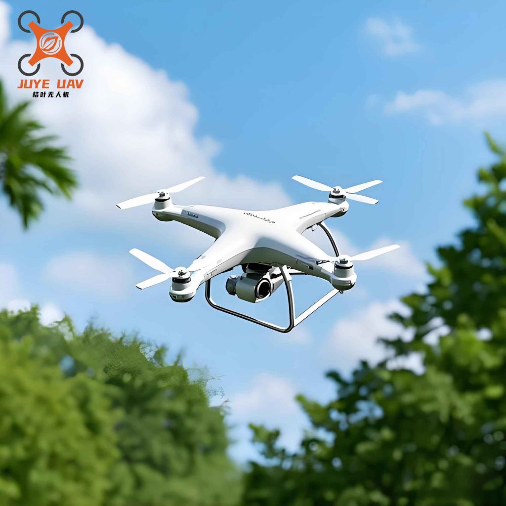
We developed three custom hardware components. The infrared camera uses an ultra‑low‑power STM32L4 MCU and an NPU for AI inference. It supports 1080p color/IR switching and stores data on a 128 GB industrial MicroSD card operating from –40 °C to 85 °C. A 20 W flexible solar panel and 10 Ah low‑temperature lithium battery provide over 60 days of continuous operation. The China UAV drone is a hexacopter with 1.5 kg payload capacity and 55 minutes of endurance under standard load. It integrates a Wi‑Fi AP module (MT7922, IEEE 802.11ac) with a 12 dBi directional antenna, multi‑mode GNSS (GPS, GLONASS, BeiDou), and a LiDAR obstacle avoidance system for safe flying in canyons and under forest canopy. The ground base station is an industrial server with a 512 GB SSD cache (30 days of data), dual‑mode access (Gigabit Ethernet and 4G/5G), and an intelligent routing algorithm that automatically selects the best available network.
Field Test Results
We conducted an 8‑week field trial in a 500 km² protected reserve (altitude 3500–5000 m) with 50 AI‑enabled cameras. The performance was compared against the traditional manual card retrieval scheme. Key metrics are summarized below:
| Metric | Manual Card Retrieval | Our Method |
|---|---|---|
| Data acquisition cycle (days) | 30 | 5 |
| Single camera data retrieval time (min) | 60.0 | 2.5 |
| Annual labor cost (CNY 10k) | 20.0 | 6.5 |
| Data transmission success rate (%) | 82.0 | 98.9 |
| Data integrity (%) | 82.0 | 98.7 |
| Equipment failure rate (%) | 12.0 | 3.8 |
Our China UAV drone system reduced the data retrieval cycle from 30 days to 5 days, achieving near‑real‑time monitoring. The transmission success rate of 98.9% and data integrity of 98.7% are attributed to the combination of edge AI filtering and reliable transmission protocols. Annual labor costs dropped by 67.5%, and the risk of personnel injury in harsh terrain was eliminated. Even under adverse weather (sandstorms, snowfall), the equipment failure rate was only 3.8%, far lower than the 12% of manual equipment.
Simulation Analysis of Key Influencing Factors
We performed control‑variable simulations to understand how major parameters affect system performance. The simulation scenario mirrored the field site: 50 cameras, 500 km² forest. The core metrics were data acquisition cycle, transmission success rate, and total energy consumption. We varied four parameters: China UAV drone endurance, environmental obstruction (represented by a signal attenuation coefficient α), AI model parameter count, and cluster size. The baseline values and variable gradients are:
| Parameter | Baseline | Gradients tested |
|---|---|---|
| China UAV drone endurance (min) | 55 | 30, 45, 55, 70, 90 |
| Obstruction coefficient α (0 = none, 1 = total) | 0.3 | 0.0, 0.2, 0.4, 0.6, 0.8 |
| AI model parameters (million) | 1.2 | 0.8, 1.2, 2.0, 3.5 |
| Cluster size (cameras per group) | 3–5 | 2, 3–5, 6, 8 |
The path loss model used in simulations was:
$$
PL(d) = PL(d_0) + 10 n \log_{10}\left(\frac{d}{d_0}\right) + X_\sigma
$$
where d is distance, n is the path loss exponent (set to 2.5 for forest), and Xσ is shadow fading with σ = 6 dB. The obstruction coefficient α scales the additional foliage loss: Lfoliage = α × 15 dB.
Key findings from the single‑variable simulations:
- Endurance: 55–70 min balances cycle time and energy. Below 55 min, the acquisition cycle increases sharply and energy rises due to extra flights. Above 70 min, no further gains; energy consumption continues to increase.
- Obstruction (α): For α ≤ 0.4, transmission success rate stays above 95%. At α = 0.6, success drops to ~82%; at α = 0.8, communication becomes unstable and success falls below 60%.
- AI model parameters: 1.2 million parameters provide the best trade‑off. At 0.8 million, accuracy drops by ~3%; at 3.5 million, camera power consumption increases by 40% and inference time doubles, reducing battery life.
- Cluster size: 3–5 cameras per cluster yields optimal performance. Size 2 causes excessive hovering overhead; size 6 and above lead to channel congestion, raising transfer time and energy.
The optimal configuration for our scenario is: endurance 55 min (or 70 min if budget allows), obstruction α ≤ 0.4 (i.e., avoid extremely dense forests beyond this value), AI model parameters 1.2 million, cluster size 3–5. Under this configuration, the system satisfies a 1‑year monitoring mission with transmission success ≥95% and reasonable energy consumption.
Cost and Energy Comparison with Alternative Approaches
We compared our China UAV drone method with three mainstream network‑free data transmission alternatives over a 5‑year lifecycle: manual retrieval (baseline), LoRa LPWAN (ground nodes + base stations), and satellite communication (Beidou short message). The scenario uses 50 cameras for one year.
| Scheme | 5‑year total cost (CNY 10k) | Cost per GB (CNY) | Total energy (kWh) |
|---|---|---|---|
| Manual card retrieval | 110.0 | 128.7 | 821.3 |
| LoRa LPWAN | 75.0 | 88.2 | 2 081.3 |
| Satellite communication | 205.0 | 240.5 | 1 095.0 |
| Our China UAV drone method | 72.5 | 85.3 | 1 541.3 |
Our method achieves the lowest total lifecycle cost and the lowest cost per gigabyte among all schemes. The energy consumption is higher than manual retrieval but significantly lower than LoRa (which requires continuous ground node operation) and satellite (which incurs high transmission power). The payback period compared to manual retrieval is 2–3 years, making it highly suitable for large‑scale deployment in network‑less reserves.
Discussion
Technical Advantages and Innovation
Our China UAV drone relay method offers several advantages over existing approaches. Compared to LPWAN (LoRa, NB‑IoT), it requires no ground base stations, enabling rapid deployment in remote areas. Compared to satellite communication, it is an order of magnitude cheaper and consumes less power, making it viable for large‑scale sensor networks. The edge AI screening dramatically reduces the data volume that needs to be transmitted, and the Wi‑Fi AP relay on the China UAV drone provides a flexible, on‑demand communication link. The cluster‑based scheduling improves efficiency by 285% (50 cameras covered in 5 days vs. 30 days manually).
Economic Viability and Scalability
The initial investment includes the AI‑enabled cameras, the China UAV drone, and the base station. Although each smart camera costs more than a traditional one, the operational savings in labor and the longer lifespan make the total cost lower over 5 years. The architecture is modular: for small reserves (e.g., 100 km²), a single China UAV drone and a few dozen cameras suffice; for larger reserves, multiple drones can be deployed with partitioned patrol areas. Moreover, the core concept of “edge intelligence + mobile relay” can be extended to other network‑less applications such as geological disaster monitoring, border patrol, and agricultural IoT, broadening its impact.
Limitations and Future Directions
Despite the promising results, some limitations remain. The China UAV drone endurance of 55 minutes restricts the number of cameras that can be served per sortie (about 15–20). For very large areas (>1000 km²), multiple drones with coordinated scheduling are required. Dense forest can reduce Wi‑Fi range to below 80 m, requiring closer hovering points and increasing patrol time. The AI model’s generalization may degrade when encountering new species or seasonal changes (e.g., snow‑covered fur). Future work will focus on three areas:
- Multi‑China UAV drone cooperative patrol: using multi‑agent reinforcement learning for task allocation and collision‑free path planning to cover larger areas efficiently.
- Communication enhancement: incorporating intelligent beamforming antennas or hybrid networks (Wi‑Fi + LoRa) to improve reliability in high‑obstruction environments.
- Online model updating: leveraging incremental learning or federated learning to distribute updated model parameters to cameras during the data handover process, enabling continuous adaptation to new species and environmental changes.
Conclusion
We have presented an automated transmission method for monitoring data from network‑less areas, integrating a lightweight AI screening module on infrared cameras with a China UAV drone‑based Wi‑Fi AP relay and an offline base station. The system significantly reduces the data acquisition cycle from 30 days to 5 days, lowers annual labor costs by 67.5%, and achieves a transmission success rate of 98.9%. Field validation and simulation analyses confirm the effectiveness and robustness of the design. The China UAV drone relay solution offers a reliable, efficient, and cost‑effective means of data backhaul for nature reserves and other network‑deprived environments. Future research will address multi‑drone coordination, enhanced signal reliability in dense vegetation, and lifelong AI learning for broader applicability.