In recent years, the advancement of flight control technology, sensor systems, and communication links has propelled the widespread use of unmanned aerial vehicles in civilian domains. Within specialized fields, research on obstacle avoidance, path planning, and rapid 3D image reconstruction for drones has gradually increased. However, in the realm of firefighting, the application of fire drones remains in its nascent stages. As a researcher deeply involved in this field, I have observed that fire departments often face challenges such as low search efficiency, disorganized search methods, and flight instability during reconnaissance missions. Therefore, identifying and integrating technologies that enhance the reconnaissance capabilities of fire drones is crucial for practical firefighting operations. This article delves into the implementation modes of fire drone reconnaissance functions, explores cooperative reconnaissance methods, and proposes optimization strategies for flight quality, aiming to provide a comprehensive reference for future developments.
The core of fire drone reconnaissance lies in its ability to swiftly and accurately gather information from complex fire scenes, which are often fraught with interference factors. From my perspective, optimizing reconnaissance functions requires a multifaceted approach, encompassing autonomous flight path planning, adaptive search strategies, and coordinated multi-drone operations. By refining these aspects, we can accelerate the formulation of firefighting and rescue plans, thereby improving overall operational efficiency. In this context, I will discuss key methodologies, including the fusion of path planning algorithms, the application of military search techniques, and innovative cooperative侦察 frameworks, all tailored to the unique demands of firefighting scenarios.
When implementing reconnaissance functions, fire drones typically operate under two control modes: manual remote control and autonomous planning. Manual control is highly dependent on factors such as distance to the target, operator skill, and building layouts, introducing numerous uncontrollable variables. In contrast, autonomous path planning enables fire drones to navigate efficiently through congested urban airspace, providing real-time data for en-route command decisions. Thus, I advocate for the adoption of autonomous航迹规划 in firefighting contexts. Current path planning algorithms can be categorized into four groups: traditional algorithms, graphical methods, intelligent bionic algorithms, and other hybrid approaches. Given the specific requirements of fire drone navigation—such as avoiding obstacles and optimizing for speed—I propose a融合 approach that combines grid mapping, the A* algorithm, and genetic algorithms to theoretically阐释 autonomous path planning for fire drones.
The primary steps for this融合 approach are as follows. First, use grid mapping to model the flight space. After determining the target location coordinates, divide the area based on Google Maps data, including road networks, building information, and structural heights, with a predefined step size. Additionally, select several relay nodes as regional targets according to jurisdictional characteristics. Second, employ the A* algorithm’s open and closed lists along with a heuristic function $$h(n)$$ to constrain the flight path, guiding the fire drone toward the designated target points. The heuristic function can be defined as the Euclidean distance: $$h(n) = \sqrt{(x_g – x_n)^2 + (y_g – y_n)^2}$$, where $$(x_g, y_g)$$ is the goal position and $$(x_n, y_n)$$ is the current node position. Third, after these steps, introduce ant colony optimization for further processing. Since the cost table established earlier reduces无效 or low-efficiency flight areas, the final flight path can be obtained with minimal iterations. This method ensures that fire drones can autonomously navigate to disaster sites, even in complex urban environments, thereby enhancing reconnaissance efficiency.
In terms of search methodologies, reconnaissance essentially involves detecting, identifying, and confirming targets. Drawing from military practices, I have adapted three search types for firefighting applications: area search, path search, and point search. These correspond to area reconnaissance, path reconnaissance, and point reconnaissance in消防 contexts. Each mode suits different scenarios, and their flexible application can significantly improve侦察 outcomes. For instance, area reconnaissance involves fire drones scouting specified regions to locate特定 targets or activities. This is particularly useful in large-scale disasters, such as earthquakes, where infrastructure damage hinders救援 efforts. By细分 the灾区 into zones like lakes, landslide areas, residential buildings, and road facilities, fire drones can conduct orderly and efficient侦察. Path reconnaissance focuses on roads or pipelines, extending several hundred meters on either side. This mode is ideal for交通事故, chemical plant fires, or petroleum industry incidents, ensuring comprehensive coverage along critical routes. Point reconnaissance entails fire drones investigating relatively small areas near known target locations. In major incidents like the Tianjin explosion, after initial inquiries, fire drones were deployed for continuous monitoring of hazardous material storage areas, exemplifying point reconnaissance. The choice of mode depends on the侦察 environment and requirements; single or combined use can achieve灵活 and effective reconnaissance.
As firefighting missions grow increasingly complex, maximizing reconnaissance efficiency with existing fire drone fleets is imperative. Cooperative task allocation among multiple fire drones offers a viable solution. In军事 domains, methods like market algorithms and auction algorithms have been proposed for multi-drone协同覆盖搜索. Based on消防 realities, I categorize cooperative侦察 into regular and irregular area tasks. For regular rectangular areas, after comparing various区域划分 algorithms, I find that lane-based搜索 is most suitable for firefighting侦察. Lane-based搜索 divides the target area into multiple lanes based on length $$L$$, then assigns侦察 tasks to fire drones along these lanes. Let the sensor detection radius of a fire drone be $$r$$, and assume the detection radius exceeds the turning radius. The number of lanes $$N_L$$ can be calculated as: $$N_L = \frac{L}{2r}$$. This approach outperforms random or grid searches in terms of target detection rate and operational efficiency. However, to avoid image断层 that might confuse command decisions, I recommend a modified lane-based path, as shown in Table 1, which summarizes the comparison of search methods.
| Search Method | Target Detection Rate | Operational Efficiency | Suitability for Firefighting |
|---|---|---|---|
| Random Search | Low | High variability | Not recommended due to low reliability |
| Grid Search | High | Low (time-consuming) | Less suitable for large-scale侦察 |
| Lane-based Search | High | Moderate to High | Ideal for large, open areas like stockyards |
For irregular polygonal areas, cooperative reconnaissance becomes more challenging. I propose using the AHP-performance index vector method to划分 tasks based on fire drone capabilities. This method addresses two key issues: how to allocate target areas according to fire drone payloads and performance indices, and what flight paths to use within sub-areas. The AHP (Analytic Hierarchy Process) helps构建 a risk assessment指标体系. First, establish the指标体系 based on evaluation criteria. Second, construct判断 matrices for the factors. Assuming $$n$$ factors $$B_1, B_2, \dots, B_n$$ are related, the judgment matrix is shown in Table 2.
| Factor | $$B_1$$ | $$B_2$$ | $$\cdots$$ | $$B_n$$ |
|---|---|---|---|---|
| $$B_1$$ | $$b_{11}$$ | $$b_{12}$$ | $$\cdots$$ | $$b_{1n}$$ |
| $$B_2$$ | $$b_{21}$$ | $$b_{22}$$ | $$\cdots$$ | $$b_{2n}$$ |
| $$\cdots$$ | $$\cdots$$ | $$\cdots$$ | $$\ddots$$ | $$\cdots$$ |
| $$B_n$$ | $$b_{n1}$$ | $$b_{n2}$$ | $$\cdots$$ | $$b_{nn}$$ |
Using software like Yaahp 6.0, calculate the weights of each indicator. To ensure consistency, perform a一致性检验 with the formula: $$CR = \frac{CI}{RI}$$, where $$CI$$ is the consistency index: $$CI = \frac{\lambda_{max} – n}{n-1}$$. Here, $$\lambda_{max}$$ is the maximum eigenvalue of the judgment matrix, and $$n$$ is its order. A $$CR < 0.1$$ indicates acceptable consistency. From this analysis, factors such as fire drone speed, flight height, and scan width significantly impact reconnaissance performance, so these are emphasized in determining the performance index.
Assume there are $$t$$ fire drones $$M_1, M_2, \dots, M_t$$ with different payloads. Each fire drone’s task performance index is $$K_1, K_2, \dots, K_t$$, satisfying: $$\sum_{i=1}^{t} K_i = 1$$. For a given侦察 region with area $$\text{Area}(C)$$, decompose it into $$t$$ sub-regions $$C’_1, C’_2, \dots, C’_t$$ with areas $$\text{Area}(C’_1), \text{Area}(C’_2), \dots, \text{Area}(C’_t)$$, such that: $$K_i = \frac{\text{Area}(C’_i)}{\text{Area}(C)}$$. Let the cruise speed of fire drone $$M_i$$ be $$v_i$$, cruise height be $$h_i$$, and its imaging sensor have vertical field of view $$d_{v,i}$$, pitch angle $$\theta_i$$, horizontal field of view $$d_{h,i}$$, and installation angle $$\alpha_i$$. The task performance index for fire drone $$M_i$$ can be derived as:
$$ K_i = \frac{v_i \cdot \left( \sin\left(d_{v,i} – \theta_i – \frac{\alpha_i}{2}\right) \cdot \tan\left(\frac{d_{h,i}}{2}\right) \right)}{ \sum_{j=1}^{t} v_j \cdot \left( \sin\left(d_{v,j} – \theta_j – \frac{\alpha_j}{2}\right) \cdot \tan\left(\frac{d_{h,j}}{2}\right) \right) } $$
This formula accounts for the fire drone’s speed and sensor capabilities, ensuring fair task allocation. After划分 sub-regions, the next step is航迹规划 within each convex polygon sub-area. Research shows that the flight direction should be parallel to one edge of the convex polygon to minimize turns. Given the flight speed, the optimal path can be determined. Additionally, consider the fire drone’s endurance. If the time required for full sub-area reconnaissance exceeds the maximum flight time, set up中转 points for recharging to avoid mission delays.
Flight quality optimization is essential for effective fire drone reconnaissance. One critical aspect is determining the optimal flight height. During reconnaissance, the effective projection area is trapezoidal, but for high-rise building fires, targets may be located above ground level. To balance flight safety and battery life, I propose an empirical formula for fire drone flight height. Let the fire drone’s pitch angle be $$\theta$$, vertical field of view be $$d_v$$, sensor installation angle be $$\alpha$$, detection zone length be $$L$$, and target height from the window sill be $$h$$. Then, the flight height can be calculated as:
$$ L = q \cdot \tan\left(d_v – \theta – \frac{\alpha}{2}\right) $$
$$ h = x + q $$
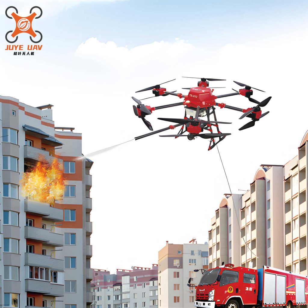
Here, $$q$$ is the distance from the fire drone to the building, and $$x$$ is derived from geometric relations. For typical scenarios, assigning $$\alpha = 60^\circ$$, $$\theta = 15^\circ$$, $$d_v = 15^\circ$$, and $$q = 1.5 \, \text{m}$$ yields $$h \approx 4.1 \, \text{m}$$. This means that for a building with a window sill height of 1.5 m, the fire drone should fly at least 4.1 m above the sill to ensure safe and effective reconnaissance.
Another key factor is stability control. In fire scenes,火风压 and strong turbulence can disrupt fire drone flight. Therefore, improving attitude control modes is crucial. I suggest two改良 approaches. First, in stability design, integrate成熟 models like SVM (Support Vector Machines), symbolic controllers, or hybrid controllers, while incorporating variables such as unpredictable wind direction and strength to build a stability model suited for urban fire environments. Second, in practical operations, set基准姿态角 and develop control loop algorithms based on fire drone responses—including adjustment time, coordinate position, and steady-state error—to fine-tune parameters and enhance stability. This ensures that fire drones maintain steady flight even in adverse conditions, thereby improving reconnaissance accuracy.
In summary, this research explores the reconnaissance功能 of fire drones from multiple angles. By implementing autonomous path planning through算法融合, adapting military search modes, and developing cooperative侦察 frameworks like the AHP-performance index vector method, we can significantly enhance firefighting reconnaissance capabilities. Additionally, optimizing flight height and stability control addresses practical challenges in complex fire environments. However, several issues remain, such as obstacle avoidance module design, effective reconnaissance in sloped or rugged terrain, and further refinement of cooperative algorithms. Future work should focus on these areas to advance fire drone technology. The integration of these methodologies will empower fire departments to conduct faster, safer, and more efficient reconnaissance missions, ultimately saving lives and property.
Throughout this discussion, the term “fire drone” has been emphasized to underscore its centrality in modern firefighting. As technology evolves, continued innovation in fire drone reconnaissance will undoubtedly play a pivotal role in emergency response. By leveraging autonomous systems, cooperative strategies, and robust flight controls, we can unlock the full potential of fire drones, transforming them into indispensable tools for消防 professionals worldwide. The journey toward fully optimized fire drone reconnaissance is ongoing, but with dedicated research and practical application, we can overcome existing limitations and pave the way for smarter, more responsive firefighting operations.