In recent years, the rapid advancement of society and economy has driven the widespread adoption of digital aerial photography for producing large-scale orthophoto maps. As a researcher engaged in geospatial technologies, I have focused on leveraging the latest vertical take-off and landing fixed-wing unmanned aerial vehicles, commonly referred to as VTOL UAVs, for generating high-precision True Digital Orthophoto Maps (TDOM). This article delves into the methodologies and workflows developed through practical applications, aiming to provide a comprehensive reference for similar data production efforts. The integration of VTOL UAV systems offers a transformative approach to aerial surveying, combining the endurance of fixed-wing platforms with the flexibility of multi-rotor systems, thereby enhancing efficiency and accuracy in photogrammetric projects.
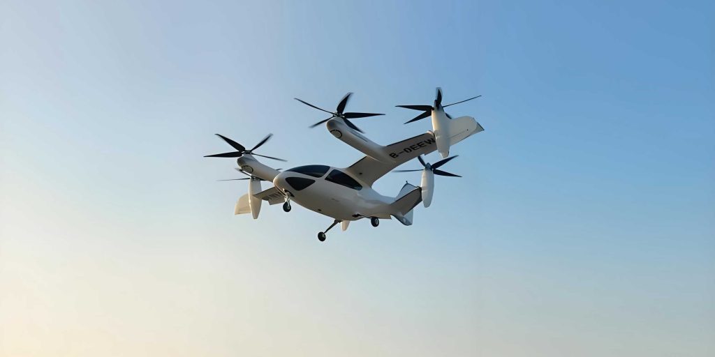
The evolution of low-altitude photogrammetry has been significantly influenced by unmanned aerial systems, with VTOL UAVs emerging as a pivotal technology. Unlike traditional fixed-wing drones that require runways or multi-rotor systems limited by short flight times, VTOL UAVs enable vertical take-off and landing, allowing operations in constrained or complex terrains. This capability is crucial for urban and rural mapping, where accessibility can be a challenge. In my experience, the use of VTOL UAVs has revolutionized data acquisition processes, reducing dependency on extensive ground infrastructure like catapults or parachutes. The system’s adaptability to various environmental conditions—from flat plains to hilly regions—makes it an ideal choice for large-scale TDOM production, which demands high-resolution imagery and precise geometric corrections.
To understand the superiority of VTOL UAVs, it is essential to compare them with other drone platforms. The following table summarizes the key advantages and disadvantages of fixed-wing and multi-rotor UAVs, highlighting why VTOL UAVs bridge these gaps effectively.
| Flight Mode | Advantages | Disadvantages |
|---|---|---|
| Fixed-wing UAV | Long flight range, high speed, substantial payload capacity, suitable for large-area coverage, extended endurance. | Requires runways for take-off and landing, limited maneuverability, inability to hover, complex operation. |
| Multi-rotor UAV | Vertical take-off and landing, hovering capability, ease of操控, high safety, ideal for detailed close-range imaging. | Short flight time, limited range and speed, smaller payload, inefficient for large-scale surveys. |
| VTOL UAV | Combines vertical take-off with fixed-wing efficiency, no need for runways, adaptable to diverse terrains, balanced endurance and flexibility. | Higher initial cost, complexity in maintenance compared to traditional systems. |
The VTOL UAV system employed in my research typically features parameters that optimize它 for photogrammetric missions. For instance, a common configuration includes a wingspan of around 4.0 meters, a maximum take-off weight of 34 kg, and a payload capacity of 3-6 kg, supporting high-resolution cameras. The巡航速度 of 25 m/s and抗风能力 up to 12 m/s ensure stable data acquisition even in challenging weather. This robustness is vital for consistent aerial photography, as it minimizes disruptions during surveys. In practice, I have observed that VTOL UAVs can achieve flight durations of 3-6 hours, depending on payload and conditions, enabling comprehensive coverage of extensive areas without frequent battery changes.
True Digital Orthophoto Map (TDOM) represents a significant leap over conventional Digital Orthophoto Maps (DOM). While DOMs correct for terrain displacement using Digital Elevation Models (DEMs), they often retain投影差 from tall structures like buildings, leading to inaccuracies in urban settings. In contrast, TDOM utilizes a Digital Surface Model (DSM) that incorporates all above-ground features—including buildings, vegetation, and bridges—to eliminate these distortions through differential rectification. The mathematical foundation for this process involves projective geometry, where each pixel in the image is transformed to its true ground position. The core equation for orthorectification can be expressed as:
$$ x’ = \frac{a_1 X + a_2 Y + a_3 Z + a_4}{c_1 X + c_2 Y + c_3 Z + 1} $$
$$ y’ = \frac{b_1 X + b_2 Y + b_3 Z + b_4}{c_1 X + c_2 Y + c_3 Z + 1} $$
Here, \( (x’, y’) \) denote the image coordinates, \( (X, Y, Z) \) are the ground coordinates from the DSM, and \( a_i, b_i, c_i \) are parameters derived from camera orientation. By applying this correction across all pixels, TDOM ensures a truly vertical perspective, free from遮蔽 and shadow effects. This accuracy is paramount for applications such as urban planning, disaster assessment, and三维 geographic information systems, where precise spatial data is indispensable. In my workflow, the production of TDOM involves multiple stages, each leveraging the capabilities of VTOL UAVs to enhance outcomes.
The technical pipeline for TDOM generation using VTOL UAVs encompasses several critical steps: flight planning, data acquisition, ground control point (GCP) measurement, aerial triangulation, DSM extraction, orthorectification, and mosaicking. Each phase must be meticulously executed to achieve the desired precision. For flight planning, parameters like overlap率 and航高 are calculated based on the required ground sample distance (GSD). The overlap rates—both longitudinal and lateral—directly impact the quality of the derived DSM. Typically, I design flights with a longitudinal overlap of 80% and a lateral overlap of 75% to ensure sufficient stereo coverage for accurate三维 reconstruction. The GSD, which defines the resolution of the output imagery, is determined by the camera specifications and飞行 altitude. For large-scale maps at 1:1000, a GSD of 0.1 meters or better is often targeted, achievable with VTOL UAVs equipped with high-resolution sensors.
In a recent project, I applied this methodology to a study area characterized by mixed平原 and丘陵 terrain. The VTOL UAV was deployed to capture imagery with a GSD of 6.6 cm, using a索尼数码相机 mounted on the platform. The flight paths were oriented east-west to align with the project boundaries, ensuring full coverage with additional buffers to avoid edge artifacts. The use of VTOL UAVs simplified the launch and recovery processes, as no specialized runway was needed—this flexibility allowed for rapid deployment across multiple zones. During data acquisition, factors like solar angle and weather conditions were monitored to minimize shadows and ensure uniform illumination, which is crucial for subsequent image processing. The VTOL UAV’s ability to maintain stable flight even in moderate winds proved invaluable for consistent image quality.
Ground control points (GCPs) are essential for georeferencing the aerial imagery. I employed network RTK techniques to measure GCPs with high accuracy, targeting an error margin of ±1.4 cm horizontally and ±0.8 cm vertically. These points were strategically placed across the survey area, selecting features with clear, identifiable影像 in the photos, such as road intersections or distinct landmarks. The integration of GCPs with onboard POS (Position and Orientation System) data from the VTOL UAV enhances the aerial triangulation process, reducing the number of required control points while maintaining precision. The mathematical model for bundle adjustment in aerial triangulation involves minimizing the residuals between observed and projected image points, expressed as:
$$ \min \sum_{i=1}^{n} \left( (x_i – \hat{x}_i)^2 + (y_i – \hat{y}_i)^2 \right) $$
where \( (x_i, y_i) \) are the measured image coordinates and \( (\hat{x}_i, \hat{y}_i) \) are the calculated ones based on camera parameters and ground coordinates. This optimization, performed in software like Pix4D or Agisoft Metashape, yields refined exterior orientation parameters that anchor the imagery to the real-world coordinate system. The VTOL UAV’s stable flight dynamics contribute to lower image blur and reduced motion artifacts, facilitating more accurate triangulation outcomes.
Following aerial triangulation, the next step is generating the Digital Surface Model (DSM). The DSM serves as the foundation for orthorectification, as it encapsulates the elevations of all surface objects. High overlap rates from the VTOL UAV imagery are critical here, as they provide multiple views of each point, enabling robust stereo matching. The process involves dense image matching algorithms that compute disparities between overlapping images to derive 3D points. The accuracy of the DSM can be quantified by the base-to-height ratio, which should ideally be less than 0.3 for optimal results. In my projects, the VTOL UAV’s consistent flight patterns ensure that this ratio is maintained, leading to DSMs with fine details and minimal noise. The DSM is then used to rectify each image, applying the correction formulas mentioned earlier to produce individual orthophotos.
The mosaicking of these orthophotos into a seamless TDOM requires careful attention to color balancing and edge blending. I utilize software tools to adjust histograms and apply feathering techniques, ensuring that the final composite appears natural without visible seams. For urban areas with tall buildings, additional processing is done to handle occlusions—where one structure blocks another—by filling gaps with data from adjacent images. This is a key advantage of TDOM over traditional DOM: it effectively eliminates投影差 and遮蔽, presenting a true vertical view. The final output is tiled according to standard mapping scales, such as 1:1000, with each tile extending beyond the nominal border to facilitate overlap with neighboring sheets. The entire workflow, from VTOL UAV flight to TDOM delivery, is streamlined to maximize efficiency and accuracy.
To validate the precision of the TDOM produced via VTOL UAV, I conducted rigorous accuracy assessments. Check points were established across the study area, independent of the GCPs, and their coordinates were compared against the TDOM. The平面位置中误差 (mean square error in plane position) was calculated using the formula:
$$ MSE = \sqrt{\frac{\sum_{i=1}^{n} (\Delta X_i^2 + \Delta Y_i^2)}{n}} $$
where \( \Delta X_i \) and \( \Delta Y_i \) are the differences between the check point coordinates and their corresponding positions in the TDOM. In one instance, involving 971 check points, the MSE was ±0.163 meters, well within the acceptable limits for large-scale mapping. The following table summarizes a subset of these误差统计, illustrating the consistency achieved through VTOL UAV-based photogrammetry.
| Point ID | Image X (m) | Image Y (m) | Check X (m) | Check Y (m) | ΔS (m) |
|---|---|---|---|---|---|
| 1 | 513451.26 | 4398540.05 | 513450.958 | 4398539.751 | 0.425 |
| 2 | 513448.19 | 4398539.95 | 513448.52 | 4398539.684 | 0.424 |
| 3 | 513448.18 | 4398539.32 | 513448.423 | 4398539.281 | 0.246 |
| 4 | 513447.55 | 4398539.29 | 513447.681 | 4398539.55 | 0.291 |
| 5 | 513447.54 | 4398539.775 | 513447.228 | 4398540.11 | 0.462 |
| … | … | … | … | … | … |
| 971 | 516015.83 | 4412817.73 | 516015.491 | 4412817.856 | 0.361 |
These results underscore the reliability of VTOL UAV systems for high-precision mapping. Compared to traditional methods, where building投影差 can cause displacements of several meters in dense urban cores, the TDOM approach ensures that all features are correctly positioned. This is particularly beneficial for applications like infrastructure monitoring, where accurate spatial data supports decision-making. Moreover, the VTOL UAV’s ability to operate at low altitudes allows for finer GSDs, enhancing the detail visible in the final产品. In discussions with peers, I have noted that the adoption of VTOL UAVs is accelerating, driven by their versatility and the growing demand for true orthophotos in digital city initiatives.
Another aspect worth exploring is the computational efficiency of TDOM production. The use of VTOL UAVs generates vast amounts of imagery, necessitating robust processing pipelines. The dense matching required for DSM extraction is resource-intensive, but advancements in GPU acceleration and cloud computing have mitigated these challenges. In my workflow, I leverage parallel processing to handle large datasets, reducing turnaround times from weeks to days. The integration of VTOL UAV data with machine learning algorithms also opens avenues for automated feature extraction, such as detecting buildings or vegetation changes. This synergy between hardware (VTOL UAV) and software (photogrammetric tools) exemplifies the modern geospatial ecosystem, where efficiency and accuracy are paramount.
Looking ahead, the role of VTOL UAVs in TDOM production is poised to expand. Emerging technologies like LiDAR integration with VTOL UAVs could further enhance DSM accuracy, especially in vegetated areas where optical imagery may struggle. Additionally, improvements in battery technology may extend flight times, enabling even larger surveys with single sorties. From my perspective, the key to maximizing the potential of VTOL UAVs lies in continuous methodology refinement—for instance, optimizing flight patterns based on real-time data feedback or developing adaptive algorithms for occlusion handling. These innovations will likely make VTOL UAV-based TDOM more accessible and cost-effective for diverse sectors, from agriculture to disaster response.
In conclusion, the application of vertical take-off and landing fixed-wing无人机 in True Digital Orthophoto Map production represents a significant advancement in photogrammetry. Through firsthand experience, I have demonstrated that VTOL UAVs offer unparalleled flexibility and precision, overcoming limitations of traditional platforms. The workflows outlined here—encompassing careful planning, data acquisition with VTOL UAVs, rigorous processing, and validation—yield TDOMs that meet stringent accuracy standards. As societal needs for detailed geospatial information grow, the adoption of VTOL UAVs will undoubtedly play a crucial role in shaping our understanding of the environment. I encourage fellow practitioners to explore these methodologies, leveraging VTOL UAVs to push the boundaries of what is possible in aerial mapping and beyond.