
In recent years, the integration of unmanned aerial vehicles (UAVs), particularly small fire UAVs, into emergency response scenarios has revolutionized fire service operations. As a researcher in this field, I have observed that the ability to transmit real-time high-resolution images from fire UAVs to command centers significantly enhances decision-making during firefighting and rescue missions. This technology leverages advanced image acquisition and transmission systems, supported by three-dimensional modeling, remote sensing data processing, and analytical applications. It offers a flexible, rapid-response, and user-friendly approach to visual command, representing a forward leap in optimizing emergency response strategies. In this article, I will explore the system composition, technical characteristics, application challenges, and practical implementations of small fire UAV image transmission technology in fire services, with an emphasis on using tables and formulas to summarize key points.
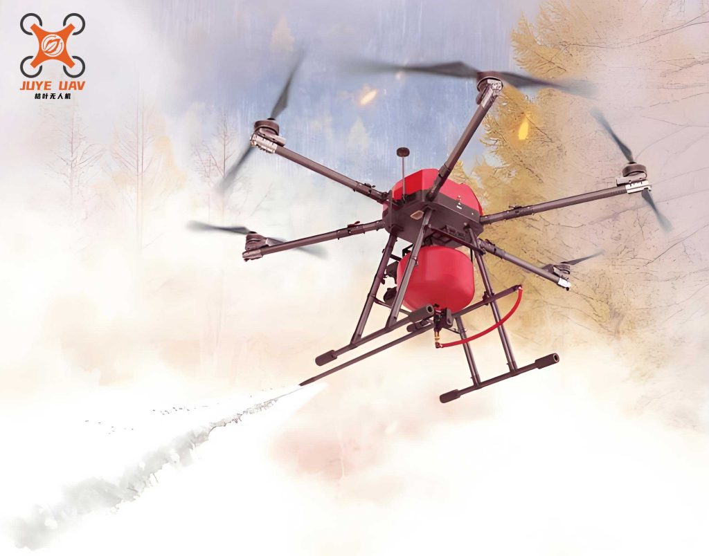
To begin, let me provide an overview of UAVs, often referred to as drones. Originally developed for military applications, UAVs have increasingly been adopted for civilian use, especially in disaster response. A typical fire UAV consists of several core components: a control system, a data link system, a launch and recovery system, an airframe, and a power system. The key advantages of fire UAVs include their high mobility and rapid response capabilities, which allow them to reach hazardous areas quickly. They are also designed for ease of operation, with automated and intelligent features such as autopilots, navigation instruments, flight path planning software, electronic maps, telemetry control systems, global positioning systems (GPS), and micro-digital photography systems. Additionally, fire UAVs exhibit strong environmental adaptability and relatively low operational costs, making them suitable for challenging conditions like poor weather or dangerous terrains where human intervention is risky.
The application of remote image transmission in fire UAVs involves capturing high-resolution video footage from aerial perspectives and transmitting it to ground stations for real-time analysis. This technology is crucial for fire services, as it enables commanders to assess situations without physical presence at the scene. In this section, I will delve into the technical composition of the video image transmission system. As illustrated in Figure 1, the onboard camera captures high-quality video signals, which are then encoded and preprocessed. The encoded data is forwarded to a wireless communication processing unit, where it undergoes further encoding before being modulated and transmitted via the UAV’s antenna. On the ground, the receiving station captures the signal and processes it for application use. This system relies on digital video signals to ensure robust secondary processing capabilities, given the long-distance and high-altitude nature of fire UAV operations.
To better understand the system, let me summarize the key components in a table:
| Component | Function | Importance in Fire UAV |
|---|---|---|
| Onboard Camera | Captures high-resolution video | Provides visual data for situational awareness |
| Encoder/Preprocessor | Compresses and prepares video data | Reduces bandwidth for efficient transmission |
| Wireless Communication Unit | Handles data encoding and modulation | Ensures reliable signal transmission over distances |
| Antenna | Transmits signals to ground stations | Critical for maintaining link integrity |
| Ground Station | Receives and processes video data | Enables command center decision-making |
Moving on to the technical characteristics, the design of fire UAV systems heavily depends on wireless control and image signal transmission channels. According to regulatory standards, such as those set by the Ministry of Industry and Information Technology, fire UAVs operate within specific frequency bands: 840.5–845 MHz for uplink control, 1430–1444 MHz for downlink telemetry and information transmission, and 2408–2440 MHz as backup. These allocations minimize interference and ensure reliable communication. In practice, fire UAV control signals often employ multi-carrier Coded Orthogonal Frequency Division Multiplexing (COFDM) technology, which enhances resilience in complex environments like mountains, suburbs, or urban areas with tall buildings. The coverage radius for control signals can be calculated using the formula:
$$ \text{Coverage Radius} = \text{Output Power} \times \text{Distance Coefficient} \times \text{Receiver Sensitivity} $$
For instance, a 20W车载发射机 (vehicle-mounted transmitter) might achieve a coverage radius of 10–20 km, while a 1W transmitter could cover 300–1200 m. To prevent accidents due to signal loss, I recommend incorporating feedback testing units that monitor signal strength in real-time, a critical feature for fire UAV operations in unpredictable environments.
Regarding image signal transmission, the channel error correction capability is paramount due to the low bit error rates required. The Consultative Committee for Space Data Systems (CCSDS) standards advocate for a concatenated coding scheme using Reed-Solomon (RS) and convolutional codes. Specifically, the RS(255,223) code is employed, where each symbol is 8 bits, with an error correction capability of E=16. The code word length is 255, including 32校验字符 (check characters), leaving 223 information characters. The generator polynomial for the RS code is given by:
$$ g(x) = \prod_{i=128}^{128+2E-1} (x – \alpha^i) $$
where E=16, and $\alpha$ is a primitive element in the Galois field. The standard allows for interleaving depths I=1,2,3,4,5, where I=1 implies no interleaving. A smaller I reduces error correction capability but simplifies the system, whereas a larger I enhances robustness at the cost of complexity. Empirical evidence suggests that I=4 strikes a balance, effectively meeting the control needs for fire UAVs. To illustrate the error correction performance, consider the following table comparing different interleaving depths:
| Interleaving Depth (I) | Error Correction Capability | System Complexity | Suitability for Fire UAV |
|---|---|---|---|
| 1 | Low | Low | Limited to stable environments |
| 2 | Moderate | Moderate | General use with minor interference |
| 3 | High | High | Resilient in moderate conditions |
| 4 | Very High | Very High | Optimal for challenging fire scenarios |
| 5 | Extreme | Extreme | Overkill for most applications |
Now, let me address the application challenges associated with fire UAV image transmission technology. These difficulties primarily revolve around three areas: flight load capacity, the composition of onboard video image acquisition and transmission units, and the functional design of backend video image processing platforms. First, flight load capacity encompasses both endurance and payload capabilities. Fire UAVs must sustain prolonged aerial missions during emergencies, necessitating careful selection between battery-powered and fuel-based engines. For example, a fire UAV with a lithium-polymer battery might offer 30 minutes of flight time, while a gasoline engine could extend this to over an hour, but at the cost of increased weight and complexity. Payload capacity is equally critical, as it determines the weight of imaging equipment that can be carried. I advocate for specialized designs tailored to fire service needs, with payloads optimized for high-resolution cameras and transmitters.
Second, the onboard video image acquisition and transmission composite unit must balance performance with energy efficiency. This system requires real-time video capture, storage, processing, and transmission, demanding high data rates, large volumes, environmental precision, real-time operation, and long transmission distances. In my experience, selecting components like low-power cameras with H.264 or H.265 encoding can reduce bandwidth usage while maintaining quality. The transmission module should possess robust data processing capabilities to ensure accurate representation of fire scenes. For instance, a typical fire UAV might use a 4K camera with a bitrate of 20 Mbps, coupled with a COFDM transmitter operating in the 1430–1444 MHz band to achieve ranges up to 5 km in urban settings.
Third, the backend video image processing platform plays a pivotal role in analyzing transmitted data. Common platforms include those based on Digital Signal Processors (DSP), Field-Programmable Gate Arrays (FPGA), and Personal Computers (PC). Each has distinct advantages and drawbacks, as summarized below:
| Platform | Advantages | Disadvantages | Relevance to Fire UAV |
|---|---|---|---|
| DSP-based | High practicality, flexible development tools, strong image processing | May consume moderate power | Ideal for real-time analysis in mobile command units |
| FPGA-based | Low power consumption, parallel processing capabilities | Complex algorithm development, limited software | Suited for embedded systems in fire UAVs |
| PC-based | Versatile software, high flexibility | High power consumption, CPU-intensive, less portable | Useful for stationary command centers |
In fire service applications, I often recommend a hybrid approach, using DSP or FPGA platforms for onboard processing to minimize data transmission loads, while employing PC-based systems at headquarters for in-depth analysis. This balances efficiency and capability, ensuring that fire UAV operations remain responsive and effective.
Turning to the practical application of small fire UAV image transmission technology in fire services, I have analyzed its advantages, current status, and persistent issues. The benefits are manifold: fire UAVs enable rapid provision of video footage for initial disaster assessment and force deployment, offer real-time situational updates to command centers, and facilitate remote decision-making by experts who cannot be on-site. For example, during hazardous chemical fires, fire UAVs can safely capture close-up images without endangering personnel, as seen in incidents like the Tianjin explosions, where drone footage aided in mapping blast zones and identifying hotspots. This underscores the transformative potential of fire UAVs in enhancing safety and operational efficiency.
However, the adoption of fire UAV technology faces several hurdles. Economically, the cost of a well-equipped fire UAV can range from tens of thousands to over a hundred thousand dollars, posing a barrier for many fire departments, especially in less affluent regions. Additionally, technical expertise is required for operating fire UAVs and processing their data, necessitating trained personnel and backup teams. There is also a need for standardized application models to prevent haphazard implementation. In my view, regional coordination in fire UAV procurement and deployment can mitigate waste and ensure compatibility with existing visual command systems. For instance, integrating fire UAV feeds with city-wide emergency response networks allows for seamless data sharing and enhanced interoperability.
To quantify these challenges, consider the following formula for cost-benefit analysis in fire UAV deployment:
$$ \text{Net Benefit} = \sum_{i=1}^{n} (R_i \times P_i) – (C_a + C_o + C_m) $$
where \( R_i \) represents the risk reduction per incident, \( P_i \) is the probability of incident occurrence, \( C_a \) is acquisition cost, \( C_o \) is operational cost, and \( C_m \) is maintenance cost. By optimizing these variables, fire departments can justify investments in fire UAV technology. Moreover, the current application scope of fire UAVs is often limited to basic video transmission, but future expansions could include automated false alarm verification, where fire UAVs are dispatched to confirm emergency calls remotely, thus conserving resources and reducing traffic congestion. Advanced functionalities like voice-controlled navigation or integration with fire suppression systems (e.g., deploying extinguishing agents) could further revolutionize fire services.
In conclusion, as I reflect on the evolution of small fire UAV image transmission technology, it is clear that we are still in a phase of exploration and promotion within fire services. The technology holds immense promise for improving response times, safety, and decision-making accuracy. By addressing the technical and practical challenges outlined—through innovations in flight endurance, onboard processing, and backend analytics—fire UAVs can become indispensable tools in modern firefighting. Looking ahead, I anticipate that fire UAV applications will grow more sophisticated, with artificial intelligence-driven image recognition and autonomous mission planning becoming standard features. This progression will not only enhance the effectiveness of fire services but also set a benchmark for other emergency response domains. As we continue to research and develop these systems, the keyword “fire UAV” will remain central to our efforts, symbolizing a commitment to leveraging technology for public safety.
To further illustrate the technical aspects, let me present a formula for the signal-to-noise ratio (SNR) in fire UAV image transmission, which affects video quality:
$$ \text{SNR} = \frac{P_t G_t G_r \lambda^2}{(4\pi d)^2 k T B F} $$
where \( P_t \) is transmitted power, \( G_t \) and \( G_r \) are antenna gains, \( \lambda \) is wavelength, \( d \) is distance, \( k \) is Boltzmann’s constant, \( T \) is temperature, \( B \) is bandwidth, and \( F \) is noise figure. Optimizing these parameters is crucial for clear image reception in fire scenarios. Additionally, the table below summarizes key frequency bands for fire UAV operations, based on regulatory guidelines:
| Frequency Band | Usage in Fire UAV | Range Characteristics |
|---|---|---|
| 840.5–845 MHz | Uplink control signals | Good penetration, moderate range |
| 1430–1444 MHz | Downlink video and telemetry | High bandwidth, suitable for urban areas |
| 2408–2440 MHz | Backup for control and data | Short-range, prone to interference |
In my ongoing work, I emphasize the importance of continuous testing and adaptation of fire UAV systems to real-world conditions. By sharing these insights, I hope to contribute to the broader adoption of small fire UAV image transmission technology, ultimately making fire services more resilient and effective in safeguarding communities.