In recent years, the integration of aerial surveying technology with unmanned aerial vehicles (UAVs) has revolutionized engineering projects, particularly in complex environments like aviation power hubs. As an engineer involved in such projects, I have witnessed the transformative impact of image control-free techniques using DJI UAVs, which eliminate the need for ground control points and enhance efficiency. This paper explores the application of these methods, focusing on the use of DJI drones, including models like the DJI Phantom4 RTK and broader DJI UAV systems, in a large-scale aviation power hub project. The adoption of DJI FPV and other advanced DJI drone technologies has enabled high-precision data acquisition and processing, significantly reducing labor and time costs while maintaining accuracy. Through detailed workflows, data analysis, and economic assessments, we demonstrate how DJI UAV solutions can optimize project outcomes in challenging engineering contexts.
Aerial surveying, traditionally reliant on ground control points for georeferencing, has evolved with the advent of image control-free technologies. These methods leverage high-precision positioning systems onboard DJI UAVs to achieve accurate measurements without extensive field setups. In this study, we employed a DJI Phantom4 RTK drone, a representative DJI drone known for its robust performance, to collect data in an aviation power hub environment. The project site covered an area of approximately 2 million square meters, with elevation variations up to 74 meters, presenting significant challenges for conventional surveying. By utilizing DJI UAV capabilities, including the DJI FPV for immersive data collection, we aimed to streamline the process and achieve sub-centimeter accuracy. The core principle of image control-free surveying involves using real-time kinematic (RTK) positioning to tag each image with precise coordinates, thereby bypassing the need for manual control point establishment. This approach not only accelerates data acquisition but also minimizes human error, making DJI drones indispensable in modern engineering applications.
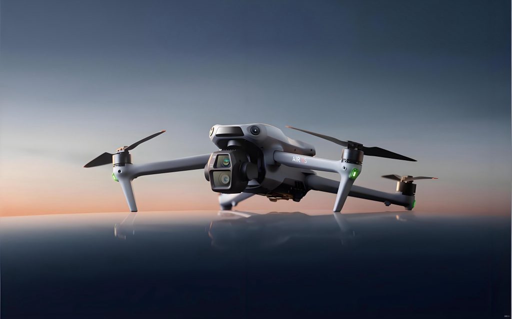
The DJI UAV platform, particularly the DJI Phantom4 RTK, was central to our data collection efforts. This DJI drone features an integrated RTK module that provides horizontal accuracy of ±0.01 m and vertical accuracy of ±0.02 m, coupled with a 1-inch 20-megapixel camera for high-resolution imagery. In our project, we also considered the versatility of other DJI UAV models, such as the DJI FPV, which offers agile maneuverability for complex terrains. The parameters of the DJI Phantom4 RTK are summarized in Table 1, highlighting its suitability for large-scale mapping. Similarly, the camera specifications, detailed in Table 2, ensure that the captured images meet the requirements for detailed 3D modeling. By leveraging these DJI drone capabilities, we conducted aerial surveys under overcast conditions to minimize shadows and enhance data quality, achieving a ground sampling distance (GSD) of 2.0 cm/pixel. This setup allowed us to cover the entire project area efficiently, with planned flight paths ensuring comprehensive data overlap.
| Parameter | Value | Parameter | Value |
|---|---|---|---|
| Takeoff Weight | 1391 g | Max Flight Altitude | 6000 m |
| Max Ascent Speed | 6 m/s (auto) | Flight Time | 30 min |
| Max Descent Speed | 3 m/s | Operating Temperature | 0°C to 40°C |
| Max Horizontal Speed | 50 km/h (positioning) | Positioning Accuracy | Vertical: 1.5 cm + 1 ppm (RMS); Horizontal: 1 cm + 1 ppm (RMS) |
| Parameter | Value | Parameter | Value |
|---|---|---|---|
| Pixel | 20 MP effective | Max Resolution | 5472×3078 (16:9), 4864×3648 (4:3), 5472×3648 (3:2) |
| Image Sensor | 1-inch CMOS | Image Format | JPEG |
| Lens | FOV 84°, 8.8 mm / 24 mm (35 mm equivalent) | Aperture | f/2.8 to f/11 |
| Shutter Speed | Mechanical: 8 to 1/2000 s; Electronic: 8 to 1/8000 s | ISO Range | Photo: 100-3200 (auto), 100-12800 (manual) |
| Built-in Gimbal | Yes |
Field data collection followed a streamlined workflow tailored for image control-free operations using DJI UAVs. Initially, we conducted a site reconnaissance to assess environmental factors and identify potential obstacles. This step was crucial for planning safe and effective flight paths, especially when deploying DJI drones in varied topography. Using specialized flight planning software, we designed an inclined circular flight path with a height of 50 meters and a radius of 50 meters, ensuring 80% overlap in both forward and side directions. This configuration, achievable with advanced DJI UAV systems like the DJI FPV, optimized data completeness and minimized gaps. During flights, we continuously monitored the RTK connection to maintain positioning accuracy, as any disruption could compromise data integrity. The DJI drone captured a total of 1,725 images, each geotagged with precise coordinates, and we performed post-flight checks to verify image quality and coverage. This process underscored the efficiency of DJI UAV technology, reducing field time compared to traditional methods that require ground control point setup.
Data processing began with importing the imagery into ContextCapture software for 3D modeling. We first screened the images using a complementary system to filter out any with floating-point positions or non-original corrections, retaining only those with fixed RTK data. This preprocessing step ensured that only high-quality images were used, enhancing the reliability of the subsequent 3D reconstruction. In ContextCapture, we adjusted parameters such as sensor size and focal length based on the DJI drone’s camera specifications, and set the spatial reference system to align with project coordinates. The aerial triangulation process solved for image orientations and generated a sparse point cloud, which served as the foundation for dense reconstruction. We then produced various outputs, including a 3D realistic model, digital surface model (DSM), digital orthophoto map (DOM), and digital elevation model (DEM). The 3D model, exported in Cesium 3D Tiles format, was further processed using a PSG 3D bare-eye digital measurement system to extract topographic features and create detailed maps. This integration of DJI UAV data with advanced software highlights the seamless workflow from acquisition to deliverable products.
To evaluate the accuracy of the image control-free DJI UAV approach, we compared the derived coordinates with those obtained from traditional surveying methods using a Leica total station. We selected 60 check points across the project area and calculated the discrepancies in plane and elevation coordinates. The plane coordinate errors (Δx and Δy) and elevation errors (Δz) are summarized in Table 3, with the root mean square error (RMSE) computed using the following formulas:
$$ M_S = \pm \sqrt{\frac{\sum \Delta S^2}{n}} $$
$$ M_Z = \pm \sqrt{\frac{\sum \Delta Z^2}{n}} $$
where ΔS represents the plane error vector magnitude, ΔZ is the elevation error, and n is the number of points. The results showed a plane RMSE of 0.043 m and an elevation RMSE of 0.022 m, both within the tolerance limits specified by standard mapping guidelines (e.g., ≤0.3 m for plane and ≤0.2 m for elevation in flat and hilly terrain). This confirms that DJI UAVs, including the DJI Phantom4 RTK and potentially DJI FPV for dynamic areas, can achieve sub-decimeter accuracy without ground control points, making them suitable for precision engineering applications.
| Point | Δx | Δy | Δz | Point | Δx | Δy | Δz |
|---|---|---|---|---|---|---|---|
| 1 | 0.026 | -0.018 | 0.025 | 31 | -0.048 | 0.010 | 0.036 |
| 2 | -0.039 | 0.048 | -0.013 | 32 | 0.048 | -0.021 | 0.023 |
| 3 | 0.032 | 0.027 | 0.026 | 33 | -0.027 | -0.047 | 0.034 |
| 4 | 0.025 | -0.001 | 0.028 | 34 | -0.048 | 0.047 | 0.023 |
| 5 | 0.039 | 0.016 | -0.018 | 35 | 0.041 | -0.010 | 0.016 |
| 6 | 0.039 | 0.013 | 0.007 | 36 | 0.014 | 0.026 | 0.034 |
| 7 | 0.025 | 0.043 | -0.005 | 37 | -0.048 | -0.036 | 0.002 |
| 8 | 0.029 | 0.037 | 0.001 | 38 | 0.044 | -0.019 | -0.012 |
| 9 | -0.005 | 0.035 | 0.021 | 39 | 0.009 | -0.016 | 0.014 |
| 10 | -0.043 | 0.050 | 0.038 | 40 | 0.038 | -0.014 | -0.012 |
| 11 | 0.027 | -0.005 | -0.004 | 41 | 0.000 | -0.018 | 0.023 |
| 12 | -0.019 | -0.008 | 0.018 | 42 | -0.004 | 0.003 | 0.014 |
| 13 | 0.038 | -0.025 | -0.006 | 43 | -0.042 | -0.021 | -0.032 |
| 14 | -0.016 | 0.025 | -0.017 | 44 | 0.008 | -0.018 | 0.034 |
| 15 | 0.034 | 0.035 | -0.008 | 45 | 0.020 | -0.032 | -0.025 |
| 16 | 0.035 | -0.033 | 0.021 | 46 | -0.045 | -0.049 | -0.029 |
| 17 | 0.044 | -0.013 | 0.031 | 47 | 0.022 | -0.015 | 0.029 |
| 18 | -0.008 | -0.012 | 0.005 | 48 | 0.029 | -0.027 | 0.008 |
| 19 | -0.048 | -0.035 | -0.029 | 49 | 0.026 | 0.033 | -0.001 |
| 20 | 0.039 | -0.029 | 0.030 | 50 | -0.025 | 0.016 | 0.019 |
| 21 | 0.044 | 0.048 | 0.010 | 51 | 0.015 | -0.008 | 0.029 |
| 22 | 0.011 | -0.037 | 0.021 | 52 | -0.018 | 0.011 | 0.025 |
| 23 | -0.032 | 0.031 | -0.014 | 53 | -0.049 | -0.018 | -0.013 |
| 24 | -0.003 | 0.014 | -0.012 | 54 | 0.012 | 0.020 | -0.014 |
| 25 | -0.022 | 0.047 | 0.020 | 55 | -0.009 | -0.035 | -0.040 |
| 26 | 0.003 | 0.044 | -0.019 | 56 | -0.023 | -0.022 | 0.019 |
| 27 | -0.049 | -0.010 | -0.001 | 57 | -0.039 | 0.002 | -0.029 |
| 28 | -0.042 | 0.045 | -0.010 | 58 | -0.044 | -0.020 | 0.037 |
| 29 | 0.024 | 0.012 | 0.020 | 59 | -0.028 | -0.002 | 0.030 |
| 30 | -0.035 | -0.015 | -0.040 | 60 | -0.040 | -0.019 | -0.023 |
An economic analysis revealed substantial cost savings when using image control-free DJI UAV technology compared to traditional surveying methods. For a project duration of three years with monthly surveys, traditional approaches would require five personnel working for three days per survey, totaling 540 labor days. At a rate of $400 per day, this amounts to $216,000 in labor costs alone. In contrast, the DJI UAV method involved one person for one day of field work and one day of data processing per survey, resulting in only 72 labor days over three years, costing $28,800. This represents a reduction to approximately 13% of the traditional labor cost, not accounting for additional savings in equipment and time. The efficiency of DJI drones, including the DJI FPV for rapid data acquisition, further reduces project timelines and enhances productivity. These economic benefits, combined with the high accuracy demonstrated, make DJI UAV solutions a compelling choice for aviation power hub projects and similar large-scale engineering endeavors.
In conclusion, the application of image control-free DJI UAV technology in aviation power hub engineering offers significant advantages in accuracy, efficiency, and cost-effectiveness. Through the use of DJI drones like the Phantom4 RTK and the integration of advanced data processing software, we achieved precise 3D models and topographic maps without the need for ground control points. The accuracy assessment confirmed that DJI UAV-derived data meet industry standards, with plane and elevation errors well within acceptable limits. Economically, the adoption of DJI UAV methods resulted in substantial labor savings and faster project completion. As DJI continues to innovate with models such as the DJI FPV, the potential for even greater efficiencies in complex environments grows. This study underscores the transformative role of DJI UAV technology in modern engineering, paving the way for broader adoption in infrastructure projects worldwide. Future work could explore the integration of AI and machine learning with DJI drone data to further automate and optimize surveying processes.