In the era of informatization, big data has progressively permeated various sectors in our country, driving modernization across industries. In agriculture, the application of big data provides strategic guidance for development, yet it faces constraints from multiple factors. The agricultural drone, as a high-tech product, offers data support for agricultural advancement and represents an effective utilization of big data. As a researcher in this field, I have explored the integration of big data with agricultural drones, aiming to enhance their functionality and coverage, thereby improving farming efficiency and enabling efficient management of agricultural production. However, practical challenges such as data mining, prediction, and security persist, potentially hindering the full potential of big data and the refinement of agricultural drone technology. This article delves into the application of big data in agricultural drones, examining hardware, workflows, software, and algorithms to foster digital transformation in agriculture.
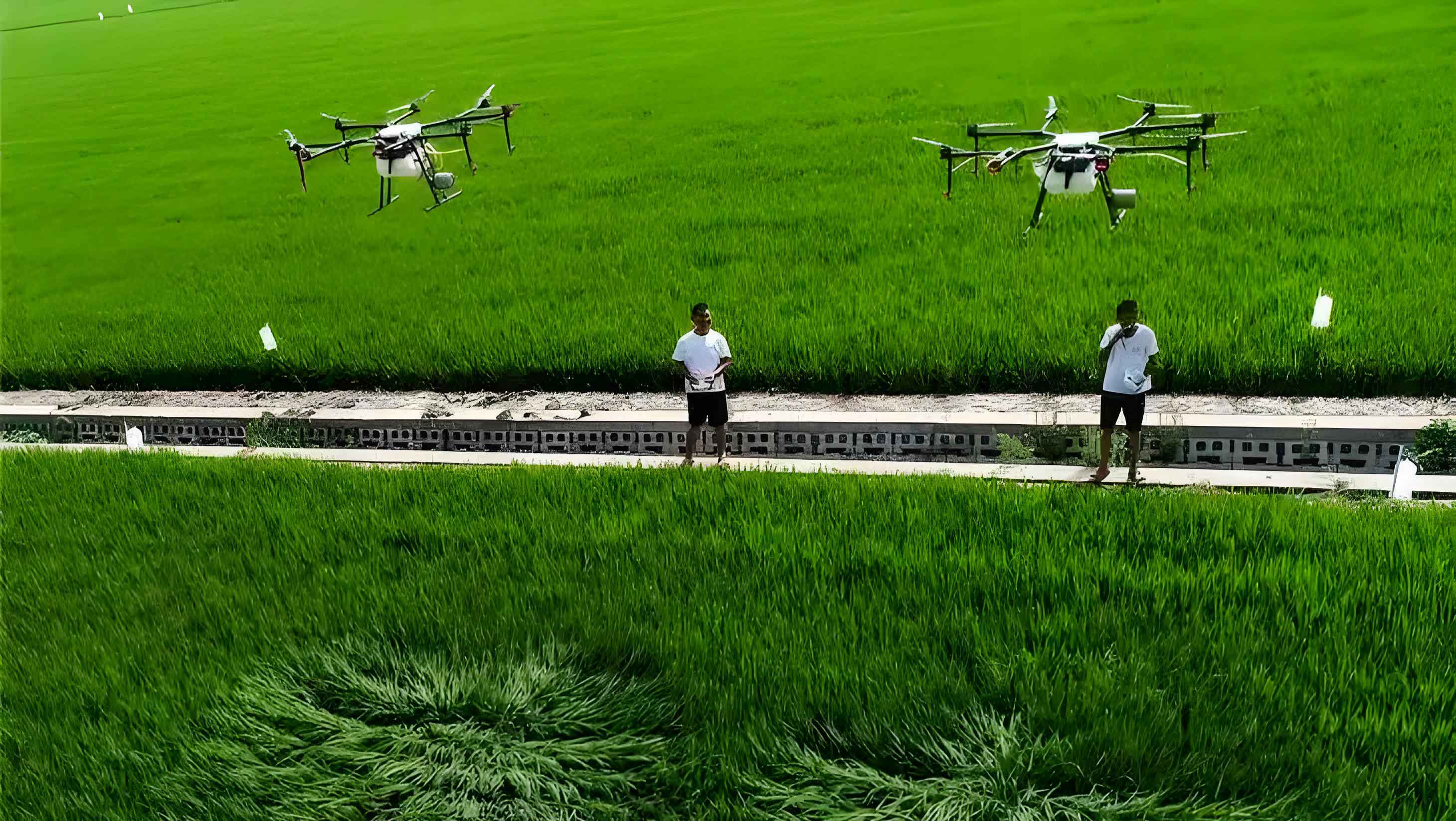
Agricultural drones, a critical category of unmanned aerial vehicles (UAVs), leverage big data technology to significantly expand their capabilities and operational range. These drones support precision agriculture by collecting vast amounts of data on crop health, soil conditions, and environmental factors. Essentially, both drones and big data share similarities in data collection, storage, and analysis. Big data refers to massive datasets characterized by volume, velocity, variety, and veracity, while agricultural drones are unmanned aircraft systems developed from advancements in computer science, information technology, and robotics. Commonly used in agriculture are rotary-wing drones, which consist of components like the airframe, remote control station, communication systems, and various sensors. By capturing aerial imagery of farmlands, agricultural drones generate and store data for analysis, aiding in decision-making processes. The synergy between agricultural drones and big data not only broadens the applicability of big data but also enhances the performance and efficiency of drones, paving the way for smarter farming practices.
In agricultural development, the application of big data relies on several key technologies. First, big data acquisition technology is crucial due to the diverse, ubiquitous, large-scale, and high-speed nature of agricultural data. Traditional methods often fail to rapidly and comprehensively gather knowledge, leading to underutilized information. For instance, agricultural drones equipped with advanced sensors can overcome these limitations by real-time monitoring. Second, big data integration technology handles structured, semi-structured, and unstructured data. It transforms complex datasets into manageable formats, though filtering is necessary to eliminate incorrect or valueless information. Third, cloud computing serves as the core platform for big data analysis, providing flexibility, support for heterogeneous networks, and ensuring availability and fault tolerance. These technologies collectively enable effective data processing and insights derivation, essential for optimizing agricultural drone operations.
The application of big data in agricultural drones involves multiple aspects, including hardware devices, specific processing workflows, and software algorithms. In my research, I have focused on integrating these elements to maximize the benefits of agricultural drones.
For hardware devices, the system primarily comprises three parts: the drone platform, ground station, and wireless transmission equipment. The drone platform typically uses professional智能 drones capable of flying for up to 30 minutes, featuring infrared obstacle avoidance and dual-mode GPS/GLONASS positioning. Wireless transmission devices offer speeds up to Class10 with a communication range of 7 km. Agricultural drones are equipped with data collection devices consisting of various sensors, such as angular velocity sensors, acceleration sensors, barometric altitude sensors, and wind speed/direction sensors. Flight control devices, including rudders, elevators, and ailerons, are installed on the wings to adjust flight direction and姿态 for autonomous navigation. Additionally, image acquisition devices with 20-megapixel sensors capture visual data, converted into digital signals via information转换装置. The ground station receives transmitted data, performs read/write operations on petabyte-scale datasets, uses computer modeling for computations, and restores digital signals to graphics. For big data analysis, the ground station employs PC servers with dual 8-core CPUs and gigabit network cards to meet storage, processing speed, and visualization demands.
| Component | Specifications | Function |
|---|---|---|
| Drone Platform | 30 min flight time, infrared避障, GPS/GLONASS | Autonomous data collection and navigation |
| Sensors | Angular velocity, acceleration, barometric, wind | Collect environmental and operational data |
| Image Acquisition | 20 MP sensor, digital signal conversion | Capture visual agricultural data |
| Wireless Transmission | Class10 speed, 7 km range | Transmit data to ground station |
| Ground Station | PC server with dual 8-core CPUs, gigabit网卡 | Data storage, processing, and analysis |
The specific processing workflow when applying big data to agricultural drones involves collecting massive datasets through drones, which contain valuable information highlighting the advantages of big data. Agricultural drones are outfitted with multiple sensor systems, data采集设施, cameras,交换机 devices, and network-connected data collectors, enhancing data comprehensiveness, real-time accuracy, and scientific validity. This provides robust data support for agriculture. However, the application is influenced by drone performance; when the onboard system cannot process data, it is transmitted via wireless communication to the ground station. Under traditional data usage, big data transmission frequency and efficiency are significantly improved. Using communication links with numerical modulation broadband facilitates data transfer to the ground station. Upon reception, the ground station organizes data according to standards, replays it as needed, and supports analysis. Agricultural big data processing can be finely segmented for various purposes. For example, data can be categorized into semi-structured and unstructured types for special handling, speeding up processing and ensuring scientific合理性. During recording, data is集中 processed,辅助决策 with knowledge bases, and挖掘 comprehensively to maximize big data effects and enhance the role of agricultural drones.
To illustrate the workflow mathematically, consider the data transmission rate. Let \( R \) be the transmission rate in Mbps, \( D \) the data size in MB, and \( T \) the time in seconds. The relationship is given by:
$$ T = \frac{D}{R} $$
For instance, with a Class10 transmission speed of 10 Mbps, transmitting 1 GB (1024 MB) of data from an agricultural drone would take approximately:
$$ T = \frac{1024 \text{ MB} \times 8 \text{ bits/byte}}{10 \times 10^6 \text{ bps}} \approx 819.2 \text{ seconds} \approx 13.65 \text{ minutes} $$
This emphasizes the importance of efficient wireless systems in big data applications for agricultural drones.
In terms of software and algorithms, big data analysis in agricultural drones often employs Hadoop technology. The Hadoop framework includes common modules and a distributed file system (HDFS), where cluster files are stored across nodes in a分布式架构. Using the MapReduce parallel computing model, Hadoop offers strong fault tolerance and scalability, making it suitable for large-scale data processing. For agricultural drone route planning, leveraging big data to select regional path algorithms is vital. While big data facilitates drone monitoring, unscientific area划分 can lead to overlapping regions during data aggregation, increasing computational complexity. To address this, I utilize a two-dimensional following algorithm for route planning, which avoids overlaps and enhances data validity. The theoretical basis is that不合理 paths stem from repeated monitoring of grid cells in the作业 area. To minimize this, a two-dimensional coordinate system is established, calculating the flight direction angular velocity to derive the drone’s projected route. Using a priority principle, the same row of grid cells is selected for sequential flight, collecting and analyzing data within each cell until all cells are covered. Additionally, anomaly detection is加强 to prevent drones from deviating from the planned path. Big data technology enables comprehensive coverage of the target area while avoiding重复 measurements, optimizing the agricultural drone’s utility.
The two-dimensional following algorithm can be formalized mathematically. Let the作业 area be divided into \( m \times n \) grid cells, with coordinates \((i, j)\) where \( i = 1, 2, \dots, m \) and \( j = 1, 2, \dots, n \). The drone’s position at time \( t \) is \((x(t), y(t))\), and its angular velocity \( \omega(t) \) determines the飞行方向. The projection航线 is computed as:
$$ \theta(t) = \int_0^t \omega(\tau) d\tau $$
where \( \theta(t) \) is the heading angle. The drone moves to the next cell based on a priority function \( P(i, j) \) that minimizes重叠. For instance, prioritize cells in the same row \( i \) sequentially in increasing \( j \). The path can be represented as a sequence of cells: \((i, j_1), (i, j_2), \dots, (i, j_n)\). This ensures efficient data collection without redundancy, crucial for big data applications in agricultural drones.
| Technology | Description | Benefit for Agricultural Drones |
|---|---|---|
| Hadoop | Distributed processing framework with HDFS and MapReduce | Handles large-scale agricultural data from drones efficiently |
| Two-dimensional Following Algorithm | Route planning algorithm to avoid overlapping areas | Optimizes flight paths, reduces data duplication |
| Cloud Computing | Platform for scalable data analysis and storage | Enables real-time processing and insights for drone data |
| Sensor Fusion | Integration of multiple sensor data streams | Enhances data accuracy and comprehensiveness for农业 applications |
Furthermore, the integration of machine learning algorithms with big data from agricultural drones can enhance predictive analytics. For example, using regression models to forecast crop yields based on sensor data. Let \( Y \) represent yield, and \( X_1, X_2, \dots, X_k \) be variables such as soil moisture, temperature, and NDVI (Normalized Difference Vegetation Index) collected by agricultural drones. A linear model can be expressed as:
$$ Y = \beta_0 + \beta_1 X_1 + \beta_2 X_2 + \dots + \beta_k X_k + \epsilon $$
where \( \beta_i \) are coefficients estimated from big data, and \( \epsilon \) is the error term. By training on historical data from agricultural drones, these models support precision farming decisions.
In practice, the application of big data in agricultural drones also involves challenges like data security and privacy. Ensuring encrypted transmission and secure storage is paramount. Techniques such as differential privacy can be applied, where noise is added to data to protect individual farm information while maintaining overall utility. Mathematically, for a query function \( f \) on dataset \( D \), a differentially private mechanism \( M \) satisfies:
$$ \Pr[M(D) \in S] \leq e^\epsilon \Pr[M(D’) \in S] $$
for any neighboring datasets \( D \) and \( D’ \) differing by one entry, and any subset \( S \) of outputs. This protects data from agricultural drones against breaches.
Looking ahead, the future of agricultural drones intertwined with big data is promising. Advances in IoT (Internet of Things) will enable more connected sensors on agricultural drones, generating even larger datasets. Edge computing can be integrated to process data locally on drones, reducing latency and bandwidth usage. For instance, lightweight algorithms can run directly on agricultural drone hardware to perform initial data filtering. The energy consumption of agricultural drones during big data operations is another area of study. Let \( E \) denote energy, \( P \) power consumption, and \( t \) time. The total energy used is:
$$ E = \int P(t) dt $$
Optimizing this through efficient algorithms can extend flight times, enhancing data collection capabilities.
In conclusion, the application of big data in agricultural drones revolutionizes agriculture by enabling data-driven insights throughout crop growth cycles. Through hardware like sensors and ground stations, workflows involving data transmission and processing, and software algorithms such as Hadoop and route planning techniques, agricultural drones become powerful tools for modern farming. They facilitate tasks like航线规划, flight control, and image processing, contributing to sustainable and efficient agriculture. By addressing challenges in data挖掘, prediction, and security, we can further unlock the potential of agricultural drones. Continuous innovation in big data technologies will drive the digital transformation of agriculture, making agricultural drones indispensable for precision agriculture and global food security. As I reflect on this research, it is clear that the synergy between big data and agricultural drones holds immense value, and future efforts should focus on scalable, secure, and intelligent systems to harness their full benefits.
To summarize key formulas discussed:
- Data transmission time: $$ T = \frac{D}{R} $$
- Heading angle in route planning: $$ \theta(t) = \int_0^t \omega(\tau) d\tau $$
- Linear yield prediction model: $$ Y = \beta_0 + \beta_1 X_1 + \beta_2 X_2 + \dots + \beta_k X_k + \epsilon $$
- Differential privacy condition: $$ \Pr[M(D) \in S] \leq e^\epsilon \Pr[M(D’) \in S] $$
- Energy consumption: $$ E = \int P(t) dt $$
These mathematical foundations support the robust application of big data in agricultural drones, ensuring that as technology evolves, agricultural drones will continue to play a pivotal role in shaping the future of farming.