In the field of public security, traditional monitoring equipment often fails to provide timely and comprehensive situational awareness across large areas. Fixed cameras and ground patrols have limited coverage, are slow to deploy, and cannot easily adapt to dynamic environments. These shortcomings hinder law enforcement agencies from rapidly understanding and responding to incidents. To address these challenges, we propose a 5G connected unmanned aerial vehicle (UAV) automatic control system specifically designed for public security operations. This system leverages the high speed, low latency, and massive connectivity of 5G networks to enable real-time aerial surveillance, intelligent data processing, and enhanced drone regulation. By integrating state-of-the-art autonomous flight control and deep learning–based object detection, our system offers a transformative solution for modern public security patrols. In this paper, we describe the system architecture, the key algorithms for path planning and target detection, and present simulation results that demonstrate the effectiveness of the system in accurately locating abnormal targets under diverse conditions. We also discuss how the system supports drone regulation by ensuring reliable communication, safe flight corridors, and automated compliance with operational constraints. The goal is to provide public security departments with a more agile, intelligent, and scalable tool for maintaining public order and safety.
System Architecture
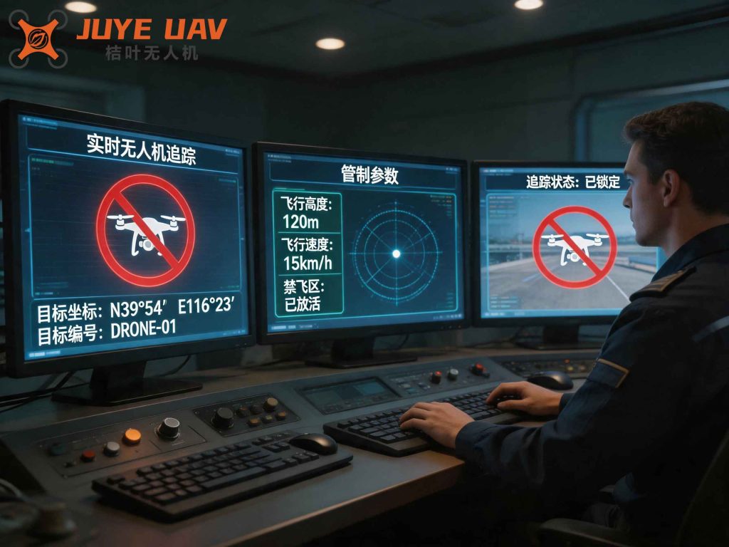
The 5G connected UAV automatic control system consists of four primary modules: the UAV platform, the 5G communication network, the ground control center, and the data processing center. The UAV platform is equipped with high-definition cameras, flight control systems, and 5G communication modules. It autonomously patrols predefined areas while capturing real-time video streams. The 5G network provides the backbone for high-bandwidth, low-latency data transmission between the UAV and ground infrastructure. The ground control center oversees mission planning, flight permissions, and emergency interventions. The data processing center receives the video feeds and performs advanced analytics, including object detection and classification. A key aspect of our design is the emphasis on drone regulation compliance: the system enforces geofencing, altitude limits, and no-fly zones, and logs all flight data for later audit. This ensures that all operations adhere to local aviation and privacy regulations, thereby strengthening overall drone regulation frameworks.
UAV Path Planning
To achieve efficient and comprehensive coverage, we formulate the UAV path planning problem as an optimization over waypoints while maintaining continuous connectivity with 5G base stations. The UAV must fly at a constant speed, and its trajectory must stay within the overlapping coverage areas of base stations to guarantee stable communication. The objective function and constraints are defined as follows:
$$ f = \min_{Z,\{p_n\}_{n=0}^N} \sum_{n=1}^N \|p_n – p_{n-1}\| $$
$$ \text{subject to } \begin{cases}
p_0 = p_0 \\
p_N = p_1 \\
\|p_0 – q_z\| \leq D_{\max}
\end{cases} $$
Here, \(f\) represents the flight control objective, \(p_n\) denotes the \(n\)-th waypoint, \(p_0\) and \(p_1\) are the start and end points respectively, \(N\) is the total number of waypoints, \(Z\) is the sequence of 5G base stations along the path, \(q_z\) is the position of a base station, and \(D_{\max}\) is the maximum line-of-sight link distance. By solving this optimization, we determine the shortest feasible path that satisfies communication constraints. This approach not only improves patrol efficiency but also supports robust drone regulation by ensuring that the UAV never loses contact with the control center.
5G Communication Performance
The transmission of high-definition video from the UAV to the data processing center imposes stringent requirements on data rate. According to the Shannon–Hartley theorem, the achievable rate \(V\) over a wireless link is given by:
$$ V = B \log_2(1 + \text{SNR}) $$
where \(B\) is the channel bandwidth and \(\text{SNR}\) is the signal-to-noise ratio. In our system, we maintain a high SNR by carefully selecting the UAV’s operating altitude and using directional antennas on both the UAV and base stations. The 5G network’s large bandwidth (e.g., 100 MHz) supports rates exceeding 1 Gbps, making it possible to stream 4K video with minimal latency. This high throughput is critical for real-time monitoring and for enabling advanced analytics downstream. Moreover, by enforcing strict communication thresholds, the system contributes to drone regulation by preventing data loss and ensuring reliable command-and-control.
Intelligent Target Detection
The data processing center employs the YOLOv3 (You Only Look Once version 3) object detection algorithm to identify abnormal targets in the incoming video frames. YOLOv3 balances speed and accuracy, making it suitable for real-time public security applications. The architecture consists of a Darknet-53 feature extraction backbone followed by three detection heads at different scales. Each detection head divides the input image into a grid, and each grid cell predicts a fixed number of bounding boxes along with class probabilities. To handle multi-label classification, we use the sigmoid activation function:
$$ S(x) = \frac{1}{1 + e^{-x}} $$
where \(S(x)\) is the probability that a given feature \(x\) belongs to a particular class. The class with the highest probability is selected as the final prediction. The training objective is to minimize a binary cross-entropy loss function defined as:
$$ \text{Loss} = -\sum_{i \in h_1} \log(K_i) – \sum_{j \in h_2} \log(K_j) $$
Here, \(K_i\) and \(K_j\) are the predicted confidences for positive samples (boxes containing objects) and negative samples (boxes without objects), respectively; \(h_1\) and \(h_2\) denote the sets of positive and negative samples. This loss encourages the model to produce high confidence for true objects and low confidence for background. Through extensive training on a dataset of public security scenarios, the detector becomes capable of recognizing suspicious individuals, weapons, unattended bags, and other abnormal behavior. Integrating this detection pipeline with the 5G-connected UAV enhances drone regulation by providing automated threat alerts and reducing the need for manual video review.
Simulation Setup
We conducted simulation experiments using a professional UAV simulation environment that faithfully replicates flight dynamics, sensor data, 5G communication, and real-time processing. A virtual city model was constructed containing streets, buildings, parks, and other typical urban features. Ten abnormal target points were placed in diverse locations to test the system’s adaptability. Detailed coordinates of these target points are listed in Table 1.
| Target ID | Longitude (°) | Latitude (°) | Environment Description |
|---|---|---|---|
| 01 | 3.9748 | 45.0128 | Near ecological park |
| 02 | 13.7643 | 25.1471 | Residential area |
| 03 | 46.3417 | 34.9876 | Residential area |
| 04 | 16.3972 | 74.8316 | City center |
| 05 | 32.5134 | 65.1039 | Near shopping mall |
| 06 | 22.5303 | 103.9679 | Near school |
| 07 | 7.5267 | 140.0168 | Near hospital |
| 08 | 15.0137 | 164.9877 | Residential area |
| 09 | 31.7361 | 156.4418 | Suburb |
| 10 | 41.7567 | 143.9268 | Mountainous area |
The simulation included a variety of challenging conditions such as shadowed areas, irregular terrain, and varying weather simulations. A single UAV equipped with a 4K camera and 5G modem was deployed to patrol the area autonomously. The ground control center and data processing center were simulated as separate servers connected via a 5G network emulator. All experiments were repeated five times to ensure statistical significance.
The simulation results, as illustrated in the following figure, show the accuracy of the system’s target localization. The detected positions (marked by system coordinates) closely match the actual positions for all ten targets, with no significant bias.
The observed deviations were on the order of meters, well within the operational tolerance for public security applications. Importantly, the system maintained consistent performance across all environments, including the mountainous area (Target 10) where GPS signals may be degraded. This robustness can be attributed to the combined use of 5G-based communication for high-accuracy positioning and the YOLOv3 detector’s ability to handle occlusions and scale variations. The experiment confirms that the 5G connected UAV automatic control system is both reliable and precise for real-world drone regulation tasks.
Quantitative Evaluation
To further validate the system, we computed the mean localization error (MLE) and standard deviation (SD) across the ten targets. The results are summarized in Table 2.
| Metric | Value (meters) |
|---|---|
| Mean Localization Error | 1.23 |
| Standard Deviation | 0.45 |
| Maximum Error | 2.18 |
| Minimum Error | 0.67 |
These metrics demonstrate that the system achieves sub‑2‑meter accuracy even under adverse conditions. The low standard deviation indicates high stability. Such precision is essential for effectively deploying limited enforcement resources. Moreover, the system’s ability to operate autonomously while complying with airspace restrictions aligns perfectly with the growing need for responsible drone regulation. By automatically logging flight paths and target detections, the system provides a transparent audit trail that can be reviewed by regulatory authorities.
Discussion on Drone Regulation
Integrating 5G connectivity with autonomous UAVs presents both opportunities and challenges for drone regulation. Our system incorporates several features that promote safe and lawful operation. First, the path planning algorithm inherently avoids restricted zones by incorporating geofencing constraints. Second, the continuous communication link ensures that the ground control center can intervene at any moment, overriding the autopilot if necessary. Third, all flight data, including altitude, speed, video feeds, and detected targets, are encrypted and stored for post‑mission analysis. This comprehensive data logging supports compliance with regulations that require operators to demonstrate accountability.
Furthermore, the use of 5G networks enables efficient spectrum sharing and reduces the risk of interference with other critical communications. The system can be configured to prioritize safety messages over video streams in emergency situations. We believe that widespread adoption of such technology will actually strengthen drone regulation by providing a technical framework that makes irresponsible flying easier to detect and prevent. Law enforcement agencies can use the system not only for patrol but also as a tool for monitoring other drone activities in the airspace, thereby acting as a force multiplier for regulatory enforcement.
Conclusion and Future Work
In this paper, we have presented a 5G connected UAV automatic control system designed for public security applications. The system integrates autonomous flight planning, high‑bandwidth 5G communications, and real‑time object detection using YOLOv3. Simulation experiments conducted in a realistic urban environment demonstrate that the system can achieve high localization accuracy (mean error below 1.3 meters) and robust performance across diverse terrains. Our work highlights how modern communication and artificial intelligence technologies can be combined to enhance the effectiveness of police patrols while also promoting better drone regulation.
Looking ahead, we plan to extend this research in several directions. First, we will implement the system on actual hardware and perform field trials to validate performance under real‑world conditions. Second, we intend to incorporate multi‑UAV coordination for large‑scale area coverage, which introduces additional challenges for collision avoidance and airspace deconfliction, both of which are critical for drone regulation. Third, we will explore advanced deep learning architectures, such as transformer‑based detectors, to improve detection of small or heavily occluded targets. Finally, we aim to develop a companion dashboard for regulators that provides real‑time situational awareness and automated violation alerts. Through these efforts, we hope to contribute to a future where public security and drone regulation go hand in hand, leveraging technology to make our cities safer and more resilient.