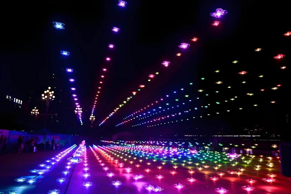
In recent years, drone performances have emerged as a spectacular form of entertainment, where multiple unmanned aerial vehicles (UAVs) execute synchronized maneuvers to create intricate patterns and displays in the sky. The core enabler of these dazzling drone shows is Real-Time Kinematic (RTK) technology, which provides centimeter-level positioning accuracy essential for safe and precise operations. As a researcher focused on advancing drone performance technologies, I have extensively studied how RTK systems overcome the limitations of traditional Global Navigation Satellite System (GNSS) methods. In this paper, I will delve into the fundamental principles of RTK, its critical role in enhancing drone show accuracy, the factors influencing its performance, and comprehensive strategies to ensure its reliability. Through detailed explanations, mathematical models, and empirical data, I aim to provide a thorough understanding of how RTK technology can be optimized for large-scale drone performances, ultimately contributing to safer and more captivating aerial displays.
RTK technology is built upon the foundation of GNSS, which includes constellations such as GPS, GLONASS, BeiDou, and Galileo. These satellites continuously transmit signals containing time and position data, which are received by ground-based stations and UAVs. The key innovation of RTK lies in its differential correction approach, where a fixed base station at a known location calculates errors in satellite signals—such as ionospheric delays, tropospheric delays, and orbital inaccuracies—and transmits these corrections to mobile stations on drones via wireless data links, often using protocols like RTCM (Radio Technical Commission for Maritime Services). This process allows for real-time adjustments, elevating positioning precision from meter-level to centimeter-level. For instance, in a typical drone performance, the base station computes the error vector $\Delta \mathbf{p}$ as follows: $$\Delta \mathbf{p} = \mathbf{p}_{\text{known}} – \mathbf{p}_{\text{measured}},$$ where $\mathbf{p}_{\text{known}}$ is the base station’s precisely surveyed coordinates, and $\mathbf{p}_{\text{measured}}$ is the position derived from satellite signals. The mobile station on the drone then applies this correction to its own measurements, resulting in an accurate position estimate: $$\mathbf{p}_{\text{corrected}} = \mathbf{p}_{\text{raw}} + \Delta \mathbf{p}.$$ This high level of accuracy is indispensable for drone shows, where formations may involve hundreds of drones flying in close proximity, with separations as small as a few meters. Without RTK, the risk of collisions and misalignments increases significantly, jeopardizing the entire drone performance.
The effectiveness of RTK in drone performances is influenced by several factors, which I have categorized into satellite geometry, base station integrity, environmental conditions, and equipment quality. Satellite geometry, often quantified by the Dilution of Precision (DOP) metric, plays a crucial role. The DOP value is derived from the geometry matrix $\mathbf{G}$ composed of unit vectors from the receiver to visible satellites: $$\mathbf{G} = \begin{bmatrix} \mathbf{u}_1 & \mathbf{u}_2 & \cdots & \mathbf{u}_n \end{bmatrix}^T,$$ where $\mathbf{u}_i$ represents the direction vector to the i-th satellite. The DOP is then calculated as: $$\text{DOP} = \sqrt{\text{trace}((\mathbf{G}^T \mathbf{G})^{-1})}.$$ Lower DOP values indicate better satellite distribution and higher positioning accuracy, which is vital for maintaining formation integrity in drone shows. For example, in open areas with minimal obstructions, DOP values can be as low as 1-2, whereas urban or mountainous regions may see values exceeding 5, leading to degraded performance. Additionally, the base station must be stable and accurately positioned; any displacement or error in its coordinates propagates directly to the drones. Environmental factors, such as electromagnetic interference from sources like power lines or communication towers, can disrupt signal reception. Signal attenuation due to weather conditions, such as heavy rain, can be modeled by the attenuation coefficient $\alpha$: $$\alpha = k \cdot R^2,$$ where $R$ is the rainfall rate and $k$ is a constant dependent on frequency. This attenuation increases noise and reduces signal-to-noise ratio (SNR), impacting RTK accuracy. Equipment aspects, including receiver sensitivity and antenna design, also contribute to performance variations. High-gain antennas improve signal capture but require precise calibration to avoid introducing biases.
To illustrate the practical implications, I have compiled data from various drone performance scenarios in the table below, highlighting how RTK enhances positioning accuracy compared to standard GNSS. This table summarizes typical performance metrics under different conditions, emphasizing the importance of RTK for reliable drone shows.
| Scenario | RTK Enabled Accuracy (Vertical, Horizontal) | Standard GNSS Accuracy (Vertical, Horizontal) | Impact on Drone Show |
|---|---|---|---|
| Open field, optimal satellite coverage | ±0.1 m, ±0.1 m | ±0.5 m, ±1.5 m | Enables tight formations and smooth transitions |
| Urban area with obstructions | ±0.2 m, ±0.3 m | ±1.0 m, ±2.5 m | Increased risk of collisions; requires redundant systems |
| Adverse weather (e.g., heavy rain) | ±0.3 m, ±0.4 m | ±1.5 m, ±3.0 m | Potential for formation drift; necessitates real-time monitoring |
| With electromagnetic interference | ±0.4 m, ±0.5 m | ±2.0 m, ±4.0 m | Higher likelihood of signal loss; emphasizes shielding needs |
In drone performances, RTK technology facilitates several critical functions. Firstly, it enables precise formation flying and dynamic pattern changes. For example, in a large-scale drone show involving thousands of UAVs, each drone must maintain its relative position with millimeter-level accuracy to create cohesive images like logos or animated sequences. The position error $\epsilon$ between drones can be minimized using RTK corrections: $$\epsilon = \|\mathbf{p}_i – \mathbf{p}_j\|,$$ where $\mathbf{p}_i$ and $\mathbf{p}_j$ are the positions of two adjacent drones. With RTK, $\epsilon$ can be kept below 0.1 meters, ensuring seamless transitions. Secondly, RTK supports accurate hovering and position holding, which is essential for static displays or synchronized light effects. The hover stability is governed by the control system’s ability to counteract disturbances, and RTK provides the necessary position feedback. Thirdly, real-time monitoring through RTK allows operators to track each drone’s location on a ground control station, enabling immediate interventions if deviations occur. This is crucial for maintaining safety in dense drone performances. Lastly, data collection during rehearsals helps optimize flight paths and formation parameters, enhancing the overall quality of the drone performance.
Empirical evidence from real-world drone shows underscores the value of RTK technology. In one notable instance, a drone performance featuring hundreds of UAVs utilized RTK to achieve precise positioning over a wide area, resulting in stunning aerial light patterns that captivated audiences. The success of such events relies on the integration of RTK with other sensors, such as inertial measurement units (IMUs), to provide redundancy and improve reliability. The combined positioning solution can be expressed as: $$\mathbf{p}_{\text{fused}} = \mathbf{p}_{\text{RTK}} + \mathbf{K} \cdot (\mathbf{p}_{\text{IMU}} – \mathbf{p}_{\text{RTK}}),$$ where $\mathbf{K}$ is a Kalman gain matrix that weights the sensor inputs based on their uncertainties. This fusion approach is particularly beneficial in environments where satellite signals are intermittently blocked, ensuring continuous operation during the drone show.
Despite its advantages, RTK systems in drone performances face challenges related to electromagnetic interference and equipment failures. To address these, I propose a multi-faceted assurance strategy focused on electromagnetic environment management and device reliability enhancement. Electromagnetic management involves proactive monitoring of the performance area using spectrum analyzers to detect and mitigate interference sources. The power spectral density (PSD) of interfering signals can be analyzed to identify their impact: $$\text{PSD}(f) = \lim_{T \to \infty} \frac{1}{T} \left| \int_{-T/2}^{T/2} x(t) e^{-j2\pi ft} dt \right|^2,$$ where $x(t)$ is the received signal. By allocating dedicated frequency bands for RTK data transmission and implementing shielding techniques, such as Faraday cages for sensitive components, the integrity of the drone performance can be preserved. Additionally, device reliability can be improved through rigorous testing and maintenance protocols. For example, receivers should undergo stress tests under simulated interference conditions, and antennas should be regularly inspected for damage or misalignment. Redundant systems, including backup base stations and multiple data links, can further bolster resilience. The failure rate $\lambda$ of RTK components can be modeled using the exponential distribution: $$F(t) = 1 – e^{-\lambda t},$$ where $F(t)$ is the probability of failure by time $t$. By selecting high-quality components with low $\lambda$ values, the overall system uptime during drone shows can be maximized.
In conclusion, RTK technology is indispensable for modern drone performances, providing the precision needed for complex formations and safe operations. Through detailed mathematical models and practical insights, I have highlighted how factors like satellite geometry and environmental conditions affect performance, and proposed strategies to mitigate these issues. As drone shows continue to evolve, leveraging RTK with robust assurance measures will be key to achieving breathtaking and reliable aerial displays. Future research could explore the integration of AI for predictive interference avoidance, further enhancing the capabilities of drone performances.