As an audit professional deeply engaged in the evolving landscape of governmental oversight, I have witnessed firsthand the transformative impact of integrating cutting-edge technologies into our workflows. The imperative to enhance audit quality, efficiency, and scope drives a continuous pursuit of knowledge and skill acquisition. In this context, the recent initiatives focusing on technological empowerment, particularly through comprehensive drone training, have marked a significant leap forward. This article delves into my experiential perspective on these developmental programs, emphasizing the critical role of drone training in modernizing audit methodologies. I will elaborate on the technical and procedural facets explored, utilizing tables and mathematical formulations to encapsulate key concepts, and reflect on the broader implications for audit excellence.
The drive for technological adoption in audit institutions stems from a strategic vision to leverage innovation for public accountability. Recognizing that traditional audit methods may fall short in addressing complex, large-scale, or geographically dispersed assets, there is a concerted push to embrace tools like unmanned aerial vehicles (UAVs). The foundational drone training sessions are designed not merely as introductory workshops but as immersive learning experiences that bridge theoretical knowledge with practical application. This drone training initiative is pivotal, as it equips auditors with the competence to independently operate drones for data collection, analysis, and evidence gathering in diverse audit scenarios such as agricultural projects, natural resource management, and infrastructure investment.
To understand the core of drone training, it is essential to break down the UAV system. A typical drone used in audit operations consists of several integrated components: the airframe, propulsion system, flight controller, Global Navigation Satellite System (GNSS) receiver, inertial measurement unit (IMU), cameras or sensors, and communication links. The flight dynamics can be modeled using basic principles of physics. For instance, the thrust required for hover is given by $$ T = m \cdot g $$, where \( T \) is thrust, \( m \) is the mass of the drone, and \( g \) is acceleration due to gravity. For forward flight, additional factors like drag come into play, approximated by $$ D = \frac{1}{2} \rho C_D A v^2 $$, with \( \rho \) as air density, \( C_D \) as drag coefficient, \( A \) as reference area, and \( v \) as velocity. These formulas underline the engineering precision needed, which drone training translates into operational awareness for auditors.
Safety and regulatory compliance form the bedrock of any responsible drone training program. Auditors must navigate a framework of aviation laws, privacy regulations, and operational guidelines. Key regulations often include restrictions on flight altitude (e.g., below 120 meters), line-of-sight requirements, no-fly zones near sensitive areas, and data protection standards. The drone training meticulously covers these aspects, ensuring that audit missions are conducted legally and ethically. A summary of common regulatory focuses is presented in the table below.
| Regulatory Aspect | Typical Requirement | Audit Implication |
|---|---|---|
| Flight Altitude | Max 120m AGL | Limits vertical coverage but ensures airspace safety. |
| Visual Line-of-Sight | Must be maintained | Requires careful mission planning for large areas. |
| Registration | Mandatory for drones >250g | Audit institutions must register fleet drones. |
| Data Privacy | Comply with local laws | Collected imagery must be secured and used solely for audit purposes. |
| Operational Permits | Needed for controlled airspace | Coordination with aviation authorities for urban audits. |
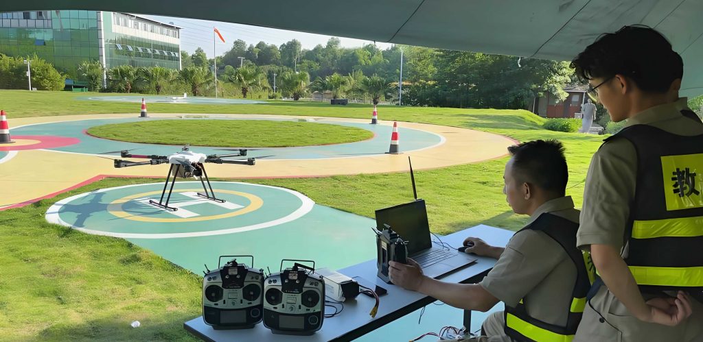
The practical component of drone training is where theoretical knowledge converges with hands-on skill. Trainees learn pre-flight checks, takeoff and landing procedures, manual and automated flight modes, and payload operation. For data acquisition, missions are planned using software that considers factors like ground sampling distance (GSD), which determines image resolution. The GSD is calculated as $$ GSD = \frac{H \cdot s}{f} $$, where \( H \) is flight altitude, \( s \) is sensor pixel size, and \( f \) is focal length. This equation helps auditors plan flights to achieve desired detail—for example, a GSD of 2 cm/pixel might be needed for crack detection in infrastructure, while 10 cm/pixel could suffice for crop health assessment. This drone training segment emphasizes how parameter choices directly influence audit evidence quality.
Following the classroom instruction, field exercises solidify competencies. A hands-on session involved mapping an office building and analyzing surrounding vegetation—a simulation of real audit tasks. Participants operated drones to capture overlapping images, which were then processed into 2D orthomosaics and 3D models. The process of photogrammetric reconstruction can be summarized by the collinearity equations, fundamental to structure-from-motion algorithms: $$ x = -f \frac{X – X_0}{Z – Z_0}, \quad y = -f \frac{Y – Y_0}{Z – Z_0} $$, where \((x,y)\) are image coordinates, \((X,Y,Z)\) are object space coordinates, \((X_0,Y_0,Z_0)\) is the camera perspective center, and \(f\) is focal length. Through iterative bundle adjustment, accurate 3D models are generated. This practical drone training demystifies the technology, enabling auditors to critically assess data provenance and accuracy.
The applications of drone training in audit are vast and transformative. For agricultural audits, drones equipped with multispectral sensors capture data beyond visible light, allowing calculation of vegetation indices like the Normalized Difference Vegetation Index (NDVI): $$ NDVI = \frac{NIR – Red}{NIR + Red} $$, where \(NIR\) is near-infrared reflectance and \(Red\) is red reflectance. This index helps assess crop health, irrigation efficiency, or compliance with subsidy programs. In natural resource audits, drones monitor mining activities, deforestation, or water body changes by creating time-series volumetric models. The volume change \(\Delta V\) between two surveys can be computed via digital elevation model (DEM) differencing: $$ \Delta V = \iint (DEM_{t2} – DEM_{t1}) \, dx\, dy $$. For investment audits on construction projects, drones automate progress monitoring and quantity verification. For instance, stockpile volume can be estimated using the prismoidal formula: $$ V = \frac{L}{6}(A_1 + 4A_m + A_2) $$, where \(L\) is length, \(A_1\) and \(A_2\) are end areas, and \(A_m\) is mid-area. These applications showcase how drone training directly enhances audit precision and scope.
To consolidate the diverse use cases, the following table categorizes typical audit scenarios empowered by drone training, listing key metrics and technologies involved.
| Audit Domain | Primary Objective | Drone Sensor Type | Key Metric/Output | Relevant Formula/Technique |
|---|---|---|---|---|
| Agriculture | Crop health assessment | Multispectral | NDVI maps, yield estimation | $$ NDVI = \frac{NIR-Red}{NIR+Red} $$ |
| Natural Resources | Land use change detection | RGB, LiDAR | 3D model, change volume | Volume integration from DEM differencing |
| Infrastructure Investment | Construction progress verification | RGB, thermal | Orthomosaic, 3D model, stockpile volume | Prismoidal formula for volumes |
| Environmental Compliance | Pollution or erosion monitoring | Multispectral, gas sensors | Contaminant dispersion maps | Statistical analysis of sensor data |
| Disaster Relief Audits | Damage assessment post-disaster | RGB | Damage extent, cost estimation | Image classification algorithms |
The interactive segment of the drone training fostered deep engagement, as auditors raised queries on measurement accuracy, software tools like DJI Terra, and data integration challenges. This dialogue highlighted that effective drone training must be iterative, addressing real-world hurdles such as wind effects on flight stability or calibration needs for metric accuracy. The error propagation in drone-based measurements can be modeled. For instance, the uncertainty in distance measurement from a drone-derived 3D model depends on GSD and matching accuracy: $$ \sigma_d = \sqrt{(GSD \cdot \sigma_p)^2 + \sigma_c^2} $$, where \(\sigma_p\) is pixel localization error and \(\sigma_c\) is calibration error. Understanding these limitations is crucial for audit evidence reliability, a core takeaway from the drone training.
Parallel to the drone training, professional development extends to other audit competencies, such as verifying reports from social intermediary agencies. This domain requires auditors to scrutinize financial statements, asset valuations, and engineering cost assessments prepared by external firms. The analytical framework often involves statistical sampling and risk assessment. For example, when selecting samples for verification, auditors might use the following formula for determining sample size \(n\) for attribute testing: $$ n = \frac{N \cdot z^2 \cdot p(1-p)}{e^2 \cdot (N-1) + z^2 \cdot p(1-p)} $$, where \(N\) is population size, \(z\) is z-score from confidence level, \(p\) is expected error rate, and \(e\) is tolerable error. This mathematical approach ensures that核查 work is both efficient and statistically valid.
The training on social intermediary agency report verification emphasized systematic procedures: understanding industry standards, identifying red flags, and applying forensic techniques. Common issues include overstated asset values, underreported liabilities, or manipulated cost data. Auditors are trained to use ratio analysis, such as the quick ratio $$ \text{Quick Ratio} = \frac{\text{Current Assets} – \text{Inventory}}{\text{Current Liabilities}} $$, to assess financial health, or the cost variance analysis in engineering reports: $$ \text{Variance} = \text{Actual Cost} – \text{Budgeted Cost} $$. Embedding such verification into all audit projects enhances comprehensiveness. The table below outlines key report types and verification focuses.
| Report Type | Typical Source | Key Verification Metrics | Common Anomalies |
|---|---|---|---|
| Financial Statement Audit | Accounting firms | Asset valuation, revenue recognition, debt levels | Overvaluation of intangible assets, premature revenue booking |
| Asset Valuation Report | Appraisal agencies | Market comparables, depreciation methods, discount rates | Inflated comparables, inappropriate discount rates |
| Engineering Cost Report | Construction consultancies | Quantity take-offs, unit rates, change orders | Overstated quantities, unrealistically low unit rates for bids |
| Performance Review | Management consultants | KPI achievement, benchmark data | Manipulated KPIs, cherry-picked benchmarks |
The synergy between technological drone training and traditional audit skill enhancement is clear. Both aim to bolster audit robustness. The drone training empowers auditors to collect primary spatial data, reducing reliance on potentially biased secondary reports. Conversely, rigorous report verification ensures that even when using external data, auditors can critically evaluate its credibility. This holistic approach is encapsulated in a risk-based audit model where overall audit risk \(R_a\) is a function of inherent risk \(R_i\), control risk \(R_c\), and detection risk \(R_d\): $$ R_a = R_i \cdot R_c \cdot R_d $$. Drone training and verification training both serve to reduce detection risk by improving evidence quality and analytical depth.
Reflecting on the drone training experience, the enthusiasm among participants was palpable. The ability to swiftly map large areas, generate precise measurements, and visualize data in 3D opens new avenues for audit assertions. For instance, in a hypothetical audit of a reforestation project, drones could periodically capture data to compute tree count and canopy cover over time, applying a growth model like $$ A(t) = A_0 e^{kt} $$, where \(A(t)\) is canopy area at time \(t\), \(A_0\) is initial area, and \(k\) is growth rate. Discrepancies from reported progress would be readily identifiable. This drone training thus transforms auditors from passive reviewers to active investigators.
Looking forward, the integration of drone training into continuous professional development is essential. As drone technology evolves—with advancements in autonomy, sensor fusion, and real-time processing—ongoing drone training will be necessary to maintain competency. Future modules might cover artificial intelligence for automatic defect detection in infrastructure or hyperspectral sensors for material identification. The learning curve can be modeled as a logistic function: $$ C(t) = \frac{L}{1 + e^{-k(t-t_0)}} $$, where \(C(t)\) is competency level, \(L\) is maximum competency, \(k\) is learning rate, and \(t_0\) is midpoint of learning. Regular drone training accelerates this curve, ensuring auditors stay at the forefront.
In conclusion, the commitment to technological adoption, exemplified by comprehensive drone training, signifies a paradigm shift in audit practice. By mastering UAV operations, data analytics, and complementary verification techniques, audit professionals can significantly enhance the quality, efficiency, and impact of their work. The mathematical frameworks and tabulated summaries presented herein underscore the technical rigor involved. This drone training initiative is not an endpoint but a catalyst for continuous innovation, driving audit institutions toward a future where technology and expertise converge to uphold accountability and foster public trust. As we embrace these tools, the very nature of audit evidence expands, promising deeper insights and more resilient oversight mechanisms.