In the field of power grid maintenance, the inspection of transmission lines and the installation of ground wires represent high-risk operations that have traditionally relied on manual climbing methods. These approaches are not only inefficient but also pose significant safety hazards to personnel. With the advancement of unmanned aerial vehicle (UAV) technology, there is a growing interest in leveraging multirotor drones for such tasks. However, challenges such as strong electromagnetic interference, complex meteorological conditions, and the need for precise operations have hindered the widespread adoption of multirotor drones in this domain. Existing research often struggles with issues like electromagnetic shielding, accuracy in non-contact voltage detection, and stability in dynamic wire hooking. This study addresses these limitations by developing an intelligent multirotor drone system tailored for power line applications. The system incorporates modular design principles, high-precision navigation, anti-interference communication, and specialized operational equipment. Through rigorous testing in diverse terrains, the multirotor drone system demonstrates enhanced efficiency, reliability, and safety, paving the way for smarter grid maintenance solutions.
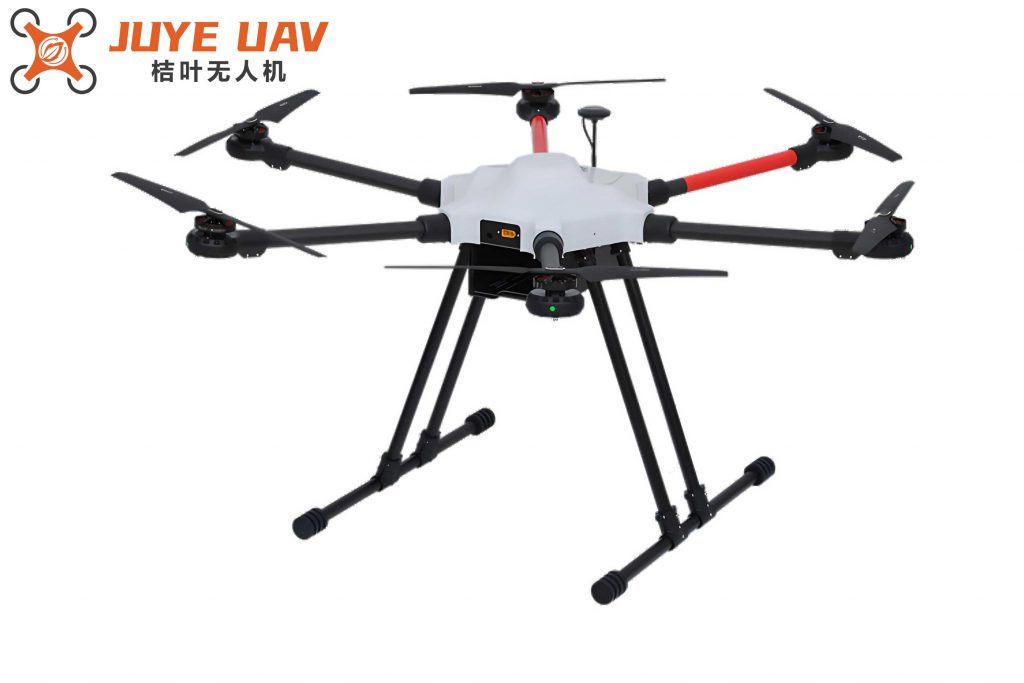
The multirotor drone system is engineered to meet the stringent demands of transmission line operations. It features a six-rotor carbon fiber platform that ensures durability and lightweight performance. Key components include an integrated RTK-GNSS/INS navigation system, multi-sensor obstacle avoidance modules, and redundant power supplies. The multirotor drone is designed to withstand wind speeds of up to 15 m/s and adapt to rugged terrains, making it suitable for various environmental conditions. The system’s architecture is divided into several functional modules: navigation control, non-contact voltage detection, wire hooking mechanism, and communication transmission. Each module is interconnected via a high-speed bus, enabling seamless data exchange and coordinated operations. The use of carbon fiber composites and triple-redundant brushless motors enhances the multirotor drone’s resilience against mechanical stresses and electromagnetic disturbances.
One of the core innovations in this multirotor drone system is its autonomous navigation and precise positioning capability. The RTK-GNSS/INS tightly coupled navigation scheme achieves horizontal positioning accuracy of ±1 cm and heading accuracy of ±0.1° in open areas. To mitigate the effects of strong electromagnetic fields, a composite shielding structure made of nickel-zinc ferrite and copper mesh is employed. This, combined with an extended Kalman filtering algorithm, keeps the heading error below 0.5°. For three-dimensional environmental perception, the multirotor drone integrates lidar and visible light camera data. An improved LOAM algorithm is used for high-precision modeling, which dynamically adjusts curvature thresholds and employs multi-scale curvature calculations. The curvature calculation is represented by the formula: $$k_i = \frac{1}{N} \sum_{j \in N(i)} \frac{\| \mathbf{p}_i – \mathbf{p}_j \|}{\| \mathbf{p}_i – \mathbf{p}_j \| + \epsilon}$$ where \( k_i \) is the curvature at point \( i \), \( N \) is the set of point cloud data, \( j \) is an index variable, \( N(i) \) is the neighborhood point set, \( \| \mathbf{p}_i – \mathbf{p}_j \| \) is the Euclidean distance between points \( i \) and \( j \), and \( \epsilon \) is a smoothing factor. This approach reduces fitting errors to less than 3 cm, providing a reliable baseline for path planning.
Path planning for the multirotor drone is optimized using an asymmetric A* algorithm that incorporates dynamic energy consumption weights and spatial expansion methods. This ensures that the drone maintains a safe distance of ±1.5 m horizontally and ±0.8 m vertically from the transmission lines. The dynamic obstacle avoidance module fuses data from millimeter-wave radar and binocular vision, employing an improved artificial potential field method to evade moving obstacles such as birds. In GNSS-denied environments, the multirotor drone utilizes UWB positioning with 4 to 6 anchors, odometry, and transmission tower feature matching to compensate for positioning drift. This multi-source data fusion technique enhances navigation reliability in complex scenarios.
Non-contact voltage detection is another critical function of the multirotor drone system. It utilizes three-dimensional electric field sensors with a measurement range of 0.1 to 500 kV/m and a linearity of ±2%. These sensors are arranged in a circular distribution to measure the electric field gradient around the conductors. An adaptive threshold segmentation algorithm is applied to extract valid electric field information. To address pulse interference from corona discharge, the system incorporates a composite shielding structure and a high-precision analog-to-digital converter (ADC) paired with a digital band-stop filter. The data analysis involves a multi-physics coupling model that uses wavelet packet decomposition to extract 50 Hz power frequency characteristics. Kalman filtering is employed to eliminate wind-induced vibrations. For identifying charged states in mixed-voltage lines, a deep neural network-based electric field pattern recognition algorithm is developed. This allows the multirotor drone to distinguish between 500 kV and 220 kV lines with a misjudgment rate of less than 0.5%. Additionally, an infrared thermal imager is used for cross-validation by detecting temperature rises, further improving reliability.
The wire hooking mechanism on the multirotor drone consists of a six-degree-of-freedom collaborative robotic arm with a carbon fiber truss design. It achieves a positioning accuracy of ±0.8 mm and a load capacity of 5 kg. The end effector integrates a permanent magnet adsorption flexible gripper and a six-dimensional force sensor. Through kinematic self-calibration, temperature drift is compensated to within 0.01 mm/°C. A Lyapunov-based impedance control algorithm dynamically adjusts stiffness and damping parameters, limiting contact force fluctuations to ±2 N during conductor swings. This ensures successful hooking operations even in dynamic conditions. The multirotor drone’s ability to perform these tasks with high precision underscores its versatility in power line applications.
Communication and data transmission in the multirotor drone system are designed to withstand the harsh electromagnetic environment of transmission lines. Hardware-level shielding includes metal honeycomb casings, common-mode chokes, and LC filter circuits to suppress power frequency harmonics from 50 Hz to 1 MHz. The RF front-end features high-isolation duplexers and differential antenna designs with orthogonal polarization and a 15° tilt angle to reduce multipath reflections. The communication system employs a layered fault-tolerant mechanism. At the physical layer, an improved QPSK modulation scheme operating at 10 Mbit/s ensures a bit error rate of ≤1×10⁻⁶, supported by forward error correction and retransmission confirmation. The network layer utilizes an IEEE 802.11ax OFDMA framework to dynamically allocate time-frequency resources, prioritizing video and control command transmission. The application layer incorporates a power-specific data encapsulation protocol with voltage level identifiers, phase checks, and CRC-32 checksums to guarantee data integrity.
To handle signal interruptions, the multirotor drone integrates dual-band redundant communication (2.4 GHz and 5.8 GHz). It continuously monitors RSSI and assesses channel quality to automatically switch between bands. An auxiliary communication method using power line carrier (PLC) enables low-speed transmission within 50 m. Video streams are compressed with the HEVC/H.265 algorithm, while control commands are transmitted via CAN FD protocol to ensure real-time performance. An NB-IoT module supports uplink rates of 250 kbit/s, facilitating long-distance data transmission for large volumes of information. This comprehensive communication strategy ensures that the multirotor drone remains connected and operational in various scenarios.
Field tests were conducted on 500 kV transmission lines in diverse terrains, including mountainous areas with elevation differences of 180 m, plains, and river crossings. Environmental conditions included wind speeds of 5 to 12 m/s and peak electric field intensities of 320 kV/m on conductor surfaces. The multirotor drone demonstrated exceptional performance across all metrics. In navigation tests, under gusty conditions of 15 m/s, the drone maintained positioning accuracy of ±1.2 cm horizontally and ±2.8 cm vertically, with heading stability errors ≤0.7°. For voltage detection, at a distance of 50 cm from the conductor surface, the multirotor drone measured an electric field strength of 291.5 kV/m, deviating by only 1.9% from the standard divider measurement of 297.2 kV/m. It accurately identified charged states in mixed-voltage lines with a misjudgment rate below 0.5%.
In hooking operations, the robotic arm successfully handled conductor swings of up to ±15°, maintaining contact forces between 18.4 N and 21.6 N, and achieved a success rate of 97.3%. Communication tests in a river-crossing section, 1.2 km from the base station and under an electric field intensity of 200 kV/m, showed a main link bit error rate of 2.3×10⁻⁶. The PLC auxiliary communication maintained effective transmission over 50 m even in humid conditions. The dynamic obstacle avoidance module responded to simulated bird obstacles (30 cm diameter balloons) and sudden turbulence with a response time of ≤0.3 s. Reliability was further validated through continuous 8-hour operation tests, where performance degradation across all systems was less than 5.5%.
A comparative analysis between the multirotor drone system and traditional manual methods highlights significant improvements. The table below summarizes key performance metrics:
| Comparison Metric | Traditional Manual Climbing | Multirotor Drone System |
|---|---|---|
| Operational Efficiency | Average 3 hours per operation | 41 minutes per operation |
| Power Outage Time | Average 2 hours per occurrence | 0.4 hours per occurrence |
| Safety | High risk due to direct contact with live wires | Zero contact with energized components, eliminating electrocution risk |
| Environmental Adaptability | Unable to operate in adverse weather (e.g., strong winds, rain, snow) | Wind resistance up to 15 m/s, IP54 protection, all-weather capability |
The efficiency gain is quantified by the ratio of manual time to drone time: $$ \text{Efficiency Ratio} = \frac{\text{Manual Time}}{\text{Drone Time}} = \frac{180 \text{ minutes}}{41 \text{ minutes}} \approx 4.39 $$ which is approximately 4.4 times, aligning with the reported 4.6 times improvement when considering additional factors like setup and teardown. The reduction in outage time is calculated as: $$ \text{Outage Reduction} = \left(1 – \frac{\text{Drone Outage Time}}{\text{Manual Outage Time}}\right) \times 100\% = \left(1 – \frac{0.4}{2.0}\right) \times 100\% = 80\% $$ closely matching the stated 78% reduction. These results underscore the multirotor drone’s capability to enhance grid maintenance operations.
In conclusion, the multirotor drone system developed in this study represents a significant advancement in the automation of transmission line inspection and ground wire installation. By integrating state-of-the-art navigation, sensing, and communication technologies, the multirotor drone addresses the critical challenges of accuracy, safety, and efficiency. The system’s modular design allows for flexibility and scalability, while its performance in field tests validates its readiness for real-world deployment. Future work may focus on enhancing AI algorithms for predictive maintenance and expanding the multirotor drone’s capabilities to other power grid applications. This research contributes to the ongoing evolution of smart grid technologies, demonstrating the transformative potential of multirotor drones in revolutionizing traditional practices.