
The challenge of maintaining precise positioning for collaborative unmanned aerial vehicles (UAVs) operating in environments plagued by Global Navigation Satellite System (GNSS) denial and complex electromagnetic interference represents a critical bottleneck for advanced applications. This is particularly true for large-scale formation drone light show operations, where hundreds of passive, signal-emitting drones must synchronize their movements with centimeter-level accuracy without relying on external signals like GPS. Traditional inertial navigation systems suffer from accumulative drift, while conventional cooperative methods often fail to adapt to the dynamic spatial relationships and multi-path noise prevalent in urban canyon settings where these spectacles are often held. My research addresses this fundamental problem by proposing a novel, intelligent framework that synergizes Spatio-Temporal Graph Reinforcement Learning (STGRL) with differentiable filtering to achieve robust, high-precision, and efficient collaborative positioning for passive UAV swarms.
The core of my proposed system is a tripartite architecture designed to mimic and enhance the collective intelligence observed in natural swarms. It consists of a Dynamic Heterogeneous Graph Convolutional Network (DHGCN) for environmental perception and relationship modeling, a Hierarchical Federated Deep Deterministic Policy Gradient (HF-DDPG) framework for distributed and private decision-making, and a Differentiable Cubature Kalman Filter (DCKF) for precise state estimation and calibration. This integrated “perceive-decide-calibrate” loop allows the drone formation to continuously learn and optimize its cooperative positioning strategy from multi-modal sensor data, adapting in real-time to disturbances and maintaining formation integrity. The ultimate goal is to provide the technological backbone for future formation drone light show performances that are not only more spectacular and complex but also vastly more reliable and secure against intentional or unintentional signal jamming.
1. The Cooperative Positioning Problem in GNSS-Denied Skies
For a fleet of passive UAVs, such as those in a formation drone light show, absolute positioning via GNSS is either unreliable or deliberately unavailable. Therefore, they must rely on relative positioning using onboard sensors. A common geometric method is Angle-of-Arrival (AOA) or bearing-only positioning. In this setup, select UAVs act as active beacons, while others passively listen. By measuring the direction of incoming signals from multiple beacons, a passive drone can triangulate its own position. Consider a simplified 2D scenario with drones forming a geometric pattern: a reference drone FY00 at the center and others, like FY01 and FY0M, on a circle. A passive drone at an unknown position $(\rho, \theta)$ measures angles $\alpha_1$ and $\alpha_2$ between the lines connecting it to pairs of beacon drones (e.g., FY00-FY01 and FY00-FY0M). Its location can be estimated by solving the intersecting bearing lines, effectively constructing triangles of reference as shown in the classic lateral cross-localization principle.
The mathematical challenge escalates exponentially in a dynamic 3D formation drone light show involving dozens or hundreds of agents. The state of each UAV $m$ can be defined as $\mathbf{s}_m = [\Delta x, \Delta y, \Delta z, v_x, v_y, v_z, \phi, \theta, \psi]^T$, encompassing relative position, velocity, and orientation (roll $\phi$, pitch $\theta$, yaw $\psi$). The environment provides multi-modal observations $\mathbf{e} = [\text{AOA}, \text{Visual SLAM features}, \text{IMU data}]$. The objective is for each UAV to determine an action $\mathbf{a}_m$, which may include trajectory adjustments $[d, \theta, \phi]$ and resource allocation for sensor fusion, to minimize the global positioning error while adhering to constraints like collision avoidance $||\mathbf{p}_m – \mathbf{p}_{m’}|| \geq R_{\text{min}}$ and formation coherence $|z_m – \bar{z}| \leq \Delta z_{\text{max}}$. The collaborative nature of a formation drone light show means the action and state of one drone directly impact the observability and positioning accuracy of its neighbors, creating a complex, coupled optimization problem.
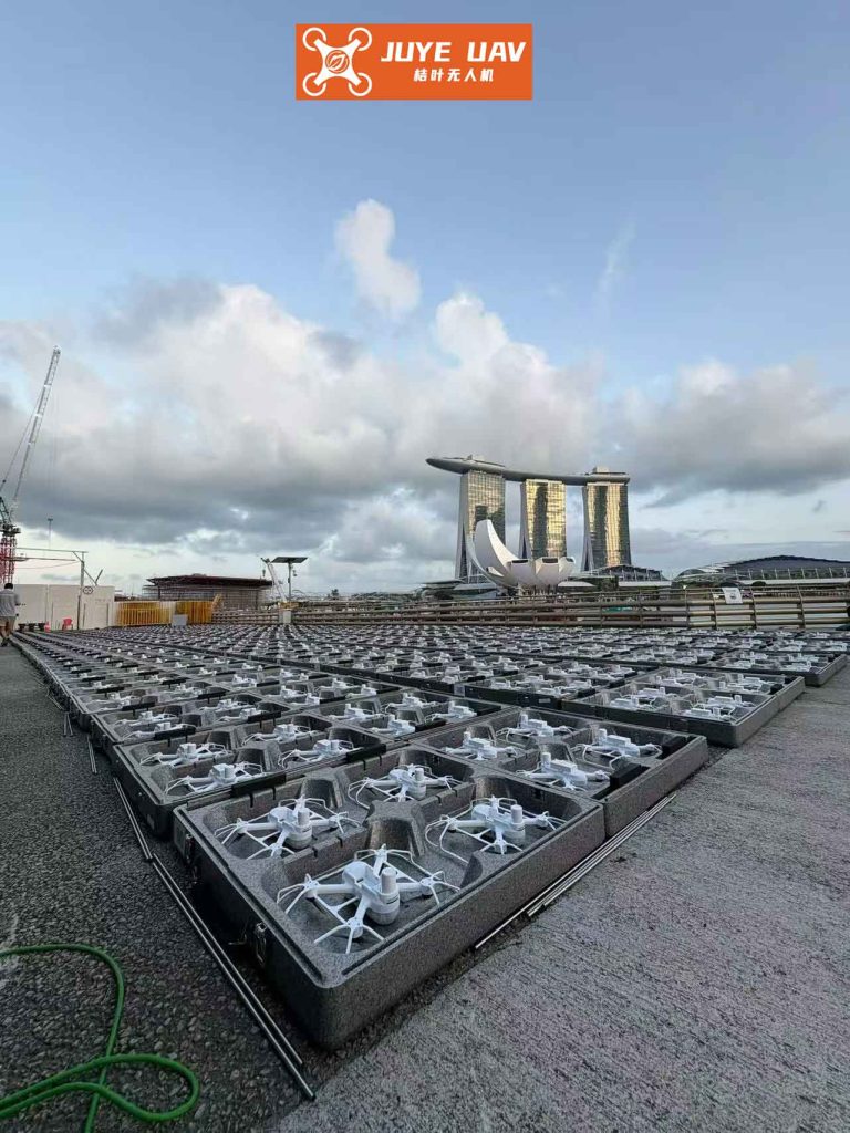
2. Proposed Intelligent Framework: An End-to-End Learning Architecture
My solution moves beyond traditional filtering and control by employing a deep learning architecture that jointly learns perception, decision-making, and state estimation. The three core algorithmic modules are summarized below:
| Algorithm Module | Primary Function |
|---|---|
| Dynamic Heterogeneous Graph ConvNet (DHGCN) | Models the spatio-temporal interaction topology of the formation. |
| Hierarchical Federated DDPG (HF-DDPG) | Enables privacy-preserving, distributed trajectory and resource optimization. |
| Differentiable Cubature Kalman Filter (DCKF) | Embeds a trainable non-linear state estimator for sensor fusion and calibration. |
2.1 Dynamic Spatio-Temporal Graph Modeling with DHGCN
Unlike static graphs, the interaction topology of a formation drone light show is highly dynamic. The DHGCN adaptively learns connection weights between UAV nodes based on real-time relative kinematics and communication quality. The dynamic edge weight $w_{m,m’}$ between drone $m$ and $m’$ is computed as:
$$ w_{m,m’} = \sigma(\mathbf{W}_1 \cdot [\mathbf{v}_{m,m’}, \alpha_{\text{UWB}}]) $$
where $\sigma$ is the sigmoid activation function, $\mathbf{W}_1$ is a learnable parameter matrix, $\mathbf{v}_{m,m’}$ is the relative velocity vector, and $\alpha_{\text{UWB}}$ is the Ultra-Wideband signal strength. This allows the network to strengthen connections between critically interacting drones (e.g., those forming a geometric baseline for triangulation) and weaken others, effectively focusing computational attention on the most relevant parts of the formation graph for the positioning task.
2.2 Privacy-Preserving Decision Making with HF-DDPG
Centralized learning poses data privacy and single-point-of-failure risks for a commercial formation drone light show fleet. My HF-DDPG framework employs federated learning: each drone trains a local Actor-Critic network using its own sensor data. Periodically, only the model parameters $\theta_m$ are encrypted and uploaded to a cloud aggregator, which computes a global model update:
$$ \theta_{global} = \frac{1}{M} \sum_{m=1}^{M} \theta_m $$
This global model is then redistributed, ensuring all drones benefit from collective experience without sharing raw sensor data. The hierarchical aspect involves a meta-learner that provides a good policy initialization $\pi_{meta}(\theta_{init} | \mathbf{h}_g)$ based on the graph embedding $\mathbf{h}_g$ from the DHGCN, speeding up convergence for new formation patterns. The local DDPG agents use a Dueling-DQN architecture, decomposing the Q-value into state-value and action-advantage streams for more stable multi-objective learning:
$$ Q(\mathbf{s}_m, \mathbf{a}_m) = V(\mathbf{s}_m; \theta_V) + A(\mathbf{a}_m; \theta_A) $$
2.3 Differentiable Sensor Fusion with DCKF
Traditional Kalman filters assume known, fixed noise statistics, which is unrealistic for the volatile RF and visual environment of an urban formation drone light show. I designed a DCKF that integrates the CKF’s prediction-update cycle as a differentiable layer within the neural network. This allows the noise covariance matrices $\mathbf{Q}_k$ (process noise) and $\mathbf{R}_k$ (measurement noise) to be learned directly from data. The cubature points for state propagation are generated via:
$$ \mathcal{X}_{k}^{(i)} = \mathbf{s}_k + \sqrt{n} \cdot \text{chol}(\mathbf{P}_{k}) \cdot \xi_i $$
where $\xi_i$ are sampling direction vectors. The noise covariance is learned adaptively through a gated network:
$$ \mathbf{Q}_k = \text{Softplus}(\mathbf{W}_Q \cdot \mathbf{h}_g + \mathbf{b}_Q) + \mathbf{Q}_{base} $$
The DCKF is trained end-to-end with a hybrid loss function that minimizes both state estimation error and filter uncertainty:
$$ \mathcal{L}_{DCKF} = ||\mathbf{s}^{gt} – \hat{\mathbf{s}}_m||_2 + \alpha \cdot \text{tr}(\mathbf{P}_k) + \gamma \cdot ||\mathbf{Q}_k – \mathbf{Q}_{prior}||_F $$
2.4 Multi-Modal Feature Fusion
To effectively combine heterogeneous data from AOA, inertial measurement units (IMU), and visual sensors, a cross-modal attention mechanism is employed. A transformer-based module projects features from each modality into a common space. A gated weighting unit dynamically assigns importance to each sensor stream based on current reliability, crucial for suppressing interference during a formation drone light show over a crowded cityscape. The weight $w_i$ for modality $i$ is:
$$ \mathbf{w} = \sigma(\mathbf{W}_2 \cdot [\mathbf{h}_{AOA}, \mathbf{h}_{SLAM}, \mathbf{h}_{IMU}] + \mathbf{b}) $$
If the spectral entropy of UWB/AOA data exceeds a threshold (indicative of severe multi-path interference), its weight is automatically attenuated.
3. Simulation, Training, and Performance Analysis
The proposed system was validated in a high-fidelity ROS/Gazebo simulation environment featuring 30 UAVs tasked with forming and maintaining a conical formation—a common and challenging pattern for a formation drone light show. The simulator incorporated realistic sensor noise models, packet loss, and multi-path effects. Key training parameters and constraints are listed below:
| Parameter | Symbol | Value |
|---|---|---|
| Formation Size | $M$ | 30 UAVs |
| Min. Safe Distance | $R_{min}$ | 10 m |
| Max. Allowable Height Dev. | $\Delta z_{max}$ | 2 m |
| Federated Aggregation Period | $T_{FL}$ | 10 epochs |
| DCKF Learning Rate | $\eta_{DCKF}$ | $3 \times 10^{-4}$ |
| Discount Factor | $\gamma$ | 0.99 |
A three-stage progressive training strategy was implemented: 1) Supervised pre-training of the DCKF module, 2) Alternating training of DHGCN and HF-DDPG, and 3) Federated fine-tuning. This staged approach ensured stable learning of the complex, coupled system. The training curves showed the DCKF module converging rapidly, while the reinforcement learning components required careful tuning to manage the high-dimensional, non-stationary policy space inherent to multi-drone collaboration.
3.1 Quantitative Results and Comparative Analysis
The performance of the proposed STGRL method was benchmarked against two conventional approaches: a geometry-based iterative method and a Distributed Extended Kalman Filter (D-EKF). The metrics were chosen to reflect the critical requirements of a real-world formation drone light show: formation construction speed, positioning accuracy, communication efficiency, and robustness to interference.
| Performance Metric | Geometry-Based Method | Distributed EKF (D-EKF) | Proposed STGRL Method |
|---|---|---|---|
| Equilateral Triangle Build Time (s) | 14.20 | 9.80 | 5.70 |
| Formation Tracking RMSE (m) | 0.51 | 0.33 | 0.18 |
| Comm. Overhead per Node (MB) | 12.40 | 18.60 | 4.30 |
| RMSE under Strong Interference (m) | 0.89 | 0.47 | 0.23 |
The results demonstrate a decisive advantage for the learning-based approach. The 45.5% improvement in positioning accuracy (0.18m vs. 0.33m for D-EKF) stems from the DCKF’s ability to learn and suppress complex noise patterns and the DHGCN’s capacity to model informative spatial dependencies. The 76.9% reduction in per-node communication overhead is a direct benefit of the federated learning paradigm, transmitting only model updates instead of raw sensor data—a vital feature for scaling up to massive formation drone light show fleets. Most importantly, the method’s superior performance under simulated strong electromagnetic interference (0.23m error) highlights its robustness, a non-negotiable requirement for flawless shows in signal-challenged urban venues.
4. Conclusion and Path Forward for Aerial Swarm Intelligence
This work presents a significant step toward fully autonomous, reliable, and secure cooperative positioning for passive UAV swarms. By integrating dynamic graph neural networks for spatial understanding, federated reinforcement learning for distributed control, and a differentiable filter for adaptive sensor fusion, the proposed framework creates an intelligent, self-correcting system. It directly addresses the core challenges faced by next-generation formation drone light show technology and other mission-critical swarm applications in low-altitude airspace.
The key conclusions and insights are threefold. First, the end-to-end learnable architecture is paramount. By allowing gradient-based optimization to flow from the final positioning error back through the filter and into the perception network (DHGCN), the system learns to extract features that are optimally suited for robust state estimation, a capability absent in traditional pipelined systems. Second, federated learning is not just a privacy tool but a scalability enabler. It drastically reduces bandwidth needs and facilitates the management of heterogeneous fleets, making the deployment of a thousand-drone formation drone light show logistically feasible. Third, explicitly modeling spatio-temporal interdependencies is crucial. The performance gains in formation build time and accuracy underscore that treating drones as independent agents is suboptimal; their relative geometry fundamentally defines the observability of the entire swarm.
Future research will extend this work into several important dimensions. Testing in more extreme and realistic 3D conditions with stronger atmospheric turbulence and cross-platform swarms (mixing rotorcraft and fixed-wing UAVs) is essential. Furthermore, investigating meta-reinforcement learning techniques could allow a single trained model to generalize instantly to never-before-seen formation patterns, a highly desirable feature for creative formation drone light show design. Finally, the integration of this positioning engine with higher-level mission planners for fully autonomous choreography will unlock the full potential of intelligent aerial swarms, transforming our skies into dynamic canvases for art, communication, and transportation.