The rapid pace of urbanization and economic growth has led to a dramatic surge in vehicle ownership within major cities globally. This growth has precipitated severe challenges, including chronic traffic congestion and frequent accidents, which significantly compromise urban public safety and operational efficiency. Traditional traffic monitoring infrastructure, primarily composed of fixed-location devices such as surveillance cameras installed on major roads and expressways, suffers from inherent limitations. These include persistent surveillance blind spots, the inefficient dispersal of video feeds across multiple screens preventing a unified situational overview, and a critical lack of intelligent, automated traffic condition analysis. Consequently, the reliance on manual monitoring for information extraction creates gaps in real-time traffic data acquisition, particularly during urban emergencies characterized by spatial and temporal unpredictability. These gaps hinder the ability of traffic management authorities to execute swift, informed, and flexible traffic control and guidance measures.
To address these deficiencies and acquire comprehensive, dynamic traffic information, this article presents the design and implementation of an advanced road traffic inspection system built upon a quadrotor drone platform. The proposed system capitalizes on the unique advantages offered by quadrotor drones, such as rapid deployment, high maneuverability, and a perspective unimpeded by surface-level traffic congestion. By serving as an agile aerial sensor platform, the quadrotor drone enables enhanced capabilities for traffic congestion assessment and preliminary incident response.
System Architecture and Operational Philosophy
The overarching goal of the quadrotor drone-based inspection system is to establish a flexible, intelligent, and responsive layer of traffic surveillance that complements existing fixed infrastructure. The system is architected to fulfill three primary objectives:
- Real-time Aerial Monitoring and Response: Utilizing the quadrotor drone as a mobile platform equipped with imaging payloads and a stabilized gimbal, the system provides traffic management centers with immediate, high-angle visual data from critical corridors or incident sites. This facilitates better decision-making for traffic疏导. Furthermore, in an emergency, the quadrotor drone can be positioned at key entry points to an incident zone, functioning as an “aerial traffic officer” to visually signal and guide diverting traffic, thereby alleviating pressure on the affected roadway.
- Intelligent Traffic Parameter Extraction and Condition Assessment: The core processing terminal receives the video stream transmitted from the quadrotor drone. It employs computer vision algorithms to extract fundamental traffic parameters (e.g., vehicle count, speed). These parameters are then synthesized using established traffic flow models, such as the Greenshields model, to autonomously rate the Level of Service (LoS) of the monitored road segment. This creates a closed-loop system for intelligent traffic judgment, aiding authorities in condition evaluation and enriching historical traffic databases.
- Dynamic Information Dissemination: An integrated publishing subsystem leverages cellular networks (e.g., GSM/GPRS) to automatically disseminate the generated traffic guidance information. This can take the form of targeted SMS alerts to relevant departments or public updates via social media platforms, assisting in proactive traffic诱导.
The system’s workflow integrates three core subsystems: the Flight Control & Payload Subsystem, the Ground-Based Image Processing & Analysis Subsystem, and the Information Publishing Subsystem. The operational flow is summarized in the following sequence: A mission is initiated from the Ground Control Station (GCS), directing the quadrotor drone to a specified location. The drone captures and wirelessly streams video back to the GCS. The image processing terminal analyzes the video feed to extract traffic data and determine the LoS. Finally, the information publishing module broadcasts the assessment and guidance messages.
Subsystem Design and Implementation
1. The Quadrotor Drone Platform: Flight Control and Payload
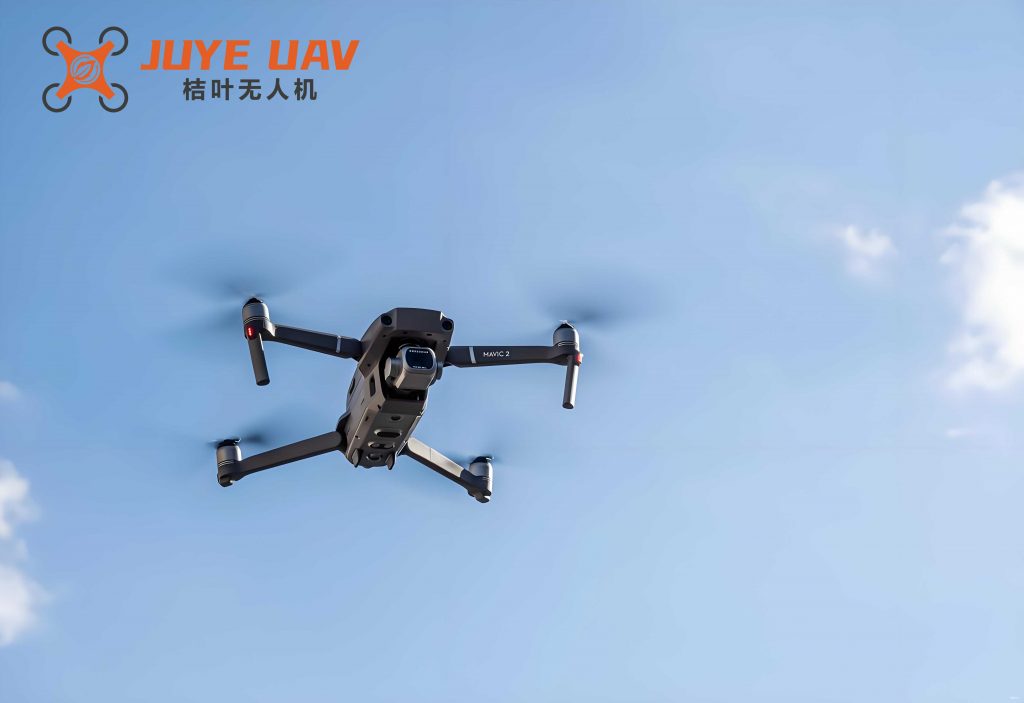
The aerial segment of the system is centered on a robust and reliable quadrotor drone. The selection of a quadrotor configuration is deliberate due to its Vertical Take-Off and Landing (VTOL) capability, exceptional hovering stability, and precise low-speed maneuverability—all critical for persistent observation over a point of interest. The platform integrates several key components:
| Component | Specification / Model | Primary Function |
|---|---|---|
| Frame & Propulsion | Carbon Fiber Frame, Brushless Motors, Electronic Speed Controllers (ESCs) | Provides structural integrity and generates lift/thrust for stable flight. |
| Flight Controller | Pixhawk-series Autopilot | The central brain running firmware (e.g., PX4, ArduPilot) for stabilization, navigation, and autonomous mission execution based on GCS commands. |
| Positioning System | GNSS (GPS/GLONASS) Module, Barometer, IMU | Provides geo-referenced location, altitude, and attitude data essential for autonomous flight and position hold. |
| Imaging Payload | High-definition (HD) Camera with 3-axis Stabilized Gimbal | Captures stable, high-quality video footage of the road scene regardless of drone movement or wind. |
| Wireless Data Link | Long-range Digital Video Transmitter (e.g., DJI OcuSync, Analog 5.8 GHz) | Streams real-time video from the quadrotor drone to the ground station with low latency. |
| Telemetry Link | Radio Modem (e.g., 915 MHz or 2.4 GHz) | Bidirectional link for sending flight commands to the quadrotor drone and receiving telemetry data (battery, position, status). |
| Auxiliary Signaling | Onboard LED Panel, Audible Alarm | Enables the “aerial traffic officer” function for visual/auditory signaling to drivers. |
The kinematics and control of the quadrotor drone are fundamental to its performance. The thrust $T_i$ generated by each rotor $i$ is proportional to the square of its rotational speed $\omega_i$:
$$T_i = k_T \omega_i^2$$
where $k_T$ is the thrust coefficient. The total thrust $T$ and the torques $\tau_\phi, \tau_\theta, \tau_\psi$ causing roll ($\phi$), pitch ($\theta$), and yaw ($\psi$) motions are given by:
$$
\begin{aligned}
T &= k_T(\omega_1^2 + \omega_2^2 + \omega_3^2 + \omega_4^2) \\
\tau_\phi &= l k_T (-\omega_2^2 + \omega_4^2) \\
\tau_\theta &= l k_T (\omega_1^2 – \omega_3^2) \\
\tau_\psi &= k_D (-\omega_1^2 + \omega_2^2 – \omega_3^2 + \omega_4^2)
\end{aligned}
$$
Here, $l$ is the arm length from the center to a motor, and $k_D$ is the drag coefficient. The flight controller continuously solves the inverse of this model to compute the required motor speeds to achieve desired attitudes and movements.
2. Ground-Based Image Processing and Traffic Analytics Subsystem
This subsystem is the computational core, responsible for transforming raw video from the quadrotor drone into actionable intelligence. Its functionality encompasses real-time monitoring, video recording, traffic parameter extraction, and LoS rating.
Image Pre-processing: To ensure robustness under varying environmental conditions (e.g., haze, low light), pre-processing techniques are applied. Histogram Equalization is a primary method used for contrast enhancement. It works by transforming the intensity values of an image so that its histogram approximates a uniform distribution. For an image with a cumulative distribution function (CDF) $C(r_k)$ for intensity level $r_k$, the transformation is:
$$s_k = T(r_k) = (L-1) \cdot C(r_k)$$
where $L$ is the number of possible intensity levels, and $s_k$ is the new mapped intensity. This enhances local contrast, making vehicle features more discernible for subsequent detection algorithms.
Traffic Parameter Extraction using Virtual Detection Lines (VDLs): The core detection algorithm is inspired by the T. Abramczuk method. Instead of processing the entire frame, efficient detection is performed using Virtual Detection Lines (VDLs)—thin, user-defined regions of interest (ROIs) drawn parallel to the traffic flow on each lane within the software interface.
- Vehicle Counting: A background model $B(x,y,t)$ is maintained for the pixels within each VDL. When a new frame $I(x,y,t)$ arrives, a foreground mask $M(x,y,t)$ is generated using frame differencing or adaptive background subtraction:
$$M(x,y,t) = |I(x,y,t) – B(x,y,t)| > \tau$$
where $\tau$ is a threshold. A vehicle passage event is registered when the number of foreground pixels within a VDL exceeds a certain count, indicating an object intersecting the line. Counting is performed per lane by monitoring each VDL independently. - Speed Estimation: Speed measurement requires at least two VDLs ($DL_1$, $DL_2$) placed a known virtual distance $D_v$ apart along the lane. The time difference $\Delta T$ between a vehicle triggering $DL_1$ and then $DL_2$ is recorded. The vehicle’s speed $V$ is calculated as:
$$V = \frac{D_v}{\Delta T}$$
The critical step is converting the pixel distance between the lines in the image to a real-world distance $D_v$. This requires knowledge of the quadrotor drone’s pose and camera parameters. For a nadir (directly downward) view, the scaling factor is relatively straightforward. For an oblique view, a perspective transformation or homography matrix $H$, estimated during system calibration, maps image coordinates to ground plane coordinates. If $\mathbf{p}_1$ and $\mathbf{p}_2$ are the image coordinates of the two detection line midpoints, their ground coordinates are $\mathbf{P}_i = H^{-1}\mathbf{p}_i$. Then $D_v = ||\mathbf{P}_1 – \mathbf{P}_2||$.
The fundamental traffic flow parameters obtained are:
- Flow Rate (Q): The number of vehicles passing a point per unit time (vehicles/hour). Calculated from the vehicle count over a sampling period.
- Space Mean Speed (V): The harmonic mean of speeds of vehicles occupying a given road segment at a given time (km/h).
- Density (K): The number of vehicles per unit length of the roadway (vehicles/km). Can be estimated from speed and flow using the fundamental relationship:
$$Q = K \cdot V$$
Level of Service (LoS) Rating Model: The extracted parameters $Q$ and $V$ are fed into a rating model. We employ a simplified adaptation of the Greenshields speed-density linear model:
$$V = V_f \left(1 – \frac{K}{K_j}\right)$$
where $V_f$ is the free-flow speed and $K_j$ is the jam density. Combining this with $Q=K \cdot V$, we can derive the speed-flow relationship. The LoS is determined by comparing the measured $Q$ and $V$ against thresholds defined for the specific road type (e.g., urban arterial). The rating logic is as follows:
| Measured Conditions | Level of Service (LoS) Rating | Description |
|---|---|---|
| $V \approx V_f$, $Q/Q_{max} < 0.3$ | A (Free Flow) | 畅行 (Unrestricted Operation) |
| $V$ slightly below $V_f$, $0.3 \leq Q/Q_{max} < 0.7$ | B & C (Stable Flow) | 一般 (Generally Unimpeded) |
| $V$ significantly reduced, $0.7 \leq Q/Q_{max} < 0.9$, stop-and-go waves appear | D & E (Unstable Flow) | 拥堵 (Congested) |
| $V \approx 0$, $Q \approx 0$, $K \approx K_j$ | F (Forced Flow) | 堵塞 (Gridlock/Standstill) |
Where $Q_{max}$ is the maximum observed or theoretical capacity flow for the road segment. This automated rating provides a concise, quantitative assessment of traffic health.
3. Communication and Information Publishing Subsystem
This subsystem bridges the analysis results with end-users. It consists of:
- GSM/GPRS Module: A hardware component (e.g., SIM800 series) connected to the ground terminal. It is programmed to send SMS alerts containing the location (e.g., “Intersection of X and Y”) and LoS rating (e.g., “CONGESTION DETECTED”) to a pre-defined list of traffic management personnel.
- Web Service Integration: The ground terminal software includes an API client that formats the traffic data (location, LoS, average speed) into a JSON packet and posts it to a dedicated web server. This server then updates a public-facing traffic dashboard or an official social media account (e.g., Twitter/Weibo feed), providing real-time updates to the commuting public. This enables proactive journey planning and route diversion.
System Operation Modes and Field Validation
The quadrotor drone-based inspection system is designed to operate in two distinct modes, allowing it to adapt to routine and emergency scenarios.
Mode 1: Scheduled Traffic Inspection Patrol. In this mode, the quadrotor drone follows a pre-planned flight path over key arterial roads during peak hours or scheduled intervals. It autonomously captures video, which is analyzed in near-real-time by the ground station. Trends in flow, speed, and LoS are logged to a database for long-term planning and performance benchmarking. The public information feed is updated periodically based on this patrol data.
Mode 2: Emergency Incident Response. Upon notification of an incident (e.g., via emergency calls or traffic sensor alerts), the system switches to response mode. The quadrotor drone is dispatched directly to the incident GPS coordinates. It provides a live aerial feed to first responders and traffic managers, offering a comprehensive overview of the scene, vehicle positions, and the extent of blockage. Simultaneously, the “aerial traffic officer” function can be activated, with the quadrotor drone hovering at key upstream intersections, using its LED panel to display warning symbols and its alarm to audibly direct drivers to alternative routes, preventing secondary congestion.
Experimental Validation and Performance Metrics
Field tests were conducted in urban road environments under daylight conditions with mild winds (< 5 m/s). The quadrotor drone was deployed to hover at an altitude of approximately 60-80 meters over multi-lane roads. The ground truth for vehicle count and speed was established manually by human observers and via ground-based radar guns for a subset of vehicles.
1. Algorithm Accuracy Test: The image processing algorithms were evaluated independently.
| Metric | Test Range (Manual vs. Algorithm) | Average Accuracy | Primary Error Source |
|---|---|---|---|
| Vehicle Count | Over 15 sampling periods (1-3 min each) | 81.5% | Occlusion from large vehicles, shadows misclassified as foreground. Counts tended to be slightly lower than manual. |
| Speed Estimation | 20 individual vehicle samples | Mean Absolute Error (MAE) of 12.7% | Calibration errors in camera-ground plane homography, slight variations in trigger point detection on VDLs. |
The results confirm the basic feasibility of the T. Abramczuk-inspired VDL method when deployed from the stable platform of a quadrotor drone. Accuracy is sufficient for macro-level traffic state estimation.
2. End-to-End System Test: A complete patrol mission was simulated. The quadrotor drone navigated to a designated road segment, streamed video, and the ground terminal successfully outputted traffic parameters (Q=642 veh/h, V=38 km/h), rated the LoS as “C – Stable Flow (Generally Unimpeded)”, and automatically posted an update to a test social media feed. The quadrotor drone’s stability and the video link’s reliability were confirmed throughout the 20-minute flight.
Discussion: Advantages, Challenges, and Future Evolution
The primary advantage of using a quadrotor drone for this application is its unparalleled flexibility and perspective. It eliminates fixed infrastructure blind spots and can be tasked on-demand. The integration of automated image processing creates a powerful tool for generating timely traffic intelligence.
However, several challenges exist for widespread adoption:
- Regulation and Safety: Operating quadrotor drones in urban airspace requires strict adherence to aviation regulations (e.g., visual line-of-sight, altitude limits, no-fly zones), which can limit operational scope.
- Weather Dependence: Quadrotor drone operations are susceptible to high winds, rain, and other adverse weather, potentially grounding the system when it might be needed most.
- Flight Endurance: Typical commercial quadrotor drones have flight times of 20-30 minutes, limiting continuous patrol duration and necessitating a fleet management or automated charging solution for persistent coverage.
- Algorithm Robustness: The computer vision algorithms need further refinement to handle complex scenes (e.g., congested traffic with partial occlusions, varying lighting from dawn to dusk, and different vehicle types).
Future Development – The Networked “Drone-in-a-Box” Concept: To address endurance and scalability, the next evolution involves deploying a network of automated docking stations (“Drone-in-a-Box” or electronic perch platforms) at strategic locations across the city (e.g., near frequent incident sites or major interchanges). These weather-proof stations would provide:
- Secure Storage & Charging: Housing and automatically charging multiple quadrotor drones.
- Automated Launch/Recovery: Allowing drones to self-deploy and land based on schedules or remote triggers.
- Local Data Backhaul: Acting as a network node to relay command, control, and video data via wired or high-bandwidth wireless links.
This networked approach would enable the creation of a persistent, city-wide aerial traffic sensing grid, where quadrotor drones can be sequentially dispatched from various perches to maintain near-continuous monitoring of critical corridors, truly integrating with and significantly enhancing the existing Intelligent Transportation System (ITS) infrastructure.
Conclusion
This article has presented a comprehensive framework for a road traffic inspection system utilizing a quadrotor drone as its central mobile sensing platform. The system effectively combines the agility and unique vantage point of a quadrotor drone with advanced, ground-based computer vision algorithms for automated traffic parameter extraction and condition assessment. By integrating a dynamic information publishing mechanism, it closes the loop from data acquisition to actionable guidance for both traffic managers and the public. Experimental validation confirms the core technical feasibility, with vehicle counting and speed estimation accuracy being adequate for macroscopic traffic state monitoring. While challenges related to regulation, endurance, and all-weather operation remain, the proposed system represents a significant step towards more dynamic, intelligent, and responsive urban traffic management. The envisioned future extension into a networked system of automated docking stations promises to unlock the full potential of quadrotor drone technology for creating resilient and efficient smart city transportation networks.