
In contemporary industrial safety management, the emergence of catastrophic fires remains a significant threat, particularly within complex environments like steel plants. Traditional steelmaking processes inherently rely on extreme temperatures, and when a fire incident occurs, the consequences can escalate rapidly and become exceptionally difficult to control. The intricate layout of plants, the presence of high-temperature molten materials, volatile auxiliary substances, and confined spaces create a uniquely hazardous rescue environment. Conventional, ground-based firefighting and rescue operations face severe limitations: personnel may be unable to access critical areas due to intense heat, structural instability, or toxic fumes, and formulating a safe, effective response plan in real-time is immensely challenging. In this context, the integration of Fire Unmanned Aerial Vehicles (Fire UAVs) has emerged as a transformative technological solution. As a researcher focusing on autonomous systems for industrial safety, I have extensively studied the application of Fire UAVs, which offer unparalleled advantages due to their compact size, operational flexibility, multi-functional payload capacity, and, crucially, their ability to operate without directly endangering human lives. This analysis delves into the systematic application framework of Fire UAV systems in steel plant fire emergencies, exploring their roles in situational assessment, active intervention, and post-event analysis.
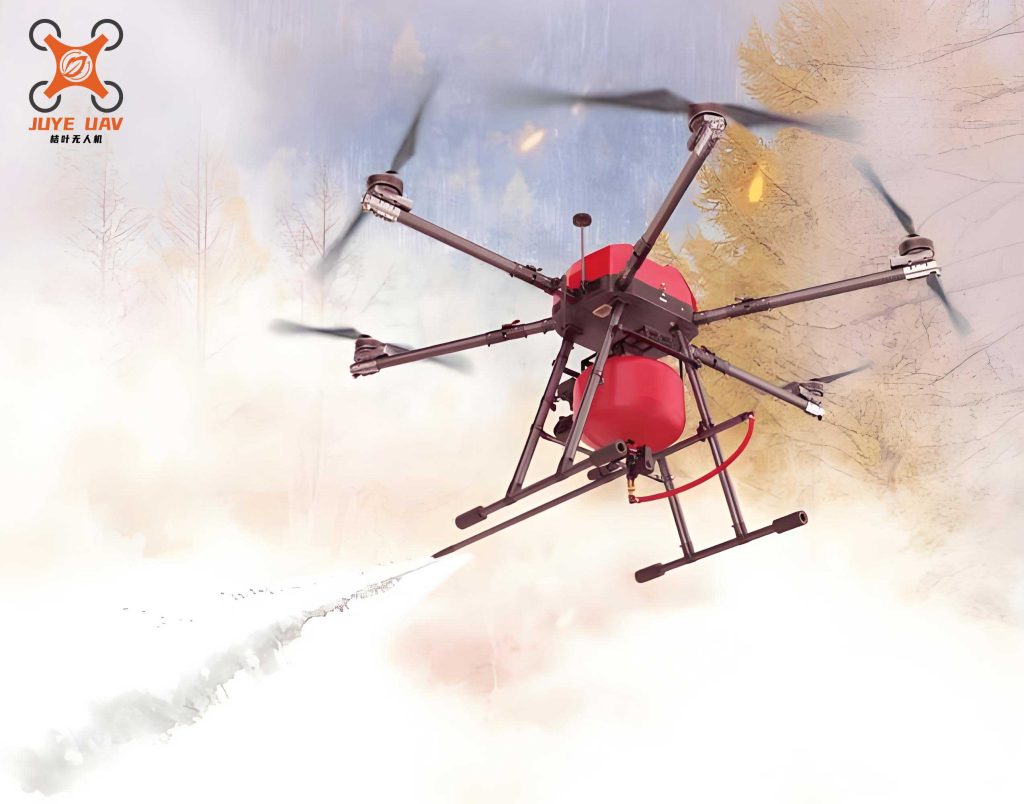
The core operational paradigm for Fire UAVs in steel plant emergencies shifts the perspective from ground-level to an aerial, comprehensive viewpoint. This overhead vantage point is critical for initial scene assessment. Unlike satellites or manned aircraft, a Fire UAV can be deployed within minutes, navigate through complex steel structures, and provide real-time, high-resolution data from within the fire zone itself. The primary mission phase begins with immediate reconnaissance and data acquisition. Specialized Fire UAVs, equipped with multi-spectral imaging systems, are tasked with mapping the fire’s extent, identifying ignition sources, and locating trapped personnel. Key sensor payloads include thermal (infrared) cameras to see through smoke and visualize heat gradients, and standard RGB cameras for detailed visual inspection. The data fusion from these sensors allows for the creation of a real-time thermal map of the incident.
Let $T(x,y,t)$ represent the temperature field detected by the Fire UAV’s thermal sensor at coordinates $(x, y)$ and time $t$. The rate of fire spread $\vec{S}$ can be modeled as a function of this temperature gradient, fuel load $F(x,y)$, and ambient airflow $\vec{A}$:
$$ \vec{S}(x,y,t) = k \cdot \nabla T(x,y,t) \cdot F(x,y) \cdot \|\vec{A}\| $$
where $k$ is a constant dependent on material properties. This model, continuously updated by Fire UAV data, helps predict fire progression and identify critical intervention points.
A crucial reconnaissance task is identifying and inventorying hazardous materials. Steel plants store various combustibles beyond raw metal, such as lubricating oils, hydraulic fluids, powdered alloys, and carbon additives. A Fire UAV can catalog these hazards. For instance, a gas sensor payload can detect volatile organic compound (VOC) plumes, signaling a leaking fuel reservoir. The following table summarizes typical reconnaissance tasks and suitable Fire UAV sensor payloads:
| Reconnaissance Objective | Primary Sensor Payload | Data Output |
|---|---|---|
| Fire Boundary & Hotspot Mapping | Long-Wave Infrared (LWIR) Camera | Real-time thermal video/imagery, temperature readings. |
| Visual Inspection through Smoke | Visible Spectrum Camera with HDR | High-definition visual feed, structural integrity assessment. |
| Trapped Personnel Location | Thermal Camera & AI-powered object detection | Heat signature identification, location coordinates. |
| Hazardous Gas/Vapor Detection | Multi-gas Sensor (VOC, CO, CH₄) | Gas concentration levels and plume mapping. |
| 3D Environment Mapping | LiDAR or Photogrammetry Suite | 3D point cloud model of the disaster site. |
Following the initial assessment, the role of the Fire UAV system transitions from passive observation to active support and intervention. This involves deploying specialized functional Fire UAVs. These units are typically larger, with higher payload capacities and equipped with mission-specific tools. Their first active role is often in establishing or securing a rescue corridor. By deploying small, targeted fire suppression agents, they can create temporary safe passages for ground teams or for trapped personnel to escape.
Consider a functional Fire UAV carrying a payload of condensed aerosol fire suppressant. The effectiveness of a single deployment can be approximated by calculating the volume $V_{zone}$ it can protect, based on the discharge mass $m_{agent}$ and the required extinguishing concentration $C_{req}$ for the specific fuel:
$$ V_{zone} = \frac{m_{agent}}{C_{req} \cdot \rho_{air}} $$
where $\rho_{air}$ is the air density. Multiple Fire UAVs can perform coordinated drops to suppress a larger area, cooling superheated structures and preventing flashover.
Another vital intervention is structural assessment. Intense heat compromises the integrity of steel beams, walkways, and storage racks. A Fire UAV equipped with a high-resolution camera and laser rangefinder can perform non-contact inspection. By monitoring deflection or using photogrammetric techniques to detect deformations over time, it can warn ground crews of imminent collapse. Furthermore, specialized Fire UAVs can be fitted with manipulator arms or magnetic grippers for light salvage operations, such as retrieving critical small components from control rooms or moving debris obstructing an exit.
The most advanced application involves collaborative operations between multiple Fire UAVs—a concept known as UAV swarm orchestration. In a large-scale steel plant fire, a single UAV is insufficient. A coordinated fleet, comprising both small reconnaissance Fire UAVs and larger functional Fire UAVs, can execute complex missions. The reconnaissance swarm fans out to achieve maximum area coverage, while functional units are directed to specific waypoints for intervention.
The task assignment problem for a heterogeneous Fire UAV fleet can be formulated as an optimization model. Let $U = \{u_1, u_2, …, u_n\}$ be the set of UAVs, and $T = \{\tau_1, \tau_2, …, \tau_m\}$ be the set of tasks (e.g., scan sector A, suppress spot B, deliver radio to location C). Each task $\tau_j$ has a location $L_j$, a priority $P_j$, and a required capability $C_j$ (e.g., thermal imaging, payload capacity). Each Fire UAV $u_i$ has a capability vector $\vec{C_i}$, a current location, and an endurance $E_i$. The objective is to find an assignment matrix $X_{ij}$ (where $X_{ij}=1$ if task $\tau_j$ is assigned to UAV $u_i$) that maximizes the total prioritized score of completed tasks while respecting constraints:
$$
\text{Maximize } Z = \sum_{i=1}^{n} \sum_{j=1}^{m} P_j \cdot X_{ij}
$$
Subject to:
$$ \sum_{j=1}^{m} (t_{ij}^{exec} + t_{ij}^{travel}) \cdot X_{ij} \leq E_i \quad \forall i \in U $$
$$ \sum_{i=1}^{n} X_{ij} \leq 1 \quad \forall j \in T $$
$$ X_{ij} = 0 \quad \text{if } \vec{C_i} \ngeq \vec{C_j} $$
$$ X_{ij} \in \{0, 1\}
$$
Here, $t_{ij}^{travel}$ is the travel time from the UAV’s position to the task, and $t_{ij}^{exec}$ is the task execution time. This model ensures efficient allocation of Fire UAV resources during the dynamic emergency.
For precision in such collaborative operations, especially indoors or under structures where GPS is unreliable, Fire UAVs utilize Real-Time Kinematic (RTK) positioning or Ultra-Wideband (UWB) anchor systems. The relative position error $\sigma_{pos}$ between two Fire UAVs in a UWB network can be modeled as a function of the signal’s time-of-flight measurement error $\sigma_{tof}$ and the geometry of the anchor constellation (Dilution of Precision, $DOP$):
$$ \sigma_{pos} = c \cdot \sigma_{tof} \cdot DOP $$
where $c$ is the speed of light. Minimizing this error is critical for safe swarm flight and accurate data fusion.
Post-suppression, the Fire UAV system’s role evolves again into damage assessment and search in the “golden 24-hour” period. The environment remains perilous, with potential for hot spots, structural collapses, and toxic atmospheres. Reconnaissance Fire UAVs, now equipped with daylight cameras and possibly methane detectors (to find gas leaks), systematically scan the rubble for signs of life or pinpoint the location of damaged critical infrastructure. They generate high-resolution orthomosaic maps and 3D models of the post-fire scene, providing an invaluable dataset for forensic analysis, insurance assessment, and planning reconstruction. The data collected by Fire UAVs throughout the event creates a comprehensive timeline, from ignition to final status, which is crucial for improving future safety protocols.
However, deploying Fire UAVs in the extreme environment of a steel plant fire presents significant technical challenges that my research seeks to address. The first is thermal resilience. Ambient air temperatures near a major fire can exceed $500\,^{\circ}\mathrm{C}$. Standard UAV electronics and batteries fail rapidly under such conditions. Advanced Fire UAV designs require active cooling systems, thermal shielding, and materials with high melting points. The heat flux $q”$ on the UAV skin can be estimated using Stefan-Boltzmann law for radiative heat transfer from the fire at temperature $T_{fire}$:
$$ q” = \epsilon \sigma (T_{fire}^4 – T_{UAV}^4) $$
where $\epsilon$ is the emissivity and $\sigma$ is the Stefan-Boltzmann constant. Mitigating this requires reflective coatings and internal cooling.
The second challenge is autonomy in GPS-denied and communication-degraded environments. Thick smoke, dense metal structures, and intense thermal plumes disrupt radio links and obscure visual navigation. Next-generation Fire UAVs must possess advanced onboard Simultaneous Localization and Mapping (SLAM) capabilities, using LiDAR and thermal-inertial odometry to navigate when visual features are obscured by smoke. They must also operate with decentralized decision-making logic, allowing a Fire UAV to complete its last assigned task or return to a safe zone even if the command link is temporarily lost.
Finally, payload integration remains an area of continuous innovation. The functional Fire UAV is essentially a flying robotic platform. Research focuses on standardized, quick-release mechanisms for various payloads: multi-spectral sensor pods, communication relays, granular fire retardant dispensers, and even articulated arms for light manipulation. The trade-off between payload weight $W_{payload}$, flight time $t_{flight}$, and UAV size is governed by fundamental aerodynamics and battery energy density $E_{bat}$:
$$ t_{flight} \propto \frac{E_{bat}}{(W_{UAV} + W_{payload}) \cdot P_{hover}} $$
where $P_{hover}$ is the power required for hover. Optimizing this equation is key to developing effective functional Fire UAVs.
In conclusion, the integration of Fire UAV systems represents a paradigm shift in responding to industrial fires, particularly in complex settings like steel plants. From my research perspective, these systems are not merely remote cameras but are evolving into intelligent, collaborative agents capable of perception, analysis, and limited intervention. They provide the critical “eyes” and “hands” in environments too dangerous for humans, enabling faster, more informed, and safer emergency response. The future development lies in enhancing their autonomy, resilience, and interoperability within a broader Industrial Internet of Things (IIoT) safety ecosystem. As artificial intelligence and robotics continue to advance, the role of the Fire UAV will expand further, potentially leading to fully autonomous first-response squads that can contain incidents before they escalate into catastrophes, fundamentally redefining safety management in heavy industry.