
In my extensive experience working in wildland fire management, the integration of unmanned aerial vehicles, particularly specialized fire UAVs, has revolutionized our approach to forest and grassland fire prevention and suppression. The advent of fire UAV technology has provided us with unprecedented capabilities in monitoring, reconnaissance, and response, fundamentally altering the risk landscape for both natural resources and human safety. This article delves into the current applications, challenges, and future trajectories of fire UAVs, drawing from practical insights and technological assessments. I will structure this discussion around key functional areas, supported by analytical tables and mathematical models to elucidate the quantitative and qualitative impacts of these systems.
The core advantage of fire UAVs lies in their operational flexibility and data acquisition prowess. Unlike traditional ground-based patrols or manned aircraft, fire UAVs can access remote, rugged terrains with ease, providing continuous, real-time surveillance over vast areas. This capability is crucial for early detection, which is the linchpin of effective fire management. The following sections will explore the multifaceted roles of fire UAVs, the persistent hurdles in their deployment, and the strategic directions needed to harness their full potential.
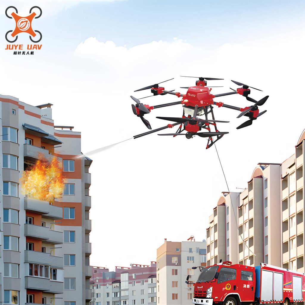
One of the primary applications of fire UAVs is in routine patrol and early warning systems. We have observed that traditional methods often suffer from blind spots and logistical constraints. Fire UAVs, equipped with high-resolution visible and infrared sensors, can perform systematic grid searches, automatically identifying thermal anomalies indicative of nascent fires. The efficiency of such a system can be modeled by considering the area coverage rate. Let \( A \) be the total area under surveillance, \( v \) the average speed of the fire UAV, \( w \) the sensor swath width, and \( t \) the operational flight time. The daily coverage area \( C \) is given by:
$$C = v \cdot w \cdot t$$
For instance, a fire UAV cruising at 15 m/s with a sensor swath of 200 meters and an endurance of 2 hours can cover:
$$C = 15 \, \text{m/s} \times 200 \, \text{m} \times 7200 \, \text{s} = 21,600,000 \, \text{m}^2 \approx 21.6 \, \text{km}^2$$
This quantitative advantage significantly reduces the human resource burden. The following table summarizes a comparison between traditional patrol and fire UAV-assisted patrol for a hypothetical 100 km² forest zone.
| Parameter | Ground Patrol Team (5 personnel) | Fire UAV System (1 operator + UAV) |
|---|---|---|
| Average Coverage per Day | ~5 km² | ~20-25 km² |
| Response Time to Alert | 30-60 minutes | 5-15 minutes |
| Accessibility to Rugged Terrain | Low | High |
| Operational Cost per Day (Approx.) | $800-$1000 | $300-$500 (including depreciation) |
| Risk to Personnel | High (terrain, wildlife) | Negligible |
When a fire incident occurs, the role of the fire UAV shifts dramatically to tactical reconnaissance and emergency response. The chaotic environment of a wildfire, with dense smoke and unpredictable winds, poses severe challenges. Here, the fire UAV becomes our eyes in the sky. By deploying a fire UAV equipped with multispectral imaging and telemetry systems, we can map the fire perimeter, identify headfire locations, and monitor rate of spread in real-time. The fire front propagation can be estimated using empirical models like Rothermel’s surface fire spread model, which, in a simplified form for wind-driven fires, relates spread rate \( R \) to wind speed \( U \) and slope \( \phi \):
$$R = R_0 \cdot (1 + \alpha U + \beta \sin \phi)$$
where \( R_0 \) is the no-wind, no-slope spread rate, and \( \alpha, \beta \) are fuel-specific constants. Data from the fire UAV on wind and terrain can feed into such models to predict fire behavior, aiding ground commanders in resource deployment. Furthermore, certain advanced fire UAVs are capable of direct suppression actions, such as precision delivery of fire retardants or water capsules. The effectiveness of a suppression drop from a fire UAV depends on factors like payload mass \( m \), release altitude \( h \), and atmospheric conditions. The impact energy \( E \) of a dropped payload (ignoring air resistance for simplicity) is:
$$E = m g h$$
where \( g \) is acceleration due to gravity. While current fire UAV payloads are limited, typically 5-20 kg, their precision allows for targeted application on spot fires or flanks, complementing broader efforts.
Post-containment, the threat of re-ignition from smoldering embers necessitates thorough mop-up operations. This is another domain where fire UAVs prove invaluable. Equipped with high-sensitivity thermal imaging cameras, a fire UAV can detect residual heat signatures invisible to the naked eye. We often define a critical heat flux threshold \( \Phi_{crit} \) for reignition. The fire UAV’s sensor measures radiant heat flux \( \Phi \) across the burn scar. Areas where \( \Phi > \Phi_{crit} \) are flagged for ground crew attention. The process enhances efficiency and safety, as personnel avoid unnecessary exposure to hazardous, unstable ground. The table below outlines a typical post-fire assessment workflow using a fire UAV.
| Phase | Fire UAV Task | Sensor Used | Data Output | Action Trigger |
|---|---|---|---|---|
| Initial Scan | Grid over entire burn area | Long-wave Infrared (LWIR) | Thermal mosaic map | Identification of hotspots |
| Focused Assessment | Hover/Low-altitude pass over hotspots | Mid-wave Infrared (MWIR) for higher resolution | Temperature gradient profiles | Priority ranking for mop-up |
| Verification | Post-mop-up scan | LWIR & Visible spectrum | Comparative thermal imagery | Confirmation of heat elimination |
Beyond active firefighting, fire UAVs play a crucial role in forensic investigation and damage assessment. After a fire, determining the point of origin and cause is paramount. Using photogrammetry software with imagery captured by a fire UAV, we can create detailed 3D models of the fire scene. By analyzing burn patterns and vegetation charring gradients, we can infer the fire’s progression. The area of burned terrain \( A_b \) can be calculated with high accuracy using georeferenced orthomosaics. If the UAV captures images with overlap, the area can be computed via pixel count and ground sample distance (GSD). Let \( N \) be the total number of pixels classified as ‘burned’ in an orthomosaic, and \( GSD \) the ground area represented by one pixel (in m²/pixel). Then:
$$A_b = N \cdot GSD$$
This method is far more efficient and precise than manual surveying, especially in large, inaccessible areas. The data also feeds into ecological impact models, helping us assess tree mortality and plan rehabilitation.
Despite these transformative applications, the integration of fire UAVs into mainstream wildland fire management is not without significant challenges. From my perspective, the first major issue is the lack of a standardized ecosystem. Currently, fire UAVs are produced by numerous manufacturers with proprietary specifications, leading to interoperability problems and inconsistent performance under extreme fireline conditions. There is no unified standard for critical parameters like heat resistance, communication protocol robustness, or data output formats. This fragmentation hinders the development of a cohesive, scalable fire UAV fleet. For instance, the operational endurance \( t_{op} \) of a fire UAV in a high-temperature ambient environment near a fire often deviates from manufacturer specs due to battery performance decay, which can be modeled as:
$$t_{op} = t_{nominal} \cdot e^{-k (T_{amb} – T_{ref})}$$
where \( t_{nominal} \) is the rated endurance at reference temperature \( T_{ref} \), \( T_{amb} \) is the ambient temperature, and \( k \) is a battery-specific degradation constant. Without standardization, predicting and comparing performance across different fire UAV models becomes difficult.
The second challenge is the relatively nascent stage of autonomous intelligence in most operational fire UAVs. While they are excellent data collectors, their ability to independently perceive, decide, and act in complex fire environments is limited. Most systems require skilled pilots for navigation and mission control. Advanced functions like real-time fire behavior prediction, automated optimal path planning for surveillance, or on-board data processing for immediate threat classification are still areas of active research. The level of autonomy \( L_a \) can be qualitatively scaled, but achieving higher levels (e.g., where a fire UAV can independently react to a sudden flare-up) demands significant advances in machine learning algorithms and sensor fusion.
Thirdly, the practicality of fire UAVs in high-intensity, large-scale wildfire scenarios is constrained by hardware limitations. The majority of deployed systems are small multi-rotors with limited payload capacity and flight duration. For sustained operations over massive fire complexes, larger, more capable platforms like fixed-wing or hybrid VTOL fire UAVs are needed, but their cost, logistics, and regulatory hurdles are higher. The trade-off between capability and deployability is summarized in the following table.
| UAV Type | Typical Endurance | Typical Payload Capacity | Best Suited Fire Management Phase | Key Limitation for Firefighting |
|---|---|---|---|---|
| Multi-rotor (Small) | 20-40 min | 1-5 kg | Short-range reconnaissance, spot fire assessment | Endurance, wind resistance |
| Multi-rotor (Large/Heavy-lift) | 30-60 min | 10-25 kg | Direct suppression (retardant drops), equipment delivery | Cost, operational complexity |
| Fixed-wing | 2-8 hours | 3-10 kg | Large-area patrol, perimeter mapping, communication relay | Requires launch/landing area, less hover capability |
| VTOL (Hybrid) | 1-3 hours | 5-15 kg | Versatile: Reconnaissance & light suppression | Emerging technology, higher cost |
Looking ahead, the development trajectory for fire UAVs must be aggressively pursued to overcome these barriers. Firstly, focused research and development is paramount. Investment should target core technologies that directly address the unique demands of the fire environment. This includes developing more efficient and heat-resistant power systems to extend the operational window of fire UAVs. For example, improving battery energy density or exploring hybrid power systems. The relationship between energy capacity \( E_{bat} \), power draw \( P \), and flight time \( t \) is fundamental:
$$t = \frac{E_{bat}}{P}$$
Increasing \( E_{bat} \) while managing \( P \) (through aerodynamic and propulsion efficiency) is a key engineering goal. Furthermore, advancing sensor miniaturization and data link resilience in smoky, RF-challenged environments is crucial for reliable fire UAV operation. Signal attenuation in a fire plume can be described by models involving particulate density, which directly impacts the command and control of the fire UAV.
Secondly, concerted efforts are needed to proliferate and normalize the use of fire UAVs across all levels of forest and grassland management agencies. This involves not just procurement, but also the development of standard operating procedures (SOPs), training curricula, and maintenance protocols. We must advocate for the operational and cost benefits of fire UAVs to secure sustained budgetary support. Demonstrations and case studies showing how a fire UAV fleet can reduce incident response times and improve outcomes are essential for building institutional buy-in.
Finally, and perhaps most critically, we must build and continuously train specialized fire UAV operator teams. The technology is only as good as its human operators. Training must encompass technical proficiency (flight skills, sensor operation, data interpretation), tactical integration (working alongside ground crews and incident command), and decision-making under stress. A well-trained operator can maximize the utility of a fire UAV, for instance, by dynamically adjusting flight paths based on real-time fire behavior models. The competency \( C_{op} \) of an operator could be modeled as a function of training hours \( H_t \), experience (number of incidents) \( N_i \), and scenario-based assessment scores \( S \):
$$C_{op} = \alpha \log(1 + H_t) + \beta \sqrt{N_i} + \gamma S$$
where \( \alpha, \beta, \gamma \) are weighting coefficients. Regular, high-fidelity exercises are necessary to maintain and enhance this competency.
In conclusion, the integration of fire UAVs into forest and grassland fire management represents a paradigm shift towards a more data-driven, efficient, and safer operational framework. From my vantage point, the capabilities of today’s fire UAVs in patrol, reconnaissance, suppression support, and post-fire analysis are already delivering tangible benefits. However, the path forward requires addressing standardization, autonomy, and platform maturity challenges through dedicated R&D, institutional adoption, and human capital development. The future fire UAV will likely be a more intelligent, resilient, and integrated node within a broader internet of things (IoT) for wildland fire management, capable of autonomous collaboration with other fire UAVs, ground sensors, and manned assets. As we continue to innovate and refine these systems, the fire UAV will undoubtedly solidify its position as an indispensable tool in our relentless effort to protect vital ecosystems and communities from the devastating impacts of wildfire.