In modern emergency response, technology stands as a critical force multiplier. From my extensive experience in operational command and communications保障, I have witnessed firsthand the transformative potential of Unmanned Aerial Vehicles (UAVs). These systems, particularly when designed and deployed for firefighting—what I will consistently refer to as fire UAVs—offer unparalleled advantages in机动性, operational flexibility, and situational awareness. Their ability to provide a comprehensive aerial perspective has begun to reshape tactics on the ground. While current applications are promising, a significant gap exists between their potential and their standardized, systemic integration into our消防救援 ecosystem. This article aims to provide a detailed, first-person analysis of the current state, challenges, and a concrete roadmap for the future integration of fire UAV systems, leveraging data, models, and operational frameworks to chart a course for their evolution from辅助 tools to core components of the救援 command structure.
Current Operational Applications of Fire UAVs
In today’s firefighting and rescue operations, fire UAVs are deployed across a spectrum of missions. Their utility is primarily defined by their airframe type and payload capability. We can categorize and evaluate these applications systematically.
| UAV Type | Key Characteristics | Primary Operational Role | Typical Endurance |
|---|---|---|---|
| Small Multi-rotor | Low cost, easy deployment, basic video/thermal imaging. | Single-operator reconnaissance, initial scene assessment. | 20-40 minutes |
| Heavy-lift Multi-rotor | High payload capacity, advanced防护等级, modular payloads. | Comprehensive reconnaissance,辅助救援 (dropping, illumination, communication relay). | 15-30 minutes (heavily dependent on payload) |
| Fixed-wing | Long endurance, high cruise speed, large area coverage. | Large-scale area reconnaissance (forest, wildfire, post-disaster assessment). | 2-6 hours |
| VTOL Fixed-wing/混合体 | Vertical take-off/landing with fixed-wing efficiency. | Rapid deployment for wide-area missions without needing runways. | 1-3 hours |
Based on this platform diversity, the current application matrix for fire UAVs is extensive. I have organized and quantified these core functions below.
| Application Domain | Operational Description | Key Payloads Utilized | Strategic Value |
|---|---|---|---|
| Situational Reconnaissance | Rapid aerial assessment using hover, orbit, and close-in flight patterns to identify key hazards and access points. | Visible Light (Zoom, Wide-angle, 360°), Infrared Thermal Imaging, Low-light Cameras. | Speed, safety in hazardous environments, comprehensive overview for command decisions. |
| Hazard Detection & Monitoring | Continuous surveillance of fire spread, thermal hotspots, and atmospheric conditions. Integrated detection provides real-time data streams. | Multi-spectral Cameras, Integrated Gas Detectors (LEL, VOCs, Toxics), Thermal Radiometers. | Enables dynamic risk assessment, tracks灾情 evolution, supports科學-based decision-making to minimize losses. |
| Search & Rescue (SAR) | Locating trapped or missing persons in complex terrain, rubble, or low-visibility conditions (night, smoke). | Thermal Imaging, Powerful Spotlights, Loudspeakers, Mobile Phone Signal Detectors (pseudo-base station). | Dramatically reduces大面积搜索 time, pinpoints locations for ground teams, operates in conditions unsafe for personnel. |
| Mapping & Modeling | Creating accurate geospatial products of the disaster site for planning, analysis, and post-incident review. | High-resolution Photogrammetry Cameras, LiDAR (Light Detection and Ranging) Scanners. | Generates 2D orthomosaics, 3D models, digital elevation models. Essential for volumetrics (collapsed structures), ingress/egress planning. |
| Communications Relay | Extending the range and reliability of ground communication networks by acting as an aerial cell tower or mesh node. | Airborne Cellular Base Stations (COW), Broadband/Narrowband Mesh Networking Payloads. | Restores critical communication in infrastructure-blackout scenarios (e.g., floods, earthquakes). The operational utility can be modeled by the enhanced coverage area: |
$$ A_{coverage} = \pi \cdot (h \cdot \tan(\theta))^2 $$
Where \( A_{coverage} \) is the additional coverage area provided by the fire UAV relay, \( h \) is its altitude, and \( \theta \) is the effective antenna half-angle. This function highlights how altitude directly expands the communications footprint.
| Application Domain | Operational Description | Key Payloads Utilized | Strategic Value |
|---|---|---|---|
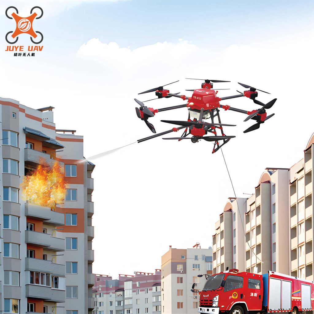
| Assisted Rescue & Firefighting | Direct physical intervention to support ground crews or initiate suppression in hard-to-reach areas. | Payload Delivery Systems (life rafts, supplies), Water/Retardant Dispensers, Line-throwing Devices, Emergency Lighting Arrays. | Enables precise, rapid delivery of critical resources, initial attack on野火 or facade fires, extends operational reach. |
| 辅助 Inspection & Law Enforcement | Conducting exterior inspections of tall buildings, industrial facilities, or post-fire investigations safely and efficiently. | High-resolution Zoom Cameras, Thermal Imagers for energy loss/热点 detection. | Identifies code violations, structural weaknesses, or fire cause indicators without requiring scaffolding or elevating platforms. |
Systemic Challenges Impeding Fire UAV Potential
Despite these applications, the integration of fire UAVs faces significant systemic hurdles that prevent their full potential from being realized. From an operational commander’s viewpoint, these are not mere technical glitches but fundamental barriers to building a mature, reliable capability.
| Challenge Category | Specific Manifestation | Operational Impact | Proposed Metric for Assessment |
|---|---|---|---|
| Fragmented & Non-systemic Equipment | Over-concentration on basic reconnaissance drones. Severe shortage of specialized platforms: direct灭火 fire UAVs, heavy-lift logistics drones, indoor inspection drones, long-endurance fixed-wing assets. | Inability to match the right platform to the specific disaster type. Ad-hoc, suboptimal deployments. Lack of a layered “toolbox” approach. | Platform Diversity Index (PDI): $$ PDI = \frac{N_{specialized}}{N_{total}} $$ Where a low PDI indicates over-reliance on generic platforms. |
| Personnel Retention & Skill Atrophy | The UAV operator/通信员 role lacks career吸引力. High turnover rates post-certification. Limited regular training on diverse scenarios and advanced platforms leads to skill stagnation at the station level. | Loss of institutional knowledge. Inconsistent operational proficiency. Inability to execute complex missions during large-scale, prolonged incidents. | Operator Attrition Rate (OAR): $$ OAR_{annual} = \frac{N_{departed\,operators}}{N_{certified\,operators}} \times 100\% $$ Observed rates can exceed 30%, which is unsustainable. |
| Absence of a Unified Command & Control Platform | Proliferation of disparate manufacturer-specific control软件. No integrated platform for fleet management, mission planning, live data fusion, and sharing with existing CAD/ICS systems. | Data and video remain in “silos.”作战 command staff cannot easily access or task fire UAV assets. Hinders development of advanced tactics and战役-level coordination. | Interoperability Quotient (IQ): Assessed by the number of different software interfaces a command post must manage simultaneously during a multi-unit response. |
| Limited Integration into Tactical Decision Loops | UAV operations are often managed solely by communications units. The intelligence gathered does not seamlessly flow to incident commanders and frontline squad leaders in a usable, real-time format. | Creates an information bottleneck. Reduces the speed and efficacy of decisions based on aerial intelligence. Fails to achieve a “digitally transparent battlefield.” | Decision Latency (DL): The time delay between a fire UAV identifying a critical piece of information (e.g., victim location, flashover risk) and that information being acted upon by the relevant ground team. |
A Constructive Development Model for Fire UAV Integration
To transition from fragmented tool use to a core operational capability, a deliberate, structured development model is required. This model must address personnel, equipment, platform, and doctrine simultaneously.
1. Professionalizing the Fire UAV Operator Corps
The human element is paramount. We must build a dedicated, professional career track for fire UAV specialists.
- Organizational Structure: Establish dedicated UAV squads at provincial and municipal command levels, responsible for advanced operations, cross-regional support, and standards. At the station level, formalize at least two dedicated UAV operator positions with clear mandates and career progression paths.
- Training & Proficiency: Implement a tiered training regime: initial certification (external), followed by continuous internal requalification on advanced tactics, payload use, and mission-specific scenarios (e.g., structural collapse, HAZMAT). Performance must be validated through regular large-scale drills.
- Retention Strategy: Enhance the status, recognition, and technical career ladder for通信 and UAV personnel, making the role a sought-after specialization rather than a temporary assignment.
2. Strategic, Tiered Equipment Acquisition
Equipment must be acquired based on a clear, mission-driven strategy, not as isolated technology purchases. A standardized tiered配备 framework is essential.
| Administrative Level | Mandatory Platform Types | Supporting Assets | Primary Mission Profile |
|---|---|---|---|
| County / Station | Advanced Reconnaissance UAV, Multi-functional UAV (speaker, drop, basic detection). | Robust field kits, multiple batteries, rapid chargers. | Initial response, scene assessment,站级前突 reconnaissance, basic辅助救援. |
| Municipal / City | All station-level assets, plus: Heavy-lift灭火 fire UAV, Mapping/LiDAR UAV, Tethered Lighting/Communication UAV. | Dedicated UAV Support Vehicle with integrated power, workstations, and secure storage. Deployment of Automated Drone-in-a-Box (DIB) systems at critical infrastructure sites for immediate automated response. | Complex incident support, technical rescue, area scanning, command post communications extension, automated first-look via DIB networks. |
| Provincial / Regional | All municipal assets, plus: Long-endurance Fixed-wing/VTOL UAVs for wide-area search, specialized platforms (indoor,江面, heavy logistics). | Mobile command vehicles with advanced UAV operation centers. Strategic stockpiles of specialized payloads. | Large-scale disaster management (wildfires, floods), regional coordination, specialized technical response. |
The automated drone-in-a-box system represents a quantum leap in response time. Upon alarm, the command center can dispatch a fire UAV from a pre-positioned airport autonomously, achieving visual on scene often before the first engine arrives. The operational readiness can be modeled as a probability function of coverage:
$$ P_{coverage} = 1 – e^{-\lambda \cdot A_{DIB} \cdot t} $$
Where \( \lambda \) is the density of DIB部署 per square kilometer, \( A_{DIB} \) is the effective coverage area per DIB站, and \( t \) is time. This highlights how network density directly improves early situational awareness probability.
3. Deployment of a Unified Flight Management & Data Fusion Platform
This is the central nervous system for effective fire UAV operations. The platform must be:
- Fleet-Agnostic: Capable of controlling drones from multiple manufacturers through a single interface.
- Mission-Centric: Allowing for easy planning of complex flight paths, automated mapping missions, and payload tasking.
- Data Fusion Hub: Live video streams, geotagged photos, sensor data (gas, thermal), and map outputs must be fused into a common operational picture (COP).
- Deeply Integrated: This COP must be seamlessly accessible within existing computer-aided dispatch (CAD) and incident command system (ICS) software used by commanders and frontline leaders via tablets and mobile data terminals.
The value \( V_{platform} \) of such a system scales with the number of connected users \( N_{users} \) and data sources \( N_{sources} \), following a network effect law: $$ V_{platform} \propto N_{users} \cdot N_{sources} $$ This underscores why breaking down data silos is critical for maximizing fire UAV utility.
4. Innovating Command, Control, and Employment Doctrine
With the right people, tools, and platform, we can re-engineer the response workflow for fire UAVs.
- Immediate Dispatch & “First Look”: Upon receiving an alarm with specific location data, the dispatch center simultaneously alerts the nearest fire station and triggers the nearest automated drone-in-a-box. The fire UAV executes a pre-planned “first look” orbit, streaming live video to both the dispatch center and the responding crews en route.
- On-Scene Handoff & Tactical Execution: Arriving station-based UAV operators deploy their own, more capable drones for detailed inspection, monitoring, or辅助救援 tasks, while the automated drone is recalled for recharge.
- Escalation & Strategic Support: For major incidents, the municipal/provincial UAV support vehicle and squad are dispatched. This unit operates under the direction of the incident command, providing advanced capabilities (mapping, heavy lift, comms relay) via the unified platform, which now integrates feeds from all airborne and ground units.
This creates a four-tiered, integrated response: Automated First Look -> Station-Level Tactical -> Municipal Operational -> Provincial Strategic.
5. Pioneering Direct Firefighting & Technical Rescue Applications
The future of fire UAVs lies in moving beyond intelligence to direct action. Key development areas include:
- High-Rise External Fire Attack: Heavy-lift multi-rotor platforms equipped with stabilized monitors or compressed-air foam systems can execute precision attacks on external fires or exposed floors, complementing interior attacks. Their rapid deployment can achieve “quick knock-down” before ground-based aerial apparatus are set up.
- Specialized Payloads: Development of standardized, quick-swap modules is crucial:
- Suppression Modules: $$ F_{extinguishment} = k \cdot \dot{m} \cdot v $$ Where \( F_{extinguishment} \) is the extinguishing force, \( k \) is an agent efficacy constant, \( \dot{m} \) is the mass flow rate, and \( v \) is the exit velocity. This guides the design of water, foam, or dry chemical systems.
- Breaching & Ventilation Modules: UAV-deployed tools for breaking tempered glass or lightweight building materials to create ventilation openings.
- Confined Space & Indoor Modules: Smaller, collision-tolerant drones or even UAV-transported ground robots for interior reconnaissance in immediately dangerous to life or health (IDLH) atmospheres.
6. Establishing a Robust Public-Private应急联动 System
No agency can maintain every possible capability in-house. Formal联勤联动 agreements with telecommunications providers (for rapid aerial cell network deployment), commercial UAV service providers with specialized skills (e.g., industrial inspection,精准农业 mapping adapted for post-fire analysis), and manufacturers for technical support and rapid repair are essential. This network ensures access to cutting-edge technology and surge capacity during major disasters.
Conclusion: Towards a Digitally Transparent Battlefield
The strategic integration of fire UAVs is not merely an exercise in adopting new gadgets; it is a fundamental step towards building a “digitally transparent battlefield.” This paradigm shift involves fusing real-time data from aerial, ground, and structural sensors into a cohesive, accessible common operational picture for all levels of command. The fire UAV is the key aerial node in this network. By professionalizing our personnel, strategically acquiring tiered assets, deploying a unified control platform, innovating our tactics, and fostering strong partnerships, we can fully unlock the potential of these systems. This evolution will exponentially enhance our situational awareness, decision-speed, operational safety, and ultimately, our effectiveness in fulfilling the mission to save lives and protect property. The technology is here. The imperative is to build the ecosystem—the doctrine, training, and integration framework—to wield it effectively.