
In the complex and high-stakes environment of modern firefighting and rescue operations, situational awareness is paramount. The ability to gather real-time, accurate information about a disaster scene directly influences strategic decision-making, resource allocation, and, ultimately, the safety of both responders and victims. Traditional reconnaissance methods, often limited by human physical constraints, accessibility issues, and hazardous conditions, can delay critical intelligence. It is within this context that Fire Drones, or Unmanned Aerial Vehicles (UAVs) specifically configured for emergency services, have emerged as a transformative tool. I have observed their evolution from niche gadgets to essential components of the fireground technology stack, particularly in revolutionizing communication and data acquisition. A Fire Drone serves as a versatile airborne platform, integrating advanced sensors and communication relays to extend the reach, perspective, and connectivity of the incident command system. This article explores the profound impact of Fire Drones, delving into their technical advantages, their fundamental role in enhancing fireground communications, their practical applications, and future trajectories, all while emphasizing the central theme of how these systems gather and deliver critical information.
The core value of a Fire Drone lies in its unique set of technical capabilities, which directly address the limitations of ground-based operations. These advantages can be systematically categorized as shown in the table below.
| Technical Advantage | Description & Impact |
|---|---|
| Mobility & Flexibility | Fire Drones are highly agile and can be deployed rapidly from minimal space. Their small size and vertical take-off and landing (VTOL) capability mean they can operate in congested urban environments, dense forests, or unstable terrain inaccessible to vehicles and hazardous for personnel. This allows for immediate aerial assessment upon arrival. |
| Expansive & Multi-Perspective Surveillance | Equipped with high-definition (HD), zoom, and often 360-degree cameras, a Fire Drone provides a “bird’s-eye view.” It can quickly orbit a structure, scan a wildfire perimeter, or peer into areas obscured from ground level, creating a comprehensive operational picture that is impossible to obtain from a fixed position. |
| Operational Simplicity & Remote Control | Modern Fire Drones are controlled via intuitive remote systems, tablets, or even smartphones. Pilots can operate from a safe distance, with live video feeds and telemetry data displayed in real-time. This simplicity enables rapid training and deployment by fire service personnel. |
| Enhanced Safety for Personnel | By acting as a remote scout, the Fire Drone minimizes the need to send firefighters into unknown, unstable, or immediately dangerous environments for initial size-up. It can detect hazardous materials (HazMat), structural instability, or rapid fire spread before crews commit to an interior attack. |
| High Survivability & Environmental Tolerance | Designed without an onboard pilot, Fire Drones can be engineered to withstand more extreme conditions. They can fly in higher temperatures near a fire, operate in smoky environments with thermal imaging, and are not limited by human physiological constraints like endurance or exposure to toxic gases. |
These technical strengths converge to make the Fire Drone an unparalleled data collection node. Its performance can be quantified using several key metrics. For instance, the effective communication range $$R$$ for a drone-mounted relay can be modeled by the Friis transmission equation, considering the drone’s altitude advantage:
$$
R = \sqrt{\frac{P_t G_t G_r \lambda^2}{(4\pi)^2 P_{min}}}
$$
where \( P_t \) is the transmission power, \( G_t \) and \( G_r \) are the gains of the transmitting and receiving antennas, \( \lambda \) is the signal wavelength, and \( P_{min} \) is the minimum receivable power. The drone’s altitude effectively increases the line-of-sight, dramatically expanding \( R \) compared to ground-based radios.
Furthermore, the endurance \( T_{endurance} \) of a Fire Drone, a critical factor for prolonged monitoring, is a function of its battery capacity \( E_{battery} \) and power consumption:
$$
T_{endurance} = \frac{E_{battery}}{P_{hover} + P_{payload} + P_{comms}}
$$
Here, \( P_{hover} \) is the power required for stable flight, \( P_{payload} \) is the power draw of the sensor suite (cameras, thermal imager), and \( P_{comms} \) is the power for data transmission systems. Maximizing \( T_{endurance} \) is a constant engineering focus.
The payload capacity \( m_{payload} \) is another crucial specification, determining what equipment a Fire Drone can carry. It must support the weight of its communication and sensor packages:
$$
m_{payload} = \frac{T_{max}}{g} – m_{frame} – m_{battery}
$$
where \( T_{max} \) is the maximum thrust generated by the rotors, \( g \) is gravity, \( m_{frame} \) is the weight of the drone’s airframe, and \( m_{battery} \) is the battery weight. Advancements in materials and propulsion directly increase usable \( m_{payload} \).
The Fire Drone as a Communication and Intelligence Nexus
The true power of a Fire Drone is realized not just in its flight, but in its function as a dynamic node in the incident communication network. It transcends being a simple flying camera to become an integrated intelligence, surveillance, reconnaissance, and communication (ISRC) platform. This role is fundamental in several ways.
First, it provides Real-Time Situational Awareness and Decision Support. The live video feed from a Fire Drone is a powerful communication medium in itself. It transmits raw, unfiltered visual data from the heart of the incident back to the Incident Commander (IC). This allows for rapid assessment of fire growth, identification of exposure hazards, location of potential victims, and evaluation of access points. The IC can make informed tactical decisions—where to deploy attack lines, when to switch from an offensive to a defensive strategy, where to establish collapse zones—based on a comprehensive, real-time overview. This visual data stream is arguably the most immediate and impactful form of communication a Fire Drone provides.
Second, Fire Drones perform Critical Communication Relay and Extension. In many disaster scenarios, such as wildfires, large-scale urban incidents, or events in topographically challenging areas like mountains or tunnels, conventional radio communication fails due to line-of-sight blockage or distance. A Fire Drone can be deployed as an airborne communication repeater. By hovering at an optimal altitude, it can receive weak signals from firefighters’ portable radios on the ground and retransmit them to the command post or to other units, effectively creating a “cell tower in the sky.” This capability ensures continuous, reliable voice and data communication, which is a lifeline for operational safety and coordination. The effectiveness of this relay mode depends on factors like frequency, antenna type, and drone position, which can be optimized using propagation models.
Third, the integration of Specialized Sensor Data creates a new layer of communicative information. The most significant of these is the thermal imaging camera. A thermal camera detects infrared radiation, visualizing heat differences. On the fireground, this allows the Fire Drone to “see” through smoke, identifying hot spots, latent fire spread within walls or attics, and the location of trapped individuals based on their body heat. This thermal data is communicated as a video overlay, providing insights completely invisible to the naked eye. However, it is crucial to interpret this data correctly. In an active fire, high-temperature smoke and gases can also register on a thermal imager, potentially misleading an observer who is not cross-referencing the view with reports from ground crews. Effective communication requires fusing the drone’s “electronic eye” with the firefighters’ “on-scene perspective.”
The following table illustrates how a Fire Drone’s communication system can be configured for different relay missions:
| Mission Type | Primary Communication Function | Typical Drone Altitude | Key Data Transmitted |
|---|---|---|---|
| Initial Size-up & Scene Assessment | Live HD Video Downlink | 50m – 150m | Broad overview video, identification of hazards, access routes. |
| Search & Rescue (Day/Night) | Live HD & Thermal Video Downlink | 20m – 100m | Thermal signatures of victims, structural heat patterns, obstacle mapping. |
| Wildfire Perimeter Mapping | Geotagged Image/Video & Telemetry Downlink | 200m – 500m | GPS coordinates of fire front, rate of spread, fuel conditions. |
| Communication Bridging in Complex Terrain | Radio Signal Repeater (UHF/VHF) | 100m – 300m | Amplified and retransmitted voice/data between ground units and command. |
Practical Applications in Firefighting and Rescue Operations
The theoretical advantages of the Fire Drone are proven daily in practical applications across a diverse range of emergency scenarios. Each application highlights its role in gathering and communicating vital information.
In Structural Firefighting, the Fire Drone is deployed immediately upon arrival. It ascends to provide a rapid 360-degree assessment of the involved structure. The live feed shows the IC the volume of fire, the direction of smoke travel (indicating flow paths), and exposures to adjacent buildings. During interior operations, a Fire Drone can be used to inspect rooftops for ventilation points or scan exterior walls with a thermal imager to track hidden fire extension, communicating this risk to interior crews before it breaches. In the aftermath, it can conduct post-fire surveys to identify structural weaknesses, ensuring the safety of investigators.
For Wildland Firefighting, the Fire Drone is a game-changer. It can fly over the fire line to map the perimeter, calculate the rate of spread, and identify spot fires ahead of the main front. This information, often integrated with GIS (Geographic Information Systems), is communicated to ground crews and incident management teams, allowing for predictive modeling and strategic deployment of resources. It can also monitor back-burn operations and assess fuel moisture in remote areas. The communication here is not just video, but geospatial intelligence.
In Search and Rescue (SAR) and Disaster Response, the Fire Drone’s value is immense. Following earthquakes or floods, it can quickly survey large, inaccessible areas for signs of life or structural damage. Its thermal camera can detect humans trapped under rubble at night or in low-visibility conditions. Furthermore, as demonstrated in major flood events, Fire Drones can be equipped with loudspeakers to communicate evacuation instructions to isolated individuals or with payload release mechanisms to drop essential supplies like life vests, medicine, or communication devices, establishing a two-way link with survivors before rescue teams can physically reach them.
Hazardous Materials (HazMat) Incidents are ideal scenarios for drone deployment. Instead of sending a reconnaissance team into a potentially toxic environment, a Fire Drone equipped with gas sensors and a spectroscopic camera can be flown into the plume or near the leak source. It communicates real-time data on gas types (e.g., methane, chlorine, VOCs) and concentrations back to the command post, allowing for accurate risk assessment and the planning of a safer, informed entry by specialized teams.
The operational workflow of a Fire Drone mission can be broken down into key phases, each with distinct communication goals:
| Mission Phase | Fire Drone Activity | Primary Communication Objective |
|---|---|---|
| Pre-Deployment & Briefing | Checklist, airspace coordination, pilot/observer roles defined. | Establish mission parameters and data needs with the IC. |
| Launch & Ascent to Survey Altitude | Rapid climb to a safe overview altitude. | Provide immediate initial wide-area video feed. |
| Systematic Reconnaissance | Orbit, grid search, or focused inspection of Points of Interest (POIs). | Stream continuous, stable video (visual/thermal) and sensor data. |
| Focused Investigation & Data Collection | Hover, zoom, or deploy specific sensor modes on identified hazards/victims. | Deliver high-detail imagery, accurate measurements, and sensor readings. |
| Communication Relay Operations | Station-keeping at designated altitude to optimize radio coverage. | Maintain robust and clear voice/data network for all ground units. |
| Egress & Data Handoff | Return to launch point, secure data logs, battery swap. | Archive all mission data, provide analytics (heat maps, orthomosaics) to IC. |
Challenges, Considerations, and the Path Forward
Despite their transformative potential, the integration of Fire Drones into fire service operations is not without challenges. Recognizing and addressing these is key to safe and effective use. Regulatory airspace integration, especially in urban environments near airports, requires careful planning and often real-time coordination with Air Traffic Control (ATC). Weather limitations, particularly high winds and heavy precipitation, can ground flights. The limited flight time of battery-electric drones (typically 20-45 minutes) constrains long-duration missions, necessitating a program with multiple pilots, drones, and batteries. Perhaps most critically, the technology is only as good as its operators. Investing in comprehensive, recurring training for pilots is non-negotiable. This training must cover not only flight skills but also airspace law, mission planning, sensor interpretation, and how to effectively communicate findings to command.
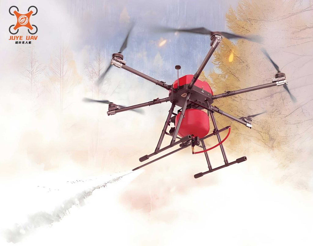
Looking ahead, the future of the Fire Drone is one of increasing autonomy, integration, and capability. We are moving towards swarm technology, where multiple Fire Drones operate collaboratively under the supervision of a single operator. One drone could act as a communication relay at high altitude while others perform low-level reconnaissance, creating a resilient and multi-layered data network. Advanced Artificial Intelligence (AI) will enable real-time analytics on the drone itself, such as automatically identifying fire hotspots in thermal video, tracking the movement of individuals, or recognizing specific HazMat placards, and then communicating these tagged alerts directly to the IC. Furthermore, the development of larger, more powerful Fire Drones or hybrid systems could lead to direct fire suppression capabilities, where drones carry and deploy extinguishing agents or barrier gels onto precise targets, especially in high-rise or industrial settings inaccessible to traditional apparatus.
The communication architecture will also evolve. Future Fire Drones will likely serve as nodes in a meshed network, seamlessly connecting ground personnel, command vehicles, and other drones in a self-healing web that ensures connectivity even if one node fails. Integration with Building Information Modeling (BIM) and real-time fire modeling software will allow the drone’s live data to update predictive models continuously, communicating not just what is happening, but what is likely to happen next.
In conclusion, the Fire Drone has firmly established itself as a cornerstone of modern fireground communication and intelligence. It is far more than an aerial camera; it is a mobile sensor platform, a communication bridge, and a decision-support tool that operates where humans cannot or should not go. By delivering real-time visual, thermal, and environmental data from unique vantage points, the Fire Drone closes the information gap that has historically plagued complex emergency responses. It empowers incident commanders with unprecedented clarity, enhances the safety of frontline responders, and increases the efficiency and effectiveness of all rescue operations. As technology continues to advance, the role of the Fire Drone will only deepen, becoming more autonomous, more integrated, and more indispensable. For any fire service committed to leveraging technology for community safety and firefighter survival, the strategic adoption and mastery of Fire Drone operations is not merely an option—it is an imperative for the future of emergency response.