The integration of Unmanned Aerial Vehicles (UAVs), specifically fire drone systems, into public safety operations represents a paradigm shift in emergency response capabilities. From my perspective as a practitioner and researcher in this field, the evolution from simple remote-controlled aircraft to sophisticated, sensor-laden fire drone platforms has been nothing short of revolutionary for firefighting communication and command. The confluence of economic demand, open-source flight control systems, and advancements in peripheral technologies has propelled the fire drone from a niche tool to a critical operational asset. However, widespread adoption in fire rescue units reveals a persistent gap between potential and practice. Challenges such as insufficient specialized training for operators and a lack of systematic, in-depth understanding of fire drone capabilities at the grassroots communication level significantly hinder optimal utilization. This article systematically explores the application of fire drone technology in fireground communication, aiming to enhance deployment frequency, broaden operational scope, and ultimately contribute to heightened fire scene safety and operational efficacy.
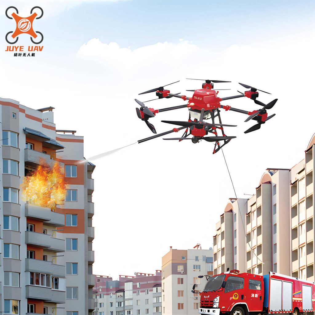
The fundamental value of a fire drone lies in its unique set of technical advantages, which directly address historical limitations in fireground awareness and communication. Modern systems integrate flight platforms, real-time video transmission, and data link systems to provide sustained aerial intelligence and support.
The core advantages can be summarized and quantified as follows:
| Technical Advantage | Key Characteristics & Impact | Typical Performance Metric |
|---|---|---|
| High Mobility & Flexibility | Lightweight (often <100 kg), rapid deployment by 1-2 personnel, minimal takeoff/landing space requirement, adaptable flight speed. | Deployment Time: < 3 minutes from vehicle arrival. |
| Comprehensive Overhead Perspective | Eliminates ground-level obstructions, provides synoptic views of incident geometry, fire spread, and personnel locations. | Field of View: 120° wide-angle + optical zoom capabilities. |
| Multi-Spectral Imaging Capability | Integration of visual, thermal (IR), and gas detection sensors allows operation through smoke, at night, and provides environmental data. | Thermal Sensitivity: <50 mK; Spectral Bands: Visible, MWIR/LWIR. |
| Operational Simplicity & Remote Access | Intuitive control interfaces; video/data feed accessible via dedicated ground control stations (GCS), tablets, or secure mobile devices over networks. | Control Latency: < 200 ms within 5 km range. |
| Enhanced Personnel Safety | Removes first responders from immediate “hot zone” dangers (collapse, flashover, toxic atmosphere) for initial reconnaissance. | Operates in environments unsuitable for human entry (e.g., >60°C ambient, >1000 ppm CO). |
The operational superiority of a fire drone can be partially modeled by an “Awareness Gain” function. Let $A_t$ represent the total situational awareness at time $t$. Traditional ground-based awareness $A_g(t)$ is limited by line-of-sight and access. Fire drone-derived awareness $A_d(t)$ provides a multiplicative factor over a coverage area $C_d$. A simplified model is:
$$
A_t = A_g(t) + \int_{0}^{t} \left( \gamma \cdot C_d(\tau) \cdot S(\tau) \right) d\tau
$$
where $\gamma$ is the data efficiency coefficient of the fire drone‘s sensors and downlink, and $S(\tau)$ is the severity function of the incident. This illustrates how the fire drone continuously feeds new information, increasing the total awareness integral over time.
Application Pathways: From Reconnaissance to Communication Relay
The deployment of a fire drone follows a logical operational pathway, each stage critical for informed decision-making. The primary application is comprehensive incident reconnaissance and assessment. Upon arrival, the fire drone provides an immediate overhead view, identifying the fire’s seat, extent, potential collapse zones, and exposures. It can detect concentrations of hazardous gases using integrated sensors, providing vital data for risk assessment before committing personnel. The intelligence gathered, $I_{recon}$, is a function of sensor suite quality $Q_s$, altitude $h$, and loiter time $T_l$:
$$
I_{recon} = k \cdot \left( \frac{Q_s \cdot T_l}{\sqrt{h}} \right)
$$
where $k$ is an environmental constant. Lower altitudes and longer loiter times with quality sensors yield higher intelligence fidelity.
Following initial recon, the role shifts to continuous monitoring and tracking. The dynamic nature of fire requires persistent observation to track spread direction, intensity changes, and structural integrity. This real-time video feed, often integrated with thermal imaging, allows the Incident Commander (IC) to adjust tactics proactively. The fire drone acts as a persistent “eye in the sky,” creating a temporal dataset of the incident’s evolution.
A transformative application is the fire drone as a communication and辅助救援 (auxiliary rescue) platform. This multifaceted role includes:
- Loudspeaker & Public Address: Directing evacuations, communicating with trapped individuals, or issuing commands to firefighters on complex high-rise or wide-area incidents.
- Payload Delivery: Transporting critical lightweight supplies such as medicines, communication devices, or personal flotation devices to inaccessible locations in water, mountain, or urban collapse scenarios.
- Mobile Communication Node/Relay: Perhaps the most significant communication role. In incidents where terrestrial communication infrastructure is damaged (earthquake, explosion) or where terrain blocks signals (forest, urban canyon), a fire drone can be deployed as an airborne cellular (LTE/5G) or mesh network node. It establishes a temporary communication bridge between isolated teams and command.
The communication link capacity $C$ provided by an airborne fire drone relay can be approximated using a modified Shannon-Hartley theorem, considering the improved line-of-sight (LoS):
$$
C = B \cdot \log_2 \left(1 + \frac{P_t \cdot G_t \cdot G_r \cdot (h_{drone}^2)}{N_0 \cdot B \cdot d^{\alpha}}\right)
$$
Here, $B$ is bandwidth, $P_t$ is transmit power, $G_t$ and $G_r$ are antenna gains, $h_{drone}$ is the drone altitude (improving the path gain), $N_0$ is noise spectral density, $d$ is the ground distance between communicating parties, and $\alpha$ is the path loss exponent (significantly lower for an LoS drone link than for obstructed ground paths).
Finally, fire drones contribute to post-incident analysis and auxiliary supervision of high-risk structures. They can document the scene for investigation and perform remote inspections of tall buildings for hidden fire spread or structural weakness, feeding data directly into building information management (BIM) or fire safety systems.
| Application Scenario | Primary Fire Drone Function | Key Enabling Technology |
|---|---|---|
| Initial Size-Up | Rapid Situational Awareness | High-Definition Gimbal Camera, GNSS |
| Interior/Structural Fire | Thermal Mapping, Search & Rescue | Radiometric Thermal Camera, Obstacle Avoidance |
| Wildland/WUI Fire | Fire Edge Tracking, Spread Prediction | Long-Range Telemetry, Multi-spectral Imaging |
| Hazmat Incident | Remote Environmental Sensing | Gas Detector Payloads (PID, etc.) |
| Communication Blackout | Aerial Mesh/Cellular Node | Software-Defined Radio (SDR), LTE/5G Picocell |
| Water/Flood Rescue | Victim Location & Life Vest Delivery | Optical Zoom, Precision Drop Mechanism |
Technical Requirements and Parametric Optimization for Fire Service Use
To perform reliably in the harsh, unpredictable environment of a fireground, a purpose-built fire drone must meet stringent technical specifications that far exceed those of commercial or recreational models. These requirements can be framed as a multi-objective optimization problem.
1. Enhanced Reliability & Environmental Hardening: The operational envelope must include high winds, heat, precipitation, and poor visibility. Demands include:
– Wind Resistance: Stable flight in winds ≥ 15 m/s (Beaufort 6-7) is essential, especially for high-rise operations. This requires robust aerodynamic design and powerful propulsion.
– Thermal/Heat Protection: Protection for electronics and sensors from radiant heat and convective updrafts. This may involve passive shielding or active cooling systems.
– Ingress Protection (IP) Rating: A minimum of IP54 (dust and water splash resistant) is advisable for all-weather operation.
The probability of system failure $P_f$ in a fire environment increases with exposure time $t$ to stressors like temperature $T$ and particulate density $\rho_p$:
$$
P_f(t) = 1 – \exp\left(-\int_0^t \lambda(T(\tau), \rho_p(\tau)) d\tau\right)
$$
where $\lambda$ is the failure rate function, which a hardened fire drone design aims to minimize.
2. Operational Performance (Endurance & Range): “Time on station” is critical. For a fire drone with a service radius of 2-5 km, a minimum useful flight time of 30 minutes is required, with a recharge/swap time under 15 minutes. Flight altitude capability must match modern building heights, often requiring service ceilings > 200m AGL. Endurance $E$ is a function of battery energy density $E_{bat}$, vehicle power consumption $P_{vehicle}$, and payload power $P_{payload}$:
$$
E = \frac{E_{bat} \cdot \eta}{P_{vehicle}(v, h) + P_{payload}}
$$
where $\eta$ is the powertrain efficiency. Optimizing $P_{vehicle}$ through efficient aerodynamics and propulsion is as important as increasing battery capacity.
3. Data Link Stability & Security: The video and telemetry downlink must be robust, low-latency, and secure. It requires strong resistance to electromagnetic interference (EMI) common at fire scenes (multiple radios, generators). Digital encrypted links with adaptive frequency hopping are necessary. The required link margin $M$ to ensure stable video ($BER < BER_{target}$) in an interfered environment is:
$$
M = P_{rx} – (N_0 + I_{ext}) – S_{min}
$$
where $P_{rx}$ is received power, $I_{ext}$ is external interference power, and $S_{min}$ is the minimum signal power for the target Bit Error Rate. A robust fire drone system maximizes $P_{rx}$ (strong transmit power, high-gain antennas) and minimizes vulnerability to $I_{ext}$.
4. System Integration & Interoperability: The fire drone cannot be a data silo. It must integrate seamlessly with existing fire service communication ecosystems. This includes:
– Data Standardization: Video streams and metadata should be compatible with common incident management software (e.g., GIS platforms, CAD systems).
– Interoperable Communications: The drone’s command and control (C2) link should not interfere with ground team radios (e.g., P25, TETRA). Its payload data should be receivable on standard field devices.
– Modular Payload Bay: A standardized mechanical/electrical interface allows quick swapping of sensors (camera, gas detector, loudspeaker, communication relay) based on incident type.
| Technical Parameter | Minimum Operational Requirement for Fire Service | Desired / Target Specification |
|---|---|---|
| Max Wind Resistance | 15 m/s (34 mph / ~Beaufort 6) | 20 m/s (45 mph / ~Beaufort 8) |
| Useful Flight Time | 25 minutes (with standard payload) | 40+ minutes (with standard payload) |
| Operational Ceiling | 150 m Above Ground Level (AGL) | 300+ m AGL |
| Data Link Range (LoS) | 5 km | 10 km |
| Video Latency | < 500 ms | < 200 ms |
| Thermal Camera Resolution | 640 x 512 pixels | 1024 x 768 pixels (or higher) |
| Takeoff/Landing Footprint | 2m x 2m clear area | Vertical Takeoff and Landing (VTOL) capability |
| IP Rating | IP43 | IP54 or higher |
5. Rigorous Operational Protocols and Training: The technology is only as good as the operator. This requirement encompasses standardized training curricula, certification processes, and clear Standard Operating Procedures (SOPs) for fire drone deployment, maintenance, and data management. Regular joint exercises with technical teams are essential to establish effective maintenance protocols and ensure high operational readiness rates.
System Integration and Network-Centric Fireground Operations
The future of fire drone application lies in moving beyond a standalone tool toward a integrated node in a Network-Centric Fireground (NCF). In this model, multiple data sources—fire drones, ground-based sensors, wearable tech on firefighters, and building systems—fuse to create a Common Operational Picture (COP).
The fire drone contributes several key data layers to this network:
1. Real-Time Geospatial Video Layer: Geo-rectified video feeds, where each pixel is mapped to a geographic coordinate.
2. Thermal/Environmental Data Layer: Temperature maps and gas concentration plots overlaid on the incident map.
3. Communication Relay Layer: Providing the network backbone for other data sources in communication-degraded zones.
This integration can be conceptualized as a data fusion center. Let $\mathbf{Z}_k$ represent the set of all measurements (video frames, telemetry, sensor data) from the fire drone at time $k$. Let $\mathbf{X}_k$ be the state vector of the incident (fire front location, intensity, hazard zones). A fusion filter (e.g., Kalman Filter variant) continuously updates the state estimate:
$$
\hat{\mathbf{X}}_{k|k} = \hat{\mathbf{X}}_{k|k-1} + \mathbf{K}_k \left( \mathbf{Z}_k – H(\hat{\mathbf{X}}_{k|k-1}) \right)
$$
where $\mathbf{K}_k$ is the optimal Kalman gain and $H(\cdot)$ is the measurement model. The fire drone‘s high-quality, overhead measurements $\mathbf{Z}_k$ provide the crucial updates that refine the COP, leading to more accurate predictions and safer, more effective tactical decisions.
Future Trajectories and Concluding Synthesis
The evolution of the fire drone in firefighting is ongoing. Key trajectories for development include:
- Increased Autonomy: Beyond manual piloting, towards automated missions (pre-programmed inspection routes), intelligent tracking of fire perimeters, and automatic return-to-home upon low battery or link loss.
- Swarm & Collaborative Operations: Deploying multiple, heterogeneous fire drones that collaborate—one for mapping, one for thermal imaging, one as a communication relay—covering larger areas more efficiently.
- Advanced Onboard Processing (Edge Computing): Implementing AI algorithms directly on the fire drone for real-time object detection (victims, firefighters, hazards), fire behavior prediction, and data compression/prioritization before transmission.
- Enhanced Payload Capacity and Specialization: Development of heavier-lift fire drones capable of deploying more substantial rescue equipment or persistent relay packages.
In conclusion, the integration of fire drone technology into fire service communication and operational frameworks is not a simple procurement exercise; it is a systemic transformation. It requires a holistic approach encompassing the selection of technically capable and hardened platforms, the development of rigorous training and procedural standards, and a forward-looking strategy for integrating aerial data into the incident command decision-cycle. The fire drone‘s ability to provide immediate, overhead, multi-spectral intelligence and to act as a versatile communication and utility platform directly enhances situational awareness, improves firefighter safety, and increases operational effectiveness. As the technology matures and integrates further with other digital fireground tools, the fire drone will solidify its role as an indispensable asset in the modern firefighter’s toolkit, fundamentally shaping the future of fireground communication and strategy.