The fight against wildfires has entered a transformative phase, one where I have witnessed the transition from purely ground-based, reactive efforts to a proactive, intelligence-driven campaign fought from the skies. At the heart of this revolution is the fire drone, an autonomous aerial platform that is fundamentally reshaping our approach to wildfire suppression, mitigation, and management. From my perspective as an engineer and operator within this field, the integration of unmanned systems represents not merely an incremental improvement, but a paradigm shift. This article details the multifaceted role of the modern fire drone, exploring its technological foundations, operational methodologies, and the algorithmic core that enables its life-saving missions.
The traditional challenges of wildfire management are formidable. Rugged terrain, intense heat, unpredictable wind patterns, and the sheer scale of a spreading conflagration create an environment that is perilous for human responders and difficult to monitor comprehensively. Manned aircraft, while invaluable, are constrained by cost, pilot endurance, and operational risk in smoke-filled skies. The fire drone emerges as the solution to these limitations. It is a versatile data and action node, capable of persistent surveillance, precise intervention, and real-time communication, all while keeping human operators at a safe distance in a command center. My work revolves around maximizing the capabilities of these systems, which I categorize into three primary, interconnected functions: Intelligence, Surveillance, and Reconnaissance (ISR); Direct Fire Suppression Support; and Communication/Logistics Relay.
1. Technological Architecture of the Modern Fire Drone
The efficacy of a fire drone is predicated on a sophisticated integration of hardware and software. The platform itself is typically a multirotor for vertical take-off and landing (VTOL) capability in confined areas, or a fixed-wing vehicle for extended range and endurance over vast forested regions. Hybrid VTOL models are increasingly prevalent, offering the best of both worlds. The payload is where the specialized mission equipment resides, turning a generic UAV into a dedicated fire drone.
The sensory suite is critical for the ISR role. It integrates several key modalities, each feeding data into a central fusion processor. The core sensors and their functions can be summarized as follows:
| Sensor Type | Primary Function | Key Metrics & Output | Advantages for Fire Drone |
|---|---|---|---|
| Thermal Imaging Camera | Heat source detection, fire front mapping, hotspot identification. | Temperature resolution (<50 mK), spectral range (LWIR: 8-14 μm), spatial resolution. | Sees through smoke, operates day/night, quantifies thermal intensity. |
| Multispectral/Hyperspectral Imager | Vegetation health analysis, fuel moisture content estimation, post-fire damage assessment. | Number of spectral bands, bandwidth, signal-to-noise ratio (SNR). | Identifies stressed vegetation (pre-ignition risk), maps burn severity. |
| Visible-Light & Zoom Camera | High-resolution visual context, structural assessment, public information gathering. | Optical zoom (30x+), resolution (4K+), stabilization. | Provides intuitive situational awareness, documents fire progression. |
| LIDAR (Light Detection and Ranging) | 3D terrain mapping, canopy height modeling, structure profiling. | Pulse rate, point density, ranging accuracy. | Creates precise digital elevation models for fire spread simulation. |
| Gas/Particulate Sensors | Air quality monitoring, detection of toxic compounds (e.g., CO, VOCs). | Sensitivity (ppm/ppb), response time, selectivity. | Protects downwind communities, assesses health hazards for crews. |
The data from these sensors is fused using algorithms to create a Common Operational Picture (COP). A fundamental task is fire front detection and characterization. The thermal imager provides a pixel-intensity matrix \( I_T(x, y) \) representing temperature. A simple thresholding algorithm can isolate potential fire pixels:
$$ F(x,y) = \begin{cases} 1, & \text{if } I_T(x,y) > T_{fire} \\ 0, & \text{otherwise} \end{cases} $$
where \( T_{fire} \) is an adaptive threshold based on ambient background temperature. More advanced machine learning models, such as convolutional neural networks (CNNs), are trained on vast datasets of thermal imagery to distinguish fire from other heat sources (e.g., sunlight on rocks) with higher accuracy, outputting a probability map \( P_{fire}(x,y) \).
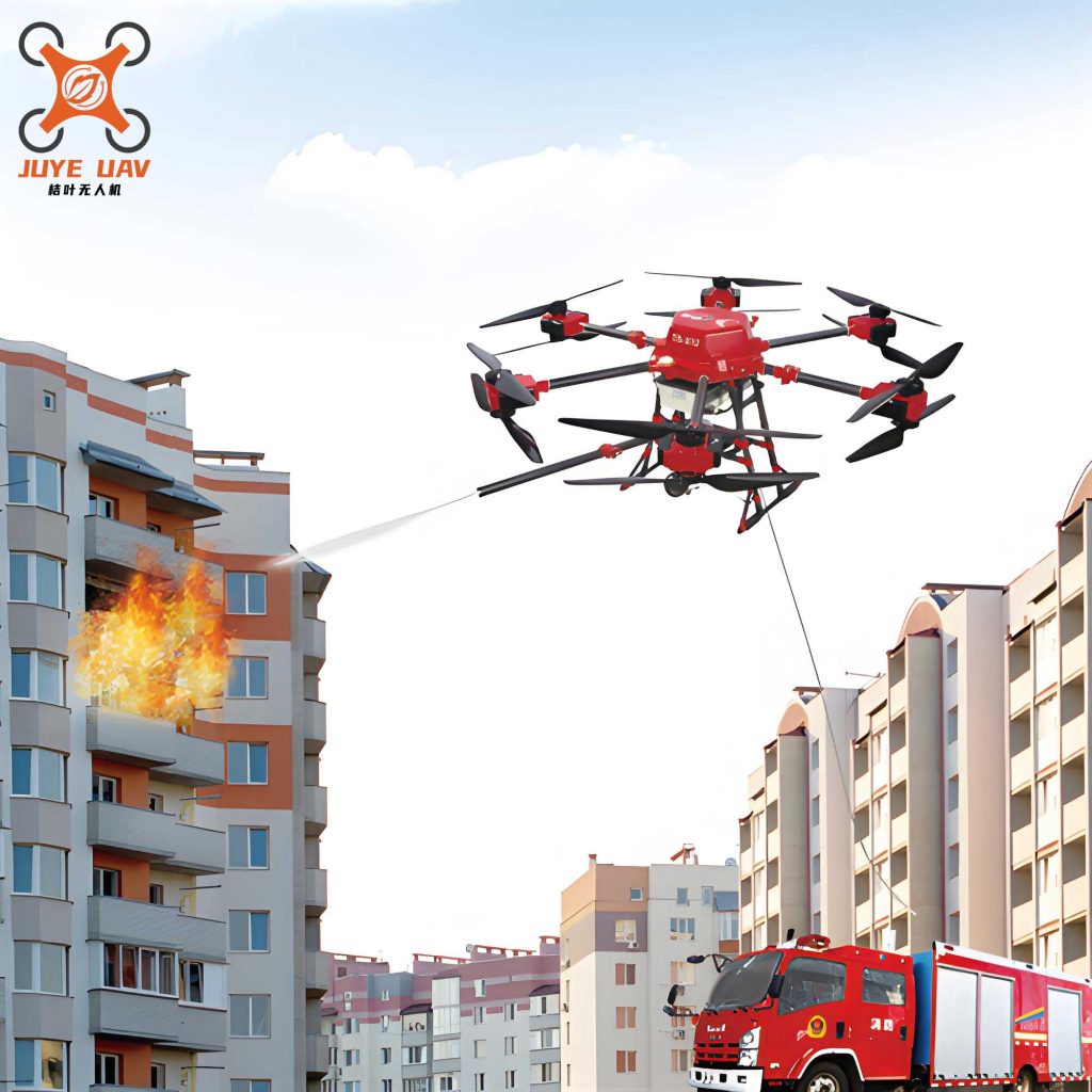
Beyond sensing, the fire drone often carries active payloads for suppression. While large-scale water or retardant drops remain the domain of manned air tankers, drones excel in targeted, precision applications. Payloads include:
- Extinguishing Agent Dispensers: Carrying 5-50 liters of water, foam, or fire-retardant gel for spot fires or creating containment lines.
- Ignition Systems: Precision-delayed ignition spheres (e.g., plastic sphere dispensers – PSDs) for executing controlled backburns, a critical tactic for fuel removal.
- Structural Protection Modules: Delivering fire-retardant coatings or gels directly onto buildings or critical infrastructure threatened by advancing flames.
The avionics system integrates inertial measurement units (IMUs), GPS/GNSS for navigation, and robust communication links. Given the electromagnetic interference and line-of-sight challenges in wildfire environments, multi-link systems are standard. A typical fire drone communication architecture might use:
| Link Type | Frequency/Range | Primary Use | Data Rate |
|---|---|---|---|
| C2 (Command & Control) | UHF/L-Band, 20-50 km | Flight control, telemetry, mission commands | Low to Medium |
| Video Downlink | C-Band/5.8 GHz, 10-20 km | Real-time HD/thermal video feed | High |
| Mesh Data Link | WiFi Mesh, 2-5 km node-to-node | Extending network for other drones/ground teams | Medium |
| Satellite Comms (SATCOM) | Global | Backup/Beyond Line-of-Sight (BLOS) control | Low |
2. Autonomous Operational Algorithms and Mission Execution
The true power of a fire drone is unlocked by autonomy. Pre-programmed waypoint flights are insufficient for the dynamic wildfire environment. Instead, the fire drone must possess a degree of onboard intelligence to perceive, plan, and act.
2.1 Autonomous Navigation and Path Planning
Operating near a fire requires navigating turbulent, smoky, and obstacle-rich airspace. The path planning algorithm must account for dynamic threats (rising heat columns, new flame fronts) and static obstacles (trees, terrain, power lines). A common approach is to use a cost-function-based planner like A* or its variants (D* Lite) on a constantly updated 3D occupancy grid \( \mathcal{G} \). Each cell \( c_{i,j,k} \) in the grid has a cost \( J(c) \) influenced by:
$$ J(c) = \alpha \cdot J_{obstacle}(c) + \beta \cdot J_{heat}(c) + \gamma \cdot J_{terrain}(c) + \delta \cdot J_{wind}(c) $$
where:
- \( J_{obstacle}(c) \) is high if the cell is occupied.
- \( J_{heat}(c) \) is derived from thermal data, penalizing proximity to extreme temperatures.
- \( J_{terrain}(c) \) penalizes high-energy climbs or risky proximity to the ground.
- \( J_{wind}(c) \) accounts for wind vectors, favoring paths with favorable tailwinds or avoiding severe shear.
- \( \alpha, \beta, \gamma, \delta \) are weighting coefficients tuned for mission safety and efficiency.
The planner finds the path \( \mathcal{P} \) from start \( s \) to goal \( g \) that minimizes the total integrated cost:
$$ \mathcal{P}^* = \arg\min_{\mathcal{P}} \sum_{c \in \mathcal{P}} J(c) $$
This allows the fire drone to automatically reroute around newly detected fire fronts or updrafts.
2.2 Multi-Agent Swarm Coordination
A single fire drone is powerful; a coordinated swarm is transformative. Swarms can perform parallel tasks: mapping a large perimeter, establishing a communication relay chain, or simultaneously attacking multiple flanks of a spot fire. Swarm control often employs a decentralized approach using algorithms like Artificial Potential Fields or consensus-based control.
For perimeter tracking, a common algorithm assigns drones to waypoints along the estimated fire boundary. Each fire drone \( i \) adjusts its position \( \mathbf{p}_i \) based on repulsion from neighboring drones (to maintain coverage) and attraction to its assigned boundary segment. A simplified model for the control input \( \mathbf{u}_i \) is:
$$ \mathbf{u}_i = -k_{rep} \sum_{j \neq i} \frac{\mathbf{p}_i – \mathbf{p}_j}{||\mathbf{p}_i – \mathbf{p}_j||^3} – k_{att} (\mathbf{p}_i – \mathbf{p}_{i, target}) + \mathbf{v}_{wind\_comp} $$
where \( k_{rep} \) and \( k_{att} \) are gains, and \( \mathbf{v}_{wind\_comp} \) is a wind compensation vector. This allows the swarm to dynamically adapt the tracking pattern as the perimeter evolves.
For suppression tasks like targeted water dropping, a cooperative allocation algorithm is used. Given a set of \( N \) spot fires with priorities \( \phi_n \) and a set of \( M \) fire drone agents with different payload capacities \( C_m \) and travel times \( t_{m,n} \), the goal is to minimize the total weighted containment time. This can be formulated as a Mixed-Integer Linear Programming (MILP) problem or solved with heuristic auction algorithms where drones “bid” on tasks based on their cost-to-complete.
2.3 Real-Time Fire Spread Modeling and Prediction
The most advanced fire drone systems integrate real-time data into physics-based fire spread models. Drones provide crucial input parameters: wind speed/direction at multiple altitudes, fuel moisture (inferred from multispectral data), and precise topography from LIDAR. A simplified Rothermel’s surface fire spread model, used in systems like FARSITE, calculates the rate of spread \( R \) as:
$$ R = \frac{I_R \xi (1 + \phi_w + \phi_s)}{\rho_b \epsilon Q_{ig}} $$
where:
- \( I_R \) = reaction intensity
- \( \xi \) = propagating flux ratio
- \( \phi_w, \phi_s \) = wind and slope coefficients
- \( \rho_b \) = fuel bulk density
- \( \epsilon \) = effective heating number
- \( Q_{ig} \) = heat of preignition
By continuously updating these parameters with data from the fire drone fleet, the prediction model can run in a data-assimilation loop, offering commanders a frequently updated, high-fidelity forecast of fire behavior. The fire drone can then be tasked to verify the predicted fire front or monitor areas of high predicted growth.
3. Mission Profiles: From Pre-Ignition to Recovery
The utility of the fire drone spans the entire lifecycle of a wildfire event.
3.1 Pre-Ignition & Prevention: Drones conduct routine patrols in high-risk areas, using multispectral sensors to create fuel moisture maps. Areas of high stress and dryness are flagged for preventative measures. LIDAR scans create detailed fuel load and continuity maps for risk assessment modeling.
3.2 Initial Attack & Containment: Upon report of a fire, a fire drone is rapidly deployed to provide the first live visuals and thermal map. It precisely locates the ignition point, maps the initial perimeter, and assesses accessibility for ground crews. It can even conduct an immediate, targeted suppression attack on the incipient fire if equipped, potentially stopping it before it grows.
3.3 Large Fire Management: During a major incident, a fleet of fire drone units performs continuous ISR. One swarm monitors the main fire front, another scouts for spot fires ahead of the perimeter, while others assist in planning and executing controlled burns. They provide thermal overlays on GIS maps in real-time, showing hotspots invisible to the naked eye. The data informs where to deploy ground crews and manned aircraft most effectively.
3.4 Mop-up & Post-Fire Analysis: After the main threat is contained, the tedious and dangerous work of mop-up—finding and extinguishing lingering hotspots—begins. A fire drone with a thermal camera can systematically scan the burn area, pinpointing hotspots for ground teams with GPS accuracy, drastically improving efficiency and safety. Post-fire, drones conduct detailed surveys to map burn severity, assess soil erosion risk, and monitor ecological recovery.
4. Performance Metrics and Quantitative Advantages
The impact of integrating fire drone technology can be measured in key performance indicators (KPIs). Let us define a comparative framework between a traditional response and a fire drone-enhanced response.
| Performance Metric | Traditional Methods (Baseline) | Fire Drone-Enhanced Response | Quantitative Improvement Factor |
|---|---|---|---|
| Time to Initial Situational Awareness | 30-90 minutes (mobilize crew/aircraft) | 5-15 minutes (drone launch & transit) | 4x – 12x faster |
| Perimeter Mapping Accuracy (RMS Error) | 50-100 m (satellite/aircraft visual) | 5-10 m (drone GPS + direct geo-tagging) | 10x more accurate |
| Hotspot Detection Rate (in smoke) | < 20% (visual from aircraft) | > 95% (thermal imaging) | > 4.75x improvement |
| Operational Cost per Flight Hour | $2,000 – $10,000+ (manned helicopter) | $100 – $500 (commercial-grade fire drone) | 95% cost reduction |
| Personnel Exposure in High-Risk Zones | Constant (ground scouts, pilots) | Minimal (remote operation) | Risk reduction by ~90% |
| Data Update Latency for Command | 30 minutes – several hours | Real-time to < 2 minutes | Near-instantaneous |
These metrics translate into tangible outcomes: smaller final fire size, reduced suppression costs, improved firefighter safety, and less environmental damage. The economic model for adoption is compelling. Consider a simplified Return on Investment (ROI) model for a fire drone fleet. The total cost of ownership \( C_{T} \) over \( N \) years includes acquisition, maintenance, and operation. The benefits \( B_{T} \) include avoided suppression costs \( S_{avoided} \) and reduced asset loss \( L_{avoided} \).
$$ ROI = \frac{B_{T} – C_{T}}{C_{T}} = \frac{ (S_{avoided} + L_{avoided}) – (C_{acq} + N \cdot C_{ops}) }{C_{acq} + N \cdot C_{ops}} $$
Studies from early adopter agencies show that by enabling faster, more precise initial attack, a single fire drone can prevent a small fire from becoming a large one, thereby avoiding millions in suppression costs (\( S_{avoided} \)) in just one incident, yielding an ROI that can exceed 1000%.
5. Challenges and Future Trajectory
Despite the clear advantages, the integration of the fire drone is not without challenges. Regulatory airspace integration, especially during major incidents when manned aviation is dense, requires sophisticated Unmanned Traffic Management (UTM) systems. Communication reliability in canyons and dense forest remains a technical hurdle being addressed by mesh networks and satellite links. Endurance, though improving, is still a limit; swappable battery systems and hybrid gas-electric powertrains are extending mission times.
The future development path for the fire drone is focused on increased intelligence and specialization. Key trends I am actively working on include:
- Enhanced AI: Moving from detection to prediction at the edge. The fire drone will not just see a hotspot, but will predict its growth potential in the next 30 minutes based on immediate local sensor data and onboard micro-models.
- Advanced Suppression: Development of new, more effective retardant gels or powders deployable by drone, and drones capable of cooperative “lift and dump” of larger payloads.
- Full Autonomy: Transition from “human in the loop” to “human on the loop” for specific, well-defined tasks like automated mop-up scanning or perimeter tracking, freeing up operator cognitive load for strategic decision-making.
- Integration with Ground Robots: The fire drone acting as a commander and eyes in the sky for autonomous ground vehicles that can perform heavy suppression, create firebreaks, or transport equipment.
The trajectory is clear: the fire drone will evolve from a tactical tool to the central nervous system of wildfire response—a persistent, intelligent, and adaptive network in the sky. It represents a fusion of robotics, aerospace engineering, artificial intelligence, and fire science, creating a force multiplier that fundamentally alters the risk calculus of fighting wildfires. As these systems become more capable, autonomous, and ubiquitous, I envision a future where the first and constant responder to any wildfire, large or small, is not a human in harm’s way, but a sophisticated, mission-driven fire drone.