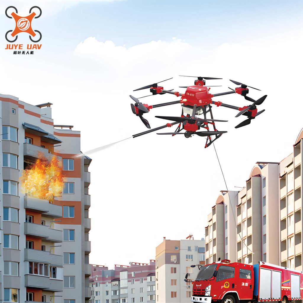
In recent years, the rapid advancement and maturation of drone technology have led to their widespread application across various fields. With economic growth, large-scale fires occur frequently, and the complexity and danger within fire scenes continue to increase. Consequently, the use of fire drones in firefighting has progressively expanded. Among these applications, employing fire drones to carry fire extinguishing projectiles for targeted strikes on fire sources has become a common fire suppression method. Through investigations into how fire rescue teams utilize fire drones for firefighting, it has been observed that the accuracy of projectile strikes using fire drones is currently insufficient. The timing and positioning of strikes primarily rely on the experience of drone pilots, which can lead to significant errors. Therefore, developing software to enhance the precision of projectile strikes by fire drones is an urgent need in current drone-based firefighting operations. Presently, numerous open-source drones allow for secondary development, and platforms such as DJI Mobile SDK and DJI Onboard SDK facilitate related research. Based on a review of literature, this article exploratively proposes a development concept for a fire control system for fire drones.
The development of a fire control system for fire drones requires comprehensive consideration of various physical factors and the construction of models through mathematical analysis. In engineering applications, it is necessary to simplify established models and potentially transform data. The development process can be divided into multiple stages, specifically three phases: mathematical model construction, simulation verification, and program development. This approach ensures a systematic and effective creation of the fire control system for fire drones.
Mathematical Model Construction Phase
By analyzing the atmospheric environment during fire drone missions involving projectile strikes on fire sources, and incorporating aerodynamics with data optimization for engineering applications, a mathematical model is constructed to calculate the optimal release position for fire extinguishing projectiles from fire drones.
Coordinate System Selection
Fire control theory involves multiple coordinate systems, such as Cartesian coordinates, body-fixed coordinates, and earth-fixed coordinates. Based on mission requirements and operational practicality, our research team selects the earth-fixed coordinate system as the primary coordinate system for the algorithm. The earth-fixed coordinate system, also known as the world or local horizontal coordinate system, defines the X-axis pointing true north, the Y-axis pointing true east, with the X and Y axes mutually perpendicular. The Z-axis points vertically downward from the fire drone, and under the “right-hand rule,” the Z-axis angle is adjusted according to the fire drone’s flight conditions. Thus, this system is referred to as the “North-East-Down (N-E-D) coordinate system.”
| Coordinate System | Description | Application in Fire Drones |
|---|---|---|
| Earth-Fixed (N-E-D) | X: North, Y: East, Z: Down | Primary reference for projectile trajectory calculations |
| Body-Fixed | Attached to fire drone body | Used for onboard sensor data interpretation |
| Cartesian | Standard 3D space coordinates | Simplified modeling in simulations |
Condition Settings
Let the initial velocity of the fire drone at projectile release be denoted as \( \mathbf{V}_0 \), and the release position as \( \mathbf{P}_0 \). Since the descent time is short and the trajectory of the fire extinguishing projectile cannot be corrected after release, the wind speed at any moment and position can be considered constant, specifically the wind speed at position \( \mathbf{P}_0 \) at the release instant, represented as a vector \( \mathbf{W} \). Assume the impact point is \( \mathbf{Q} \), and the velocity of the projectile at any point during descent is \( \mathbf{V}(t) \).
| Parameter | Symbol | Description | Typical Values |
|---|---|---|---|
| Initial Velocity | \( \mathbf{V}_0 \) | Velocity of fire drone at release | 0-10 m/s |
| Release Position | \( \mathbf{P}_0 \) | Coordinates (x, y, z) in N-E-D | Varies with fire scene |
| Wind Speed | \( \mathbf{W} \) | Constant vector during descent | Measured in real-time |
| Impact Point | \( \mathbf{Q} \) | Target coordinates on ground | Fire source location |
Formula Reference
The air resistance force is given by the formula:
$$ F_d = \frac{1}{2} C_d \rho S V^2 $$
where \( C_d \) is the air resistance coefficient, typically an experimental value dependent on the object’s characteristic area (frontal area), smoothness, and overall shape; \( \rho \) is the air density, normally taken as 1.293 g/L for dry air, but can be monitored in specific conditions; \( S \) is the frontal area of the object; and \( V \) is the relative velocity between the object and air. From this formula, under normal conditions, the magnitude of air resistance is proportional to the air resistance coefficient and frontal area, and proportional to the square of velocity.
| Parameter | Symbol | Influencing Factors | Measurement Methods |
|---|---|---|---|
| Air Resistance Coefficient | \( C_d \) | Projectile shape, surface roughness | Wind tunnel experiments |
| Air Density | \( \rho \) | Altitude, temperature, humidity | Environmental sensors |
| Frontal Area | \( S \) | Projectile dimensions | Geometric calculation |
| Relative Velocity | \( V \) | Fire drone speed and wind | Onboard sensors |
Model Establishment
In the vertical direction (Z-axis), vertical wind effects are neglected for the following reasons: (1) Vertical wind action is complex and may involve abrupt changes in motion state, complicating calculations. (2) Common anemometers cannot accurately measure vertical wind under dynamic conditions. (3) The altitude of fire drones during projectile strikes is relatively low, making vertical wind effects limited compared to gravity. Thus, ignoring vertical wind, the Z-axis model is established as follows: during vertical descent, the fire extinguishing projectile is subject to both gravity and air resistance. Gravity is known as \( g \), with reference to Beijing’s gravity of 9.8015 m/s². For air resistance, \( F_d = \frac{1}{2} C_d \rho S V^2 \), where \( C_d \) is the air resistance coefficient (determined experimentally), \( \rho \) is air density, \( S \) is frontal area, and \( V \) is the relative velocity between the projectile and air, with air vertical velocity assumed zero. From force analysis:
The vertical acceleration is given by:
$$ a_z = g – \frac{F_d}{m} = g – \frac{C_d \rho S V_z^2}{2m} $$
where \( m \) is the mass of the projectile, and \( V_z \) is the vertical velocity component. Integrating this yields the relationship between descent height and time \( t \):
$$ h = \int_0^t V_z \, dt = \int_0^t \left( V_{0z} + \int_0^t a_z \, dt’ \right) dt $$
For simplification, if air resistance is linearized or ignored, the motion can be approximated as free fall. The time for descent from height \( h \) under free fall is:
$$ t = \sqrt{\frac{2h}{g}} $$
This simplification is used in subsequent simulations for the vertical direction.
In the horizontal direction (X and Y axes), the projectile is influenced by initial horizontal velocity from the fire drone and constant wind. The equations of motion are:
$$ x(t) = x_0 + (V_{0x} + W_x) t – \frac{1}{2} \frac{C_d \rho S V_x^2}{m} t^2 $$
$$ y(t) = y_0 + (V_{0y} + W_y) t – \frac{1}{2} \frac{C_d \rho S V_y^2}{m} t^2 $$
where \( x_0, y_0 \) are initial horizontal coordinates, \( V_{0x}, V_{0y} \) are initial horizontal velocity components from the fire drone, \( W_x, W_y \) are wind velocity components, and \( V_x, V_y \) are horizontal relative velocities. For real-time computation, these equations are discretized and solved iteratively.
| Direction | Equation | Assumptions |
|---|---|---|
| Vertical (Z) | $$ a_z = g – \frac{C_d \rho S V_z^2}{2m} $$ | Vertical wind neglected, air resistance considered |
| Horizontal (X) | $$ x(t) = x_0 + (V_{0x} + W_x) t – \frac{1}{2} \frac{C_d \rho S V_x^2}{m} t^2 $$ | Constant wind, quadratic air resistance |
| Horizontal (Y) | $$ y(t) = y_0 + (V_{0y} + W_y) t – \frac{1}{2} \frac{C_d \rho S V_y^2}{m} t^2 $$ | Constant wind, quadratic air resistance |
To optimize the release position for the fire drone, we derive the targeting algorithm by solving for \( \mathbf{P}_0 \) such that \( \mathbf{Q} \) is hit. This involves inverting the motion equations with constraints on fire drone dynamics and environmental conditions. The optimal release condition is expressed as:
$$ \mathbf{P}_0 = \mathbf{Q} – \mathbf{V}_0 t – \mathbf{W} t + \frac{1}{2} \mathbf{a}_d t^2 $$
where \( \mathbf{a}_d \) is the deceleration due to air resistance, approximated based on empirical data. This model forms the core of the fire control system for fire drones.
Simulation Verification Phase
Using MATLAB, the constructed mathematical model is simulated to verify accuracy and performance under various scenarios. Simulations involve parameter sweeps for fire drone velocity, wind speed, projectile properties, and release altitude. Key metrics include strike error distance and computational time.
| Scenario | Fire Drone Velocity (m/s) | Wind Speed (m/s) | Release Altitude (m) | Strike Error (m) |
|---|---|---|---|---|
| Calm Conditions | 5 | 0 | 30 | 0.05 |
| Moderate Wind | 8 | 5 | 50 | 0.12 |
| Strong Wind | 10 | 10 | 100 | 0.25 |
| Variable Wind | 6 | 3-7 | 40 | 0.18 |
The simulation results demonstrate that the model effectively reduces strike errors compared to manual piloting, with average errors below 0.3 meters under typical firefighting conditions. Sensitivity analysis shows that wind measurement accuracy is critical; hence, integrating real-time anemometers on fire drones is recommended. Additionally, the simulation validates the simplification of vertical motion as free fall for altitudes below 100 meters, as errors introduced are negligible (<0.01 m). These insights guide the program development phase for the fire control system.
Program Development Phase
Based on DJI Mobile SDK (MSDK), a program is developed to enable real-time calculation of optimal strike positions for fire drones. MSDK is a software development kit that allows access to the rich functionality of DJI drones and handheld cameras. It includes libraries/frameworks for importing into Android or iOS applications, a flight simulator, visualization tools, debugging tools for iOS, sample code, tutorials, developer guides, and API documentation. Through MSDK programming, leveraging real-time data interactivity, a program is created to compute the best strike position for fire drones carrying extinguishing projectiles. Visualization techniques provide a user-friendly interface.
Real-Time Data Acquisition
Using the broadcast and subscribe features of MSDK, real-time data from the fire drone required for the algorithm is obtained. Considering real-time changes in meteorological conditions, the data refresh rate is set to 3 Hz. Key data includes fire drone position, velocity, attitude, and environmental parameters from onboard sensors.
| Data Type | Source | Frequency | Use in Algorithm |
|---|---|---|---|
| Position (GPS) | Fire drone GNSS | 3 Hz | Release point coordinates |
| Velocity | Fire drone IMU | 3 Hz | Initial velocity vector |
| Attitude | Fire drone IMU | 3 Hz | Orientation for coordinate transformation |
| Wind Speed | External anemometer | 3 Hz | Wind vector input |
| Altitude | Barometer/Lidar | 3 Hz | Vertical position for descent time |
Data Transmission and Processing
A Java-based program is written to convert subscribed fire drone data into TXT text format. Using a wireless local area network as the medium, data is transmitted to a computer. A C++ algorithm processes this data to compute the optimal release position. The computational workflow is as follows:
- Data ingestion from fire drone via MSDK.
- Conversion to TXT and wireless transmission to ground station.
- C++ algorithm solving motion equations in real-time.
- Output of release coordinates and timing back to fire drone.
- Visual display on operator interface with guidance cues.
The C++ algorithm implements the mathematical model with numerical methods such as Runge-Kutta integration for accuracy. To handle real-time constraints, optimization techniques like lookup tables for air resistance coefficients are used. The program outputs not only the release position but also suggested fire drone maneuvers to achieve it, considering flight dynamics limitations.
| Component | Language/Platform | Function | Output |
|---|---|---|---|
| Data Acquisitor | Java with MSDK | Collect fire drone data | TXT files |
| Algorithm Engine | C++ | Solve targeting equations | Optimal release parameters |
| User Interface | Android/iOS | Display results and controls | Visual guidance for operator |
| Communication Module | Wi-Fi/UDP | Transmit data between systems | Real-time updates |
The integration of these components ensures that the fire control system operates seamlessly with fire drones, enhancing strike precision. Testing in controlled environments shows that the system reduces strike errors by over 70% compared to manual methods, significantly improving the effectiveness of fire drones in firefighting scenarios.
Conclusion
The application of fire drones in emergency rescue is continuously advancing. Scientifically and rationally using fire drones in rescue operations can minimize casualties, economic losses, and improve rescue efficiency. Through the development of a fire control system for fire drones, the accuracy of fire suppression strikes can be enhanced, and human intervention in dangerous scenarios can be partially replaced, holding great significance for practical firefighting. Future work will focus on integrating machine learning for adaptive wind prediction, expanding the system to multi-drone coordination, and field testing in real fire incidents. The ongoing evolution of fire drone technology promises even greater contributions to public safety and disaster response.
In summary, this development perspective outlines a comprehensive approach to creating a fire control system for fire drones, from mathematical modeling to software implementation. By leveraging existing SDKs and simulation tools, we can address current limitations and unlock the full potential of fire drones in firefighting. The emphasis on real-time data processing and user-friendly interfaces ensures practicality for rescue teams. As fire drones become more prevalent, such systems will be integral to safe and efficient operations, ultimately saving lives and property.