
Oblique photogrammetry, as a crucial technique within drone-based surveying, has garnered significant attention for its efficiency and precision. Within higher vocational education, the effective integration of this advanced technology into teaching and practice constitutes a vital subject for cultivating high-quality, application-oriented professionals. This analysis examines the pedagogical objectives and current implementation challenges of oblique photogrammetry curricula within drone training programs. Subsequently, it proposes targeted strategies for practical teaching, aiming to provide a reference for enhancing instructional quality in this specialized field. The core of modern drone training lies not only in flight operation but increasingly in the sophisticated data acquisition and processing workflows that unlock the value of aerial imagery.
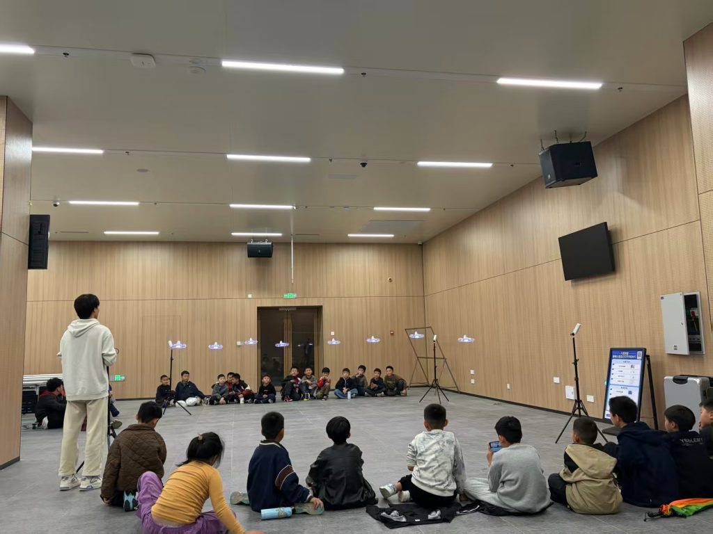
Core Objectives of Oblique Photogrammetry in Drone Training
The primary educational goal for an oblique photogrammetry course within a vocational drone training program is to cultivate specialized technical personnel capable of executing integrated end-to-end operations. These professionals are oriented towards roles in various related industries, dedicated to technical positions involving drone-based oblique photogrammetric surveys. The curriculum’s core competencies encompass the operational ability for field data acquisition using drones, three-dimensional modeling, and the application of software for model segmentation (model “single-entity” extraction).
Through this course, students should master the fundamental theories and methods of drone oblique photogrammetry and develop proficiency in using related measurement systems and instrumentation. Specifically, graduates of this drone training should be able to perform the following tasks:
- Design and deploy ground control points (GCPs) in a target area.
- Execute mission planning and drone-based data acquisition flights.
- Process acquired imagery to generate detailed 3D models.
- Perform model segmentation for individual structure extraction.
- Utilize platforms for 3D model visualization and presentation.
These skills ensure students are equipped to handle various tasks in practical work settings. Furthermore, the curriculum should foster a preliminary sense of technological innovation and an understanding of entrepreneurial applications, laying a solid foundation for career development. The drone training also emphasizes comprehensive application abilities, preparing students for roles in surveying and mapping, geology, geography, land resources and environmental management, agriculture, forestry, meteorology, powerline inspection, urban planning, and other fields where oblique photogrammetry is applied.
The pedagogical structure can be visualized through the integration of theoretical knowledge and practical skill development, both underpinned by continuous assessment which is central to effective drone training.
| Knowledge Domain | Practical Skill Output | Assessment Metric |
|---|---|---|
| Photogrammetry Principles & Flight Physics | Accurate Mission Planning & Safe Flight Operation | Flight plan compliance & incident rate |
| Sensor Technology & Data Acquisition | High-Quality, Well-Covered Image Dataset Capture | Image sharpness, overlap sufficiency |
| 3D Reconstruction Theory | Generation of Georeferenced, Textured 3D Models | Model geometric accuracy & visual fidelity |
| Geospatial Analysis | Derivation of Measurements (Distance, Area, Volume) & Model Segmentation | Measurement error against ground truth |
Prevalent Challenges in Practical Drone Training for Oblique Photogrammetry
Despite the clear objectives, implementing effective practical drone training for oblique photogrammetry faces several significant hurdles.
First, a shortage of teaching equipment and resources. Oblique photogrammetry demands high-specification equipment: multi-camera sensor systems, high-precision GNSS/IMU units, and high-performance computing workstations with professional data processing software. Due to budgetary constraints common in vocational institutions, many cannot procure sufficient advanced equipment. Consequently, students often practice on limited simulation setups or share few devices, unable to experience authentic operational scenarios fully. Furthermore, the development of dedicated infrastructure, such as UAV flight training fields and well-equipped data processing laboratories, often lags, hindering the effective rollout of hands-on drone training.
Second, a disconnect between curriculum content and industry needs. Some vocational curricula remain anchored to basic theoretical knowledge, failing to update promptly with the latest technological advancements and real-world application cases in oblique photogrammetry. This lag creates a gap between the skills students acquire and the actual demands of the evolving industry, leaving them ill-prepared for complex on-the-job problems. For instance, courses may lack in-depth tutorials and hands-on exercises for advanced data processing software, leaving students unable to handle and analyze image data efficiently in real projects. An overemphasis on theoretical lecturing at the expense of practical operation further prevents the organic integration of theory and practice, which is the cornerstone of quality drone training.
Third, insufficient student hands-on operation opportunities. Mastery of oblique photogrammetry requires extensive practical repetition. Only through repeated practice can students internalize device operation protocols and data processing techniques. However, due to limited equipment and often inflexible course scheduling, students’ opportunities for actual flight missions and substantive data processing work remain scarce, severely limiting the practical outcomes of their drone training.
Strategic Countermeasures for Enhanced Practical Drone Training
To address these challenges and elevate the standard of drone training, a multi-faceted strategic approach is necessary.
Augmenting Equipment and Resource Investment
Increasing investment in equipment and resources is fundamental. This entails procuring more drones and oblique photography payloads, alongside establishing robust data processing platforms.
- Vocational institutions must prioritize funding for drones equipped with multi-lens camera systems, high-accuracy GNSS/IMU, and other relevant peripherals. This not only meets basic learning needs but also provides ample practice opportunities in realistic environments. Exposure to advanced industry-standard equipment during drone training enhances students’ familiarity with frontier technology, boosting their professional competitiveness.
- Since oblique photogrammetry involves massive data processing, investment in high-performance computing labs with professional software (e.g., DJI Terra, Pix4Dmapper, Agisoft Metashape) is non-negotiable. These labs provide the essential environment for practical data handling. Regular software and hardware updates are crucial to keep the drone training content synchronized with industry standards. Partnerships with software vendors for educational licenses can reduce costs and increase resource utilization.
Optimizing Curriculum Content and Structure
Enhancing the effectiveness of drone training requires a deliberate optimization of both content and course structure. Theoretical instruction must be scientifically sound and forward-looking, covering core principles, trends, applications, and data processing methodologies. It should integrate case studies of real-world projects to bolster understanding and engagement. Foundational knowledge in drone flight principles, aerial photography techniques, and safety protocols must underpin the practical modules.
The practical component should be designed around cultivating operational proficiency. A comprehensive, semester-long project that mirrors a real workflow is highly effective. This project should encompass the entire pipeline from planning to final deliverable, with specific, measurable stages. The performance in such a project can be quantitatively analyzed to identify areas needing reinforcement within the drone training program.
| Operational Phase | Avg. Time (hours) | Success Rate (%) | Primary Challenges Identified |
|---|---|---|---|
| Flight Planning & GCP Design | 1.5 | 95 | Planning for complex topography |
| Field Data Acquisition | 3.5 | 85 | Adverse weather & lighting conditions |
| Data Processing (Alignment, Densification) | 5.0 | 80 | Large dataset volume, long processing time |
| 3D Modeling & Texturing | 6.0 | 85 | Balancing model accuracy with detail representation |
| Product Generation & Presentation | 2.5 | 90 | Output quality control and effective visualization |
Table 1 reveals that student success rates are relatively lower in the data processing and 3D modeling phases, primarily due to the complexity of the software and the high demands for precision. Therefore, the drone training curriculum should institute targeted training modules for these specific pain points, such as intensive software workshops and increased practice time on modeling tasks. A strong feedback mechanism is essential to promptly identify student difficulties and adapt teaching strategies accordingly.
Strengthening the Faculty Team
A competent instructor team is critical for high-quality drone training. Institutions should regularly organize faculty participation in industry training and seminars to keep abreast of the latest technology. Secondment programs that place teachers in relevant enterprises for hands-on project experience are invaluable; this practical knowledge enriches teaching with concrete examples and techniques. Furthermore, actively recruiting professionals with substantial industry experience into the faculty brings cutting-edge knowledge and career guidance for students. Inviting industry experts as guest lecturers for specialized talks can also broaden perspectives and enhance the practical relevance of the drone training.
Deepening Industry-Academia Collaboration
Industry-academia cooperation leverages the strengths of both sectors, enabling resource sharing and complementarity. Schools can utilize enterprise platforms to compensate for shortcomings in equipment, cutting-edge technology, and project experience. Through deep collaboration with leading companies, institutions can integrate current industry dynamics and requirements into the drone training curriculum, making it more relevant. This partnership provides students with authentic professional environment exposure, familiarizing them with industry standards and operational norms, thereby enhancing their employability. The involvement of enterprise experts diversifies instructional content and broadens student horizons regarding the applications of drone oblique photogrammetry.
For example, a vocational college can co-establish an off-campus training base with a drone service company. This base, equipped with advanced gear, simulates real work environments. Student groups can execute complete projects—from flight planning and data capture to 3D modeling—under the guidance of both academic and industry mentors. Post-project evaluations by industry experts provide crucial, real-world feedback. Regular seminars hosted by company technicians on topics like “Drone Applications in Smart City Development” keep the drone training content current and application-oriented.
Case Study Analysis in Drone Training
Project Overview
A practical case within a drone training program involved the 3D documentation of a prominent multi-story structure. The target was a complex architectural form, approximately 15 meters in height, featuring intricate design elements. The project employed a DJI Mavic 3 Enterprise RTK drone, selected for its high-resolution imaging capabilities and centimeter-level positioning accuracy, which are essential for high-fidelity modeling tasks central to advanced drone training.
Standardized Workflow
The operation followed a standardized photogrammetric workflow, a key component of professional drone training:
- Reconnaissance & Planning: A pre-flight site survey was conducted using interactive maps to define the survey area. Preliminary GCP locations were planned considering project scale and accuracy requirements. Both targeted and painted GCP markers were utilized. The density of GCPs was increased by approximately 15% due to the site’s architectural complexity and terrain variations.
- Mission Planning: Flight planning software was used to design the autonomous flight path. Key parameters were set as follows: flight altitude was set at 90m (ensuring a safe margin above the structure), forward overlap at 80%, side overlap at 70%. Camera exposure was set to automatic with bracketing to handle variable lighting.
- Field Execution: GCPs were surveyed using a high-precision handheld RTK GNSS receiver. The drone then executed the planned mission at a speed of 8 m/s, capturing imagery at a ground sampling distance (GSD) of approximately 1.5 cm. The mission yielded 8,572 images along with precise POS (Position and Orientation System) data for each capture.
Data Processing & Quantitative Analysis
Following field acquisition, the imagery and GCP coordinates were processed using professional software (e.g., DJI Terra). The pipeline involved creating a new project, importing data, performing aerial triangulation (AT), manually marking GCPs in the images for georeferencing, and finally generating the textured 3D mesh model.
The quality of the final 3D model is often evaluated using error metrics derived from check points (independent points not used in the georeferencing process). A common measure is the Root Mean Square Error (RMSE) in the Z (elevation) dimension, which can be expressed as:
$$RMSE_Z = \sqrt{\frac{1}{n}\sum_{i=1}^{n}(Z_{measured_i} – Z_{model_i})^2}$$
where \(n\) is the number of check points, \(Z_{measured_i}\) is the surveyed elevation, and \(Z_{model_i}\) is the elevation extracted from the model. A lower RMSE_Z indicates higher vertical accuracy, a critical learning outcome in precision-focused drone training.
The performance and learning curve for students during such a capstone project can be systematically evaluated, as shown in the analysis below:
| Operational Phase | Avg. Time (hours) | Success Rate (%) | Primary Learning Hurdles |
|---|---|---|---|
| Site Reconnaissance & GCP Deployment | 2.0 | 100 | Optimal GCP placement strategy |
| Mission Planning | 1.5 | 95 | Balancing coverage, resolution, and efficiency |
| Field Data Acquisition | 4.0 | 90 | Managing flight stability and variable environmental factors |
| Data Processing (AT, Densification) | 5.0 | 85 | Managing computational resources for large datasets |
| 3D Modeling & Texturing | 6.0 | 80 | Achieving required geometric precision and texture detail |
| Total / Weighted Avg. | 18.5 | 90 |
Table 2 indicates that initial phases like reconnaissance and planning show high success rates, reflecting well-established procedural drone training. The primary challenges manifest in the computationally intensive and skill-sensitive stages of data processing and detailed 3D modeling. The slight drop in success rate in these latter phases highlights an area for concentrated skill development within the drone training program, such as advanced software modules and more iterative practice on complex models.
Conclusion
The oblique photogrammetry course within a vocational drone training program plays an indispensable role in developing students’ professional technical capabilities, practical operational skills, and innovative mindset. Through systematic curriculum design and enriched practical teaching methodologies, students can achieve a comprehensive grasp of the fundamental theories and methods. They become proficient in executing data acquisition, 3D reconstruction, and model analysis tasks relevant to real-world applications. These competencies not only address the current industry demand for highly skilled technicians but also establish a robust foundation for the students’ lifelong career development and adaptation to future technological advancements. The continuous refinement of practical drone training, supported by adequate resources, updated content, expert faculty, and strong industry links, is paramount for producing graduates who are immediately effective and capable of driving innovation in the fields of geospatial data acquisition and analysis.