In recent years, the rapid advancement of technology has revolutionized various fields, and natural resource surveying engineering is no exception. Traditional surveying methods, which often rely on manual measurements and ground-based instruments, face significant limitations in terms of accuracy, efficiency, and adaptability to complex environments. These methods require high measurement conditions and frequently fail to produce densely detailed graphical representations that meet modern engineering demands. As socioeconomic development accelerates, the demand for residential and infrastructure projects has surged, making it imperative to enhance surveying quality to ensure project success and safety. In this context, drone remote sensing technology has emerged as a transformative tool, offering unparalleled capabilities in data acquisition, real-time monitoring, and spatial analysis. From my perspective as an industry practitioner, the integration of drones into surveying workflows not only streamlines processes but also opens new avenues for innovation in resource management, environmental protection, and disaster response.
The core of drone remote sensing lies in its ability to capture high-resolution imagery and geospatial data from aerial platforms, leveraging advanced sensors and communication systems. For instance, in emergency scenarios, drones have proven instrumental in providing rapid assessments, as seen in cases where they delivered critical data within hours of a disaster—far outperforming traditional methods. This technology encompasses multiple technical aspects, including communication protocols, positioning systems, real-time data transmission, and intelligent data interpretation. Throughout this discussion, I will delve into these elements, emphasizing the importance of comprehensive drone training to maximize potential. By fostering skilled operators and analysts, we can address existing challenges and harness drones for more effective natural resource surveying. Below, I outline key application points, current limitations, and strategic approaches, supported by tables and formulas to summarize complex concepts.
Analysis of Key Application Points in Drone Remote Sensing
The effectiveness of drone remote sensing in surveying engineering hinges on several technological pillars. Each component contributes to the overall performance, from data collection to processing, and understanding them is crucial for optimization. Here, I explore four critical aspects: communication technology, GPS positioning, real-time monitoring, and intelligent analysis, with a focus on how drone training enhances their implementation.
Communication Technology
Communication technology serves as the backbone of drone operations, enabling seamless data exchange between the aerial platform and ground stations. Drones typically utilize wireless protocols such as 4G/5G, Wi-Fi, and Bluetooth to transmit high-volume data, including imagery, sensor readings, and control signals. The reliability of these communications directly impacts data accuracy and timeliness, especially in remote or harsh environments. From my experience, advanced communication systems allow for real-time monitoring of environmental parameters like air quality or water pollution, facilitating immediate analysis and decision-making. The data transmission rate can be modeled using Shannon’s theorem, which defines the maximum achievable rate \(R\) in bits per second:
$$ R = B \log_2 \left(1 + \frac{S}{N}\right) $$
where \(B\) is the bandwidth and \(S/N\) is the signal-to-noise ratio. This formula underscores the need for robust communication links to handle the dense data streams from drones. In practice, enhancing communication efficiency often requires specialized drone training for operators to manage network configurations and troubleshoot issues. The table below summarizes key communication technologies and their applications in drone surveying:
| Technology | Data Rate | Range | Use Case in Surveying |
|---|---|---|---|
| 4G/5G | Up to 10 Gbps | Wide area | Real-time HD video streaming for large-scale mapping |
| Wi-Fi | Up to 1 Gbps | Short range (100 m) | Local data transfer in field operations |
| Bluetooth | Up to 2 Mbps | Short range (10 m) | Device pairing and control interfaces |
By integrating these technologies, drones achieve high flexibility, but their performance depends on operator expertise gained through rigorous drone training programs.
GPS Positioning Technology
Accurate positioning is fundamental to geospatial data integrity in drone surveying. GPS technology, often augmented with Real-Time Kinematic (RTK) corrections, provides precise location, velocity, and time information by triangulating signals from multiple satellites. The positioning error \(\sigma\) can be expressed as a function of individual component errors:
$$ \sigma = \sqrt{\sigma_x^2 + \sigma_y^2 + \sigma_z^2} $$
where \(\sigma_x\), \(\sigma_y\), and \(\sigma_z\) represent errors in longitude, latitude, and altitude, respectively. Standard GPS offers meter-level accuracy, while RTK can achieve centimeter-level precision, essential for detailed terrain modeling or cadastral surveys. In my work, I’ve observed that GPS modules—comprising antennas, receivers, and signal processors—enable autonomous flight paths and reliable data georeferencing. However, factors like multipath interference or atmospheric conditions can degrade accuracy, necessitating advanced drone training to calibrate systems and interpret results. For example, in land resource investigations, precise GPS positioning allows drones to capture ground feature information, supporting management and planning. The following table contrasts GPS modes:
| GPS Mode | Accuracy | Typical Application | Training Requirement |
|---|---|---|---|
| Standard GPS | 3-5 meters | Broad area mapping | Basic operation and data logging |
| RTK GPS | 1-3 centimeters | High-precision cadastral surveys | Advanced calibration and error analysis |
Through dedicated drone training, surveyors learn to leverage these technologies effectively, minimizing errors and enhancing dataset reliability.
Real-Time Monitoring and Rapid Response
One of the standout advantages of drone remote sensing is its capacity for real-time monitoring and swift response to dynamic situations. Drones are lightweight, portable, and can be deployed quickly without extensive infrastructure, making them ideal for emergency scenarios like natural disasters. Their agility allows them to reach inaccessible areas within minutes, capturing imagery that provides first-hand insights for rescue operations. Statistically, drones can conduct preliminary damage assessments within an hour post-disaster, outperforming traditional methods by a factor of several. This capability hinges on high-speed data transmission and sensor integration, but it also demands proficient operators who can navigate complex environments. In my view, drone training is critical to harnessing this potential, as it equips teams with skills in flight planning, situational awareness, and data prioritization. The responsiveness \(R_t\) of a drone system can be quantified as:
$$ R_t = \frac{D}{T} $$
where \(D\) is the data coverage area and \(T\) is the time to acquisition. By optimizing \(R_t\) through training, we improve disaster management outcomes, as evidenced in cases where drones have aided in flood or earthquake responses.
Intelligent Analysis and Interpretation
The voluminous high-resolution imagery collected by drones requires sophisticated analysis to extract meaningful insights. Intelligent techniques, such as convolutional neural networks (CNNs) and recurrent neural networks (RNNs), automate the identification and monitoring of features like vegetation cover, water bodies, or urban sprawl. For instance, CNNs apply convolution operations to images, defined for a 2D input \(I\) and kernel \(K\) as:
$$ (I * K)(i,j) = \sum_{m} \sum_{n} I(i-m, j-n) K(m,n) $$
This enables automatic classification with errors under 5%, facilitating tasks like vegetation dynamics assessment or soil erosion monitoring. In one watershed study, drone-based analysis revealed a 20% annual reduction in soil loss, demonstrating the value of these methods. However, implementing such algorithms requires expertise in machine learning and data science, underscoring the need for continuous drone training. Through workshops and courses, surveyors can learn to deploy these tools, improving efficiency and accuracy. The table below highlights common intelligent analysis applications:
| Algorithm | Function | Accuracy | Training Focus |
|---|---|---|---|
| CNN | Image classification and object detection | 90-95% | Model training and validation techniques |
| RNN | Time-series analysis for change detection | 85-90% | Sequential data processing and interpretation |
By investing in drone training, we empower professionals to leverage these advanced analytics, turning raw data into actionable intelligence for resource management.
Current Status of Drone Remote Sensing in Natural Resource Surveying
Despite its promise, drone remote sensing faces several challenges that hinder its widespread adoption in surveying engineering. From data quality issues to regulatory constraints, these limitations must be addressed to unlock full potential. Based on my observations, the current landscape involves three primary areas of concern: data accuracy and stability, data processing capabilities, and legal frameworks. Each aspect intersects with the necessity for robust drone training to mitigate risks and enhance performance.
Data Accuracy and Stability Problems
Data accuracy and stability remain persistent hurdles in drone surveying. Unmanned platforms and onboard sensors are susceptible to environmental factors—such as wind, rain, or electromagnetic interference—that can compromise data quality. For example, flight altitude, speed, and sensor performance introduce variability, leading to inconsistencies in photogrammetric outputs like digital elevation models or orthophotos. The overall error \(E\) in drone-derived data can be modeled as a composite of multiple sources:
$$ E = \alpha \cdot E_{\text{sensor}} + \beta \cdot E_{\text{flight}} + \gamma \cdot E_{\text{env}} $$
where \(E_{\text{sensor}}\), \(E_{\text{flight}}\), and \(E_{\text{env}}\) represent errors from sensors, flight dynamics, and environment, respectively, with weights \(\alpha\), \(\beta\), \(\gamma\). To reduce \(E\), we must improve hardware and operational protocols, which is where drone training plays a pivotal role. Trained operators can execute calibrated flights, maintain equipment, and apply correction algorithms, thereby enhancing data reliability. The table below summarizes key factors affecting accuracy:
| Factor | Impact on Accuracy | Mitigation via Training |
|---|---|---|
| Flight height | Higher altitude reduces ground resolution | Teach optimal altitude planning for specific surveys |
| Weather conditions | Wind causes image blur; rain degrades sensors | Instruct on weather assessment and flight postponement |
| Sensor calibration | Misalignment leads to geometric distortions | Provide hands-on calibration workshops |
Through targeted drone training, we can stabilize data outputs, making drones more dependable for critical applications like cadastral mapping or environmental monitoring.
Insufficient Data Processing and Analysis Capabilities
The sheer volume and complexity of drone-captured data often overwhelm traditional processing pipelines. Raw imagery may contain noise, motion blur, or misalignments due to drone movements, necessitating preprocessing steps like deblurring or orthorectification. These tasks are time-consuming and require advanced software skills, highlighting a gap in analytical capacity. Moreover, drone data are often multi-source—combining optical, LiDAR, or thermal inputs—requiring fusion techniques for comprehensive interpretation. While machine learning algorithms offer solutions, their implementation demands expertise that many surveying teams lack. In my experience, this underscores the value of drone training focused on data science. For instance, training programs can cover tools for point cloud processing or spectral analysis, enabling more efficient workflows. The processing time \(T_p\) for drone data can be approximated as:
$$ T_p = N \cdot t_{\text{unit}} + C $$
where \(N\) is the number of images, \(t_{\text{unit}}\) is time per image, and \(C\) is a constant for fusion overhead. By optimizing \(t_{\text{unit}}\) through skilled personnel, we accelerate project timelines. The following table outlines common processing challenges and training remedies:
| Challenge | Description | Training Solution |
|---|---|---|
| Image stitching errors | Misalignment in panoramic mosaics | Teach photogrammetry software usage (e.g., Agisoft Metashape) |
| LiDAR data noise | Outliers in point clouds from sensor artifacts | Offer courses on filtering algorithms and classification |
| Multispectral analysis | Difficulty in interpreting band combinations | Provide workshops on spectral indices like NDVI |
Investing in drone training thus bridges the gap between data acquisition and actionable insights, fostering more competent surveying teams.
Regulatory Policies and Privacy Protection Limitations
Legal and privacy concerns pose significant barriers to drone deployment in surveying. Regulations, such as aviation laws and no-fly zones, govern drone operations to ensure safety and security. For example, drones over 250 grams often require registration, and flights in sensitive areas may need permits. Additionally, data collection must comply with privacy laws to prevent unauthorized surveillance of individuals. These constraints necessitate thorough knowledge of legal frameworks, which can be imparted through drone training. In my practice, I’ve seen how training programs include modules on regulatory compliance, teaching operators to navigate airspace restrictions and data ethics. The risk \(R_l\) of legal non-compliance can be expressed as:
$$ R_l = P_{\text{violation}} \cdot C_{\text{penalty}} $$
where \(P_{\text{violation}}\) is the probability of violating rules and \(C_{\text{penalty}}\) is the associated cost. By reducing \(P_{\text{violation}}\) via education, we mitigate legal risks. The table below lists key regulatory aspects and training responses:
| Regulatory Aspect | Requirement | Training Component |
|---|---|---|
| Flight authorization | Permits for controlled airspace | Guide on application processes and flight planning tools |
| Data privacy | Anonymization of personal information in imagery | Ethics courses on data handling and encryption |
| Equipment standards | Compliance with safety certifications | Technical sessions on maintenance and standards |
Thus, comprehensive drone training not only enhances technical skills but also ensures lawful and ethical operations, protecting both surveyors and the public.
Effective Application Strategies for Drone Remote Sensing in Natural Resource Surveying
To overcome current challenges and leverage drone technology fully, strategic initiatives are essential. From my viewpoint, these should prioritize technological innovation, legal adaptation, human resource development, and collaborative frameworks. Central to all is the emphasis on drone training, as it underpins successful implementation. Below, I outline four strategies, incorporating tables and formulas to illustrate their impact.
Strengthening Technology R&D and Standardization
Advancing technology research and development (R&D) alongside standardization is crucial for improving drone performance and interoperability. This involves enhancing communication systems, refining GPS algorithms, and establishing industry-wide standards for data formats and processing workflows. For instance, integrating 5G technology can boost data transmission rates, while standardized protocols ensure consistency across projects. The benefit \(B\) of R&D investments can be modeled as:
$$ B = \sum_{i=1}^{n} (E_i \cdot I_i) $$
where \(E_i\) is the efficiency gain from innovation \(i\) and \(I_i\) is its implementation level. To achieve this, drone training must evolve to include cutting-edge technologies, preparing operators for new tools and methods. The table below presents R&D focus areas and associated training needs:
| R&D Area | Goal | Training Curriculum |
|---|---|---|
| Communication upgrades | Real-time HD video streaming with low latency | Courses on 5G network management and troubleshooting |
| Sensor miniaturization | Lighter drones with enhanced payload capacity | Workshops on sensor integration and calibration |
| Data standardization | Uniform formats for easy sharing and analysis | Sessions on ISO standards and metadata tagging |
By coupling R&D with targeted drone training, we accelerate adoption and ensure that technological gains translate into practical surveying benefits.
Improving Legal Regulations and Flight Management Systems
Clear and adaptive legal frameworks are vital for safe and compliant drone operations. This includes updating aviation laws to accommodate drone specifics, streamlining permit processes, and defining privacy guidelines. In my experience, effective flight management systems—incorporating geofencing and real-time tracking—reduce accidents and unauthorized incursions. The compliance rate \(C_r\) can be improved through training:
$$ C_r = \frac{N_{\text{compliant}}}{N_{\text{total}}} = f(T) $$
where \(T\) represents training intensity. Thus, drone training programs should cover regulatory modules, teaching operators to navigate legal landscapes. For example, training can simulate flight scenarios in restricted zones, emphasizing protocol adherence. The table below links legal components to training interventions:
| Legal Component | Challenge | Training Intervention |
|---|---|---|
| Airspace classification | Confusion over no-fly zones vs. permitted areas | Interactive maps and quizzes on airspace rules |
| Data security laws | Risk of breaching privacy during surveys | Case studies on ethical data collection and storage |
| Insurance requirements | Liability coverage for drone operations | Seminars on insurance policies and risk management |
Through such drone training, we foster a culture of compliance, minimizing legal hurdles and enhancing public trust in drone-based surveying.
Enhancing Talent Cultivation and Technical Training
The human element is perhaps the most critical factor in drone surveying success. Cultivating a skilled workforce through education and hands-on training ensures that technological tools are used effectively. Drone training should encompass both foundational knowledge—such as remote sensing principles and flight mechanics—and advanced skills like data analysis or machine learning. From my perspective, integrating training into academic curricula and professional development programs is key. The competency level \(L_c\) of an operator can be expressed as:
$$ L_c = \alpha \cdot K + \beta \cdot S + \gamma \cdot E $$
where \(K\) is knowledge, \(S\) is skills, and \(E\) is experience, with weights \(\alpha\), \(\beta\), \(\gamma\). Training programs aim to maximize \(L_c\) by balancing these components. The following table outlines a sample training framework:
| Training Module | Content | Duration | Outcome |
|---|---|---|---|
| Basic flight operations | Drone piloting, safety checks, maintenance | 40 hours | Certified drone pilot license |
| Data acquisition techniques | Sensor selection, flight planning, image capture | 30 hours | Ability to design efficient survey missions |
| Advanced analytics | GIS integration, machine learning for image analysis | 50 hours | Proficiency in deriving insights from drone data |
Inserting a visual element here, I recall that practical drone training often involves field exercises, as depicted below:
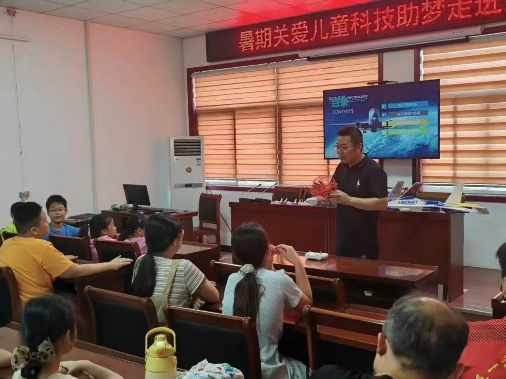
This image underscores the hands-on nature of effective drone training, where learners engage directly with equipment and scenarios. By prioritizing such education, we build a pipeline of experts capable of driving innovation in natural resource surveying.
Promoting Cross-Department Collaboration and Data Sharing
Breaking down silos between agencies and institutions amplifies the impact of drone surveying. Cross-department collaboration—for example, between environmental, agricultural, and urban planning bodies—facilitates data pooling and holistic resource management. Data sharing platforms, powered by cloud computing, enable real-time access to drone-derived datasets, improving decision-making. The synergy \(S_y\) from collaboration can be quantified as:
$$ S_y = \frac{\sum \text{Shared Data}}{\text{Total Data}} \cdot \text{Utilization Rate} $$
To achieve high \(S_y\), stakeholders need common standards and interoperable systems, which are taught in drone training programs focusing on collaboration tools. In my work, I’ve seen how joint projects between universities and industry boost innovation, such as developing custom image processing algorithms. The table below illustrates collaboration benefits and training supports:
| Collaboration Type | Benefit | Training Support |
|---|---|---|
| Government-academia partnerships | Access to research insights and testing grounds | Workshops on project management and grant writing |
| Inter-agency data sharing | Comprehensive datasets for regional planning | Courses on data governance and platform usage |
| Public-private initiatives | Commercial deployment of drone solutions | Seminars on business models and regulatory alignment |
Through inclusive drone training that emphasizes teamwork and data ethics, we foster ecosystems where shared knowledge accelerates progress in surveying engineering.
Conclusion
In summary, drone remote sensing represents a paradigm shift in natural resource surveying engineering, offering enhanced precision, efficiency, and versatility over traditional methods. From communication and positioning technologies to real-time monitoring and intelligent analysis, drones have proven their value across diverse applications, including land use planning, environmental conservation, and disaster response. However, challenges related to data accuracy, processing capabilities, and regulatory compliance persist, necessitating strategic interventions. Central to overcoming these hurdles is comprehensive drone training, which equips professionals with the skills to harness technology effectively. By investing in R&D, legal frameworks, talent development, and collaborative networks—all underpinned by rigorous training—we can unlock the full potential of drones. As technology continues to evolve, I am confident that drone-based surveying will become even more integral to sustainable resource management, driven by a well-trained workforce ready to innovate and adapt.