
In the rapidly evolving landscape of modern agriculture, the integration of artificial intelligence (AI) with unmanned aerial vehicles (UAVs) has emerged as a transformative force. As a researcher deeply immersed in this field, I have observed how agricultural UAVs, often referred to as drones, are revolutionizing tasks such as crop spraying, seeding, monitoring, and data collection. However, the core efficiency and precision of these operations hinge critically on the sophistication of route planning. Traditional methods, reliant on static maps and linear algorithms, fall short in dynamic agricultural environments. In this article, I explore the paradigm shift brought by AI in optimizing farmland route planning for agricultural UAVs, addressing inherent challenges, proposing intelligent strategies, and outlining systemic approaches for implementation. Through detailed analysis, tables, and mathematical formulations, I aim to provide a comprehensive perspective on harnessing AI to elevate the capabilities of agricultural UAVs.
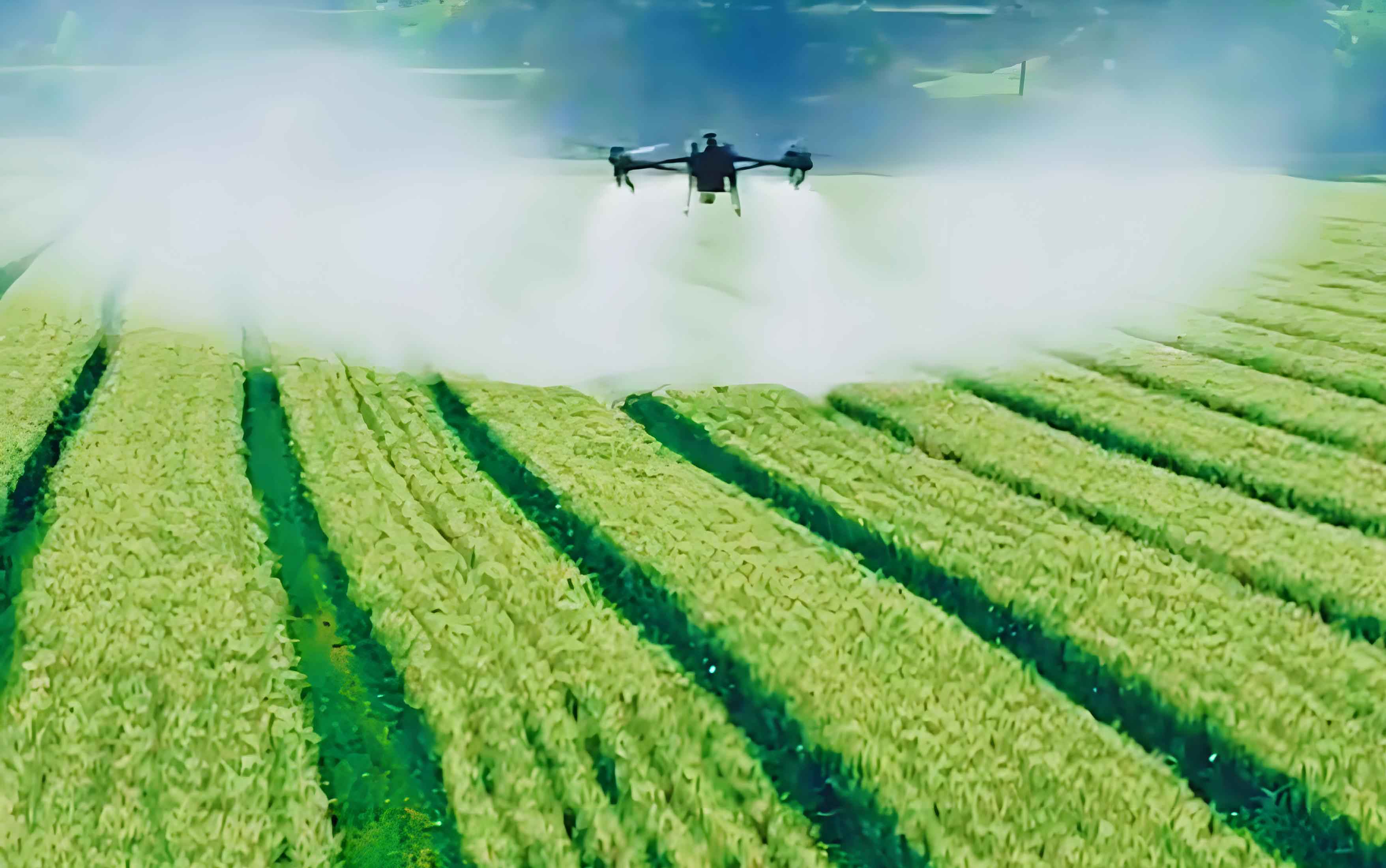
The advent of digital agriculture has propelled agricultural UAVs into the spotlight as indispensable tools for precision farming. These aerial platforms offer unparalleled flexibility, reducing labor costs and enabling targeted interventions. Yet, their potential is often bottlenecked by suboptimal route planning. In my experience, the planning process for agricultural UAVs must balance multiple, sometimes conflicting, objectives: maximizing coverage accuracy, minimizing operational time, conserving energy, and adapting to real-time field conditions. AI, with its capabilities in machine learning, computer vision, and optimization, presents a groundbreaking avenue to transcend these limitations. This article delves into the real-world dilemmas faced in agricultural UAV route planning, reconstructs strategies through an AI lens, and proposes actionable frameworks to foster widespread adoption. By emphasizing the role of AI, I seek to underscore how intelligent algorithms can transform agricultural UAVs from mere flying machines into autonomous, decision-making agents in the agricultural ecosystem.
Real-World Challenges in Agricultural UAV Route Planning
In practical scenarios, route planning for agricultural UAVs is fraught with complexities that stem from the inherent trade-offs and environmental variabilities. From my analysis, two primary dilemmas persistently hinder optimal performance: the tension between operational accuracy and efficiency, and the conflicts arising in complex terrains or multi-objective missions. These issues are not merely technical but are deeply intertwined with the economic and ecological sustainability of farming practices.
First, the contradiction between precision and efficiency is a fundamental challenge. Agricultural UAVs are tasked with applications like pesticide spraying or fertilizer distribution, where uniform coverage at centimeter-level accuracy is crucial to avoid over-application (leading to pollution and waste) or under-application (compromising crop health). To achieve high precision, agricultural UAVs often must fly slower, increase path density, or incorporate overlapping routes, which inherently reduces the area covered per unit time and raises energy consumption. Conversely, prioritizing speed and minimal turns can create gaps or uneven distribution. This trade-off can be modeled as a multi-objective optimization problem. For instance, let the coverage error \(E_c\) and operational time \(T\) be key metrics. The goal is to minimize both, but they are often inversely related. A simple representation is:
$$ \text{Minimize } F = \alpha \cdot E_c + \beta \cdot T $$
where \(\alpha\) and \(\beta\) are weighting coefficients reflecting the importance of accuracy versus efficiency. In traditional planning, these weights are fixed, but AI allows for dynamic adjustment based on real-time data. For example, in sensitive crop stages, \(\alpha\) might be increased to prioritize accuracy. The table below summarizes key factors influencing this trade-off for agricultural UAVs:
| Factor | Impact on Precision | Impact on Efficiency |
|---|---|---|
| Flight Speed | Higher speed reduces spray uniformity | Increases area coverage per hour |
| Path Overlap | Increases coverage completeness | Decreases effective coverage rate |
| Turning Radius | Tighter turns improve adaptability | Increases time and energy per turn |
| Sensor Resolution | Higher resolution boosts accuracy | May slow data processing |
Second, complex terrains and multi-objective missions introduce severe route conflicts. Agricultural UAVs frequently operate in heterogeneous environments such as hills, orchards, or fields interspersed with obstacles like trees, power lines, or irrigation channels. In these settings, predefined linear paths fail to account for elevation changes or sudden barriers, leading to safety risks or incomplete coverage. For instance, in terraced farmland, an agricultural UAV must constantly adjust altitude to maintain optimal spraying height, which complicates path continuity. Moreover, modern farming demands that a single flight of an agricultural UAV accomplishes multiple tasks—say, simultaneous crop health monitoring and targeted spraying. Each task has distinct requirements: monitoring may need high-altitude, stable flights for imagery, while spraying requires low-altitude, slow movement. Coordinating these without conflict is non-trivial. The path planning problem here becomes a constrained optimization challenge. Let \(P\) represent a path composed of waypoints \((x_i, y_i, z_i)\), and let \(O_j\) denote obstacles. The objective might be to minimize total path length \(L(P)\) while ensuring coverage of all task zones \(Z_k\) and avoiding obstacles:
$$ \text{Minimize } L(P) = \sum_{i=1}^{n-1} \sqrt{(x_{i+1} – x_i)^2 + (y_{i+1} – y_i)^2 + (z_{i+1} – z_i)^2} $$
subject to:
$$ \text{distance}(P, O_j) \geq d_{\text{safe}}, \quad \forall j $$
$$ \text{coverage}(P, Z_k) \geq C_{\text{min}}, \quad \forall k $$
where \(d_{\text{safe}}\) is the safe distance from obstacles, and \(C_{\text{min}}\) is the minimum coverage required per zone. Traditional algorithms struggle with such multi-constraint problems, but AI techniques like reinforcement learning can explore solution spaces more effectively.
Reconstructing Route Planning Strategies Through Artificial Intelligence
To overcome these challenges, I propose a holistic reconstruction of route planning strategies centered on AI. This involves three interconnected pillars: intelligent path generation with real-time perception feedback, machine learning-based modeling of agricultural behaviors, and multi-level intervention of AI algorithms. These components collectively enable agricultural UAVs to achieve adaptive, efficient, and precise operations.
Intelligent Path Generation and Perception Feedback Mechanisms
In AI-driven systems, path planning for agricultural UAVs evolves from a static pre-flight activity to a dynamic, closed-loop process. Initially, the agricultural UAV leverages onboard sensors—such as LiDAR, multispectral cameras, and GPS—to create a high-resolution 3D map of the farmland. This map includes terrain contours, crop rows, and identified obstacles. AI algorithms, like convolutional neural networks (CNNs), process this data to segment the field into navigable zones and no-fly areas. The path generation then employs heuristic or optimization algorithms to produce an initial route. However, the true innovation lies in the perception feedback loop. During execution, the agricultural UAV continuously monitors environmental variables: wind speed, humidity, spray nozzle status, or unexpected obstacles. Edge computing units on the agricultural UAV analyze this data in real time. If deviations are detected—say, a sudden gust diverting the drone—the system triggers a feedback mechanism to recalibrate the path locally. This can be formulated as a control problem. Let \(X_t\) be the state vector (position, velocity, sensor readings) at time \(t\), and \(U_t\) be the control action (adjusted path waypoints). The feedback law might be:
$$ U_t = K \cdot (X_{\text{desired}} – X_t) + \int_{0}^{t} (X_{\text{desired}} – X_{\tau}) d\tau $$
where \(K\) is a gain matrix optimized via AI. This approach ensures that the agricultural UAV not only reacts to changes but also learns from them. Historical feedback data is stored to refine future path predictions, creating a self-improving system. For instance, if certain wind patterns consistently cause drift, the algorithm can preemptively adjust paths in similar conditions.
Machine Learning-Based Modeling of Farmland Operational Behaviors
Moving beyond geometric path planning, AI enables the modeling of entire agricultural operations as learned behaviors. By leveraging machine learning, we can capture the nuanced patterns of how agricultural UAVs interact with farmland over time. Supervised learning techniques, for example, use labeled datasets of “successful” and “failed” routes to train classifiers that evaluate path quality based on metrics like coverage ratio, energy consumption, and avoidance success. These models can pre-screen proposed routes before deployment. Unsupervised learning, such as clustering, identifies common operational patterns from historical flight logs of agricultural UAVs. For instance, clustering might reveal that in rice paddies, optimal paths often involve spiral patterns, while in orchards, zigzag routes prevail. This knowledge informs adaptive planning. Deep learning, particularly recurrent neural networks (RNNs), can model temporal dependencies. Consider an RNN that predicts pest outbreak zones based on historical data; the agricultural UAV can then prioritize those areas in route planning. The behavior modeling can be expressed as a probability distribution over actions given states:
$$ P(A_t | S_t) = \frac{\exp(f_\theta(S_t, A_t))}{\sum_{A’} \exp(f_\theta(S_t, A’))} $$
where \(A_t\) is the action (e.g., turn left, change speed), \(S_t\) is the state (e.g., crop health, weather), and \(f_\theta\) is a neural network parameterized by \(\theta\). By training on vast datasets from agricultural UAV operations, this model learns to emulate expert decision-making. The table below contrasts traditional and AI-based behavior modeling for agricultural UAVs:
| Aspect | Traditional Modeling | AI-Based Modeling |
|---|---|---|
| Basis | Fixed rules and geometry | Data-driven patterns |
| Adaptability | Low; requires manual updates | High; learns from new data |
| Complexity Handling | Struggles with multi-variable scenarios | Excels in high-dimensional spaces |
| Implementation in Agricultural UAVs | Static flight plans | Dynamic, context-aware routes |
Multi-Level Intervention Modes of AI Algorithms in Route Optimization
AI algorithms do not merely serve as tools for initial planning; they intervene at multiple levels throughout the lifecycle of an agricultural UAV mission. This multi-level engagement encompasses pre-mission global optimization, in-flight real-time adjustments, and post-mission analysis for continuous improvement. At the core are advanced optimization algorithms like genetic algorithms (GAs), particle swarm optimization (PSO), ant colony optimization (ACO), and deep reinforcement learning (DRL). Each offers unique strengths for route planning in agricultural UAVs. For example, GAs evolve a population of candidate paths through selection, crossover, and mutation, aiming to minimize objectives like flight time and energy use. The fitness function for a path \(P\) in a GA might be:
$$ \text{Fitness}(P) = \frac{1}{w_1 \cdot L(P) + w_2 \cdot E(P) + w_3 \cdot R(P)} $$
where \(L(P)\) is path length, \(E(P)\) is energy consumption, \(R(P)\) is risk (e.g., proximity to obstacles), and \(w_i\) are weights. DRL, on the other hand, frames route planning as a Markov decision process. The agricultural UAV agent learns a policy \(\pi\) that maps states to actions by maximizing cumulative reward \(R\). The Q-learning update rule is:
$$ Q(s_t, a_t) \leftarrow Q(s_t, a_t) + \eta [r_{t+1} + \gamma \max_{a} Q(s_{t+1}, a) – Q(s_t, a_t)] $$
where \(\eta\) is the learning rate, \(\gamma\) is the discount factor, and \(r\) is the reward (e.g., positive for covering area, negative for collisions). Through simulation, the agricultural UAV learns optimal policies without explicit programming. The intervention modes can be categorized as follows:
| Intervention Level | AI Techniques Used | Role in Agricultural UAV Operations |
|---|---|---|
| Pre-mission (Global) | Genetic Algorithms, PSO | Generate optimal baseline routes considering field layout and tasks |
| In-flight (Local) | Reinforcement Learning, Neural Networks | Adjust paths in real-time for obstacle avoidance or weather changes |
| Post-mission (Analytical) | Deep Learning, Data Mining | Analyze performance data to refine models and predict future needs |
This layered approach ensures that the agricultural UAV remains responsive and efficient across varying conditions. For instance, if an unexpected obstacle appears, the local intervention layer can quickly compute a detour, while the global layer might replan the remainder of the mission to minimize disruption.
Systemic Strategies for Advancing AI-Enabled Route Planning in Agricultural UAVs
The integration of AI into agricultural UAV route planning is not solely a technological endeavor; it requires supportive ecosystems and strategic frameworks. Based on my research, I propose three pivotal strategies to accelerate adoption and maximize impact: strengthening digital infrastructure in farmlands, fostering multi-stakeholder collaboration, and optimizing mechanisms for translating agricultural科技成果 into practical solutions.
Enhancing Farmland Digital Infrastructure
The efficacy of AI-driven route planning for agricultural UAVs is fundamentally dependent on the quality and availability of digital data from farmlands. Currently, disparities in infrastructure—such as inadequate sensor networks, poor connectivity, and incomplete geospatial databases—hinder the deployment of advanced systems. To address this, a concerted effort is needed to build robust digital foundations. This includes deploying IoT sensors for soil moisture, weather stations, and high-precision GPS base stations across agricultural regions. These elements form the sensory backbone that feeds real-time data to agricultural UAVs. Moreover, creating standardized digital twins of farmland—virtual replicas that include topography, crop types, and historical yield data—can serve as testing grounds for AI algorithms. The investment in infrastructure can be justified through a cost-benefit analysis. Let \(C_{\text{infra}}\) be the cost of digital infrastructure per hectare, and \(B_{\text{UAV}}\) be the annual benefit from optimized agricultural UAV operations (e.g., reduced input costs, increased yields). The net benefit \(NB\) over \(n\) years is:
$$ NB = \sum_{t=1}^{n} \frac{B_{\text{UAV},t} – C_{\text{infra},t}}{(1 + r)^t} $$
where \(r\) is the discount rate. With AI improving \(B_{\text{UAV}}\) through better routes, the return on investment becomes attractive. Governments and agribusinesses should collaborate on funding such initiatives, prioritizing regions with high agricultural output. Additionally, open-data platforms can democratize access, allowing smallholder farmers to benefit from agricultural UAV technologies.
Establishing Multi-Stakeholder Collaborative Planning Mechanisms
The development and deployment of intelligent route planning systems for agricultural UAVs involve diverse actors: farmers, technology companies, researchers, policymakers, and extension services. Fragmentation among these groups often leads to suboptimal solutions that fail to address on-ground realities. Therefore, establishing collaborative mechanisms is crucial. One effective approach is to form local consortia where farmers provide field insights, tech companies contribute AI expertise, and universities offer research support. Together, they can co-design route planning algorithms that are both technologically advanced and pragmatically viable. For example, participatory design workshops can help tailor agricultural UAV interfaces to farmer needs. A governance framework can ensure data sharing while protecting privacy. The synergy can be quantified using a collaboration index \(CI\), which might combine factors like information exchange frequency, joint project funding, and user satisfaction scores. Regular feedback loops should be institutionalized, where performance data from agricultural UAVs is analyzed collectively to iterate on planning models. The table below outlines roles and contributions in a collaborative ecosystem for agricultural UAV route planning:
| Stakeholder | Primary Role | Contribution to Agricultural UAV Route Planning |
|---|---|---|
| Farmers | End-users | Provide practical constraints, validate routes, offer feedback |
| Agricultural UAV Manufacturers | Technology providers | Develop hardware and integrate AI algorithms into flight controllers |
| AI Researchers | Algorithm designers | Create and optimize machine learning models for path planning |
| Government Agencies | Regulators and funders | Set safety standards, subsidize infrastructure, promote adoption |
| Agricultural Cooperatives | Intermediaries | Aggregate demand, facilitate training, manage shared UAV fleets |
Such collaboration not only enhances the relevance of AI solutions but also builds trust, accelerating the uptake of agricultural UAVs in everyday farming.
Optimizing the Transformation of Agricultural Scientific and Technological Achievements
Bridging the gap between academic research and field application is a persistent challenge. Many breakthroughs in AI and route planning for agricultural UAVs remain confined to laboratories due to inefficient translation mechanisms. To optimize this process, I advocate for creating innovation hubs that serve as intermediaries. These hubs can facilitate pilot testing, where experimental algorithms are trialed in controlled farm environments using agricultural UAVs. Metrics such as route efficiency gains, reduction in chemical usage, and crop yield improvements should be rigorously measured. Furthermore, intellectual property (IP) frameworks need to be streamlined to incentivize researchers. For instance, royalty-sharing models can reward inventors when their AI models are commercialized in agricultural UAV systems. The transformation flow can be modeled as a pipeline: Research → Prototyping → Field Testing → Commercialization. At each stage, AI plays a role—e.g., simulating routes in research, adapting them in testing. A success rate \(S\) for transformation can be defined as:
$$ S = \frac{N_{\text{commercialized}}}{N_{\text{research projects}}} \times 100\% $$
By investing in incubation programs and offering grants for applied research, this rate can be improved. Additionally, education programs should train a new generation of agri-tech professionals skilled in both AI and agriculture, ensuring sustained innovation for agricultural UAVs.
Conclusion
In conclusion, the integration of artificial intelligence into route planning for agricultural UAVs represents a paradigm shift toward smarter, more responsive farming systems. Through my exploration, I have highlighted how AI addresses core challenges like the precision-efficiency trade-off and complex terrain navigation by enabling intelligent path generation, behavior modeling, and multi-level algorithmic intervention. The strategies proposed—enhancing digital infrastructure, fostering collaboration, and optimizing knowledge transformation—provide a roadmap for scalable implementation. As AI continues to evolve, its synergy with agricultural UAVs will undoubtedly deepen, paving the way for fully autonomous farming operations that maximize productivity while minimizing environmental impact. The future of agriculture lies in harnessing these technologies to create sustainable, data-driven ecosystems, with intelligent route planning at its core.