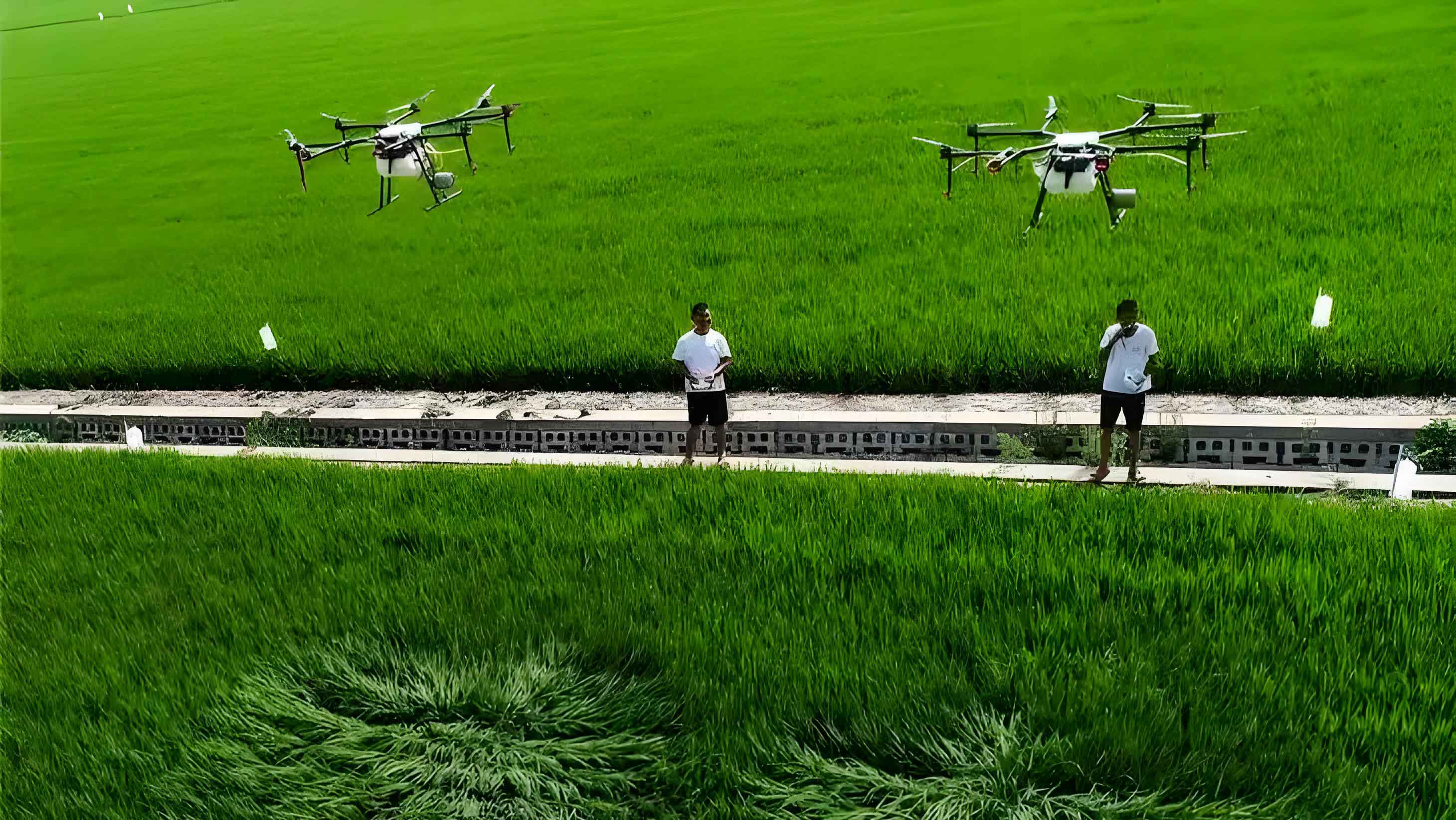
In recent years, agricultural UAVs (unmanned aerial vehicles) have emerged as a transformative force in crop protection, leveraging advantages such as digitization, intelligence, low cost, high efficiency, and broad adaptability. These agricultural UAVs are becoming essential equipment for enhancing the technological content of agricultural plant protection. Compared to traditional manual and ground-based mechanical operations, agricultural UAVs offer superior speed and applicability; relative to general aviation aircraft, they provide better operational quality, flexibility, minimal reliance on ground infrastructure, lower hardware investment thresholds, ease of operation, and greater potential for widespread adoption. This is particularly true for challenging tasks like pesticide application and fertilization in paddy fields or during the late growth stages of tall crops, where intensity and difficulty are high.
In regions like Heilongjiang Province, with expanding rice and corn cultivation areas and a逐年短缺的劳动力 reality, agricultural UAVs have found a rapid development契机. Industry statistics indicate that by 2018, the province had 2,437 agricultural UAVs, covering an annual operational area of 1.75 million hectares. As agricultural UAVs increasingly integrate into large-scale unified pest and disease control programs for major crop pests, urgent issues have arisen:如何解决 more precise operations, accurate界定 of task completion, precise evaluation of overall作业质量, and scientific judgment of operational disputes. A promising solution lies in harnessing the high数字化程度 of agricultural UAVs by combining their作业管理 with internet, big data, and cloud platform technologies. The key distinction between agricultural UAVs and traditional spraying machinery is their全程数字化 signal control. From field determination to flight and spraying, every环节 of agricultural UAV operations can be implemented via digital signals over the internet. This全程数字化 characteristic makes数字化,可视化 management of agricultural UAV operations feasible. Currently, leading domestic agricultural UAV companies like XAG, DJI, and Quanfeng have established their own operational management platforms. However, due to differing platform architectures and transmission protocols, these systems often operate in isolation, creating inefficiencies in provincial-scale unified management. To address this, in 2017, the Heilongjiang Plant Inspection and Protection Station collaborated with Heilongjiang Jingfei Technology Co., Ltd. to develop the Heilongjiang Agricultural UAV Operational Quality Monitoring Platform. By equipping existing agricultural UAVs in the province with智能信息终端, this platform resolves the incompatibility issues from different transmission protocols, enabling可视化,数字化 management of agricultural UAV operations at a provincial scale.
Framework and Functions of the Heilongjiang Agricultural UAV Operational Quality Monitoring Platform
The main framework of the Heilongjiang Agricultural UAV Operational Quality Monitoring Platform was adapted from Beijing Weijia UAV Technology Co., Ltd.’s Smart Agriculture Public Service Platform. The platform is structured into several core modules, each designed to streamline the management of agricultural UAV operations. Below is a summary of the platform’s架构:
| Module | Primary Functions |
|---|---|
| Registration Management | Registration and administration of agricultural UAVs, assigning unique ID codes, and implementing a four-tier management system (province-city-county-operation team). |
| Field Management | Planning and delineation of operational fields, along with geographic information management for completed fields. |
| Operation Management | Real-time monitoring of flight parameters,作业轨迹, and geographic location during agricultural UAV operations. |
| Analysis and Assessment | Overall evaluation of operational quality and system alerts for non-compliant operations. |
| Product Navigation | Guidance tools for users to navigate platform features and resources. |
The four-tier management system for agricultural UAVs ensures hierarchical oversight, with each level (province, city, county, and operation team) granted specific permissions. This structure facilitates coordinated management across large regions. The platform’s functions are designed to enhance precision and accountability in agricultural UAV operations.
Key Functional Capabilities
1. Synchronized Management of Agricultural UAV Teams: Through the Registration Management Module, all agricultural UAVs involved in unified control tasks are registered on the platform. Each agricultural UAV is assigned a unique ID, enabling traceability. The provincial-city-county-operation team hierarchy allows for tailored administrative control, improving coordination in large-scale deployments of agricultural UAVs.
2. Positioning Functionality: Once logged into the platform, an agricultural UAV’s exact longitude and latitude are实时准确定位 from takeoff, providing real-time方位 data. This is critical for monitoring the location of each agricultural UAV during operations.
3. Precise Delineation of Operational Fields: The Field Management Module offers historical data on field面积 and方位, reducing the workload for on-site field marking. This precision supports efficient planning for agricultural UAV missions.
4. Real-time Viewing and Playback of Operational Trajectories: The Operation Management Module allows monitoring of any logged-in agricultural UAV’s performance. Key parameters—such as flight path轨迹, flight height, speed, spray volume per unit time, and effective spray width—are uploaded as digital signals. The platform provides both real-time viewing and playback capabilities. All operational data are stored in the cloud for at least three years, ensuring long-term accessibility for agricultural UAV management.
5. Alert and Error Correction Function: The Analysis and Assessment Module alerts administrators to non-standard operations by agricultural UAVs. If an agricultural UAV deviates from prescribed parameters like spray width or volume, the platform triggers an alert. Corrective actions, such as restricting or blacklisting the违规 UAV, can be taken to maintain quality.
6. Operational Analysis and Evaluation: Post-mission, the platform自动统计分析作业面积 and达标情况, meeting验收 requirements for unified control tasks. This feature supports data-driven decision-making for agricultural UAV deployments.
Implementation Route for Digital Monitoring Functions
In Heilongjiang, many of the 2,437 agricultural UAVs lacked operational management platforms, while others used proprietary systems from manufacturers. Due to varying architectures and protocols, unified digital management was challenging. To overcome this, the province installed智能信息终端 on agricultural UAVs for free. These terminals,类似行车记录仪, are external devices typically smaller than 10 cm × 5 cm × 2 cm and weighing 50–100 g. They connect to the agricultural UAV’s药箱, enabling data transmission. The implementation route for digital monitoring via these terminals is illustrated below, with the process summarized in a formula for operational efficiency of agricultural UAVs.
The智能流量终端 acts as a bridge, receiving digital signals from the agricultural UAV and uploading them to the platform. This allows for seamless integration across different agricultural UAV models. The workflow can be represented as:
$$ \text{Digital Management Flow: } \text{Agricultural UAV} \rightarrow \text{智能终端} \rightarrow \text{Platform} $$
Specifically, the process involves:
- Agricultural UAV registration and login on the platform.
- Takeoff and operation, with parameters transmitted as digital signals.
- 智能终端接收 signals and uploads to platform.
- Platform analyzes and assesses if operations meet standards.
- If达标, data is stored; if not, alerts are issued for corrective actions.
To quantify operational quality, we can use a formula for spray coverage efficiency of agricultural UAVs:
$$ \text{Spray Coverage Efficiency (E)} = \frac{A_{\text{covered}}}{A_{\text{total}}} \times 100\% $$
where \( A_{\text{covered}} \) is the area effectively sprayed by the agricultural UAV, and \( A_{\text{total}} \) is the total target area. The platform monitors parameters like flight height \( h \) and speed \( v \) to compute this. For instance, the effective spray width \( w \) and flow rate \( q \) are critical:
$$ \text{Spray Volume per Unit Area} = \frac{q \times t}{A} $$
Here, \( q \) is the flow rate, \( t \) is time, and \( A \) is area. The platform ensures that for agricultural UAVs, these values adhere to预设 standards, such as \( h \approx 1.5–2.5 \) meters and \( v \approx 3–5 \) m/s for optimal droplet deposition.
The integration of智能终端 enables real-time data流, enhancing the precision of agricultural UAV operations. Below is a table summarizing key monitored parameters for agricultural UAVs:
| Parameter | Symbol | Typical Range | Importance for Agricultural UAVs |
|---|---|---|---|
| Flight Height | \( h \) | 1.5–2.5 m | Affects spray drift and coverage uniformity. |
| Flight Speed | \( v \) | 3–5 m/s | Influences operational效率 and droplet density. |
| Spray Flow Rate | \( q \) | 0.5–2.0 L/min | Determines chemical application volume. |
| Effective Spray Width | \( w \) | 3–6 m | Defines coverage per pass of the agricultural UAV. |
| Operational Area | \( A \) | Variable (hectares) | Total area covered by the agricultural UAV. |
By continuously monitoring these parameters, the platform ensures that each agricultural UAV operates within optimal ranges, minimizing waste and maximizing efficacy.
Application and Outcomes in Heilongjiang Province
After its development in 2017, the Heilongjiang Agricultural UAV Operational Quality Monitoring Platform was piloted in counties like Tonghe and Zhaoyuan. Following validation and refinements, it was推广 province-wide in 2018. The application scale expanded significantly, as shown in the data below for agricultural UAV integrations.
| Year | Counties Integrated | 智能终端 Installed | Agricultural UAVs Registered | Percentage of Provincial Total | Operation Teams Registered |
|---|---|---|---|---|---|
| 2018 | 22 | 1,000 | 1,012 | 41.4% | 55 |
In 2018, during unified control campaigns for major pests like rice blast and third-generation armyworms, provincial, city, and county plant protection departments used the platform to monitor agricultural UAV operations. The cumulative monitored area reached 30,000 hectares, with 25,325 flight sorties tracked over 9,550 fields. This accounted for 27.3% of the unified control tasks. The platform recorded 3,700 operational轨迹, issued 612 alert纠错, performed 410 real-time monitoring sessions, and 2,500 playback reviews. The operational quality达标率 exceeded 93.3%, demonstrating effective provincial-scale精准作业管理 and验收 for agricultural UAVs.
The success can be attributed to the platform’s ability to handle large数据流 from multiple agricultural UAVs simultaneously. For statistical analysis, we can model the overall performance metric \( P \) for agricultural UAV operations as:
$$ P = \alpha \cdot \text{Compliance Rate} + \beta \cdot \text{Efficiency} + \gamma \cdot \text{Coverage} $$
where \( \alpha, \beta, \gamma \) are weighting factors based on operational priorities. In Heilongjiang’s case, with a compliance rate of 93.3%, the high \( P \) value indicates robust management. The platform’s data storage capacity, holding over 3 years of agricultural UAV data, supports longitudinal studies for improving agricultural UAV technologies.
Furthermore, the platform facilitated resource optimization. By monitoring agricultural UAV trajectories, managers could identify inefficiencies, such as overlapping sprays or missed areas. This aligns with the goal of precision agriculture, where agricultural UAVs are deployed to minimize input use while maximizing output. The economic impact can be estimated using a cost-benefit formula for agricultural UAVs:
$$ \text{Net Benefit} = (Y_{\text{increase}} \cdot P_{\text{crop}}) – (C_{\text{UAV}} + C_{\text{chemical}} + C_{\text{labour}}) $$
Here, \( Y_{\text{increase}} \) is yield increase due to precise spraying by agricultural UAVs, \( P_{\text{crop}} \) is crop price, and \( C \) terms represent costs. The platform’s management reduces \( C_{\text{chemical}} \) via精准施药 and \( C_{\text{labour}} \) via automation, enhancing the net benefit of using agricultural UAVs.
Challenges and Directions for Improvement
Despite the platform’s successes, several challenges emerged during its application for managing agricultural UAVs. These issues highlight areas for future enhancement to further optimize agricultural UAV operations.
| Challenge Category | Specific Issues | Impact on Agricultural UAV Operations |
|---|---|---|
| Awareness and Acceptance | Low overall认识程度 among agricultural UAV service teams regarding standard精准施药; resistance to platform integration. | Reduces compliance and adoption rates for agricultural UAV best practices. |
| Market Pressures | Rapid growth and intense competition in the agricultural UAV sector demand high作业效率; some teams view platform monitoring as a hindrance. | May lead to bypassing of digital controls, compromising agricultural UAV operational quality. |
| Technical Knowledge Gaps | Insufficient understanding of agricultural UAVs within plant protection systems; limited research on agricultural UAV spraying technologies. | The platform manages规范 but cannot alone ensure high防效; overall agricultural UAV expertise needs elevation. |
| Resource Investment | High costs for R&D, maintenance,智能终端 installation, and training; requires cross-sector collaboration. | Financial and human resource constraints may limit scalability of agricultural UAV digital management. |
To address these, several改进方向 have been identified, focusing on leveraging the platform to advance agricultural UAV ecosystems.
1. Enhanced Dispatch Functionality: We plan to add a调度 module to the platform, enabling free发布 of service team and task information. This will facilitate task对接, improving the utilization efficiency of agricultural UAVs across the province. By matching demand with supply, the platform can reduce idle time for agricultural UAVs, modeled as:
$$ \text{Utilization Rate} = \frac{\text{Operational Time}}{\text{Total Available Time}} \times 100\% $$
Aiming for rates above 80% for agricultural UAVs through better scheduling.
2. Refined Operational Quality Assessment System: Using historical data analytics, the platform will develop comprehensive evaluations for agricultural UAV teams and pilots. This could involve a scoring formula:
$$ \text{Team Score} = \sum_{i=1}^{n} w_i \cdot S_i $$
where \( S_i \) represents scores for parameters like accuracy, efficiency, and compliance, and \( w_i \) are weights. This will incentivize high-quality operations by agricultural UAVs.
3. Resource Integration and Collaboration: Most major agricultural UAV manufacturers have proprietary management platforms, and newer models often include built-in智能流量计. To avoid resource waste from external devices, we are negotiating with agricultural UAV companies for授权查看 mechanisms. This would allow the provincial platform to access data seamlessly, simplifying digital management for agricultural UAVs. The goal is to establish a standard protocol for agricultural UAV data sharing, enhancing interoperability.
4. Expert-Field Operator Communication Channels: We aim to bridge the gap between plant protection experts and agricultural UAV operators. By using platform data on施药位置, speed, and流量, experts can provide targeted guidance. This will strengthen the platform’s监管职能, ensuring that agricultural UAV operations not only meet规范 but also achieve optimal agronomic outcomes. For example, real-time alerts can be coupled with advisory messages to pilots of agricultural UAVs, fostering a continuous improvement loop.
In terms of technical enhancements, we are exploring advanced algorithms for agricultural UAV path optimization. The trajectory planning can be formulated as a minimization problem:
$$ \min \int_{0}^{T} (E(v(t)) + \lambda \cdot \text{Error}(t)) \, dt $$
where \( E \) is energy consumption of the agricultural UAV, \( \text{Error} \) is deviation from ideal spray parameters, and \( \lambda \) is a regularization factor. Integrating such models into the platform could autonomously suggest optimal routes for agricultural UAVs, boosting efficiency.
Conclusion
The Heilongjiang Agricultural UAV Operational Quality Monitoring Platform exemplifies how数字化,可视化 systems can revolutionize the management of agricultural UAVs in large-scale operations. By integrating智能信息终端, the platform overcomes compatibility issues, enabling unified provincial oversight. Its modules—from registration to analysis—provide comprehensive tools for monitoring飞行参数,作业轨迹, and compliance, ensuring that agricultural UAVs operate with precision. The application results, with over 93.3%达标率 in unified control tasks, underscore its effectiveness in enhancing the quality and accountability of agricultural UAV deployments.
Looking ahead, the challenges of awareness, market pressures, knowledge gaps, and resource needs must be addressed through continuous improvement. By adding调度功能, refining assessment systems, promoting resource integration, and fostering expert-operator collaboration, the platform can evolve into a more robust ecosystem for agricultural UAV management. The integration of advanced formulas and algorithms will further optimize agricultural UAV performance, contributing to sustainable agriculture. As agricultural UAVs become increasingly prevalent, such digital platforms will be indispensable for ensuring that these technologies deliver on their promise of efficiency, precision, and scalability in crop protection worldwide.
Ultimately, the success of this initiative highlights the critical role of digital innovation in harnessing the full potential of agricultural UAVs. By embracing data-driven management, we can transform agricultural UAV operations from isolated tasks into coordinated, high-impact systems that benefit farmers, industries, and the environment alike.