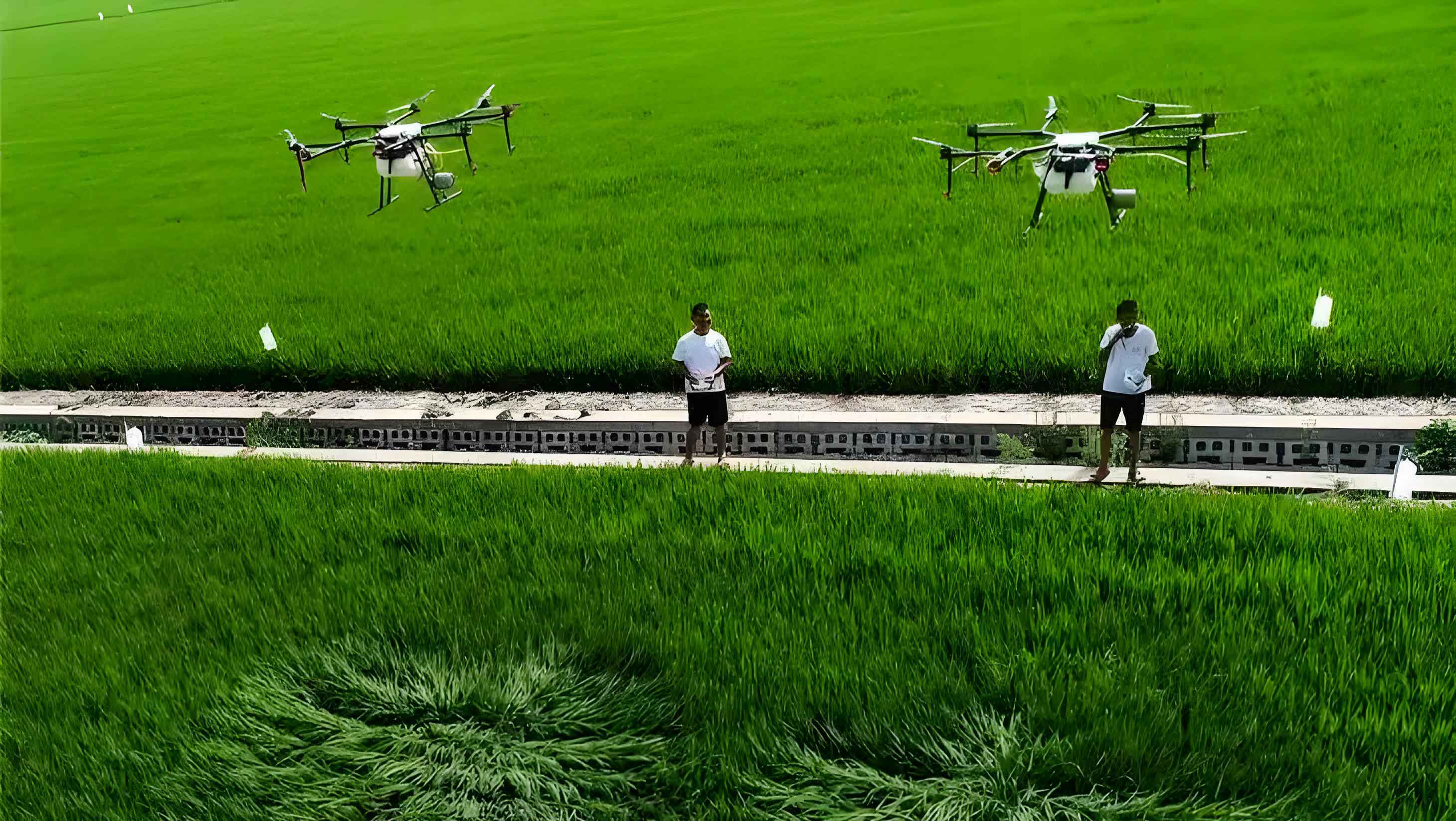
In the field of precision agriculture, we address a critical challenge in crop protection: the inefficiency of fixed-path planning for agricultural drones due to variable row spacing in cornfields. This research designs an adaptive flight path planning algorithm for agricultural drones, leveraging Beidou navigation to dynamically adjust routes based on real-time corn row spacing perception. The primary goal is to minimize pesticide leakage and redundant spraying, thereby enhancing pesticide utilization and overall plant protection efficacy. By integrating high-precision positioning with visual recognition, we propose a novel solution that pushes the boundaries of intelligent agricultural equipment.
The core innovation lies in the “real-time row spacing recognition—dynamic path adjustment” mechanism, which enables agricultural drones to autonomously adapt to spatial variations in corn planting. Traditional agricultural drones often follow predetermined routes, leading to significant waste and uneven coverage in fields with irregular row spacing. Our approach bridges this gap by fusing Beidou-derived location data with machine vision, allowing for precise, on-the-fly modifications to flight trajectories. This not only improves operational accuracy but also reduces reliance on manual intervention, making agricultural drones more robust and efficient in diverse farming environments.
The significance of this work extends beyond technical optimization; it contributes to sustainable agriculture by promoting pesticide reduction and minimizing environmental impact. Agricultural drones equipped with our algorithm can achieve higher precision in spray application, directly benefiting crop health and yield. In the following sections, we detail the design, implementation, and validation of this system, emphasizing the synergy between Beidou navigation and adaptive control logic for agricultural drones.
Correlation Between Beidou Navigation and Path Planning for Agricultural Drones
Beidou navigation systems provide foundational data for enabling precise maneuvers in agricultural drones. The characteristics of Beidou positioning information are crucial for real-time decision-making in dynamic field conditions.
Characteristics of Beidou Navigation Positioning Information
Beidou navigation offers high-accuracy spatial data, including coordinates (longitude, latitude, altitude), velocity, heading, and precise timing. These data points are derived from satellite signal resolution, with centimeter-level precision in ideal conditions, making them reliable for agricultural drone operations. Key attributes include:
- Real-time Capability: Continuous updates allow agricultural drones to respond instantly to environmental changes.
- High Precision: Positioning errors can be reduced to less than 3 cm with augmentation systems, essential for aligning agricultural drones with crop rows.
- Robustness: Beidou signals maintain integrity even in rural areas, supporting stable navigation for agricultural drones.
Mathematically, the position vector $\mathbf{P}(t)$ of an agricultural drone at time $t$ is given by:
$$
\mathbf{P}(t) = [x(t), y(t), z(t)]^T
$$
where $x$, $y$, and $z$ denote the coordinates. The velocity $\mathbf{v}(t)$ and heading $\theta(t)$ are derived from time derivatives of $\mathbf{P}(t)$, forming the basis for path planning.
Importance of Path Planning Parameters in Agricultural Drones
Path planning parameters directly influence the effectiveness and safety of agricultural drones. For cornfield operations, key parameters include flight height $h$, speed $v$, and route spacing $d_{route}$. These must be optimized to ensure uniform pesticide deposition and avoid obstacles. Inadequate parameterization leads to issues like drift or collision. The relationship between these parameters and spray coverage can be modeled as:
$$
C(x,y) = f(h, v, d_{route}, \mathbf{P}(t))
$$
where $C(x,y)$ represents the pesticide concentration at ground coordinates $(x,y)$. Optimizing $h$, $v$, and $d_{route}$ minimizes deviations in $C(x,y)$, enhancing performance of agricultural drones.
Necessity of Integrating Row Spacing Information with Path Planning
Integrating real-time row spacing data with path planning is essential to overcome the limitations of fixed routes. Corn row spacing $d_{row}$ often varies due to seeding equipment or terrain, causing mismatches with preset $d_{route}$ in agricultural drones. By dynamically aligning $d_{route}$ with $d_{row}$, we ensure parallel flight along crop rows, reducing gaps and overlaps. This integration is formalized as an adaptive control problem: adjust $\mathbf{P}(t)$ based on $d_{row}$ measurements to maintain optimal coverage. The synergy between Beidou positioning and row spacing perception enables agricultural drones to achieve unprecedented accuracy in variable fields.
Design of the Beidou-Based Adaptive Path Planning Algorithm for Agricultural Drones
We designed an algorithm that allows agricultural drones to autonomously modify flight paths based on real-time corn row spacing. This involves defining adaptation standards, data collection, row recognition, and dynamic adjustment logic.
Row Spacing Adaptation Standards and Objectives
To handle row spacing variability, we established thresholds for deviation and corresponding adjustment modes. Let $d_{set}$ be the target row spacing (e.g., 60 cm for corn), and $d_{measured}$ be the real-time perceived row spacing. The deviation $\Delta d$ is computed as:
$$
\Delta d = d_{measured} – d_{set}
$$
Based on $\Delta d$, we define three adjustment modes for agricultural drones, as summarized in Table 1.
| Mode | Deviation Range ($|\Delta d|$) | Adjustment Gain ($k$) | Action |
|---|---|---|---|
| Fine-tuning | ≤ 3 cm | 0.5 | Apply low-pass filtering for smooth minor corrections. |
| Standard Adjustment | 3 cm < |Δd| ≤ 5 cm | 1.0 | Direct compensation of flight path offset. |
| Emergency Correction | > 5 cm | 1.0 with constraints | Rapid correction with limits on turning rate. |
The path offset $\delta$ for agricultural drones is calculated as:
$$
\delta = k \cdot \Delta d
$$
This logic ensures that agricultural drones respond proportionally to deviations, balancing precision and stability.
Row Spacing Perception Data Collection
We collected extensive field data to train and validate the perception system. Using agricultural drones equipped with Beidou modules and multispectral cameras, we gathered datasets across corn growth stages: seedling (height ~30 cm), jointing (~120 cm), and filling periods. Data includes:
- Time-stamped Beidou/GNSS coordinates.
- Multispectral image streams geotagged with position data.
- Inertial Measurement Unit (IMU) readings for orientation.
These datasets form the basis for developing robust row recognition algorithms, crucial for adaptive behavior in agricultural drones.
Row Recognition Algorithm Design
We developed a deep learning-based algorithm to identify corn row centerlines in real-time. An improved YOLOv5 model processes multispectral images to detect plant stems or canopies. Using the pixel coordinates and corresponding Beidou positions, we generate a point cloud of plant locations. Clustering and linear fitting algorithms then compute the local row spacing $d_{measured}$ along the flight direction. The process is summarized as:
- Image acquisition by agricultural drones: $\mathbf{I}(t)$ at time $t$.
- Plant detection: $\mathbf{D} = \text{YOLOv5}(\mathbf{I}(t))$, where $\mathbf{D}$ is a set of bounding boxes.
- Coordinate mapping: Convert pixel coordinates to world coordinates using Beidou data.
- Row fitting: Apply linear regression to points, yielding row lines $L_i$ with spacing $d_{measured}$ between adjacent lines.
The accuracy of this step is vital for reliable performance of agricultural drones, with targeting error below 2 cm in trials.
Dynamic Path Adjustment Algorithm Design
The core path planning algorithm uses a segmented smooth control strategy based on row spacing variation rate. This allows agricultural drones to adjust trajectories while maintaining flight smoothness. The algorithm operates in a loop:
- Acquire $d_{measured}$ and compute $\Delta d$.
- Determine mode from Table 1.
- Calculate offset $\delta$ and apply smoothing filters if needed.
- Update the flight path waypoints for the agricultural drone.
The control law for agricultural drones is expressed as:
$$
\mathbf{P}_{new}(t) = \mathbf{P}_{planned}(t) + \delta \cdot \mathbf{n}
$$
where $\mathbf{P}_{planned}(t)$ is the original waypoint, and $\mathbf{n}$ is the unit vector normal to the flight direction. This ensures agricultural drones stay aligned with rows despite variations.
System Integration and Hardware Deployment
We integrated the perception and adjustment modules into the flight control system of agricultural drones. Key hardware components include:
- Beidou high-precision receiver for positioning.
- Edge computing unit (power < 15 W) running recognition algorithms.
- Flight controller with extended navigation module for dynamic adjustments.
Data flows via CAN/CANFD buses to ensure low latency (< 1 s from perception to adjustment). This integration enables agricultural drones to operate autonomously in real-time, with minimal human oversight.
Evaluation Metrics for Algorithm Performance in Agricultural Drones
To assess the effectiveness of our adaptive algorithm for agricultural drones, we defined quantitative metrics focusing on spray accuracy, efficiency, and stability. These metrics are crucial for comparing against traditional fixed-path agricultural drones.
| Metric | Symbol | Formula/Definition | Optimal Value |
|---|---|---|---|
| Leakage Rate | $MR$ | $MR = \frac{A_{leak}}{A_{total}} \times 100\%$, where $A_{leak}$ is area missed, $A_{total}$ is target area. | Minimize (near 0%) |
| Redundant Spraying Rate | $OR$ | $OR = \frac{A_{over}}{A_{total}} \times 100\%$, where $A_{over}$ is overlapped spray area. | Minimize (near 0%) |
| Pesticide Utilization Efficiency | $PUE$ | $PUE = \frac{M_{effective}}{M_{total}} \times 100\%$, where $M_{effective}$ is pesticide deposited on target, $M_{total}$ is total sprayed. | Maximize (ideally >45%) |
| Control Efficacy | $CE$ | $CE = \frac{N_{initial} – N_{final}}{N_{initial}} \times 100\%$, for pests like corn aphids. | Maximize (ideally >90%) |
| Positioning Error | $E_{pos}$ | $E_{pos} = \sqrt{(x_{Beidou} – x_{RTK})^2 + (y_{Beidou} – y_{RTK})^2}$, comparing Beidou to RTK ground truth. | Minimize (e.g., <3 cm) |
| Recognition Accuracy Fluctuation | $\sigma_{acc}$ | Standard deviation of row spacing recognition accuracy over time. | Minimize (stable near 95%) |
These metrics provide a comprehensive framework for evaluating agricultural drones. For instance, lower $MR$ and $OR$ indicate better path planning, while higher $PUE$ and $CE$ reflect improved agronomic outcomes. Stability metrics like $E_{pos}$ and $\sigma_{acc}$ ensure reliable operation of agricultural drones in prolonged missions.
Field Validation of Agricultural Drones with Adaptive Algorithm
We conducted field trials to validate the performance of agricultural drones using our adaptive algorithm. Tests covered three typical corn planting scenarios with varying row spacing and growth stages, comparing our adaptive agricultural drones against traditional fixed-path agricultural drones.
Experimental Scenarios and Setup
Three scenarios were designed to represent common field conditions:
- Mechanical Planting: Row spacing 55–65 cm, relatively uniform.
- Manual Planting: Row spacing 50–70 cm, high variability.
- Different Growth Stages: Seedling and jointing periods, with plant height affecting perception.
In each scenario, agricultural drones operated with identical spray settings. The adaptive group used our algorithm, while the control group followed predefined equidistant routes. We measured the metrics from Table 2 over multiple runs.
Results and Analysis
The results demonstrate significant improvements with adaptive agricultural drones. Key findings are summarized in Table 3.
| Scenario | Agricultural Drone Type | Leakage Rate ($MR$) | Redundant Spray Rate ($OR$) | Pesticide Utilization ($PUE$) | Control Efficacy ($CE$) |
|---|---|---|---|---|---|
| Mechanical Planting | Adaptive | 3.2% | 5.1% | 48.7% | 93.5% |
| Traditional | 12.8% | 22.3% | 35.4% | 88.2% | |
| Manual Planting | Adaptive | 4.5% | 7.3% | 45.2% | 91.8% |
| Traditional | 18.5% | 30.1% | 28.9% | 85.6% | |
| Growth Stages | Adaptive | 4.1% | 6.8% | 46.5% | 92.4% |
| Traditional | 16.2% | 25.7% | 32.1% | 87.1% |
The adaptive agricultural drones consistently outperformed traditional ones across all scenarios. For example, in manual planting with high variability, leakage rate was reduced from 18.5% to 4.5%, and redundant spraying from 30.1% to 7.3%. Pesticide utilization efficiency rose to above 45%, indicating more targeted application by agricultural drones. Control efficacy remained above 90% for adaptive agricultural drones, showcasing better pest management.
Additionally, we monitored system stability during continuous operations over 50 acres. The positioning error $E_{pos}$ for agricultural drones averaged 2.3 cm with a standard deviation of 0.5 cm, while recognition accuracy fluctuation $\sigma_{acc}$ was 1.8%, confirming reliable performance. These results highlight the robustness of agricultural drones equipped with our algorithm in real-world conditions.
Discussion on Algorithm Efficacy
The success of adaptive agricultural drones stems from the seamless integration of Beidou navigation and real-time perception. By dynamically adjusting paths, agricultural drones minimize gaps and overlaps, leading to superior metrics. The algorithm’s segmented control strategy effectively balances responsiveness and stability, preventing abrupt maneuvers that could disrupt spray patterns. This is particularly beneficial for agricultural drones operating in complex terrains with irregular row spacing.
Furthermore, the reduction in pesticide waste aligns with sustainable agriculture goals. Agricultural drones using this algorithm can achieve higher precision with less chemical input, reducing environmental impact and operational costs. The improved control efficacy also supports better crop health, demonstrating the practical value of intelligent agricultural drones.
Conclusion
Through this research, we have developed and validated an adaptive path planning algorithm for agricultural drones based on Beidou navigation. The algorithm addresses the critical issue of variable corn row spacing by integrating real-time perception with dynamic flight adjustments. Field trials confirm that agricultural drones equipped with this system significantly reduce leakage and redundant spraying, enhance pesticide utilization, and maintain high pest control efficacy.
The implications extend beyond corn cultivation; this approach can be adapted to other row crops, broadening the applicability of agricultural drones in precision agriculture. By minimizing reliance on fixed routes and manual oversight, our algorithm advances the autonomy and intelligence of agricultural drones, contributing to more efficient and eco-friendly farming practices.
Future work may focus on scaling the system for larger fleets of agricultural drones or integrating additional sensors for comprehensive crop health monitoring. Ultimately, this research underscores the transformative potential of Beidou-enabled adaptive control in elevating the performance of agricultural drones, paving the way for smarter agricultural ecosystems.