As an expert in the field of aviation and unmanned systems, I have witnessed the rapid evolution of agricultural drone technology and its transformative impact on modern farming practices. Agricultural drones, also known as unmanned aerial vehicles (UAVs), are increasingly deployed for tasks such as crop monitoring, pesticide spraying, soil analysis, and irrigation management. Their ability to operate with precision, efficiency, and minimal human intervention has revolutionized agriculture, leading to enhanced productivity and sustainability. However, the proliferation of agricultural drones poses significant challenges for air traffic management (ATM) and surveillance, particularly in low-altitude airspace where these devices often operate. In this article, I will explore the critical issues surrounding agricultural drone integration into national airspace systems, discuss management frameworks, and delve into advanced surveillance technologies. My goal is to provide a comprehensive analysis that addresses safety, efficiency, and regulatory concerns, ensuring that agricultural drones can coexist safely with manned aircraft and other airspace users.
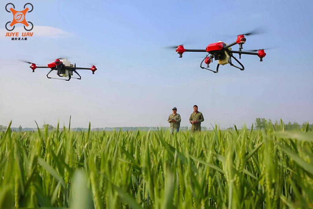
The use of agricultural drones has expanded globally, driven by advancements in automation, sensors, and data analytics. These drones range from small multirotor systems to fixed-wing models, capable of performing complex tasks autonomously. For instance, an agricultural drone equipped with multispectral cameras can capture detailed images of crops, allowing farmers to detect stress, disease, or nutrient deficiencies early. Similarly, spraying drones can apply pesticides or fertilizers with pinpoint accuracy, reducing chemical usage and environmental impact. Despite these benefits, the uncontrolled growth of agricultural drone operations raises safety risks, such as mid-air collisions, interference with manned aviation, and ground hazards. Therefore, a systematic approach to air traffic management is essential to mitigate these risks and unlock the full potential of agricultural drones.
In this context, I will first examine the operational problems associated with agricultural drones in shared airspace. Then, I will outline management principles and rules for integrating agricultural drones, followed by a detailed discussion on surveillance technologies like command-and-control links and automatic dependent surveillance-broadcast (ADS-B). Throughout, I will incorporate tables and mathematical formulas to summarize key concepts, emphasizing the technical aspects of agricultural drone operations. By adopting a first-person perspective, I aim to share insights from my research and experience, highlighting the urgent need for robust frameworks to support the safe and scalable deployment of agricultural drones.
Operational Challenges of Agricultural Drones in Airspace
The integration of agricultural drones into non-segregated airspace is fraught with complexities, primarily due to their unique operational profiles. Unlike manned aircraft, agricultural drones often fly at very low altitudes (below 152.4 meters above ground level), perform non-linear missions (e.g., hovering over fields), and are controlled remotely or autonomously. This creates several challenges:
- Collision Risks: Agricultural drones may inadvertently enter controlled airspace near airports, posing collision threats with manned aircraft. Their small size and low radar cross-section make detection difficult for traditional air traffic control systems.
- Communication Vulnerabilities: Agricultural drones rely on command-and-control (C2) links for operation. These links can be susceptible to interference, latency, or failure, potentially leading to loss of control and accidents.
- Regulatory Fragmentation: Current regulations for agricultural drones vary across regions, leading to inconsistencies in licensing, flight permissions, and safety standards. This hampers widespread adoption and cross-border operations.
- Weather and Environmental Factors: Agricultural drones are often deployed in rural areas with unpredictable weather conditions, such as strong winds or precipitation, which can affect stability and navigation.
To quantify collision risks, consider a scenario where multiple agricultural drones operate in proximity. The probability of a mid-air collision can be modeled using statistical methods. For example, let $P_c$ represent the collision probability per flight hour for an agricultural drone. It depends on factors like airspace density, drone speed, and avoidance capabilities. A simplified formula is:
$$P_c = \frac{N \cdot A \cdot v}{V}$$
where $N$ is the number of agricultural drones in a given volume, $A$ is the effective cross-sectional area, $v$ is the relative velocity, and $V$ is the airspace volume. This underscores the need for traffic management systems to monitor and regulate agricultural drone densities.
Furthermore, the operational altitude of agricultural drones often overlaps with general aviation activities, such as crop dusting or emergency medical flights. Without proper coordination, conflicts can arise. The table below summarizes key operational challenges for agricultural drones:
| Challenge | Description | Impact on Agricultural Drone Safety |
|---|---|---|
| Airspace Congestion | High density of agricultural drones in farming regions | Increases collision risk and complicates traffic flow |
| C2 Link Reliability | Dependence on radio frequencies for control | Loss of link can lead to uncontrolled drift or crash |
| Regulatory Compliance | Varying rules for flight paths, altitudes, and permissions | Creates confusion and non-compliance among operators |
| Environmental Hazards | Exposure to wind, rain, or electromagnetic interference | Reduces operational efficiency and poses safety threats |
Addressing these challenges requires a holistic approach that combines technology, policy, and industry collaboration. In the following sections, I will delve into management frameworks designed specifically for agricultural drones.
Air Traffic Management Frameworks for Agricultural Drones
Effective air traffic management for agricultural drones involves establishing rules, procedures, and infrastructure to ensure safe integration into existing airspace systems. Drawing from international standards and my research, I propose a multi-layered management framework tailored for agricultural drone operations. This framework aligns with concepts like UAS Traffic Management (UTM) or U-space in Europe, which aim to support large-scale drone deployments through digital services and automation.
Management Principles
The core principles for agricultural drone ATM are derived from International Civil Aviation Organization (ICAO) guidelines, emphasizing safety, efficiency, and interoperability. Key principles include:
- Risk-Based Classification: Agricultural drones should be categorized based on weight, speed, and operational context (e.g., visual line-of-sight vs. beyond visual line-of-sight). This allows for tailored regulations, such as requiring transponders for larger agricultural drones flying near controlled airspace.
- Dynamic Airspace Organization: Low-altitude airspace (below 152.4 meters) should be segmented into zones for agricultural drone operations, with geofencing used to restrict access to sensitive areas like airports or crowded events.
- Automated Coordination: Agricultural drones should be equipped with systems that automatically communicate with air traffic control or UTM services, reducing pilot workload and enhancing situational awareness.
Mathematically, airspace segmentation can be optimized using computational models. For instance, let $S$ represent a set of airspace zones for agricultural drones, and let $C_i$ denote the capacity of zone $i$ in terms of maximum agricultural drone density. The optimization problem can be formulated as:
$$\text{Maximize } \sum_{i=1}^{n} U_i(C_i) \text{ subject to } \sum_{i=1}^{n} C_i \leq T$$
where $U_i$ is a utility function reflecting agricultural drone operational efficiency in zone $i$, and $T$ is the total airspace capacity. This approach ensures balanced utilization while preventing congestion.
Integration Rules for Agricultural Drones
To facilitate seamless integration, agricultural drones must adhere to specific rules based on their operational mode. For example, in controlled airspace (Classes A to G), agricultural drones flying under instrument flight rules (IFR) should mimic manned aircraft procedures, including flight planning, communication, and navigation. However, adaptations are needed for unique agricultural drone characteristics:
- Performance Adjustments: Agricultural drones often have lower speeds and climb rates compared to manned aircraft. This necessitates modified separation minima, which can be calculated using formulas like $D_{\text{sep}} = k \cdot v \cdot t$, where $D_{\text{sep}}$ is the separation distance, $v$ is the agricultural drone velocity, $t$ is reaction time, and $k$ is a safety factor.
- Emergency Protocols: In case of C2 link loss, agricultural drones should execute pre-programmed procedures, such as returning to a home point or landing safely. These protocols must be communicated to air traffic controllers.
- Weather Tolerance: Agricultural drones operating in agricultural settings should be equipped with sensors to detect adverse weather, with algorithms adjusting flight paths dynamically. For instance, wind resistance can be modeled as $F_w = \frac{1}{2} \rho C_d A v_w^2$, where $\rho$ is air density, $C_d$ is drag coefficient, $A$ is frontal area, and $v_w$ is wind speed.
The table below outlines integration rules for different types of agricultural drones:
| Agricultural Drone Type | Operational Altitude | Required Equipment | Integration Rule |
|---|---|---|---|
| Small Multirotor (e.g., for spraying) | < 152.4 m AGL | Geofencing, ADS-B Out | Operate in designated UTM zones with automatic conflict avoidance |
| Fixed-Wing (e.g., for surveying) | 152.4-300 m AGL | Transponder, C2 Link Redundancy | File flight plans and comply with ATC instructions in controlled airspace |
| Large Hybrid (e.g., for cargo) | > 300 m AGL | Detect-and-Avoid Systems, IFR Capability | Treat as manned aircraft with remote pilot oversight |
These rules ensure that agricultural drones operate safely without disrupting existing aviation activities. Moreover, they pave the way for advanced applications, such as automated inspection, which I will discuss later.
Surveillance Technologies for Agricultural Drones
Surveillance is a cornerstone of agricultural drone safety, enabling real-time tracking, identification, and conflict detection. Traditional radar systems are often inadequate for small agricultural drones due to limited resolution. Therefore, innovative technologies are required. Based on my analysis, I focus on three key surveillance approaches for agricultural drones: command-and-control links, automatic dependent surveillance-broadcast (ADS-B), and cellular-based systems.
Command-and-Control (C2) Links
C2 links are critical for maintaining control over agricultural drones. They transmit commands from ground stations to the agricultural drone and relay telemetry data back. However, these links face challenges like latency, interference, and range limitations. To enhance reliability, I recommend using redundant links and adaptive frequency hopping. The performance of a C2 link can be quantified by the signal-to-noise ratio (SNR):
$$\text{SNR} = \frac{P_t G_t G_r \lambda^2}{(4\pi d)^2 N_0 B}$$
where $P_t$ is transmit power, $G_t$ and $G_r$ are antenna gains, $\lambda$ is wavelength, $d$ is distance, $N_0$ is noise density, and $B$ is bandwidth. For agricultural drones, maintaining an SNR above a threshold (e.g., 10 dB) ensures stable control. Additionally, protocols like LTE or 5G can supplement traditional radio frequencies, providing broader coverage in rural areas where agricultural drones often operate.
Automatic Dependent Surveillance-Broadcast (ADS-B)
ADS-B is a surveillance technology where aircraft broadcast their position, velocity, and identity via satellite or ground networks. For agricultural drones, ADS-B offers high accuracy and update rates, but regulatory barriers exist—most small agricultural drones are not required to equip ADS-B out systems due to cost and spectrum constraints. To address this, I propose a hybrid approach: agricultural drones could use lightweight ADS-B transceivers that operate on dedicated frequencies, such as 978 MHz, to avoid interference with manned aviation. The position broadcast rate can be optimized based on agricultural drone density using the formula:
$$R_b = \frac{1}{\Delta t} \log\left(1 + \frac{D_{\text{max}}}{D_{\text{curr}}}\right)$$
where $R_b$ is the broadcast rate, $\Delta t$ is a time constant, $D_{\text{max}}$ is maximum allowable agricultural drone density, and $D_{\text{curr}}$ is current density. This ensures efficient spectrum use while maintaining situational awareness.
Cellular and 5G-Based Surveillance
With the rollout of 5G networks, cellular technology presents a promising solution for agricultural drone surveillance. Base stations can triangulate agricultural drone positions using time-difference-of-arrival (TDOA) methods. The position error $\sigma_p$ in a cellular network can be approximated as:
$$\sigma_p = \frac{c \cdot \sigma_t}{\sqrt{N}}$$
where $c$ is the speed of light, $\sigma_t$ is timing error, and $N$ is the number of base stations. For agricultural drones in rural areas, 5G small cells can enhance coverage, but challenges like handover delays persist. Integrating cellular data with ADS-B feeds can create a robust surveillance network for agricultural drones, as summarized in the table below:
| Surveillance Technology | Advantages for Agricultural Drones | Limitations | Recommended Use Case |
|---|---|---|---|
| C2 Links | Direct control, low latency for close-range operations | Limited range, susceptible to interference | Real-time agricultural drone maneuvering during spraying or inspection |
| ADS-B | High accuracy, compatibility with manned aviation systems | Regulatory hurdles, spectrum congestion | Agricultural drones operating near airports or in high-density airspace |
| 5G Cellular | Wide coverage, high data rates, scalability | Infrastructure dependence, latency in remote areas | Large-scale agricultural drone fleets in smart farming applications |
By leveraging these technologies, agricultural drone operators can achieve comprehensive surveillance, reducing risks and enabling complex missions like automated inspection, which I explore next.
Automated Inspection and Advanced Applications
Beyond basic operations, agricultural drones are increasingly used for automated inspection, leveraging computer vision and machine learning to monitor crops, infrastructure, and environmental conditions. As an advocate for technological innovation, I believe automated inspection represents a paradigm shift in agriculture, driven by data-driven decision-making.
Automated inspection relies on sensors like RGB cameras, multispectral imagers, and LiDAR mounted on agricultural drones. These sensors capture high-resolution data, which is processed using algorithms to extract actionable insights. For example, vegetation indices (VIs) such as the Normalized Difference Vegetation Index (NDVI) are calculated from spectral bands to assess crop health. The formula for NDVI is:
$$\text{NDVI} = \frac{\text{NIR} – \text{Red}}{\text{NIR} + \text{Red}}$$
where NIR is near-infrared reflectance and Red is red light reflectance. Agricultural drones can compute NDVI in real-time, allowing farmers to identify stressed areas and apply targeted treatments. This not only boosts yield but also minimizes resource use, aligning with sustainable agriculture goals.
Moreover, automated inspection enables the creation of digital elevation models (DEMs) for fields, which can optimize irrigation planning. Using photogrammetry techniques, agricultural drones capture overlapping images to generate 3D maps. The accuracy of such models depends on factors like flight altitude and camera resolution, expressed as:
$$GSD = \frac{H \cdot s}{f}$$
where GSD is ground sampling distance, $H$ is flight height, $s$ is sensor pixel size, and $f$ is focal length. A smaller GSD indicates higher resolution, crucial for detecting subtle crop variations.
To illustrate the benefits, consider a scenario where an agricultural drone fleet inspects a 100-hectare farm. The efficiency gain compared to manual inspection can be modeled as:
$$E = \frac{T_m – T_d}{T_m} \times 100\%$$
where $E$ is efficiency improvement, $T_m$ is time for manual inspection, and $T_d$ is time for agricultural drone inspection. Typically, agricultural drones reduce inspection time by over 80%, demonstrating their transformative potential.
The table below highlights advanced applications of agricultural drones in automated inspection:
| Application | Sensor Used | Data Output | Impact on Agriculture |
|---|---|---|---|
| Crop Health Monitoring | Multispectral Camera | NDVI Maps, Disease Detection | Early intervention, reduced crop loss |
| Soil Moisture Analysis | Thermal Imager | Moisture Index, Irrigation Zones | Water conservation, improved yield |
| Pest Detection | High-Resolution RGB Camera | Image Annotations, Pest Density Maps | Targeted pesticide application, cost savings |
| Infrastructure Check | LiDAR | 3D Models, Structural Integrity Reports | Preventive maintenance, safety assurance |
These applications underscore the versatility of agricultural drones, but their success hinges on robust air traffic management and surveillance, as discussed earlier. In the conclusion, I will synthesize key insights and future directions.
Conclusion
In this comprehensive exploration, I have addressed the critical aspects of agricultural drone air traffic management and surveillance. From operational challenges to management frameworks and technological solutions, it is clear that agricultural drones hold immense promise for modern agriculture, yet their safe integration requires coordinated efforts. The proliferation of agricultural drones necessitates adaptive air traffic systems, such as UTM, that can handle low-altitude operations without compromising safety. Surveillance technologies like ADS-B and 5G offer viable paths for real-time tracking, while automated inspection unlocks new efficiencies in farming.
Looking ahead, I anticipate continued innovation in agricultural drone capabilities, including swarming for large-scale missions and AI-driven autonomy. However, regulatory harmonization remains a priority; policymakers must establish clear rules that balance innovation with risk mitigation. By embracing collaborative approaches—involving industry, academia, and aviation authorities—we can foster an ecosystem where agricultural drones thrive safely and sustainably. Ultimately, the journey toward seamless agricultural drone integration is ongoing, but with the frameworks and technologies outlined here, we are well-positioned to navigate the complexities and reap the benefits of this transformative technology.
As I reflect on my research, I am convinced that agricultural drones will become indispensable tools in global food security efforts. By prioritizing safety through advanced air traffic management and surveillance, we can ensure that these devices not only enhance agricultural productivity but also contribute to a safer and more efficient airspace for all users. The future of farming is airborne, and with careful planning, agricultural drones will lead the way.