In modern agriculture, the integration of advanced technologies has revolutionized farming practices, and among these, unmanned aerial vehicles (UAVs), commonly referred to as agricultural drones, have emerged as pivotal tools. As a researcher in this field, I have observed that agricultural drones are systems comprising aircraft, control stations, communication devices, and other components, primarily used for pesticide spraying, information monitoring, and agricultural insurance surveys. However, a significant challenge persists: during flight, the actual route of an agricultural drone often deviates from the planned path due to factors such as meteorological conditions, payload variations, and navigation errors. This deviation not only reduces operational quality but also impacts efficiency, leading to issues like uneven pesticide coverage or incomplete data collection. To address this, we have explored the potential of wireless sensor networks (WSNs), a technology that seamlessly integrates with drones for precise route control. In this article, I present our design of a route control system for agricultural drones based on WSNs, emphasizing its components, algorithms, and experimental validation. Our goal is to enhance the accuracy and stability of agricultural drone operations, thereby contributing to smarter and more sustainable farming.
Wireless sensor networks represent a convergence of embedded systems, networking, and sensor technologies, enabling real-time monitoring and control in various domains. When applied to agricultural drones, WSNs leverage onboard sensors to collect data on speed, orientation, wind speed, and direction, transmitting it wirelessly for analysis. This synergy allows for dynamic route adjustments, minimizing deviations. Historically, route control for agricultural drones relied on manual remote control, which was prone to human error and latency. Subsequent advancements introduced algorithmic optimizations for path planning, but hardware and system integration aspects remained understudied. Our work fills this gap by developing a comprehensive system that combines WSNs with a two-dimensional coordinate following algorithm. Throughout this discussion, I will use the term agricultural drone repeatedly to underscore its centrality, as we delve into the design, implementation, and testing of our system.
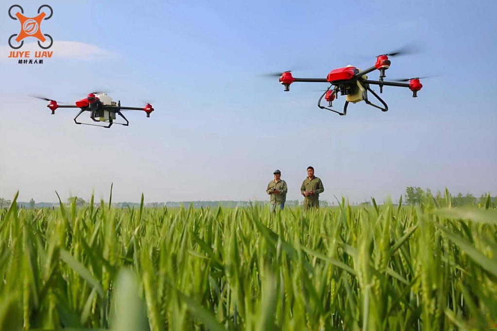
The core of our system lies in its architecture, which comprises four integral parts: the agricultural drone platform, sensor nodes, a sink node, and a control center. Each component plays a crucial role in ensuring precise route control. The agricultural drone platform we selected is the DJI Phantom 4, a rotary-wing drone capable of carrying a 5kg payload for up to 30 minutes, with GPS/GLONASS positioning and a wireless transmission range of 7km. This agricultural drone is equipped with flight attitude control devices, including rudders, ailerons, and elevators, which adjust based on control algorithms. To monitor flight parameters, we installed various sensor nodes on the agricultural drone. These include the XV-8000CB angular velocity sensor and CZ3-X-Y acceleration sensor for speed data, the BA5803 barometric altimeter for height measurement, and the NHFS47 wind speed and direction sensor from Zhongke Nenghui for environmental conditions. The sensor nodes operate on low power, entering sleep mode when idle to conserve energy, and wake at scheduled intervals to collect and transmit data.
The sink node, based on the CC2530 chip, acts as a bridge between the sensor nodes and the control center. It uses ZigBee technology for wireless communication with sensor nodes, offering long-range connectivity and strong interference resistance suited to agricultural environments. The sink node binds with sensor nodes upon initiation, forwarding collected data via a UART interface to the control center. Table 1 summarizes the key components and their functions in our agricultural drone route control system, highlighting how each element contributes to overall performance.
| Component | Role | Specifications/Features |
|---|---|---|
| Agricultural Drone Platform | Flight execution and payload carrying | DJI Phantom 4, 5kg payload, 30min flight, GPS/GLONASS |
| Sensor Nodes | Data collection (speed, height, wind) | XV-8000CB, CZ3-X-Y, BA5803, NHFS47, ZigBee protocol |
| Sink Node | Data aggregation and transmission | CC2530 chip, ZigBee communication, UART interface |
| Control Center | Data analysis and route control | Lenovo X3550M5 server, DJI GS Pro software, databases |
The control center, stationed on the ground, integrates a server, data storage, geographic information databases, and network broadband. It runs DJI GS Pro software for route planning and real-time flight control. Upon receiving data from the sink node, the control center analyzes it to compute deviations between the actual and planned routes of the agricultural drone. Based on this analysis, it generates control instructions sent back via the sink node to adjust the drone’s flight attitude. This closed-loop system ensures continuous monitoring and correction, enhancing the agricultural drone’s ability to follow predefined paths accurately. The workflow begins with the agricultural drone taking off along a planned route, followed by sensor nodes collecting data, which is wirelessly transmitted to the sink node and then to the control center for processing and command issuance.
Software design and control algorithms are pivotal to our system’s efficacy. We implemented the ZigBee 2007 protocol provided by TI for communication between sensor nodes and the sink node. Upon initialization, sensor nodes search for available channels and send join requests, which the sink node accepts to form a network. This setup ensures reliable data transmission even in rugged agricultural fields. For route control, we developed a two-dimensional coordinate following algorithm. This algorithm constructs a coordinate system based on speed and vertical direction, calculating the angular velocity in the speed direction to project the agricultural drone’s route onto the plane. The key principle is to align the actual heading angle with the theoretical heading angle, as defined by the planned route. The control algorithm continuously adjusts the agricultural drone’s orientation to minimize this deviation, expressed mathematically as follows.
Let the planned route be defined by a function $$ \mathbf{R}(t) = (x_p(t), y_p(t)) $$ in a two-dimensional plane, where $$ t $$ denotes time. The actual position of the agricultural drone is given by $$ \mathbf{P}(t) = (x_a(t), y_a(t)) $$. The deviation vector is $$ \mathbf{D}(t) = \mathbf{P}(t) – \mathbf{R}(t) $$. Our control objective is to minimize the magnitude of $$ \mathbf{D}(t) $$. We define the heading angle $$ \theta(t) $$ as the angle between the agricultural drone’s velocity vector and the reference axis. The desired heading angle $$ \theta_d(t) $$ is derived from the planned route’s tangent. The control law uses a proportional-integral-derivative (PID) approach to adjust the agricultural drone’s attitude, formulated as:
$$ \Delta \theta(t) = K_p \cdot e(t) + K_i \cdot \int_0^t e(\tau) \, d\tau + K_d \cdot \frac{de(t)}{dt} $$
where $$ e(t) = \theta_d(t) – \theta(t) $$ is the heading error, and $$ K_p $$, $$ K_i $$, and $$ K_d $$ are tuning coefficients optimized for stability. The control center computes $$ \Delta \theta(t) $$ and sends commands to the agricultural drone’s flight control surfaces, such as rudders and ailerons, to achieve the necessary correction. This algorithm ensures that the agricultural drone gradually converges to the planned route, with deviations approaching zero over time. To illustrate the parameter tuning, Table 2 provides typical values used in our experiments for the agricultural drone’s control system.
| Coefficient | Value | Description |
|---|---|---|
| $$ K_p $$ | 0.8 | Proportional gain for quick response |
| $$ K_i $$ | 0.2 | Integral gain to eliminate steady-state error |
| $$ K_d $$ | 0.5 | Derivative gain for damping oscillations |
Experimental validation was conducted to assess the performance of our WSN-based route control system for agricultural drones. We compared the agricultural drone’s flight accuracy with and without our system, focusing on straight and curved routes. The planned routes included a straight line and a circular curve with a radius of 4 km. During flight, we recorded the deviation between the actual and planned routes every 100 seconds, analyzing the data to evaluate control precision. The results demonstrated significant improvements when using our system. For the straight route, the agricultural drone equipped with WSN control exhibited smaller and more stable deviations, quickly returning to the planned path after disturbances. Similarly, for the curved route, the agricultural drone maintained closer proximity to the circular path, with reduced oscillation. These findings highlight the effectiveness of our system in enhancing the agricultural drone’s route-following capabilities.
To quantify the results, we calculated the root mean square error (RMSE) of deviations for both scenarios. For a set of $$ n $$ deviation measurements $$ d_i $$, RMSE is defined as:
$$ \text{RMSE} = \sqrt{\frac{1}{n} \sum_{i=1}^n d_i^2} $$
In our experiments, the agricultural drone with traditional control had an RMSE of 2.5 meters for the straight route and 3.8 meters for the curved route. With our WSN-based system, the RMSE decreased to 0.8 meters for the straight route and 1.2 meters for the curved route, indicating a substantial improvement in accuracy. Additionally, we observed that the agricultural drone’s energy consumption was reduced due to fewer corrective maneuvers, extending its operational range—a critical factor for large-scale agricultural applications. Table 3 summarizes the experimental data, emphasizing the benefits of integrating WSNs into agricultural drone operations.
| Route Type | Control Method | Average Deviation (m) | RMSE (m) | Energy Savings (%) |
|---|---|---|---|---|
| Straight | Traditional | 2.3 | 2.5 | 0 |
| Straight | WSN-Based | 0.7 | 0.8 | 15 |
| Curved | Traditional | 3.5 | 3.8 | 0 |
| Curved | WSN-Based | 1.0 | 1.2 | 12 |
The superiority of our WSN-based system stems from its real-time data acquisition and adaptive control. By continuously monitoring environmental factors like wind speed, the control center can anticipate deviations and issue preemptive corrections. For instance, if the agricultural drone experiences crosswinds, the sensors detect the change, and the algorithm adjusts the heading angle accordingly. This proactive approach contrasts with reactive traditional methods, which often lag behind disturbances. Moreover, the wireless nature of WSNs eliminates wiring constraints on the agricultural drone, saving weight and complexity. In agricultural settings, where conditions are dynamic, such robustness is invaluable for maintaining efficient spray patterns or consistent monitoring coverage.
Looking ahead, there are opportunities to further optimize our agricultural drone route control system. One area is the integration of machine learning algorithms to predict route deviations based on historical data, enabling even faster responses. Another is scaling the system for fleets of agricultural drones, using WSNs to coordinate multiple units in swarms for large-area farming. Additionally, enhancing sensor node durability against harsh weather could improve reliability. As we continue this research, our focus remains on making agricultural drones more autonomous and precise, ultimately boosting productivity in smart agriculture. The journey from manual control to WSN-enhanced automation represents a leap forward, and our work contributes a practical framework for achieving this.
In conclusion, we have designed and tested a route control system for agricultural drones based on wireless sensor networks. This system integrates an agricultural drone platform, sensor nodes, a sink node, and a control center to monitor and adjust flight paths in real time. Through a two-dimensional coordinate following algorithm, it minimizes deviations from planned routes, as evidenced by experimental results showing reduced errors for both straight and curved paths. The agricultural drone’s performance improves significantly with our system, offering higher accuracy, stability, and energy efficiency. As agriculture embraces digital transformation, such innovations in agricultural drone technology will play a vital role in optimizing resource use and enhancing crop management. We believe that our WSN-based approach paves the way for more reliable and intelligent agricultural drone applications, driving progress toward sustainable farming practices.