The rapid proliferation and widespread adoption of consumer-grade unmanned aerial vehicles (UAVs), or civilian drones, represent a paradigm shift with dual implications. On one hand, they offer unprecedented convenience, enabling innovative applications in photography, delivery, agriculture, and infrastructure inspection. On the other hand, their misuse poses a severe and growing threat to public safety and security. Incidents involving civilian drones threatening national security, disrupting air traffic, endangering public figures, invading privacy, and facilitating illicit activities have highlighted an urgent need for robust regulatory oversight. The core challenge lies in addressing both negligent “non-cooperative drone flights” by casual users and malicious “rogue drone operations” by hostile actors. The solution is the establishment of a comprehensive, integrated airspace management system capable of achieving effective defense and supervision through a “detect, track, and neutralize” trifecta. This article explores the design and implementation of such an effective civilian drone management and control system.
The proposed system architecture is modular and hierarchical, designed to provide layered defense. It integrates four core functional subsystems: a Reconnaissance and Early Warning System, a Counter-UAS (C-UAS) Management and Control System, a Command Center System, and a supporting Training and Testing System. These components work in concert to create a seamless operational workflow. Upon detection of an unauthorized civilian drone by the reconnaissance layer, target data is instantly relayed to the Command Center. The center then orchestrates tracking for visual confirmation and, based on the assessed threat level, authorizes the deployment of countermeasures from the management layer to mitigate the intrusion. Simultaneously, it can guide ground personnel to locate the pilot.
The foundation of any effective counter-drone strategy is reliable detection and identification. The Reconnaissance and Early Warning System employs a multi-sensor, data-fusion approach to overcome the limitations of any single technology. This suite typically includes radar, radio frequency (RF) scanners, acoustic sensors (often called “skyward” sensors), and electro-optical/infrared (EO/IR) cameras.
RF detection is particularly crucial for identifying and classifying civilian drones. It operates passively, scanning the electromagnetic spectrum without emission, making it stealthy and environmentally friendly. Most commercial civilian drones operate on standard ISM bands such as 433 MHz, 915 MHz, 2.4 GHz, and 5.8 GHz, employing frequency-hopping spread spectrum (FHSS) or direct-sequence spread spectrum (DSSS) techniques for their command and control (C2) links. A sophisticated RF detection system analyzes signal patterns, modulation, and hopping sequences to fingerprint specific drone models and distinguish them from other wireless devices. The process involves wideband scanning, signal acquisition, parameter estimation (like hop duration and rate), and finally, classification and direction finding. This information is used to cue other sensors, like EO/IR trackers, for positive visual identification and to guide countermeasures with precision. Key performance metrics for such a system include rapid response time (under 10 seconds for full analysis), high probability of intercept for short signals (min burst duration ~500 µs), and wide instantaneous bandwidth coverage (>80 MHz).
The following table summarizes the primary sensors and their roles within the reconnaissance layer:
| Sensor Type | Primary Function | Key Advantages | Typical Range |
|---|---|---|---|
| Radar | Long-range detection, tracking of micro-Doppler signature for drones. | All-weather, day/night operation; provides precise range, azimuth, and velocity. | 5-8 km+ |
| RF Scanner | Detection, identification, and pilot localization via C2/telemetry signals. | Passive operation; provides positive drone ID and pilot location. | 3-5 km |
| Acoustic Sensor | Detection via unique acoustic signature of drone motors/propellers. | Passive, low-cost; effective in cluttered RF environments. | 0.5-1 km |
| EO/IR Camera | Visual confirmation, tracking, and forensic evidence gathering. | Provides high-confidence visual ID; records intrusion events. | 1-3 km (visual dependent) |
Once a non-cooperative civilian drone is positively identified and deemed a threat, the Management and Control System is activated to achieve a safe mitigation outcome. This subsystem employs radio frequency jamming as its primary neutralization method. The goal is to disrupt the critical communication links between the drone and its operator: the Global Navigation Satellite System (GNSS) signal (e.g., GPS, GLONASS, BeiDou) and the C2/telemetry datalink.
Jamming GNSS signals is often the most efficient method. Drones rely on GNSS for positional stabilization and autonomous flight functions like “Return-to-Home” (RTH). The required jamming power to suppress the GNSS receiver at a given range can be calculated using the free-space path loss (FSPL) formula and link budget analysis. The FSPL in decibels is given by:
$$L_{bf} = 32.45 + 20 \log_{10}(f_{MHz}) + 20 \log_{10}(d_{km})$$
Where $f_{MHz}$ is the frequency in MHz and $d_{km}$ is the distance in km. For the L1 GPS band at 1575.42 MHz and a target distance of 0.1 km (100m), the path loss is:
$$L_{bf} = 32.45 + 20 \log_{10}(1575.42) + 20 \log_{10}(0.1) \approx 32.45 + 63.95 – 20 = 76.4 \text{ dB}$$
Considering a typical GPS receiver sensitivity of around -130 dBm and a receiver antenna gain (towards a ground jammer) of approximately -40 dB, the received jammer power $P_r$ must exceed a certain threshold. Factoring in processing gain, the required transmit power $P_t$ from the jammer can be surprisingly low for close ranges:
$$P_t = P_r + L_{bf} – G_{proc}$$
Where $G_{proc}$ is the processing gain (approximately 20 dB for C/A code). With practical measurements, even low-power jammers in the 10-100 mW range can effectively deny GNSS to civilian drones within a 100-meter radius.
Disrupting the C2 link is more power-intensive due to the use of spread-spectrum and frequency-hopping technologies designed for robustness. This often requires broadband barrage jamming across the entire 2.4 GHz and/or 5.8 GHz ISM bands to ensure effectiveness. The required power for C2 jamming at 100 meters can be on the order of tens to hundreds of watts. The system employs a variety of form factors to address different operational needs:
| Countermeasure Platform | Deployment Mode | Typical Use Case |
|---|---|---|
| Fixed Station | Permanently installed at critical sites. | Continuous protection of high-value infrastructure (power plants, government buildings). |
| Mobile Vehicle-based | Mounted on vehicles for rapid deployment. | Event security, temporary no-fly zones for VIP movements. |
| Portable/Man-portable | Carried by a single operator or small team. | Point defense, tactical response, pilot localization teams. |
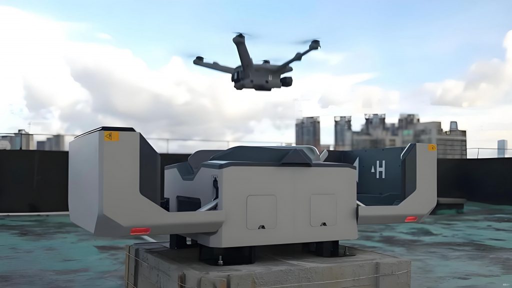
| Drone-based “Net” or Capture | Deployed from a interceptor UAV. | Kinetic capture for evidence gathering in sensitive areas where jamming is undesirable. |
The Command Center System is the central nervous system and the human-machine interface (HMI) for the entire architecture. It integrates data from all distributed sensors and effectors, providing a unified operational picture (UOP) and enabling command-level decision-making. Its core components include the client application, the server backend, a real-time data bus, and an Aero-GIS platform.
The server backend acts as the system core, managing device configurations, user permissions, geofenced protection zones (no-fly areas), and the data routing logic. The real-time data bus, often based on publish-subscribe protocols like MQTT or DDS, is the critical middleware that facilitates low-latency, reliable data exchange between all sensors, effectors, and the command client over LAN/WAN. The Aero-GIS platform provides the geographical context, displaying high-resolution maps, sensor coverage footprints, real-time drone tracks, and the location of all friendly and hostile entities.
The client application presents this fused information through an intuitive dashboard. Key displays include a real-time tactical map showing all tracks and alerts, a video feed from the EO/IR tracker following a target, a panel for system health and device status, and controls for manual operator intervention. This platform enables 24/7 automated surveillance, with audible and visual alarms triggered upon rule violations (e.g., entering a geofenced zone). It also supports forensic analysis and reporting by maintaining a searchable database of all flight tracks and incident logs, which is crucial for post-event investigation and prosecution related to rogue civilian drone activities.
The deployment of such a system requires careful network planning to balance performance with security. Devices can be connected via wired Ethernet for stability, wireless links for flexibility, or a hybrid approach. A critical design principle is network segmentation. The management and control network should be isolated from public networks. Communication with external or higher-level security networks, if required, should occur through rigorously controlled security gateways or firewalls to prevent any potential external compromise of the C-UAS system itself. This ensures operational integrity while allowing for necessary data sharing.
To illustrate a practical deployment, consider the protection of a major international forum venue. A layered defense is established:
- Inner Protection Core (1.5 km radius): Dense coverage with fixed jammers, portable units, and EO/IR trackers for positive identification and immediate neutralization capability.
- Intermediate Detection & Tracking Ring (2.5 km radius): Deployment of primary detection assets like RF scanners and acoustic sensors, with radar providing wide-area coverage. This ring identifies threats early and cues the inner-layer defenses.
- Outer Early Warning Zone (5-8 km radius): Primarily covered by long-range radar, providing the earliest possible alert of approaching civilian drones.
This concentric model ensures that threats are detected early, tracked continuously, and engaged at the optimal point to prevent them from reaching the protected core.
The advantages of this integrated system approach are significant. It enables 24/7 automated vigilance, shifting security posture from reactive to proactive. By automating the detection and alerting process, it drastically reduces operator workload and minimizes human error. The system’s architecture supports scalability and centralized management across multiple, geographically dispersed sites from a single command center. It is built on open, modular principles, allowing for the integration of new sensor and effector technologies as they emerge, protecting the investment against obsolescence. Finally, by providing definitive forensic evidence—including flight paths and, when possible, visual confirmation—it enables the attribution and prosecution of malicious actors, creating a stronger deterrent against the misuse of civilian drones.
In conclusion, managing the risks associated with the exponential growth of civilian drones requires a sophisticated, layered technological solution. The proposed airspace management and control system, integrating reconnaissance, identification, tracking, and mitigation capabilities under a unified command platform, provides a viable and effective framework. Such systems are already transitioning from concept to critical infrastructure, safeguarding high-profile events and sensitive locations. As the technology of civilian drones continues to evolve, so too must the countermeasures. Future developments will likely see increased use of artificial intelligence for automated threat classification and response, the integration of directed energy weapons for silent, precise engagement, and more advanced non-kinetic methods like seamless control takeover via spoofing. The continuous advancement of these integrated systems is essential to ensure public safety, protect national security, and foster the responsible use of commercial drone technology, thereby allowing society to harness its benefits while mitigating its inherent risks.