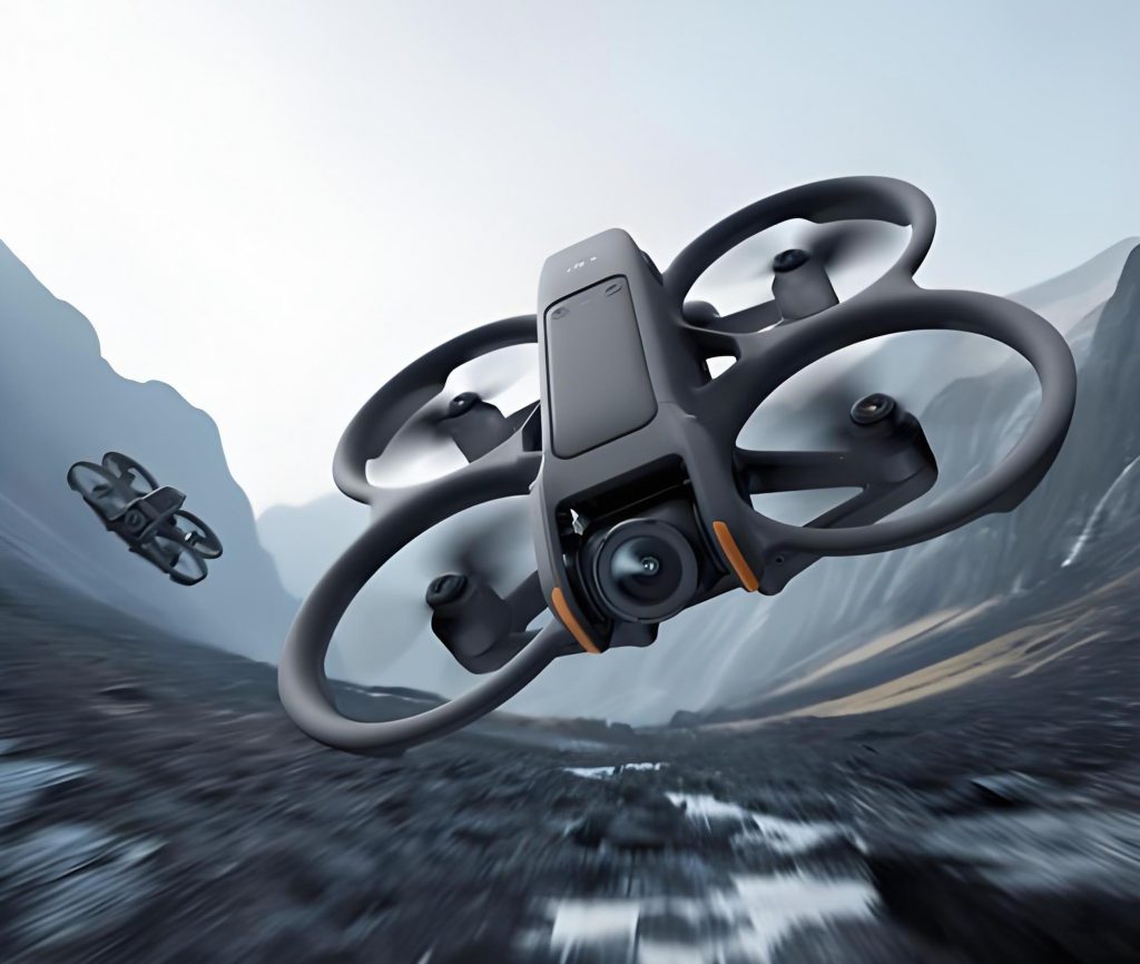
In recent years, aerial surveying with unmanned aerial vehicles (UAVs) has become an indispensable part of the surveying and mapping industry. Compared to traditional surveying methods, the use of DJI drones significantly enhances operational efficiency, particularly in challenging terrains such as mountainous and hilly areas. With advancements in onboard camera technology and the integration of Real-Time Kinematic (RTK) positioning into drone photogrammetry, it is now possible to create detailed three-dimensional realistic models of geological hazards, generate digital orthophoto maps, and rapidly map and identify disaster ranges and deformation characteristics. This technology is increasingly applied in fields like surveying and mapping, planning and design, environmental monitoring, agricultural monitoring, and emergency response. As drone surveying technology matures, its applications continue to expand. In mine surveying, innovative photogrammetric techniques, especially tilt photogrammetry using DJI drones, have been adopted to improve the accuracy and efficiency of survey results. This article shares my firsthand experience in utilizing DJI Phantom 4 RTK drones for mine surveying, covering key aspects from field operations to data processing, with a focus on practical insights and methodologies.
The adoption of DJI drones in mine surveying represents a paradigm shift from conventional techniques. Traditional surveying often involves labor-intensive fieldwork, with limitations in accessing remote or hazardous areas like deep ravines or dense vegetation. This can lead to data inaccuracies and inefficiencies, especially for large-scale topographic mapping. In contrast, DJI drones equipped with tilt photogrammetry capabilities enable comprehensive data acquisition without direct physical contact, allowing for the reconstruction of 3D models from 2D imagery and extraction of geometric and physical properties. My experience with the DJI Phantom 4 RTK drone, acquired in July 2019, has demonstrated its versatility in various mine surveying tasks, including topographic surveys, earthwork volume calculations, subsidence area monitoring, and tailings dam assessments. Over more than a year of use, this DJI drone has proven to be a reliable tool, transforming our surveying workflows and outcomes.
One of the core advantages of using a DJI drone in mine surveying is its ability to streamline both field and office operations. The following table summarizes the key characteristics of DJI drone-based surveying compared to traditional methods, highlighting the transformative impact of this technology:
| Aspect | Traditional Surveying | DJI Drone Surveying |
|---|---|---|
| Fieldwork Intensity | High; requires extensive manual measurements and access to all points. | Low; automated flight paths cover large areas quickly, reducing human effort. |
| Productivity | Limited by crew size and terrain challenges; slow data collection. | High; one DJI drone can equate to 10-20 surveyors, with faster data acquisition. |
| Data Visualization | 2D maps and point clouds; limited 3D context. | 3D models generated from imagery; intuitive interpretation and analysis. |
| Accuracy | Variable; depends on point measurements and environmental factors. | High and uniform; enhanced by RTK positioning and aerial triangulation. |
| Flexibility | Rigid; difficult in inaccessible or dangerous areas. | Highly flexible; DJI drones can fly over obstacles and adapt to different terrains. |
| Cost-effectiveness | Higher long-term costs due to labor and equipment. | Lower operational costs; affordable DJI drone platforms with minimal maintenance. |
| Application Range | Limited to accessible sites; challenges in large or complex mines. | Broad; suitable for small to large areas, including hazardous zones like pit walls. |
These characteristics underscore why DJI drones have become essential in modern mine surveying. The efficiency gains are particularly notable in terms of reduced fieldwork time. Previously, our team struggled with extensive outdoor operations, but with the DJI drone, we can complete surveys in a fraction of the time, allowing for more focus on data analysis and project planning. Moreover, the accuracy of data collected by the DJI drone is bolstered by its RTK module, which provides centimeter-level positioning precision. This is crucial for applications such as volume calculations and deformation monitoring, where errors can have significant financial or safety implications.
When conducting field flights with a DJI drone, several critical parameters must be optimized to ensure data quality. The flight altitude and image overlap are primary factors influencing the ground sampling distance (GSD) and model accuracy. The GSD, which represents the pixel size on the ground, can be calculated using the formula:
$$GSD = \frac{H \times s}{f}$$
where \(H\) is the flight altitude above ground, \(s\) is the sensor pixel size, and \(f\) is the focal length of the camera. For the DJI Phantom 4 RTK drone, with a 20-megapixel camera and a sensor pixel size of approximately 2.4 micrometers, and a focal length of 8.8 mm, the GSD varies with altitude. For instance, at a flight height of 100 meters, the GSD is around 2.7 cm per pixel, but in practice, we aim for a GSD of 8 cm or less for 1:500 to 1:2000 scale maps, as per surveying standards. To achieve this, we typically set the flight altitude between 80 and 180 meters, depending on the required detail. The overlap between consecutive images—both along-track (longitudinal) and across-track (lateral)—is equally important. We use the following relationships to determine minimum overlaps:
$$Longitudinal\ Overlap = \frac{B}{G} \times 100\%$$
$$Lateral\ Overlap = \frac{S}{W} \times 100\%$$
where \(B\) is the base distance between photo centers, \(G\) is the ground coverage per image, \(S\) is the side lap distance, and \(W\) is the image width on ground. In our mine surveys, we set longitudinal overlap to 80% and lateral overlap to 70% to ensure sufficient tie points for aerial triangulation. The table below provides recommended settings for different surveying scales using the DJI drone:
| Map Scale | Flight Altitude (m) | GSD (cm/pixel) | Longitudinal Overlap (%) | Lateral Overlap (%) |
|---|---|---|---|---|
| 1:500 | 80-100 | 5-8 | 85 | 75 |
| 1:1000 | 120-150 | 10-12 | 80 | 70 |
| 1:2000 | 160-180 | 15-18 | 75 | 65 |
Another vital aspect of field operations is the placement of ground control points (GCPs). GCPs serve as reference points for georeferencing the drone imagery and improving accuracy. We typically deploy at least five GCPs per survey area, with additional check points for validation. The distribution should be uniform, covering the entire region of interest. For a DJI drone flying at 100 meters, we mark GCPs using red paint in cross or L-shaped patterns, with dimensions no smaller than 80 cm in length and 10 cm in width to ensure visibility in the imagery. At higher altitudes, such as 200 meters, the markings are scaled up to 160 cm by 20 cm. This practice enhances the precision of subsequent data processing.
Weather conditions also play a crucial role in the successful deployment of a DJI drone. We avoid flying in winds exceeding 6级 (approximately 10-12 m/s) to maintain stability and safety. Since the DJI Phantom 4 RTK is not waterproof, rainy conditions are strictly avoided. Additionally, we take care to protect the drone from dust by closing its case when not in use. Battery management is another key consideration; the drone’s 5800 mAh battery supports around 20-25 minutes of flight time. We ensure batteries are charged after cooling down from use, and we use the charger’s “charge” mode (indicated by a green light) rather than “storage” mode (blue light). To maintain battery health, we recharge them monthly even during idle periods to prevent deep discharge.
Data storage is handled via memory cards, and we adhere to capacity limits to prevent photo loss. For large surveys, we use high-capacity cards and monitor storage during flights. The integration of RTK with the DJI drone eliminates the need for extensive GCPs in some cases, but we still employ them for redundancy and accuracy verification. Overall, these field practices ensure that the DJI drone captures high-quality data efficiently, paving the way for robust indoor processing.
Once field data is acquired, the indoor processing phase begins, which involves two main steps: aerial triangulation and point cloud generation, followed by mapping and analysis. We use specialized software like Pix4Dmapper for the initial processing. The process starts with importing the drone imagery and GCP coordinates. Pix4Dmapper performs aerial triangulation, which involves bundle adjustment to optimize camera positions and orientations. The mathematical basis for this can be expressed as:
$$\min \sum_{i=1}^{n} \sum_{j=1}^{m} ||x_{ij} – P_i(X_j)||^2$$
where \(x_{ij}\) is the observed image coordinate of point \(j\) in image \(i\), \(P_i\) is the projection function for image \(i\), and \(X_j\) is the 3D coordinate of point \(j\). This minimization adjusts parameters to reduce reprojection errors, resulting in a sparse point cloud. The DJI drone’s RTK data enhances this process by providing accurate initial positions. Next, dense point cloud generation is performed, where millions of points are created using multi-view stereo algorithms. The density can be controlled based on needs; for mine surveying, we often use medium settings to balance detail and processing speed. From this, a digital surface model (DSM) and orthomosaic are exported.
The second step involves using software like EPS (Electronic Photogrammetric System) 2016 for mapping directly on the 3D model. This allows for intuitive feature extraction, such as contour lines, breaklines, and volume calculations. For example, to compute earthwork volumes, we compare DSMs from different epochs using the formula:
$$V = \iint (Z_2(x,y) – Z_1(x,y)) \, dx \, dy$$
where \(Z_1\) and \(Z_2\) are elevation values at times \(t_1\) and \(t_2\), respectively. The DJI drone data facilitates this by providing high-resolution elevation models. We then export the data to surveying software like South CASS for final map production. Throughout this process, we manage data volume carefully; excessive point clouds can slow down processing, so we apply filters to retain relevant points. The table below outlines a typical workflow for indoor processing with DJI drone data:
| Step | Software/Tool | Key Actions | Output |
|---|---|---|---|
| 1. Data Import | Pix4Dmapper | Load images, GCPs, and RTK metadata; set coordinate system. | Initial project with geotagged images. |
| 2. Aerial Triangulation | Pix4Dmapper | Run bundle adjustment; optimize camera parameters and point positions. | Sparse point cloud and refined exterior orientation. |
| 3. Dense Reconstruction | Pix4Dmapper | Generate dense point cloud; control density and quality settings. | Dense 3D point cloud in LAS or PLY format. |
| 4. Model Generation | Pix4Dmapper | Create DSM, digital terrain model (DTM), and orthomosaic. | Raster files (GeoTIFF) for elevation and imagery. |
| 5. Mapping and Analysis | EPS 2016 | Extract features, measure distances/areas/volumes, annotate maps. | Vector data (DXF, SHP) and reports. |
| 6. Final Output | South CASS | Produce topographic maps, cross-sections, and engineering drawings. | Standardized map sheets and digital deliverables. |
In our mine surveying applications, the DJI drone has been instrumental in various tasks. For topographic mapping, we have covered dozens of square kilometers, producing detailed maps for construction planning and resource management. The accuracy meets engineering requirements, with errors typically within ±10 cm horizontally and vertically. In earthwork volume calculations, such as for stockpiles or excavation sites, the DJI drone enables rapid assessments. We use the DSM differences to compute volumes, with formulas adapted for irregular shapes. For instance, the volume of a conical stockpile can be approximated as:
$$V = \frac{1}{3} \pi r^2 h$$
where \(r\) is the base radius and \(h\) is the height, derived from drone data. Similarly, for monitoring subsidence areas in mines, we conduct periodic flights with the DJI drone to detect changes over time. By comparing DSMs, we identify deformation patterns and assess risks. This proactive approach enhances safety and operational planning.
The versatility of the DJI drone extends to environmental monitoring, such as tailings dam inspections. We capture high-resolution imagery to analyze dam integrity, erosion, and vegetation cover. The 3D models allow for slope stability assessments using factors of safety calculations, often expressed as:
$$F_s = \frac{\sum \text{Resisting Forces}}{\sum \text{Driving Forces}}$$
where resisting forces include shear strength, and driving forces include gravitational loads. The DJI drone data provides precise geometry for these analyses. Moreover, in emergency scenarios, such as landslides or structural failures, the DJI drone can be deployed quickly for rapid mapping, aiding in decision-making and resource allocation.
Looking ahead, the integration of DJI drones with emerging technologies like artificial intelligence and IoT sensors will further revolutionize mine surveying. For example, automated anomaly detection in drone imagery could identify cracks or displacements in real-time. The continuous development of DJI drone platforms, with improved sensors and longer flight times, will expand their applicability. In our experience, the DJI Phantom 4 RTK has been a cost-effective solution, but newer models like the DJI Matrice series offer enhanced capabilities for larger-scale projects.
In conclusion, the use of DJI drones in mine surveying has proven transformative, offering unparalleled efficiency, accuracy, and flexibility. From field operations to data processing, the DJI drone streamlines workflows and enables detailed 3D modeling. My experience underscores the importance of proper planning—such as optimizing flight parameters and GCP placement—and robust indoor processing with software like Pix4Dmapper. As mines move towards digitalization and automation, DJI drones will play a pivotal role in achieving smart mining objectives. The ability to rapidly acquire and analyze spatial data with a DJI drone not only supports engineering and safety but also contributes to sustainable resource management. With ongoing advancements, the future of mine surveying is undoubtedly intertwined with the evolution of DJI drone technology.