The rapid development of inland waterway transportation has placed unprecedented demands on the safety and efficiency of navigation channels. As a vital artery for regional economies, the continuous and unobstructed operation of these waterways is paramount. In our capacity managing a significant stretch of a major river system, we have long relied on traditional, crewed vessel patrols for channel inspection and maintenance. These methods, while foundational, have become increasingly strained, struggling to provide the comprehensive, timely, and cost-effective monitoring required in the modern era. Faced with challenges such as vast patrol distances, complex geography, safety concerns for personnel, and budgetary constraints, our search for a transformative solution led us to the forefront of aerial technology: the unmanned aerial vehicle, specifically, automated DJI drone systems.
Our jurisdiction encompasses over 160 kilometers of diverse waterways, including high-traffic Grade II channels and more remote tributaries. The traditional patrol model involved a crew of four personnel undertaking lengthy voyages, often exceeding 10-13 hours per mission when accounting for lock transits. This approach was characterized by several critical inefficiencies and risks. The spatial and temporal coverage was limited, creating blind spots and delays in identifying issues like aid-to-navigation (ATON) malfunctions, siltation, or bank erosion. The safety of our crew was a constant concern, especially during night patrols or in adverse weather conditions in treacherous sections of the river. Furthermore, the high operational costs—fuel, vessel maintenance, and personnel hours—placed a significant burden on our resources, while the lag in information feedback hampered rapid response capabilities.
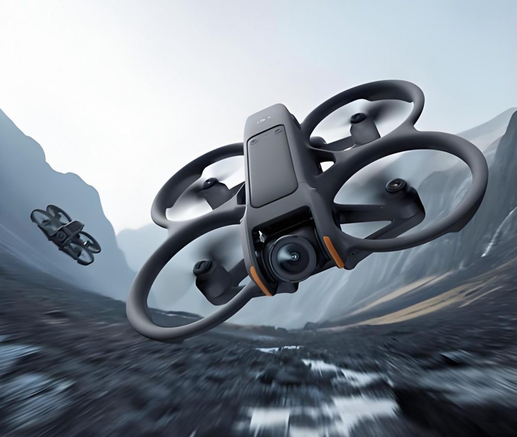
The decision to pilot an automated DJI drone patrol system, centered on the DJI Dock 2 platform, was driven by the need to overcome these fundamental limitations. This initiative targeted a strategic 20-kilometer section downstream of a newly operational navigation lock, an area where traditional patrol time had increased substantially. The core hypothesis was that an automated DJI drone network could provide superior situational awareness, operational efficiency, and safety. This document details our first-person journey from system conception and technical deployment to a rigorous analysis of the tangible benefits realized, serving as a practical case study on the integration of advanced DJI drone technology into critical infrastructure management.
The Architectural and Technical Foundation of the DJI Dock 2 System
The successful implementation of an unmanned patrol system hinges on meticulous planning and the seamless integration of several advanced technologies. Our deployment of the DJI Dock 2 system involved a structured, multi-phase approach.
1. Strategic Site Assessment and Network Planning
The initial phase involved a comprehensive survey of the target patrol corridor. Key factors analyzed included topography, the location of critical infrastructure (bridges, ports), ATON distribution, communication signal coverage, and power accessibility. The primary objective was to determine optimal locations for the DJI Dock 2 stations to ensure complete and redundant coverage of the 20-kilometer segment. Based on the flight endurance and range parameters of the DJI drone, a two-dock network was designed. The placement followed a central positioning logic to minimize maximum flight distance to any point in the zone, governed by the simple coverage relation:
$$ \text{Number of Docks } (N) \geq \frac{\text{Total Patrol Length } (L)}{\text{Effective Drone Range per Dock } (R_{eff})} $$
where \( R_{eff} \) accounts for battery reserves for safe return and contingency. The docks were sited at elevated, secure locations with reliable grid power and cellular network connectivity, forming the autonomous backbone of the operation.
2. Core Technology Stack for Robust Patrols
The DJI Dock 2 and its associated enterprise-grade DJI drone integrate a suite of technologies that directly address the shortcomings of manual patrols.
| Technology | Function | Impact on Waterway Patrol |
|---|---|---|
| RTK Centimeter-Level Positioning | Provides real-time, centimeter-accurate GNSS data for the DJI drone and dock. | Enables precise, repeatable navigation to ATON waypoints. Essential for detecting minor shifts in buoy position or bank coordinates. Forms the geospatial foundation for all automated flight paths. |
| 4G Enhanced Image Transmission | Uses cellular networks as a redundant data link alongside traditional radio frequency. | Ensures continuous live video feed and telemetry, even in areas with terrain obstructions. Eliminates signal loss, guaranteeing real-time monitoring and control. |
| Omnidirectional Sensing & Avoidance | Utilizes vision and infrared sensors to detect obstacles in all directions. | Dramatically enhances operational safety in complex environments. The DJI drone can automatically avoid birds, temporary structures, cables, and other unforeseen hazards mid-flight. |
| Multi-Payload Capability | Supports interchangeable payloads (zoom camera, thermal camera, etc.). | Transforms the DJI drone into a versatile inspection tool. A zoom camera can read buoy numbers from afar; a thermal camera can identify vessel heat signatures or subsurface leaks in infrastructure at night. |
| Fully Automated, Unattended Operation | The dock manages charging, deployment, recovery, and data upload autonomously based on schedules or triggers. | Enables true 24/7 patrol readiness. The system can execute multiple daily patrols or immediate incident-response flights without any on-site personnel. |
| Advanced Data Link Encryption | Secures all communication between the DJI drone, dock, and control center. | Protects sensitive geospatial and video data, ensuring operational security and compliance with data protection regulations for critical infrastructure. |
3. Intelligent Flight Path Planning and Execution
Creating effective automated patrol routes is a critical engineering task. Our process synthesizes regulatory maps with real-world verification. The workflow is as follows:
Step 1: Data Fusion. Official ATON deployment charts provide theoretical coordinates. A survey team then uses a manual DJI drone flight to visually confirm and record the precise real-world coordinates (\( \phi_{actual}, \lambda_{actual} \)) of each navigation mark.
Step 2: Mission Programming. These verified coordinates are input into the flight control platform. For each ATON, a flight “waypoint” is created. At each waypoint, specific actions are programmed, which can be generically represented as a function of the drone’s state:
$$ \text{Action}(WP_i) = f(\text{Position}, \text{Gimbal Pitch}(\theta), \text{Camera Zoom}(z), \text{Trigger}) $$
A standard inspection action for a buoy would be: Position = directly overhead; \( \theta = -90^\circ \) (nadir); Trigger = “Capture High-Res Photo”.
Step 3: Optimization for Coverage and Safety. The sequence of waypoints is optimized into a continuous flight path. The planning algorithm must satisfy multiple constraints, which can be framed as an optimization problem seeking to minimize total flight time \( T \) while meeting all inspection criteria:
$$
\begin{aligned}
\text{Minimize: } & T = \sum_{i=1}^{n-1} \frac{d(WP_i, WP_{i+1})}{v} \\
\text{Subject to: } & \text{Coverage Constraint: All critical assets } j \in J \text{ are observed.} \\
& \text{Safety Constraint: } \min(\text{distance to obstacle}) > d_{safe} \quad \forall \text{ flight segments.} \\
& \text{Regulatory Constraint: Altitude } h \in [h_{min}, h_{max}]. \\
& \text{Battery Constraint: } E_{consumed}(T) \leq E_{reserve}.
\end{aligned}
$$
Factors like maintaining line-of-sight with shore, avoiding temporary no-fly zones, and adapting to seasonal weather patterns are also integrated into the final flight plans, which are stored for one-click execution.
Quantitative and Qualitative Benefit Analysis
After six months of operational piloting, the impact of the automated DJI drone system has been evaluated across multiple dimensions. The following analysis compares the traditional vessel-based patrol with the DJI Dock 2 system for the 20-kilometer pilot segment.
| Performance Metric | Traditional Vessel Patrol | DJI Dock 2 Automated Patrol | Improvement / Analysis |
|---|---|---|---|
| Patrol Duration | ~6.3 hours (incl. transit & lock time) | ~30 minutes (air time) | Time efficiency increased by over 90%. Patrols can be conducted multiple times per day. |
| Human Resource Requirement | 4 personnel (Captain, Engineer, Technician, Deckhand) | 0.5 FTE (Technician for data review) | Direct personnel deployment reduced by 87.5%. Staff are redeployed to higher-value analysis and maintenance tasks. |
| Operational Cost per Patrol | Fuel: ~1469 CNY Implicit Labor: High Vessel Wear: Significant |
Electricity: Negligible Data Plan: Low System Maintenance: Low |
Direct variable costs reduced by >95%. Eliminates fuel consumption and major vessel wear for the covered segment. |
| Annual Cost (Estimated) | ~185,069 CNY (fuel only) + 3294 labor-hours | ~15,000 CNY (est. power, comms, maintenance) | Potential for >90% annual cost reduction for the patrolled segment. |
| Safety Profile | High-risk: Exposure to water hazards, night operations, vessel collisions, fatigue. | Low-risk: Personnel remotely monitor from office. DJI drone features omnidirectional obstacle avoidance. | Eliminates personnel exposure to the primary physical hazards of channel patrols, especially at night. |
| Data Richness & Responsiveness | Manual logs, periodic photos. Information delay from field to office. | High-res geotagged photos/video, real-time live stream. Immediate upload to cloud platform. | Enables persistent surveillance, rapid anomaly detection, and data-driven trend analysis (e.g., bank erosion rates). |
| Patrol Frequency & Flexibility | Limited by schedule, crew availability, and cost. | Fully flexible. Can perform scheduled (e.g., 3x daily), on-demand, or emergency response flights instantly. | Transforms patrols from a periodic snapshot to a continuous monitoring capability. |
The benefits extend beyond these direct metrics. The consistent, high-resolution visual data collected by the DJI drone over time creates a powerful digital twin of the waterway. This archive allows for precise measurement of environmental changes. For instance, the rate of siltation near a confluence can be monitored by comparing georeferenced images over time, allowing for predictive, rather than reactive, dredging scheduling. The ability to instantly deploy a DJI drone to assess a reported obstruction or accident provides commanders with real-time visual intelligence, drastically improving situational awareness and response coordination.
Conclusion and Future Trajectory
The pilot integration of the DJI Dock 2 automated DJI drone system into our waterway patrol operations has unequivocally demonstrated its transformative potential. It has successfully addressed the core inefficiencies of the traditional model: dramatically improving patrol frequency and coverage, significantly reducing operational costs and risks to personnel, and enabling a new paradigm of data-centric waterway management. The system has proven to be a reliable, all-weather tool that enhances our ability to ensure safe and efficient navigation.
Looking forward, the trajectory for DJI drone technology in maritime and fluvial management is toward deeper integration and increased intelligence. The next evolutionary steps are clear:
- AI-Powered Automated Analysis: Integrating computer vision algorithms to automatically detect anomalies in the DJI drone‘s video feed—such as a missing buoy, an encroaching vessel, or new debris—and generate immediate alerts, reducing the human workload from monitoring to managing exceptions.
- Multi-Sensor Fusion for Holistic Inspection: Beyond visual spectrum cameras, deploying payloads like hyperspectral sensors or bathymetric LiDAR on a DJI drone platform could allow for simultaneous water quality monitoring, underwater obstruction mapping, and detailed structural integrity assessment of banks and levees in a single automated flight.
- Networked Swarm Operations: Scaling from individual dock-cell systems to a coordinated network of multiple DJI Dock stations managing a fleet of DJI drones. This would enable dynamic tasking, where the closest available DJI drone is dispatched to an incident, or multiple drones collaboratively inspect a large area simultaneously.
- Integration with Vessel Traffic Systems (VTS) and IoT: Creating a unified operational picture by fusing DJI drone live video and data with AIS signals, radar data, and water level sensors. A DJI drone could be autonomously dispatched to visually identify a vessel not broadcasting AIS or to verify a sensor alert.
In conclusion, the adoption of automated DJI drone technology, as exemplified by the DJI Dock 2 system, is not merely an incremental upgrade but a fundamental shift in waterway management philosophy. It moves the sector from reactive, labor-intensive patrols to proactive, intelligent, and data-driven stewardship. As the technology continues to mature and integrate with other digital ecosystems, the DJI drone is poised to become an indispensable cornerstone of smart, resilient, and sustainable waterway infrastructure worldwide.