The relentless global demand for energy resources continues to drive the mining industry, yet it faces persistent challenges in safety, efficiency, and environmental stewardship. In our pursuit of a transformative solution, we have focused on the paradigm of intelligent, smart mine construction. This vision moves beyond traditional, labor-intensive methods towards a data-driven, automated, and interconnected operational model. The core of this transformation lies in deploying advanced sensing and autonomous systems to gather real-time data, enabling predictive maintenance, enhanced safety protocols, and optimized resource extraction. Among the most versatile tools for this digital leap is the unmanned aerial vehicle, or drone. This document details our first-person journey in the research, development, and practical implementation of an Intelligent Drone Patrol System specifically designed for the vast and dynamic environment of open-pit coal mines, with the DJI drone platform serving as its cornerstone.
Our project was initiated by a critical analysis of the status quo. Traditional inspection and monitoring in large-scale open-pit mines rely heavily on manual patrols by personnel in vehicles and a network of fixed CCTV cameras. We identified significant shortcomings in this approach. Manual inspections place personnel at considerable risk, as they must navigate active mining areas shared with massive haul trucks and excavators, creating a high-risk environment for collisions. Furthermore, fixed cameras have inherent limitations: blind spots are inevitable due to the constantly changing topography of the mine, their installation and maintenance are costly and logistically challenging, and their field of view is static, unable to adapt to new areas of interest. Data collection for tasks like volume calculation and digital terrain modeling was periodic, slow, and often disruptive to operations.
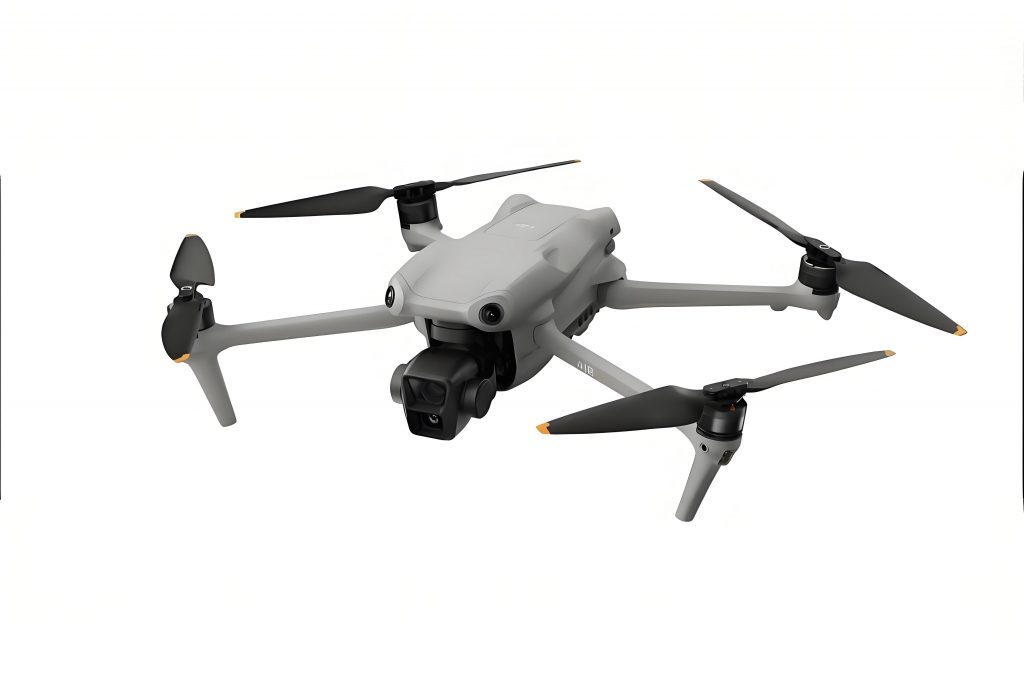
Our objective was clear: to develop a system that could provide persistent, mobile, and intelligent oversight. The system needed to automate routine inspections, capture high-resolution geospatial data on demand, and, most importantly, proactively identify safety hazards and regulatory non-compliance in real-time. We required a platform that was robust, precise, and capable of sophisticated data capture. After extensive evaluation, we selected the DJI drone model MK300RTK as our primary aerial sensor platform. This DJI drone offered centimeter-level positioning accuracy through its Real-Time Kinematic (RTK) module, essential for repeatable automated flight paths and precise data stitching. Its payload capacity allowed for the integration of dual sensors—a high-resolution visual camera and a thermal infrared camera—which became the “eyes” of our intelligent system. The reliability and programmability of the DJI drone SDK were crucial factors in our decision, enabling deep integration with our custom software stack.
The developed system is an integrated ecosystem of hardware and software, designed to function with minimal human intervention. The architecture can be broken down into several core components, summarized in the table below.
| System Component | Description | Key Function |
|---|---|---|
| Aerial Platform (DJI Drone) | DJI Matrice 300 RTK with dual gimbal (4K visual & thermal camera). | Mobile data acquisition unit. Executes autonomous flight missions. |
| Smart Hangar | Weather-proof, temperature-controlled docking station with automatic doors. | Secure storage, automatic battery swap/charging, and launch/landing pad. |
| Ground Control & Data Link | 5G/LTE routers and proprietary control link. | Enables long-range, real-time command and HD video/data streaming. |
| Central Control Server | On-premises/Cloud server running core applications. | Hosts flight control, AI processing, data storage, and 3D modeling software. |
| AI Recognition Engine | Custom software based on deep learning frameworks (TensorFlow/PyTorch). | Processes imagery to detect safety violations and anomalies. |
| 3D Modeling Suite | Software for processing aerial imagery into geospatial models. | Generates digital surface models (DSM), orthomosaics, and 3D point clouds. |
System Development and Core Technologies
1. Autonomous Operations Infrastructure
The foundation of reliable automation is the Smart Hangar. We engineered it to withstand the harsh mining environment—extreme temperatures, dust, and wind. Its primary function is to serve as a home base for the DJI drone. Upon receiving a mission schedule from the central server, the hangar doors open, and the DJI drone autonomously takes off. After mission completion, it returns, and the hangar’s robotic arm facilitates a hot-swap of the battery, placing the depleted one on a charger and installing a fresh one, readying the DJI drone for the next task with minimal downtime. Environmental sensors on the hangar (anemometer, thermometer) provide real-time weather data. A safety algorithm evaluates flight conditions; if winds exceed the DJI drone‘s operational limits or visibility is too poor, missions are automatically postponed.
The flight path planning software was a critical development. We created an interface where safety officers can define Areas of Interest (AOIs)—such as active dig faces, haul roads, dump sites, and equipment parking areas. The software automatically calculates the optimal flight path for the DJI drone to cover these AOIs, considering factors like altitude for resolution, sensor field of view, and obstacle avoidance. The precision of the DJI drone‘s RTK system allows these paths to be flown repeatedly with centimeter-level accuracy, ensuring consistent data collection. The path optimization can be framed as a variant of the Coverage Path Planning (CPP) problem, where the goal is to minimize flight time while ensuring complete coverage of a polygon $P$ (the AOI) with a sensor footprint of width $w$. A simplified cost function for a simple back-and-forth (raster) pattern is:
$$
\text{Total Flight Distance } L \approx \frac{\text{Area}(P)}{w} + \text{Perimeter}(P)
$$
Our software dynamically adjusts $w$ based on the required Ground Sampling Distance (GSD) for the mission’s objective (e.g., finer GSD for crack inspection, coarser for general overview).
2. The AI-Powered Vision for Safety
The true “intelligence” of the system resides in its ability to understand what the DJI drone‘s cameras see. We developed a multi-stage AI recognition engine. The first step is real-time data transmission. As the DJI drone flies, it streams high-definition video (from the visual camera) and thermal data back to our central server via the 5G network.
The core challenge was creating robust computer vision models for the complex, unstructured visual environment of a mine. We collected and annotated tens of thousands of images from our DJI drone flights. The annotations labeled objects of interest: person, hard_hat, haul_truck, excavator, personal_vehicle, safety_berm. For anomaly detection, we labeled thermal hotspots and standing water. We then trained deep convolutional neural networks (CNNs), primarily based on YOLO (You Only Look Once) architectures, for real-time object detection. The model takes an image frame $I$ and outputs a set of bounding boxes $B_i$ with class labels $C_i$ and confidence scores $S_i$.
$$
\text{Model}(I) = \{(B_1, C_1, S_1), (B_2, C_2, S_2), … (B_n, C_n, S_n)\}
$$
The post-processing logic then applies safety rules to these detections. For example:
- Person Detection + Hard Hat Violation: If a `person` is detected and the `hard_hat` class is not detected within a proximate spatial region, a “No Hard Hat” violation is triggered.
- Vehicle in Motion + Person Outside: If a `person` is detected within a dangerous proximity to a moving `haul_truck`, a “Person in Equipment Zone” violation is triggered.
- Thermal Anomaly: The thermal feed is analyzed pixel-by-pixel. A potential fire hazard is flagged if a region’s temperature $T_{region}$ significantly deviates from the ambient mean $T_{ambient}$ by a threshold $\Delta T_{crit}$: $$ T_{region} – T_{ambient} > \Delta T_{crit} $$
- Safety Berm Compliance: Using photogrammetric techniques, the dimensions of safety berms (the protective walls along roads) are estimated from the imagery. If the estimated height $H_{est}$ or width $W_{est}$ falls below regulatory minimums ($H_{min}, W_{min}$), a “Berm Deficiency” alert is generated: $$ \text{Alert if } (H_{est} < H_{min}) \lor (W_{est} < W_{min}) $$
Every triggered alert is instantly displayed on the live dashboard in the control room with a visual highlight and logged into a database with a timestamp, location (from the DJI drone‘s GPS), and evidence snapshot. This allows for immediate radio communication to the site and the generation of automated digital work orders for corrective action.
3. Digital Twin Creation via Aerial Surveying
Beyond real-time monitoring, the system is a powerful tool for spatial analytics. We programmed the DJI drone to perform systematic grid flights over target areas (e.g., the entire pit or a new dump site) with high front and side overlap (80%/70%) between images. Using Structure-from-Motion (SfM) photogrammetry algorithms, we process these images to create high-fidelity 3D models.
The SfM pipeline solves for the 3D structure (point cloud $P$) and camera parameters (positions $X_j$, orientations $R_j$) simultaneously by finding corresponding features $x_{ij}$ across multiple images $I_i$. The core optimization minimizes the reprojection error:
$$
\min_{P_i, X_j, R_j} \sum_{i,j} d(\pi(X_j, R_j, P_i), x_{ij})^2
$$
where $\pi$ is the camera projection function and $d$ is a distance metric. From the dense point cloud, we generate deliverables crucial for mine planning:
- Digital Surface Models (DSM): For volumetric calculations of stockpiles and cut/fill analysis.
- True Orthomosaics: Georeferenced, distortion-free maps for spatial referencing.
- 3D Textured Mesh: An immersive digital twin for virtual walkthroughs and stakeholder presentations.
The efficiency gain is monumental. A survey that would take a ground crew days is completed by the DJI drone in a couple of hours, with data processing automated overnight.
Performance Metrics and Observed Impact
After deployment at a large open-pit mine in Northwest China for an extended testing period, the system demonstrated significant operational advantages. The table below quantifies the improvements over traditional methods.
| Performance Aspect | Traditional Method | Intelligent Drone System | Improvement / Impact |
|---|---|---|---|
| Inspection Coverage Area | Limited to road-access areas & fixed camera FOV. | Full aerial coverage of any defined AOI; no blind spots. | >95% area coverage per mission. |
| Inspection Frequency | 1-2 manual patrols per shift; static cameras. | 3-5 fully autonomous patrols per shift, on-demand surveys. | 300% increase in patrol frequency. |
| Hazard Identification Rate | Reactive, dependent on personnel vigilance. | Proactive, AI-driven real-time detection. | Average of 8-12 automatic alerts per day for PPE violations, zone intrusions. |
| Survey Data Acquisition Time | 2-3 days for a major stockpile survey. | 1.5 hours of flight time for equivalent area. | ~90% reduction in field data acquisition time. |
| Personnel Risk Exposure | High (inspectors in active mining areas). | Minimal (operators in remote control room). | Eliminated direct risk for inspection personnel. |
| Data for Volume Calculation | Monthly, with lower point density. | Weekly or on-demand, with high-density point clouds. | Higher frequency and accuracy in inventory management. |
The AI models showed robust performance in the field. Initial accuracy for hard-hat detection was around 87%, but with continuous feedback—where operators confirmed or corrected false alerts—the model underwent iterative re-training. After several cycles, accuracy for key violation classes stabilized above 94%. The system’s ability to automatically generate and assign digital work orders for identified issues closed the loop on safety management, ensuring accountability and traceability.
Conclusion and Future Development
The development and deployment of this Intelligent Drone Patrol System, centered on the versatile DJI drone platform, has validated the transformative potential of unmanned systems in heavy industry. We have successfully transitioned key aspects of open-pit mine oversight from manual, reactive, and risky operations to an automated, proactive, and data-centric paradigm. The system synthesizes several advanced technologies—robotics, precise navigation, high-speed telecommunications, and artificial intelligence—into a cohesive tool that enhances safety, boosts operational efficiency, and provides unparalleled situational awareness through digital twins.
Looking forward, the evolution of this system is continuous. We are exploring several avenues:
- Advanced AI Integrations: Implementing more sophisticated models for predictive analytics, such as detecting early signs of slope instability from subtle ground deformations in sequential 3D models or predicting equipment failure from thermal patterns.
- Multi-Drone Coordination (Swarm): Deploying multiple DJI drone units managed by a single system to simultaneously cover different sectors of a mega-mine, drastically reducing the time for full-site inspections or emergency response surveys.
- Enhanced Sensor Fusion: Integrating additional sensors onto the DJI drone payload, such as LiDAR for penetrating vegetation on reclaimed areas or multispectral cameras for environmental monitoring.
- Tighter Integration with Mine Planning Software: Automatically feeding the high-frequency topographic changes captured by the drones directly into mine planning and fleet management systems, enabling real-time rescheduling and optimization.
The journey from identifying a critical operational gap to implementing a working intelligent system has been challenging but immensely rewarding. The DJI drone proved to be a reliable and capable aerial platform, but the true value was created by the custom software stack and AI engine we built around it. This system stands as a testament to how targeted technological innovation can address core industry challenges, paving the way for smarter, safer, and more sustainable mining operations. It provides a scalable blueprint for the intelligent mine of the future, where autonomous systems like our patrol drones act as the perpetual sensory layer for a fully digitized enterprise.